4.0 Villages Visited
4.1 Western Samoa
The GEER team arrived in Western Samoa on 5 October 2009. Throughout the day of 6 October, the team toured the south eastern portion of Upolu Island, Samoa. Photos, GPS coordinates, and measurements were taken of the tsunami damage. Figure 13 shows the capital of Samoa, Apia, and the villages visited.
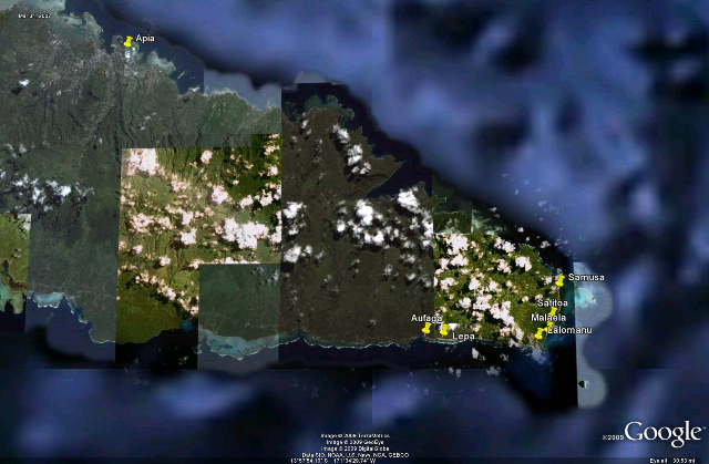
Figure 13. Western Samoa. Villages visited: Aufaga, Lepa, Lalomanu, Malaela, Satitoa, Samusa
Aufaga
Figure 14. Aufaga (S14 deg 02'27.78" W171 deg 31'17.85")
The first village visited on the southern coast of Samoa was Aufaga. The village was completely devastated by the tsunami. All houses to the west of the river were destroyed and most of the houses to the east of the river were badly damaged such that major repair or complete renovation would be needed.
Lepa
Figure 15. Lepa (S14 deg 02'30.05" W171 deg 30'14.87")
East of Aufaga, the village of Lepa was also destroyed. This town had the highest trim line (high water mark) of any village on Samoa or American Samoa, 13.6m.
From the beachhead inland, there is a small rise in topography, then a ravine, then a steep hillside. Most of the devastation was seen behind the small rise in topography and the hillside. The ravine was littered with debris, houses, and cars. Almost 90% of the structures in this area were destroyed.
Lalomanu
Figure 16. Lalomanu (S14 deg 02'48.44" W171 deg 26'31.97")
Lalomanu is located at the south-eastern tip of Samoa and saw serious destruction from the tsunami impact. Similar to the topography of Lepa, the ravine behind the beachhead shows the location of the majority of damage.
In Figure 16, notice the trim line along the ravine. Beyond the ravine, the grass remains green indicating that the tsunami surge did not breach the ravine in those areas.
Malaela
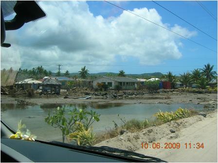
Figure 17. Malaela (S14 deg 02' 26.86", W171 deg 26'10.42")
The town of Malaela is located on the eastern side of Upolu Island. This town has protection from the ocean via a coral reef which extends a substantial distance from shore. Malaela does not back up to steep cliff, but remains rather flat for some distance inland. Tsunami damage was limited and resembled damage due to flood, rather than impact.
Satitoa

Figure 18. Satitoa (S14 deg 01'47.00" W171 deg 25'54.33")
The town of Satitoa is backed up against hills and is located along the eastern edge of the island. As evidenced in Figure 18, the trim line can easily be seen on the hillside. This town was heavily damaged with almost 80% of the structures destroyed.
Samusa
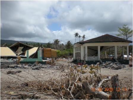
Figure 19. Samusa (S14 deg 00'24.17" W171 deg 25'33.53")
The village of Samusa is located at a higher elevation than the other villages along the eastern and southern coast of Upolu. However, the few homes that were located near the beach received heavy inundation from the tsunami. Damage was minimal due to the higher elevation and relatively flat terrain.
4.2 American Samoa
The GEER team arrived in American Samoa on the evening of 6 October 2009. On the morning of the 7th of October, the team investigated Pago Pago Harbor. While setting up for the second LIDAR position, a Tsunami Warning was issued for the Mw=7.7 Vanuatu earthquake. In an orderly fashion, the team packed up all gear and in similar fashion to the locals, made their way into the hills. It was a very orderly process and no panic was observed during the evacuation. After approximately 1 1/2 hours, the warning was canceled and work resumed. The remainder of the day encompassed a preliminary reconnaissance to the western end of Tutuila Island.
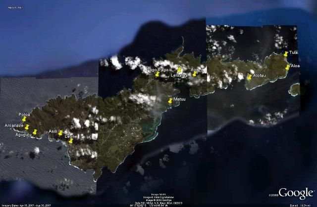
Figure 20. Tutuila Island, American Samoa. Villages visited Poloa, Amanave, Agugulu, Asili, Leone, Matuu, Pago Pago, Leloaloa, Aua, Alofau, Alao, Tula
On the 8th of October, the team went to the eastern side of Tutuila Island to perform LIDAR scans at both Alao and Tula. On the 9th of October, the team revisited the western side of Tutuila to take LIDAR images of Leone and Poloa. Before departing on the 10th of October, the team hiked up the hills of Aua to investigate the recent rockslides.
Agugulu
This village is located on the western side of Tutuila Island and had a large landslide. This earthquake-induced landslide will be further covered in Section 5.2.
Alofau
This village is located on the near the eastern end of Tutuila Island on the southern exposure. This site had a medium earthquake-induced landslide that will be further covered in Section 5.2.
Alao
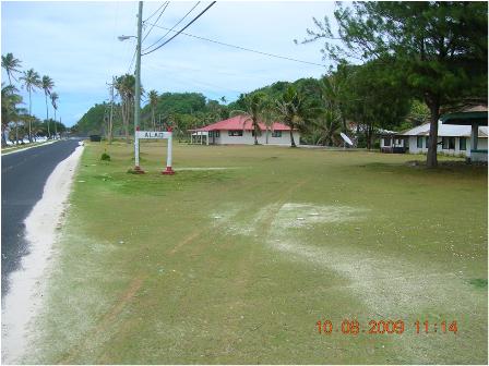
Figure 21. Alao (S14 deg 15.612' W170 deg 33.758')
This village is located on the eastern side of the island and sustained light flood inundation due to the tsunami. This site was surveyed using LIDAR to document the scour patterns around several of the housing structures.
Amanave
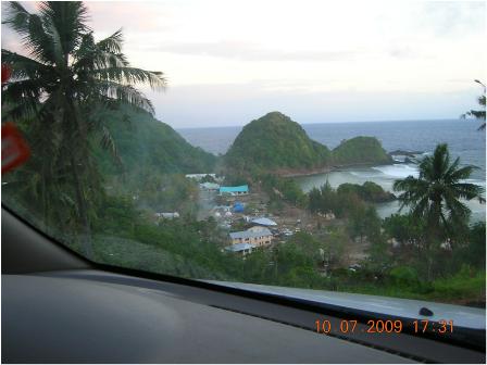
Figure 22. Amanave (S14 deg 19'31.50" W170 deg 49'50.82")
Amanave is located on the western-most side of American Samoa. This village was heavily damaged by wave impact and inundation. Beach structures were destroyed and inundation reached several hundred meters past the beachhead.
Asili
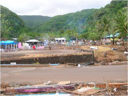
Figure 23. Asili (S14 deg, 19' 52.06" W170 deg, 47'47.19")
The village of Asili is located on the western-most side of American Samoa and has a southern exposure. Like Amanave, this village was heavily damaged by wave impact and inundation. The inundation is seen a few hundred meters past the beachhead.
On the western edge of the village, there were signs of an earthquake-induced landslide.
Aua
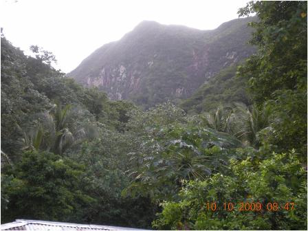
Figure 24. The hillside near Aua (S14 deg 16'18.70" W170 deg 39'38.05")
The village of Aua, which borders Pago Pago Harbor, was not damaged by the tsunami or earthquake. The lack of tsunami damage was attributed to the elevation of the village. However, the water supply for the village was damaged when a large boulder from the hillside smashed the small retention dam. Further information on this incident and the additional rockfall from the earthquake is discussed in Section 5.2.
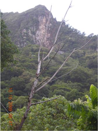
Figure 25. Scarred hillside as evidence of recent earthquake-induced rockfall. (S14 deg 16'18.70" W170 deg 39'38.05")
The light patch on the sheer cliff shown in Figure 25 is a result of the rockfall.
Leloaloa
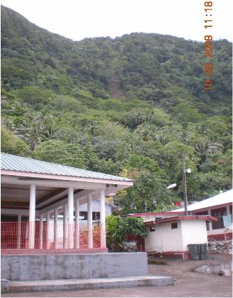
Figure 26. Leloaloa (S14 deg 16'4.76" W170 deg 40'33.99")
Leloaloa also sits at the edge of the Pago Pago Harbor, yet received little tsunami damage. A small, earthquake-induced landslide is evidenced on the hillside behind the village.
Leone
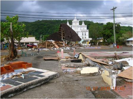
Figure 27. Leone (S14 deg 20'20.26" W170 deg 47'09.54")
One of the hardest hit villages, Leone sustained heavy wave impact and widespread inundation. Beachside structures were destroyed. Behind the village is a lagoon that now holds many of the destroyed homes, various debris, vehicles, and shipping containers.
The bridge through the center of the village, retaining structures, foundations, and homes were heavily damaged by scour and erosion. LIDAR of the bridge and surrounding lagoon is featured in Section 5.3.
Matuu
This village is located on the near the center of Tutuila Island on the southern exposure. This site had a medium earthquake-induced landslide that will be further covered in Section 5.2.
Pago Pago
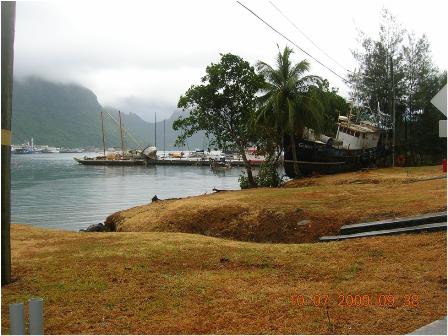
Figure 28. Pago Pago (S14 deg 16'27.39" W170 deg 41'57.13")
Pago Pago Harbor was inundated by the tsunami wave by as much as 2 meters. Harbor structures, buildings, shipping vessels were all severely damaged. Although no earthquake damage was seen, massive amounts of destruction due to the inundation were seen throughout the town. Additional information on the tsunami damage can be seen Section 5.4 of this report.
Poloa
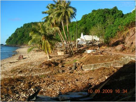
Figure 29. Poloa (S14 deg 18'58.07" W170 deg 50'01.97")
Of all villages on the island of American Samoa, Poloa sustained the most damage. All structures were destroyed except for the church, which sustained heavy damage. The sheer cliffs show trim lines of at least 12 meters. Poloa is located on the western side of Tutuila Island and has a north western exposure. At the time of writing this report, all remaining residents have abandoned Poloa and have moved into the surrounding hills.
Tula
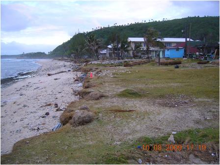
Figure 30. Tula (S14 deg 15.107' W170 deg 33.918')
Located on the eastern end of Tutuila Island with an eastern exposure, Tula sustained heavy damage in portions of the village. Wave inundation extended through the village for several meters. The low-lying mangroves provided a conveyance system for the tsunami wave to travel farther inland.
|