5.0 Geo-hazards
Effects from the earthquake and tsunami were investigated on both Samoa and on American Samoa. This chapter documents the observations made by the GEER team and they traversed across both islands. LIDAR, hand measurements, and documentation via photography and interviewing were utilized as the part of the observations
5.1 Scour
Scour around foundations was visible at many locations. This scour was caused by both the incoming wave and the return wave. Scour occurs when wave energy and pressure becomes concentrated around an object as water tries to pass around the object. Most scour was observed around the foundations of homes; however, some scouring was also observed around utility poles, as well. Scouring was most prevalent in Lepa, Alao, and Leone. Additionally, some scouring was observed in Asili, Poloa, and Tula.
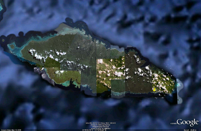
Figure 31. Occurrence of Scour in Samoa: Lepa
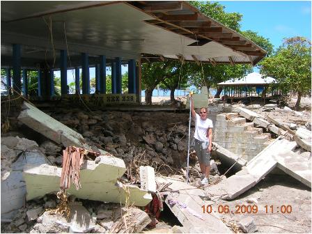
Figure 32. Scour observed in Lepa, Western Samoa causing the collapse of part of a village meetinghouse. (S14 deg 02¡¦30.05¡¨, W171 deg 30¡¦14.87¡¨)
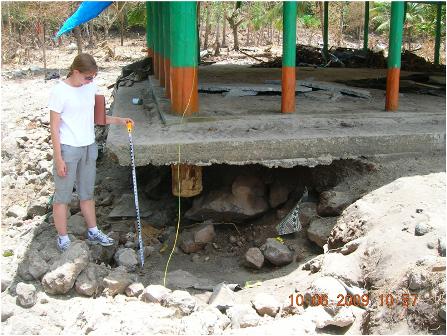 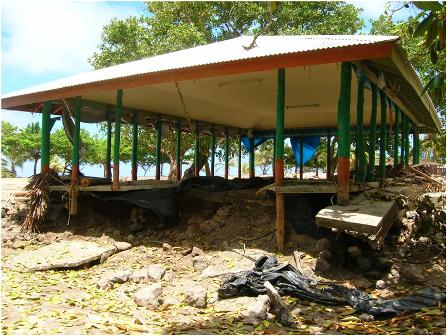
Figure 33. Scouring observed around a village meetinghouse in Lepa, Western Samoa. Note that the scouring is approximately 3.1 feet in depth. Additionally, note the foundation failure caused by the scouring. (S14 deg 02¡¦30.05¡¨, W171 deg 30¡¦14.87¡¨)
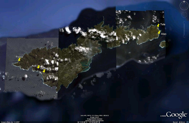
Figure 34. Occurrence of Scour in American Samoa: Poloa, Asili, Leone, Alao, Tula
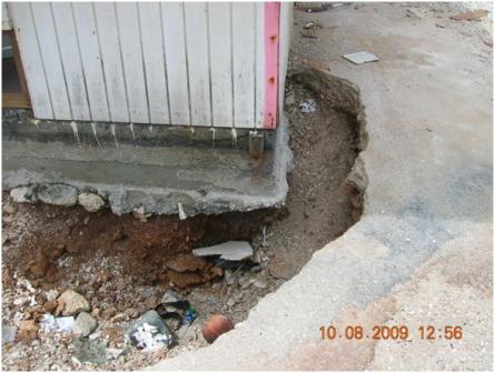
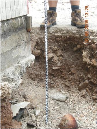
Figure 35. A) Scouring observed in Alao, American Samoa. B) shows a close-up with a measurement of approximately 3 feet of scouring. (14 deg 15'55.49"S, 170 deg 33'51.25"W)
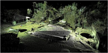
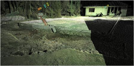
Figure 36. LIDAR scans collected surrounding a foundation with substantial scouring. A) Overview, B) Close-up of scour. Scour depth: 1 m (14 deg 15¡¦36.43¡¨ S, 170 deg 33¡¦45.42¡¨ W)
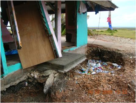
Figure 37. Additional scouring in Alao, American Samoa. Note the cantilevered door entry. (14 deg 15¡¦35.49¡¨ S, 170 deg 33¡¦44.5¡¨ W)
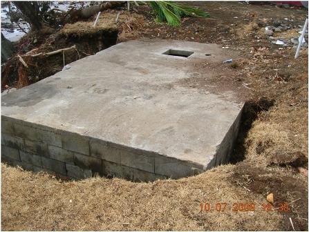
Figure 38. Scouring around a foundation in Asili, American Samoa. (S14 deg 19¡¦52.06¡¨, W170 deg 47¡¦47.19¡¨)
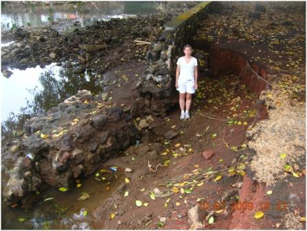
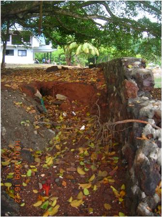
Figure 39. Scouring around a retaining wall adjacent to a river in Leone, American Samoa. A) East Side. B) West Side. (14 deg 20¡¦12.86¡¨ S, 170 deg 47¡¦12.23¡¨ W)
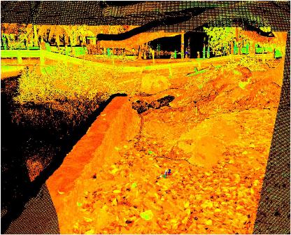
Figure 40. LIDAR scans of the same location in Leone, American Samoa, showing 1m scour depth. (14 deg 20¡¦12.86¡¨ S, 170 deg 47¡¦12.23¡¨ W)
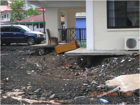
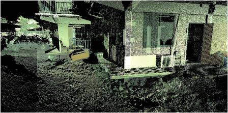
Figure 41. Scouring underneath a large multi-family dwelling in Leone, American Samoa. (14 deg 20¡¦10.73¡¨ S, 170 deg 47¡¦12.10¡¨ W). (B) Lidar point cloud. Scour depth: 0.65 m.
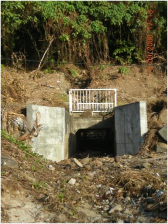 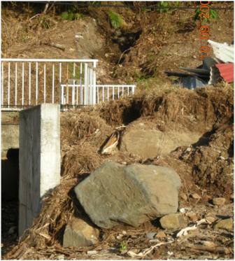
Figure 42. Scouring around a culvert in A) Poloa, American Samoa. B) Closeup. (14 deg 19¡¦04.27¡¨ S, 170 deg 50¡¦05.07¡¨ W)
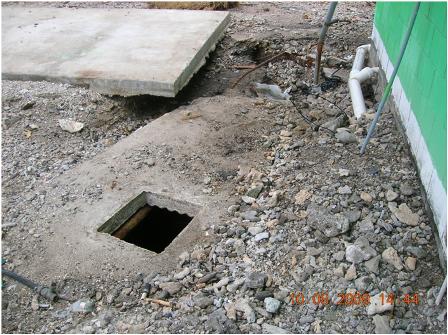
Figure 43. Scouring around a foundation in Tula, American Samoa. (14o15¡¦05.11¡¨ S 170o33¡¦84.27¡¨ W). Scour depth: 0.3m
5.2 Landslides/Rockfall
The intensity of ground shaking recorded by the U.S. GEOLOGICAL SURVEY for the Mw=8.0 event for American Samoa registered between a IV to VII on the Modified Mercalli scale. These levels are typical of light to very strong shaking with no damage to moderate damage.
This level of shaking may induce landslides and rockfalls in moderately steep to steep slopes. The landslides and rockfalls that were observed in American Samoa were typically on sheer to near vertical cliffs. No deep-seated landslides were observed; most appeared to be a form of raveling of the hillside.

Figure 44. Occurrence of Landslide in Samoa: Lepa
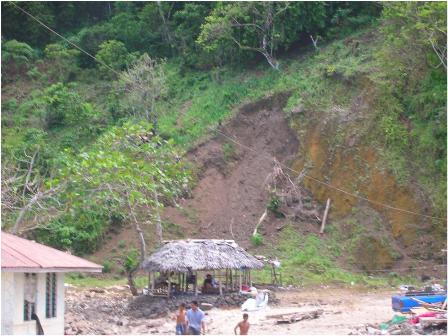
Figure 45. Small Landslide in Lepa, Samoa. This small landslide was possibly induced by scour of the toe of the slope by the tsunami wave. (S14 deg 02¡¦30.05¡¨, W171 deg 30¡¦14.87¡¨)
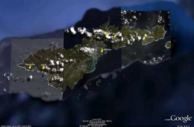
Figure 46. Occurrence of Landslides in American Samoa: Agugulu, Asili, Matuu, Leloaloa, Aua, Alofau.
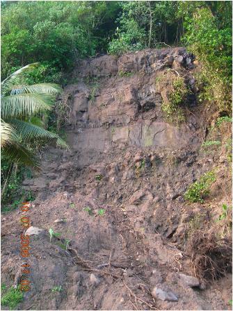
Figure 47. Landslide near Agugulu, American Samoa. It appears that the soil sloughed off the side. The amount of soil which slid was substantial, as it blocked the main road. The toe of the slide was excavated in order for the road to be cleared. The top of the cliff face is approximately 50 feet above the road surface. (14 deg 19'47.61"S, 170 deg 49'22.40"W)
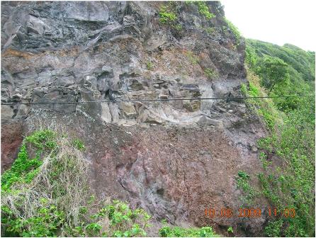
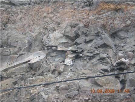
Figure 48. Rockfall near Alofau. A) Rocks fell from near the center of the photo, B) Close-up of the rockfall area, notice additional rocks hanging precariously. (S14 deg 16.521¡¦, W170 deg 36.222¡¦)
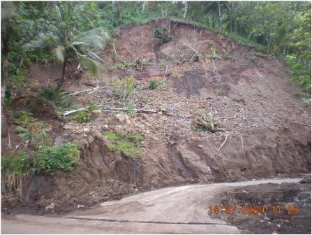
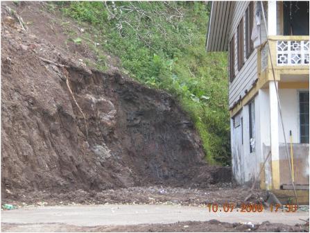
Figure 49. Landslide near Asili, American Samoa. A) Evidence that this is an existing slide which was reactivated due to the earthquake shaking, B) the residents have recently excavated the toe of the slope in order to remove the material from their home. (14 deg 19'53.26"S, 170 deg 47'51.41"W)
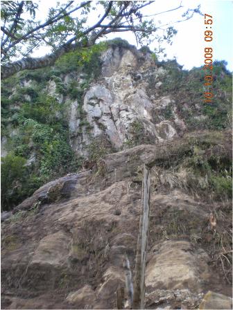
Figure 50. Cliff face of recent rock fall. The light gray/pink near the center of the photograph is the site of the rockfall origin. The cliff face is at an elevation of approximately 350 meters. Near Aua, American Samoa (14 deg 16'18.79"S, 170 deg 39'37.98"W).
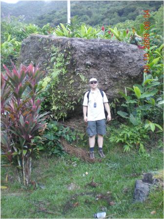
Figure 51. Large boulder, existing prior to earthquake, in the front yard of a resident of Aua. Approximate elevation of 35 meters. A boulder this size smashed the small water retention dam at an elevation of approximately 100 meters.
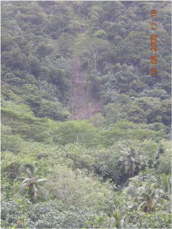
Figure 52. Landslide near Leloaloa, American Samoa. Notice the sheer cliff face left behind. (14 deg 16'4.56"S, 170 deg 40'34.65"W)
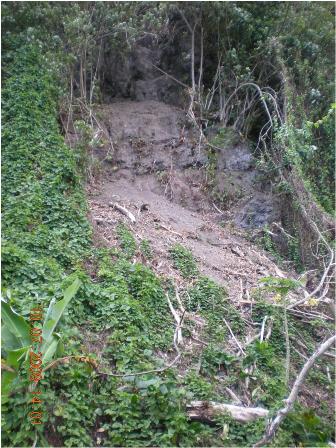
Figure 53.Small earthquake-induced landslide near Matuu, American Samoa. Landslide material looks to have slumped off the hillside. (14 deg 17'57.11"S, 170 deg 41'8.00"W)
5.3 Erosion
Substantial erosional damage from the Tsunami was observed. Further, additional erosion and landslides are anticipated with future precipitation because of the vegetation destroyed from the Tsunami. Unfortunately, reference data are not available, as of current, for overall quantification of the erosion. However, using the LIDAR data surrounding areas of erosion, previous topography can be estimated in some locations for erosion quantification.
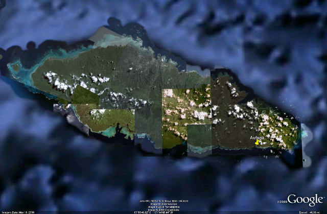
Figure 54. Occurrence of Erosion on Samoa: Aufaga
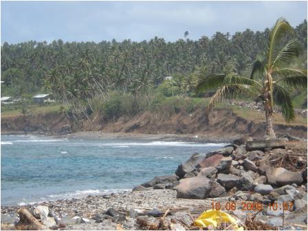
Figure 55. Wave induced bluff erosion observed in Aufaga, Western Samoa. (14 deg 02'23.70" S and 171 deg 31'44.87" W)
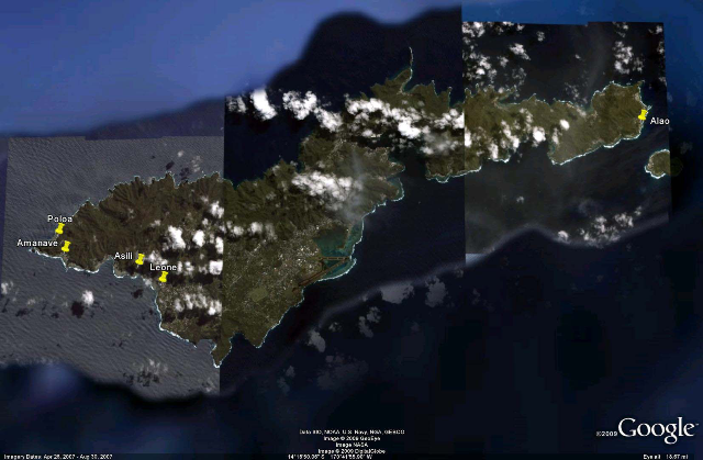
Figure 56. Occurrences of erosion on American Samoa: Poloa, Amanave, Asili, Leone, Alao
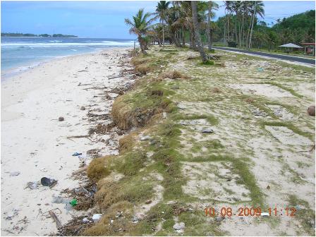
Figure 57. Beach erosion and sediment displacement observed in Alao, American Samoa. Note that the road has been cleaned. (14 deg 15¡¦55.3¡¨ S and 170 deg 33¡¦51.28¡¨)
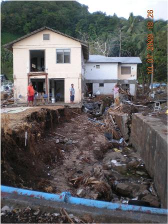
Figure 58. Erosion of channel bank and failure of a retaining wall in Amanave, American Samoa. (14 deg 19¡¦30¡¨ S 170 deg 49¡¦51.5¡¨ W). Note the lack of reinforcement in the retaining wall.
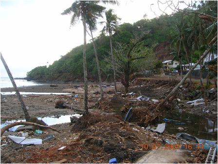
Figure 59. Beach and bluff erosion observed in Asili, American Samoa. Note the uprooting of vegetation. (14 deg 19¡¦55.26¡¨ S, 170 deg 48¡¦03.17¡¨ W)
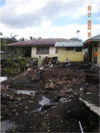
Figure 60. Erosion of a river channel bank caused by failure of a retaining wall. Few remnants of the retaining wall can be seen in the photograph where the person in the yellow vest is located. Leone, American Samoa (14 deg 20'13.89" S, 170 deg 42'12.27" W)
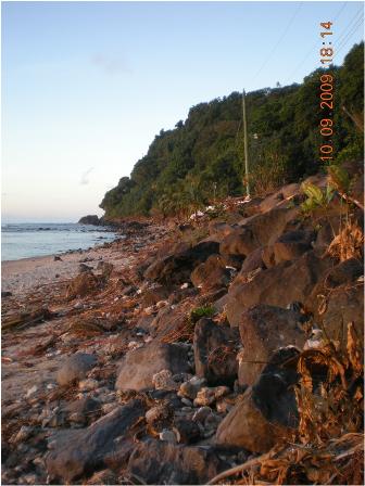
Figure 61. Erosion and destruction of vegetation along coast in Poloa, American Samoa. Note the clear trim line (high water mark) between dead, brown vegetation, and healthy green vegetation. (14 deg 19'01" S, 170 deg 50'04"W)
5.4 Tsunami Damage
Widespread damage was seen throughout Samoa and American Samoa. This section gives a general description and pictorial of some of the damage done by the tsunami.
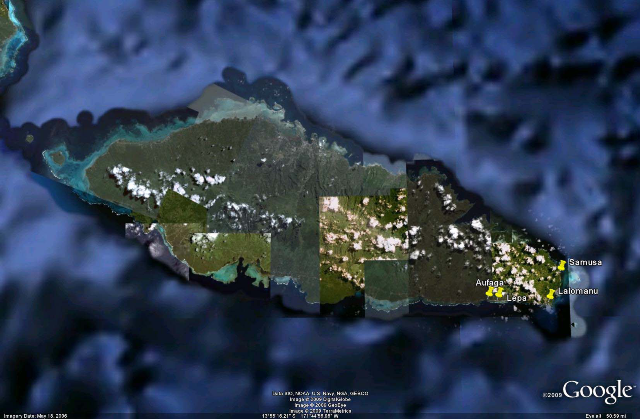
Figure 62. Occurrences of devastating tsunami damage in Samoa: Aufaga, Lepa, Lalomanu, Samusa
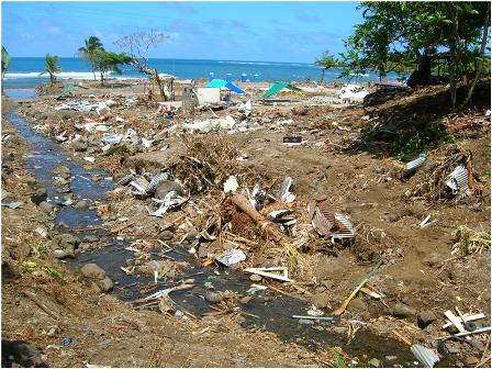
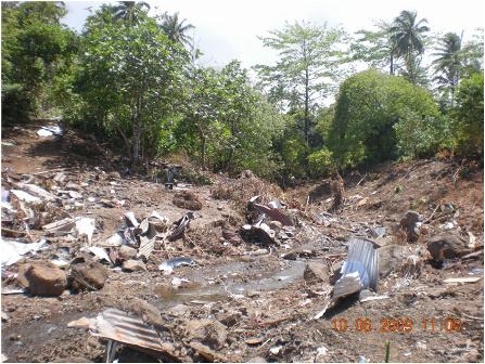
Figure 63. Debris in channel near Aufaga, Samoa A) Picture taken looking down the channel. B) Picture taken up the channel. The trim line on the right side of the channel is approximately 7 meters above sea level. (S14 deg 02'27.78", W171 deg 31'17.85")
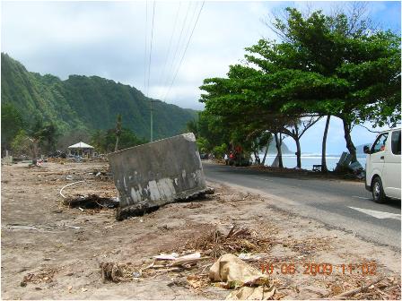
Figure 64. Concrete vault near Lepa, Samoa. This 3m x 3m x 2m concrete vault was relocated from the right side of the roadway to the left by the tsunami. (14 deg 2'29.93"S, 171 deg 29'59.77"W)
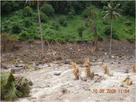
Figure 65. Trim line near Lepa, Samoa. The trim line was measured at 13.6 meters above sea level near this location. (14 deg 2'25.76"S, 171 deg 30'4.48"W)
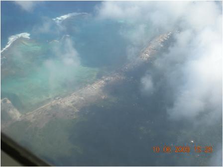
Figure 66. Lalomanu, Samoa from the air. Notice that the extents of inundation can be seen. (S14 deg 02'48.44", W171 deg 26'31.97")
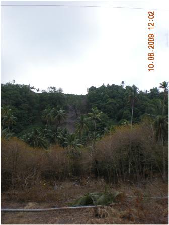
Figure 67. Near Lalomanu, Samoa. Seawater inundation from the tsunami has killed the vegetation. The extents of the inundation become obvious. (S14 deg 02'48.44", W171 deg 26'31.97")
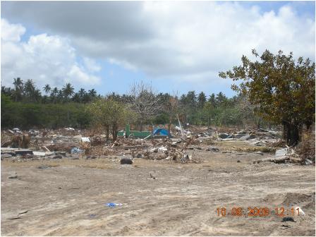
Figure 68. Near Samusa, Samoa. This low-lying area was leveled by the tsunami. (S14 deg 00'24.17", W171 deg 25'33.53")
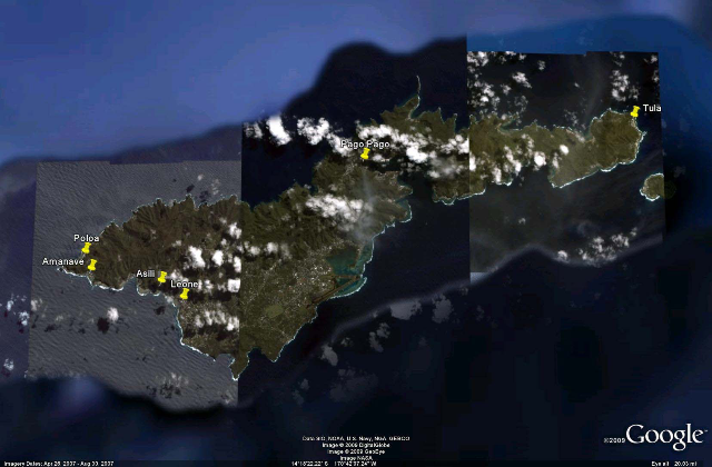
Figure 69. Occurrences of devastating tsunami damage in American Samoa: Poloa, Amanave, Asili, Leone, Pago Pago, Tula.
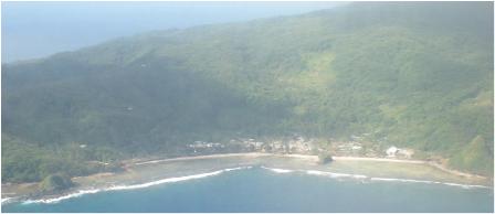
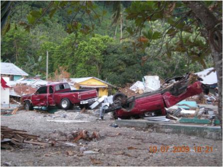
Figure 70. Amanave, American Samoa. A) Amanave from the air. The extents of damage are evidenced by the debris line B) destruction in the village of Amanave (14 deg 19'30.19"S, 170 deg 49'51.57"W)
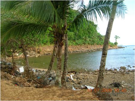
Figure 71. Beach and trim line on opposite hillside, near Asili, American Samoa (S14 deg 19'52.06", W170 deg 47'47.19")
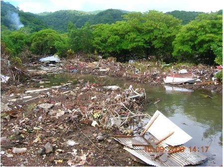
Figure 72. Debris in lagoon behind Leone, American Samoa (14 deg 20'12.85"S, 170 deg 47'12.90"W)
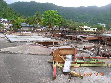
Figure 73. Site of hardware store and additional buildings. Harbor structures were heavily damaged. Pago Pago Harbor (S14 deg 16'27.39", W170 deg 41'57.13")
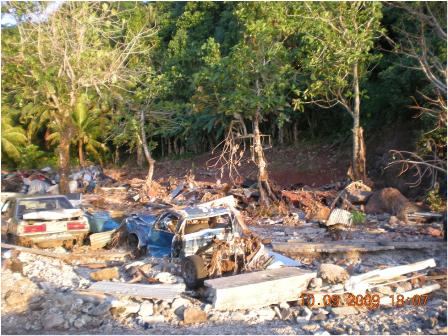
Figure 74. Multiple cars and debris strewn around in the aftermath. Notice the trim line on the hillside at an elevation of approximately 8 meters above sea level. Poloa, American Samoa (14 deg 19'1.20"S, 170 deg 50'3.37"W)
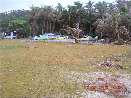
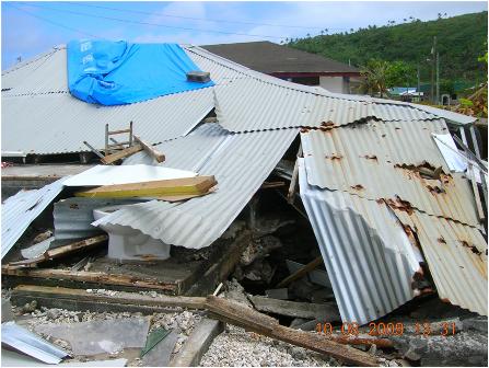
Figure 75. Damage in Tula, American Samoa A) Concrete house destroyed, B) Additional structure destroyed by tsunami. (S 1 deg 15.107', W 170 deg 33.918')
5.5 Structural Damages
A substantial amount of structural damage was observed on both islands. Generally, columnar structures were in better condition because there was less water pressure buildup because of less exposed surface area. However, several columnar structures with weak reinforcement were severely damaged.
Some foundations failed due to scouring. However, most foundations were found in acceptable conditions. Many people setup temporary shelters on top of their foundations (Figure 21).
Structural damage appeared to have only occurred from the tsunami and not from strong ground motion from the earthquake.
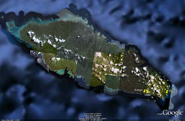
Figure 76. Occurrences of Structural Damage in Samoa: Aufaga, Lepa, Satitoa
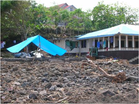
Figure 77. Comparison of structural damage observed in Aufaga, Western Samoa. Note that the structure on the right has a columnar structure and remained more intact, whereas the structure on the left has been completely destroyed. Additionally the structure on the right is built up to a higher elevation. (14 deg 2'25.34"S, 171 deg 31'29.20"W)
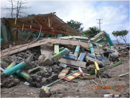
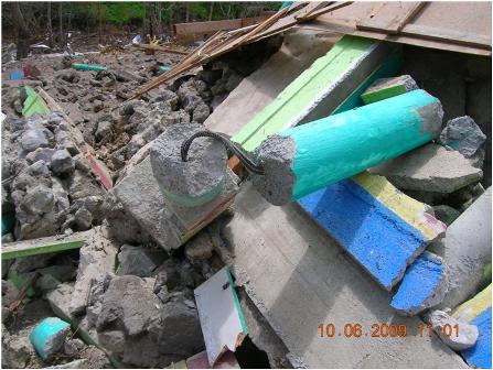
Figure 78. Collapse of a columnar structure in Lepa, Western Samoa. Note the minimal reinforcement only in the center of the column.(S14 deg 02'30.05", W171 deg 30'14.87")
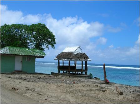
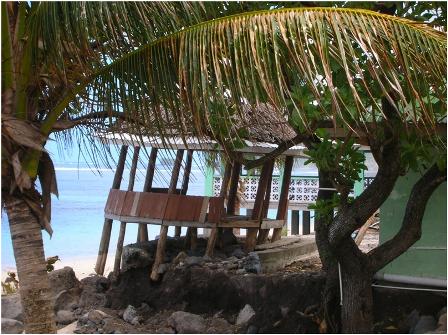
Figure 79. Structures on the coast in Lepa, Western Samoa. Note that from one viewpoint A), the structure looks intact, but from another viewpoint (looking east), damage to the foundation is observed. (S14 deg 02'30.05", W171 deg 30'14.87")
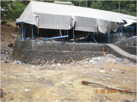
Figure 80. Damage to a structure in Lepa, Western Samoa. Note the excellent condition of the rock wall surrounding the base. (S14 deg 02'30.05", W171 deg 30'14.87")
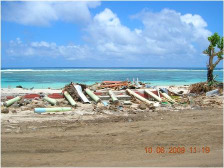
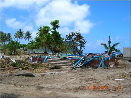
Figure 81. Complete destruction of structures in Satitoa, Western Samoa. Note that minimal reinforcement is present in the concrete. (S14 deg 01'47.00", W171 deg 25'54.33")
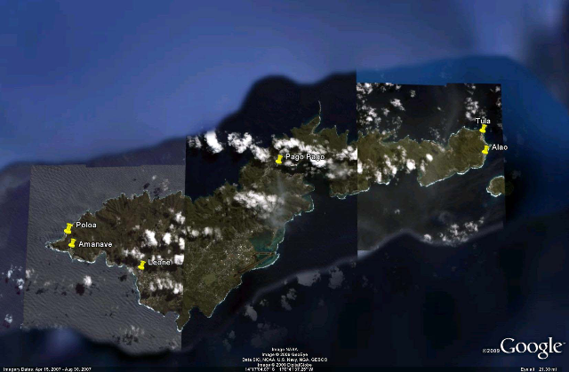
Figure 82.Occurrences of Structural Damage in American Samoa: Poloa, Amanave, Leone, Pago Pago, Alao, Tula
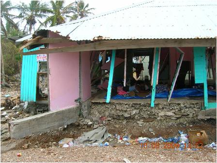
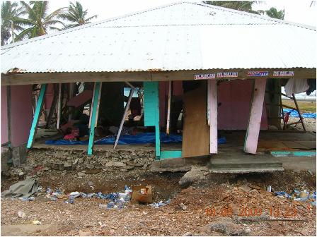
Figure 83. Damage to a home in Alao, American Samoa. Note the broken concrete beam on the left side of the structure. Minimal reinforcement is present in the beam. Note the scouring creating a cantilevered front porch. (14 deg 15'35.49" S, 170 deg 33'44.5" W)
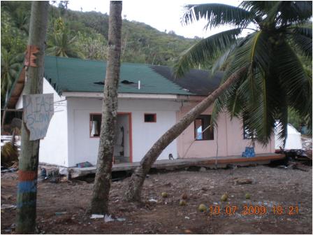
Figure 84. House that was removed from its foundation in Amanave, American Samoa. (14 deg 19'28.44"S, 170 deg 49'56.26"W)
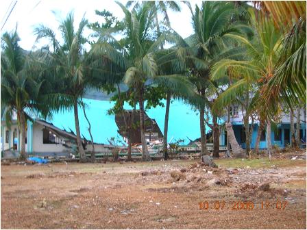
Figure 85. Church with collapsed roof in Amanave, American Samoa. Generally, churches and other public buildings withstood impacts of the tsunami with minimal damage. (14 deg 19'34.82" S,170 deg 49'47.04"W)
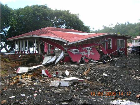
Figure 86. Near collapse of a structure in Leone, American Samoa. (14 deg 20'11.24"S, 170 deg 47'12.40"W)
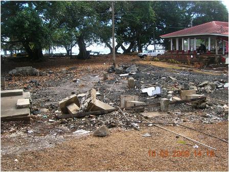
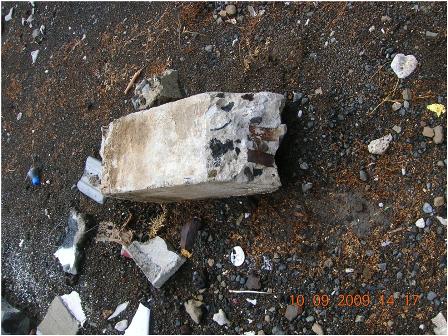
Figure 87. Complete collapse of a structure adjacent to the structure in Figure 86. B) Close-up of column. No reinforcement was visible in the collapsed structure. Leone, American Samoa (14 deg 20'11.69"S, 170 deg 47'11.74"
W)
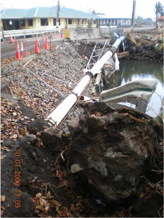
Figure 88. Collapsed bridge in Leone, American Samoa. An entire lane of the bridge was destroyed. Note the damage to utilities. (14 deg 20'13.23"S, 170 deg 47'12.91"W)
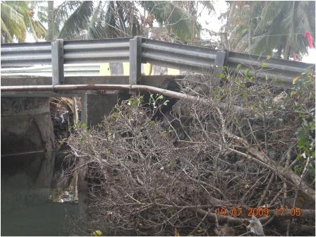
Figure 89. Additional view of collapsed bridge in Leone from East side looking West. (14 deg 20'13.23" S, 170 deg 47'12.91"W)
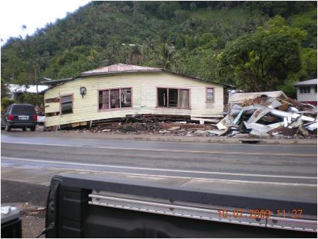
Figure 90. Damaged structure in Pago Pago, American Samoa. Note the complete removal from foundation. (S14 deg 16'27.39", W170 deg 41'57.13")
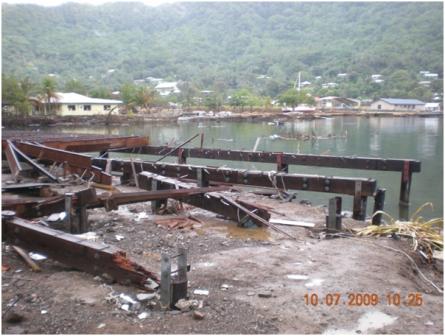 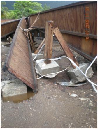
Figure 91. Damaged wood dock in Pago Pago harbor, American Samoa. (S14 deg 16'27.39", W170 deg 41'57.13")
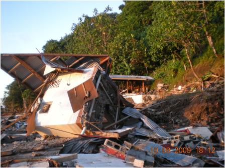
Figure 92. Overturned house in Poloa, American Samoa. (14 deg 19'1.20"S, 170 deg 50'3.37"W)
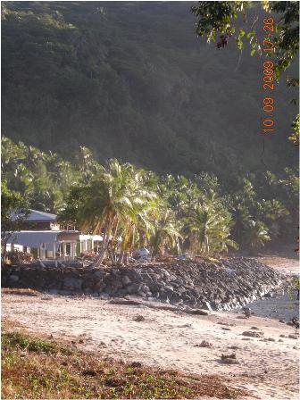
Figure 93. Rip rap revetment in Poloa, American Samoa. Note the excellent performance of the revetment.?Additionally, note the coral deposits on the beach. (14 deg 19'5.98"S, 170 deg 50'6.24"W)
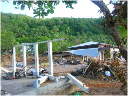
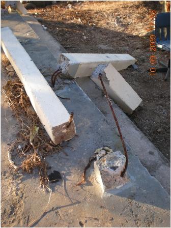
Figure 94. Damage to a column structure in Poloa, American Samoa. Note the minimal reinforcement present in the concrete. The structure was approximately 10 m from the ocean, atop the revetment shown in Figure 93. (14 deg 19'5.98"S, 170 deg 50'6.24"W)
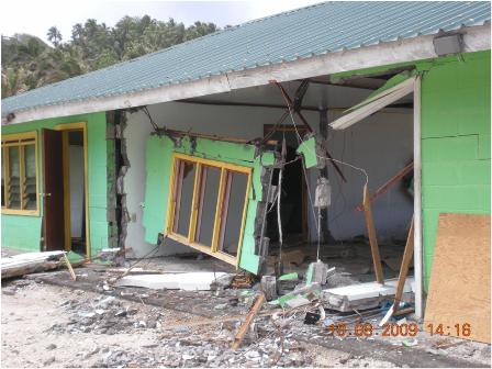
Figure 95. Damaged structure in Tula, American Samoa. (14 deg 15'05.53"S,170 deg 33'54.25"W) |