PORT OF KANDLA
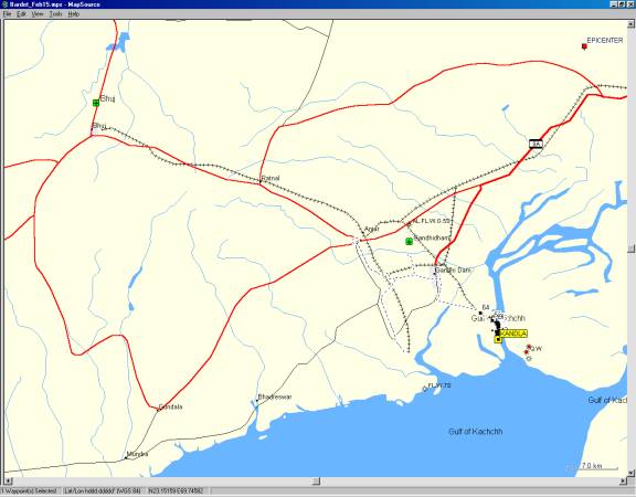
The port of Kandla is a modern port located in the Gulf of Kachchh. In the year 2000, it handled 45 millions of tons, including timber, rice, coal and sulfur, with many different countries around the world. The port of Kandla is located approximately 40 km to the South of the earthquake epicenter (Figure 1). There were only a few casualties in the port, which were mainly caused by the collapse of a building. At the time of the earthquake, it was 8:46 AM on a vacation morning day, and there were however little activity in the port.
The damage to the port was confined to a few buildings, warehouses, and some old jetties. The tower of the port of Kandla titled as the result of lateral ground deformation close to the waterfront. Nearby buildings showed signs of settlement. The ground floor of the two-story building adjacent to the tower collapsed, and was reported to have killed some of its occupants. There were two instances of roof damage to warehouses with heavy roof structures. Othere warehouses with lighter steel roofs were reported undamaged. The open ground in the port settled uniformly, with some sand boils and some evidence of lateral ground deformation and cracking along unsupported waterfront sections. One of the most striking damage was observed on a 50 year old jetty. Most of its 2500 hollow RC piles were cracked about 30 cm below the pile caps. This damage reduced temporarily the operation loads on the jetty, which were reduced from 3.5 ton/m2 to 1.5 ton./m2 until crack damage are repaired. Another small jetty with hybrid RC columns and steel piles displayed bending cracks along the waterfront. Overall, the modern (10 -15 year old) pile-supported jetties performed very well. There was no detectable signs of permanent displacement on the pile-supported jetties, which could have impaired the functioning of loading cranes.
Figure 1. The port of Kandla is located on the Gulf of Kachchh, 40 km to the South of the earthquake epicenter.
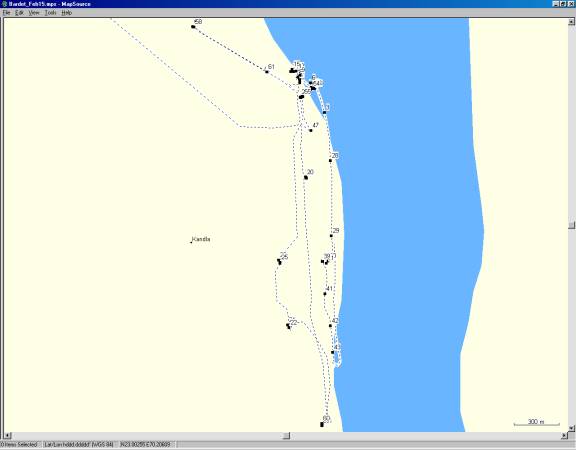
Figure 2. Location of figures.
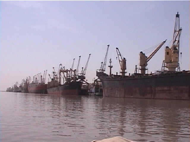
Figure 3. The port of Kandla was in operation on February 15, 2001 (2/15/01 12:35:30 PM, N23.00698 E70.22417).
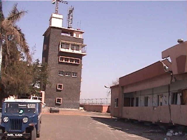
Figure 4. Distant view of the tower of the Kandla port (2/15/01 11:16:54 AM, N23.00875 E70.22256).
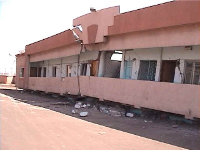
Figure 5. The first floor of the two-story building close to the tower collapsed (2/15/01 11:16:50 AM, N23.00878 E70.22257).
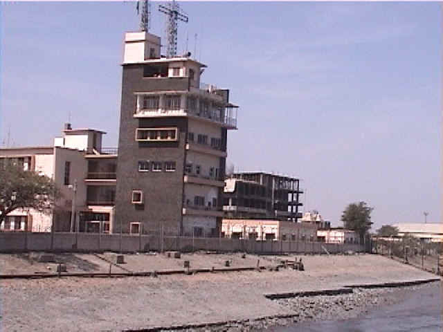
Figure 6. The tower of the Kandla port viewed from the waterfront (2/15/01 12:32:09 PM, N23.00874 E70.22328).
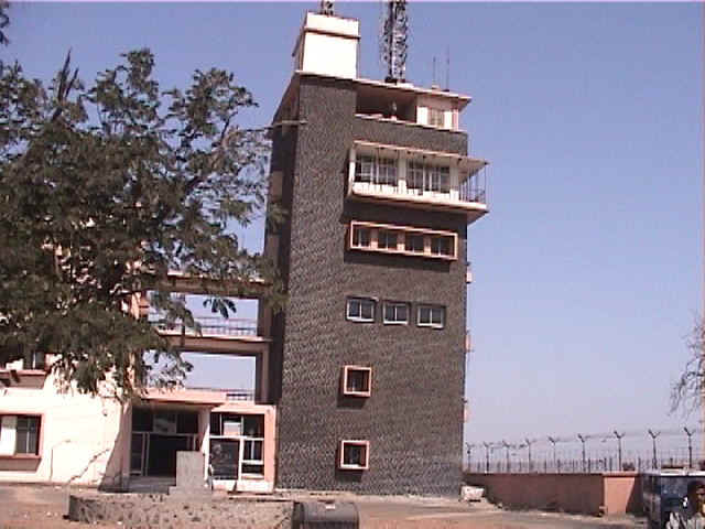
Figure 7. The tower of the Kandla port leaned sideways toward the water front. (2/15/01 11:16:15 AM, N23.00893 E70.22256).
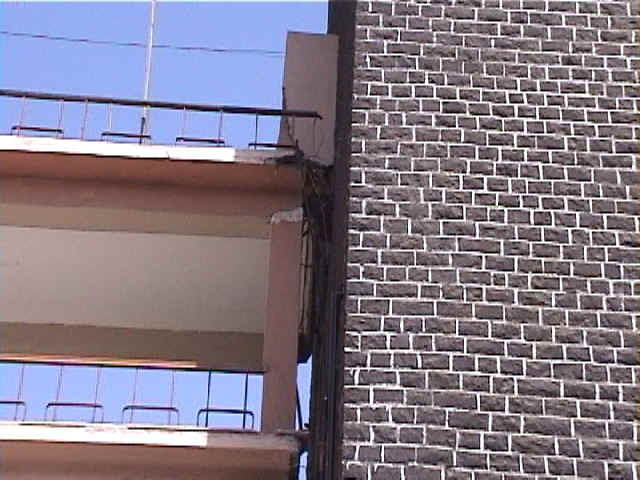
Figure 8. Separation between tower and adjacent building. The tower leaned toward the waterfront. There was one foot of tilt at the tower top (2/15/01 10:58:03 AM, N23.00910 E70.22246).
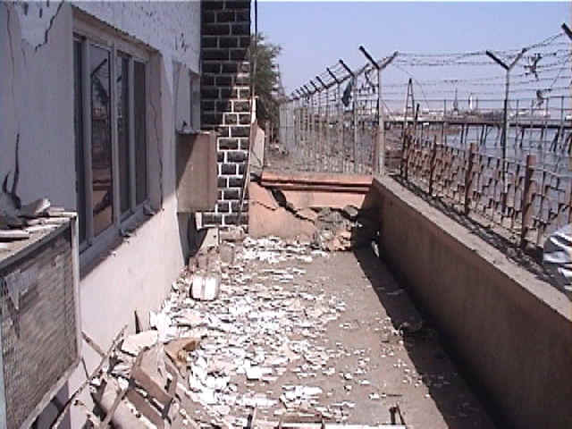
Figure 9. Separation between tower and adjacent wall, indicating lateral ground displacement toward the waterfront (2/15/01 11:01:33 AM, N23.00922 E70.22260).
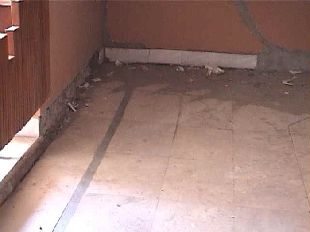
Figure 10. Settlement of tile floor in building adjacent to tower (2/15/01 11:06:16 AM, N23.00944 E70.22232).
Figure 11. The tile floor of a small room in the building adjacent to the tower settled more in the center than along the edges (2/15/01 11:07:37 AM, N23.00943 E70.22219).
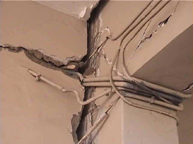
Figure 12. The displacement of the electrical conduits indicated a relative vertical displacement between two adjacent buildings (2/15/01 11:09:09 AM, N23.00942 E70.22204).
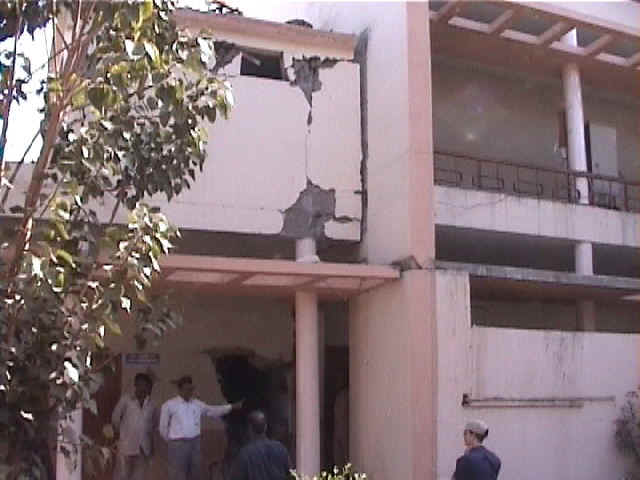
Figure 13. The building to the left settled relatively to the building to the right. (2/15/01 11:09:38 AM, N23.00941 E70.22199).

Figure 14. Close view of the relative settlement between two adjacent buildings (2/15/01 11:10:00 AM, N23.00941 E70.22199).
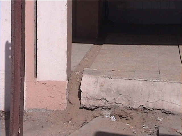
Figure 15. Separation in the walkway, indicating a lateral ground displacement (2/15/01 11:12:12 AM, N23.00957 E70.22207).
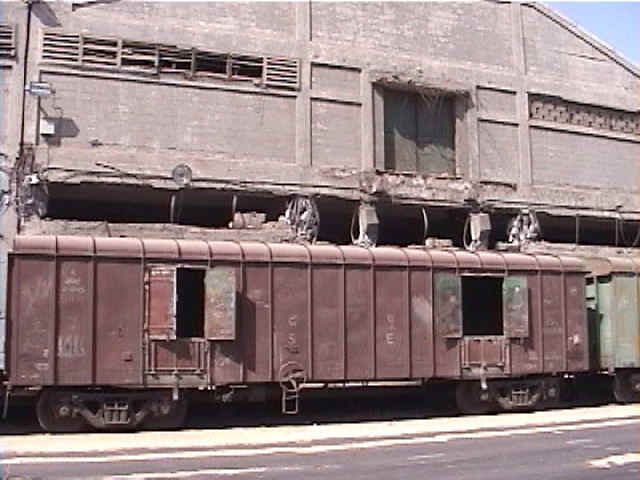
Figure 16. Most of the short columns of this particular warehouse had failed, whereas those of nearby warehouse had not failed. A port engineer explained that the second floor of the warehouse was loaded with goods at the time of the earthquake. (2/15/01 11:28:01 AM, N23.00305 E70.22300).
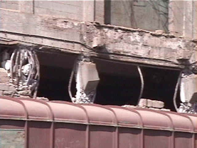
Figure 17. Most of the short columns of the warehouse had failed under compression (2/15/01 11:24:02 AM, N23.00310 E70.22298).
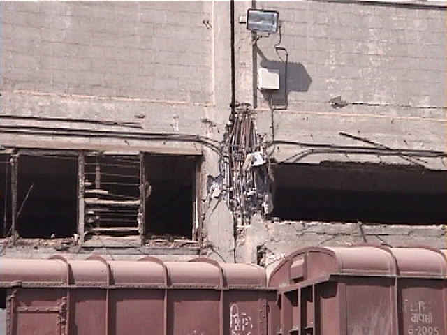
Figure 18. The short column of the warehouse failed under compression (2/15/01 11:23:58 AM, N23.00310 E70.22298).
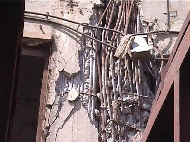
Figure 19. Detailed view of column reinforcement showing non corrugated mild steel bars and very few stirrup bars. (2/15/01 11:29:48 AM, N23.00313 E70.22294).
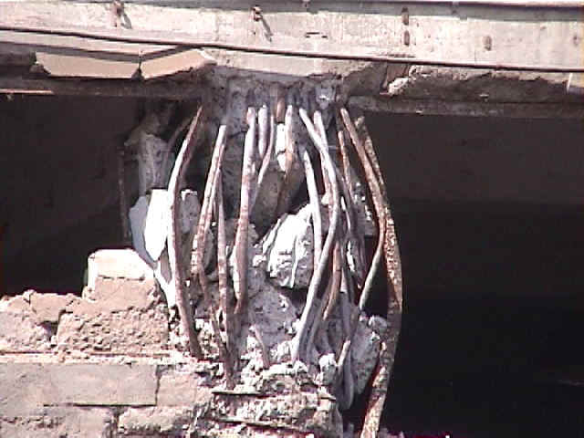
Figure 20. A close view of a failed column (2/15/01 11:27:18 AM, N23.00310 E70.22296).
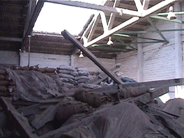
Figure 21. A section of the warehouse roof collapsed. The roof structure is rather heavy as it is made of prestressed beams and trusses (2/15/01 11:56:44 AM, N22.99424 E70.22178).

Figure 22. Separation of two adjacent sections of the warehouse roof (2/15/01 11:58:37 AM, N22.99408 E70.22188).
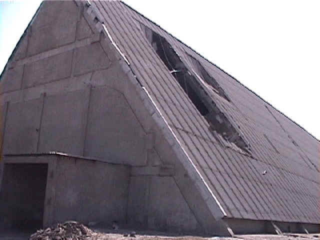
Figure 23. General view of the V-shaped warehouse with roof damage (2/15/01 12:11:24 PM, N22.99812 E70.22120).
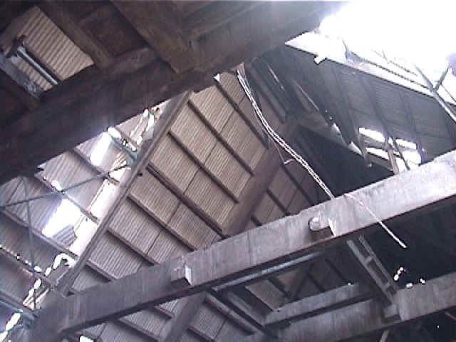
Figure 24. A section of the V shaped warehouse roof collapsed. The roof is designed to support the weight of a conveyor belt (2/15/01 12:07:50 PM, N22.99793 E70.22127).
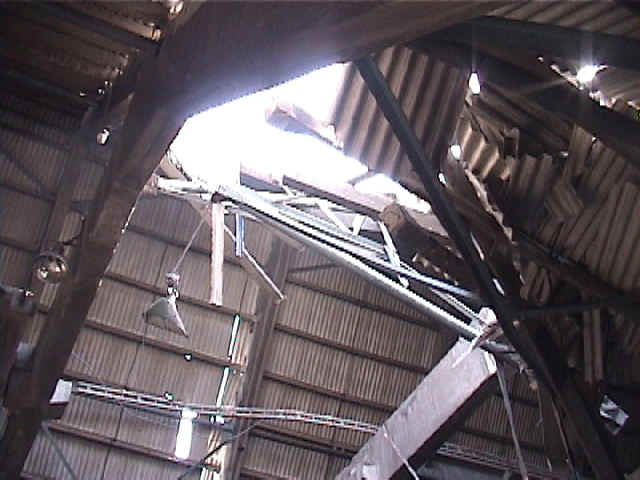
Figure 25. Another view of the roof damage to the V-shaped warehouse (2/15/01 12:10:32 PM, N22.99799 E70.22129).
Figure 26. The Customs house settled and titled after the earthquake (2/15/01 12:19:19 PM, N23.00786 E70.22266).
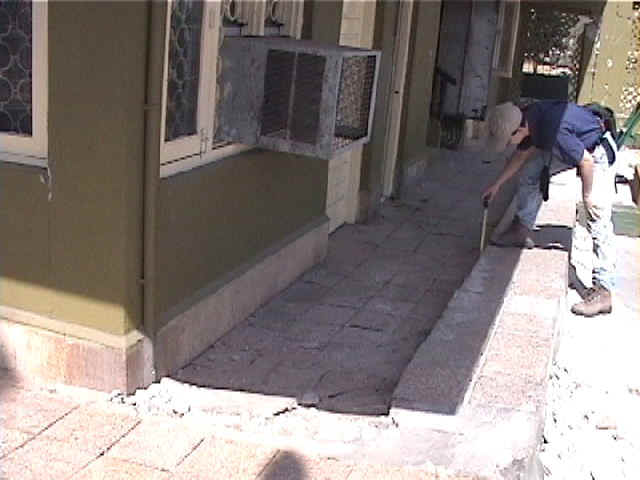
Figure 27. Settlement and tilt of the customs guard house in the port of Kandla (2/15/01 12:18:41 PM, N23.00790 E70.22260).
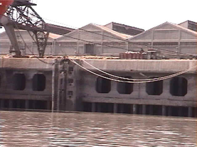
Figure 28. View of the old jetty section founded on hollow RC piles (2/15/01 12:36:49 PM, N23.00410 E70.22456).
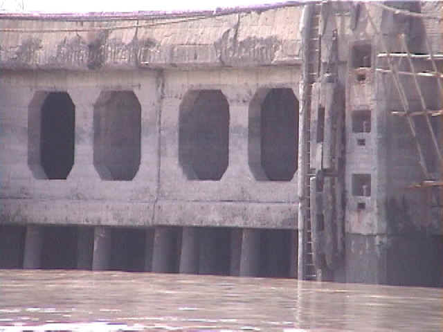
Figure 29. Close view of the old jetty section founded on hollow RC piles (2/15/01 12:38:50 PM, N22.99959 E70.22463).

Figure 30. Repair work related to corrosion damage, and not to earthquake damage (2/15/01 12:39:39 PM, N22.99809 E70.22440).
Figure 31. Close view of repair work related to corrosion damage. Some rebars are exposed. A wire mesh is attached, before covering it with shotcrete (2/15/01 12:39:49 PM, N22.99795 E70.22429).
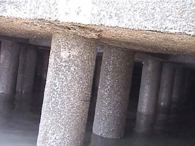
Figure 32. The first row of RC piles is usually filled in with concrete to resist to lateral bollard loads. Some of these piles were cracked close to the pile cap (2/15/01 12:40:54 PM, N22.99805 E70.22405).
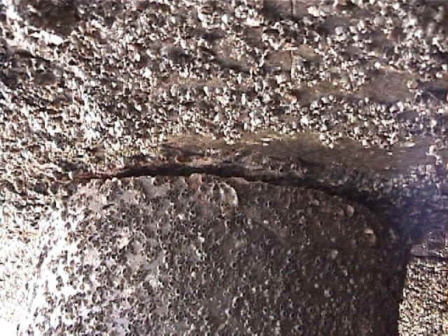
Figure 33. This pile in the old jetty seemed to have separated from the wharf before the earthquake (2/15/01 12:42:07 PM, N22.99804 E70.22405).
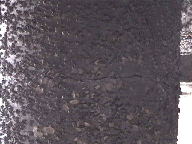
Figure 34. Many, if not all piles, displayed small circumferencial cracks at about 30 cm below pile caps (2/15/01 12:43:03 PM, N22.99804 E70.22404).
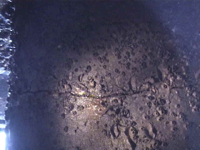
Figure 35. Another crack in a hollow RC piles of the old jetty (2/15/01 12:44:54 PM, N22.99804 E70.22403).

Figure 36. Some cracks were more opened on the land side than on the waterfront side (2/15/01 12:46:50 PM, N22.99804 E70.22403).
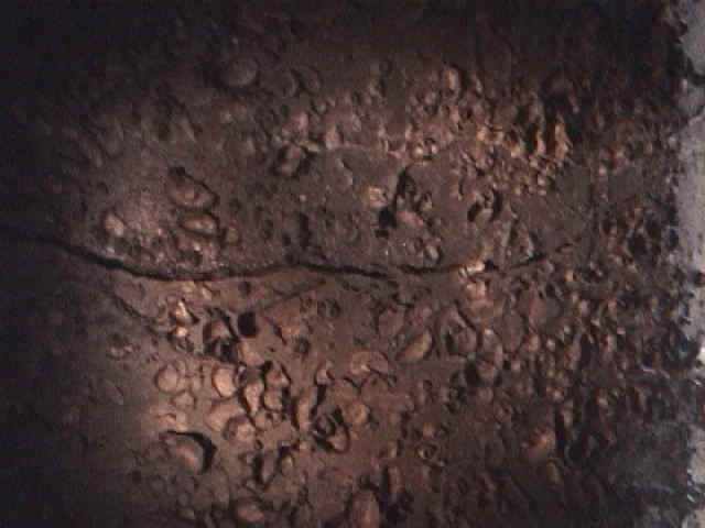
Figure 37. Close view of a crack in an hollow RC pile (2/15/01 12:46:58 PM, N22.99804 E70.22403).
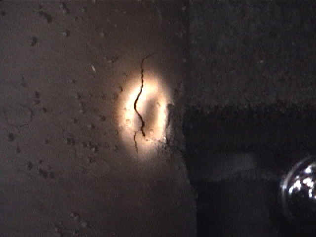
Figure 38. Spalling of concrete in a pile of old jetty. Only few piles exhibited spalling (2/15/01 12:55:29 PM, N22.99805 E70.22402).
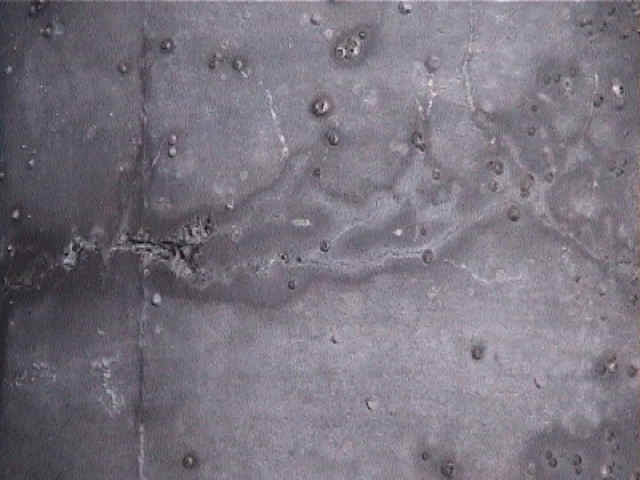
Figure 39. On some piles, the cracks were very small and hard to detect. Very few pile were battered. There were located at the back of the jetty in sections difficult to access (2/15/01 1:02:33 PM, N22.99806 E70.22402).
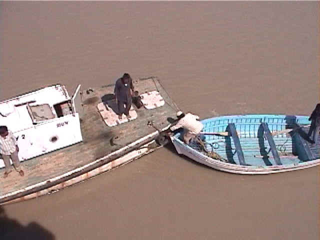
Figure 40. Boats used to inspect the piles under the wharf. The pile inspection was performed using the flatter boat at low tide (2/15/01 1:36:33 PM, N23.00849 E70.22332).
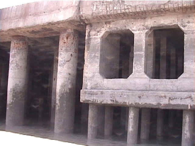
Figure 41. Transition between old and newer jetty. Newer jetty had no damage (2/15/01 1:23:03 PM, N22.99611 E70.22421).
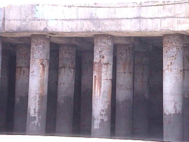
Figure 42. Another view of the newer jetty section with steel pile support (2/15/01 1:25:00 PM, N22.99419 E70.22456).
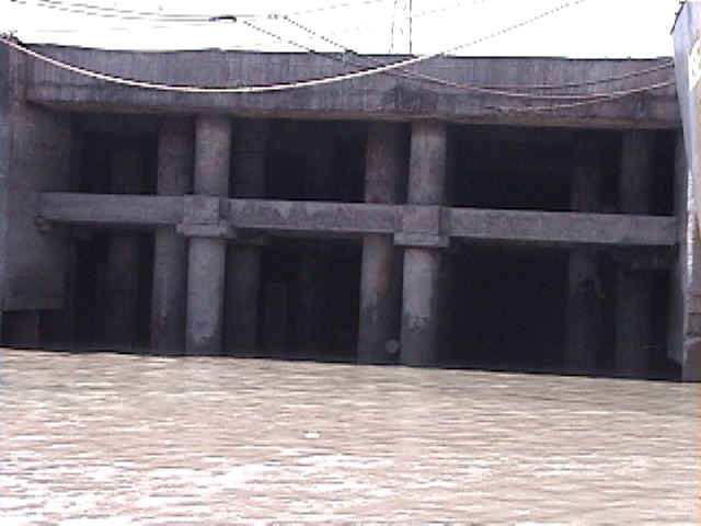
Figure 43. The jetties of the port of Kandla had several designs. The first row of this section had lateral bracings. (2/15/01 1:26:01 PM, N22.99261 E70.22472).
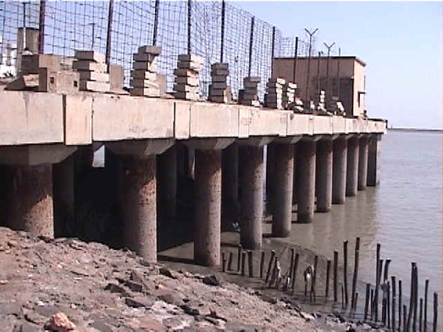
Figure 44. The latest sections of steel pile supported wharf performed very well during the earthquake. There was no apparent sign of damage (2/15/01 11:41:56 AM, N22.98832 E70.22403).

Figure 45. Close-up view of the steel piles supporting the most modern wharf section. The piles are filled in with concrete. (2/15/01 11:45:06 AM, N22.98824 E70.22404).
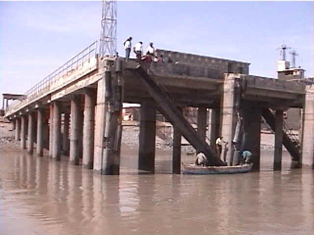
Figure 46. Hybrid wharf supported by steel piles and RC columns (2/15/01 12:34:15 PM, N23.00840 E70.22353).
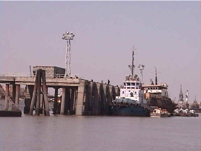
Figure 47. View of the wharf from the ocean (2/15/01 1:34:29 PM, N23.00590 E70.22331).
Figure 48. Separation of two sections of the wharf (2/15/01 12:26:47 PM, N23.00841 E70.22328).
Figure 49. Close view of the separation between two wharf sections (2/15/01 12:27:59 PM, N23.00843 E70.22326).
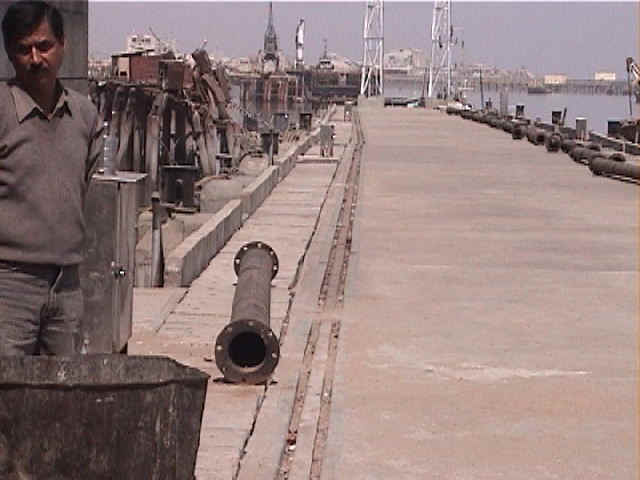
Figure 50. Rail misalignment resulting from the lateral displacement and rotation of a section of the wharf (2/15/01 12:29:13 PM, N23.00844 E70.22336).
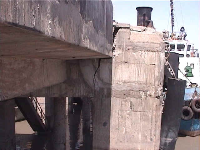
Figure 51. The first row of reinforced concrete columns of the wharf had cracks and were slightly inclined (2/15/01 12:32:58 PM, N23.00835 E70.22326).
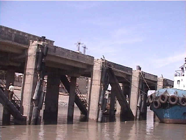
Figure 52. View of the wharf with lateral-deformation induced damage (2/15/01 12:33:57 PM, N23.00842 E70.22348).

Figure 53. Settlement of the ground relative to the passenger jetty (2/15/01 1:39:24 PM, N23.00793 E70.22273).
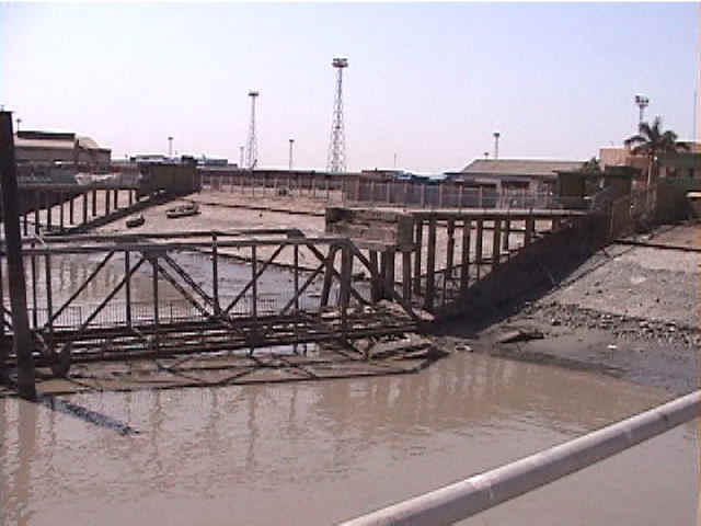
Figure 54. Inoperational passenger jetty in the port of Kandla. The jetty was not damaged by the earthquake, but by a cyclone (2/15/01 12:25:42 PM, N23.00839 E70.22337).
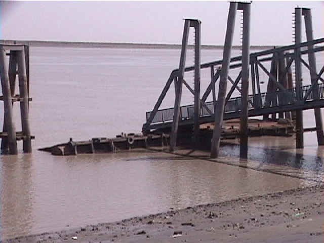
Figure 55. Earthquake damage to one of the passenger jetties. The left sliding connection, which allows the floating deck to move vertically was damaged by the earthquake shaking (2/15/01 1:41:01 PM, N23.00792 E70.22276).
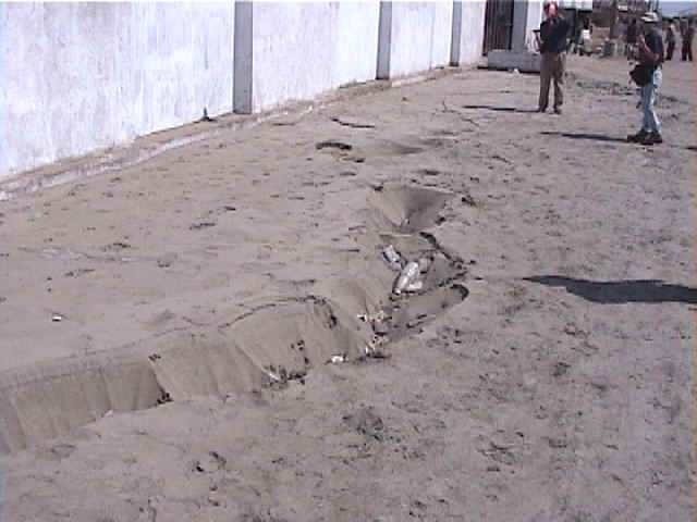
Figure 56. Sand was ejected on the road surface in the port of Kandla (2/15/01 1:49:18 PM, N23.01211 E70.21561).
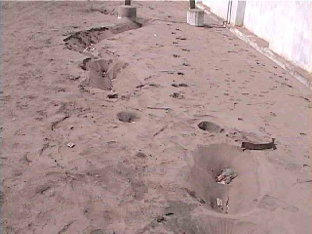
Figure 57. The ejected sand came out through cracks (2/15/01 1:50:02 PM, N23.01208 E70.21563).
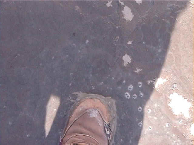
Figure 58. The ejected sand was still wet. A few pushes with the foot reactivated liquefaction (2/15/01 1:51:00 PM, N23.01210 E70.21569).
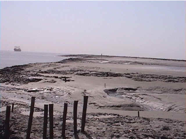
Figure 59. View of the nativel ground on which Kandla port was built. Soil Description at Kandla Port Soil borings from Berths 6 and 7 at Kandla Port were obtained. These borings indicate 5 to 10 m of soft silty clay at the surface underlain by sand. The Atterberg Limits of the soil (PL = 20, LL = 50 to 70, PI = 30 to 50) indicate the clay is highly plastic and the in situ water content is close to the liquid limit. Field vane shear tests indicate undrained shear strengths as low as 20 kPa near the surface, increasing linearly with depth, and a sensitivity of 3 to 5. The clay is fairly compressible, with approximately 1 m of settlement occurring when 4 m of fill was placed in sections of the port. This observation indicates a compression index of between 0.8 and 1.0. The properties of this soil are very similar to those of San Francisco Bay Mud (2/15/01 11:43:52 AM, N22.98821 E70.22401).
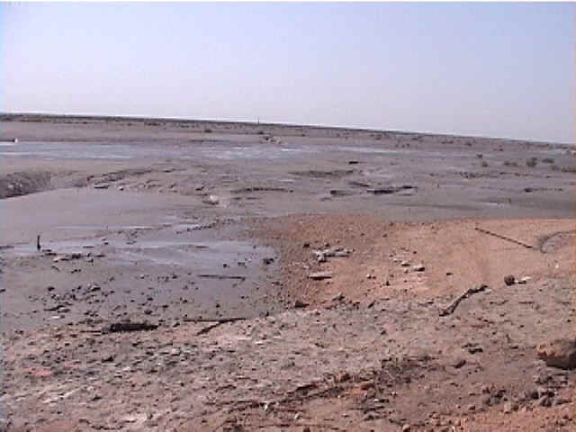
Figure 60. View of the natural ground under the Kandla port. The land was developed by pouring weathered decomposed rock on top of it. (2/15/01 11:41:33 AM, N22.98836 E70.22401).
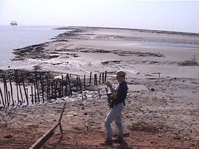
Figure 61. View of the original ground on which Kandla port was reclaimed (2/15/01 10:41:07 AM, N23.00939 E70.22043).