Navlakhi Port
Navlakhi Port is a small peninsula-shaped port located on the eastern edge of the Gulf of Kachchh, approximately 45 km west of the city of Morbi and 45 km south of the earthquake epicenter. The port is situated on marshy deposits, consisting mainly of soft silty clay with interbedded sand. Significant ground cracking, lateral deformation, and slope failures were concentrated along the southern edge of the port, with less severe cracking occurring along the northern edge. The main pile-supported wharf sustained no damage, but a newly constructed non pile-supported wharf suffered considerable damage. Three large slope failures occurred along the southern edge of the port. One of these failures was initiated by earthquake shaking, but did not slide significantly until high tide occurred. The earthquake also caused cracking along the access road to the port and this area subsequently slid during the high tide.
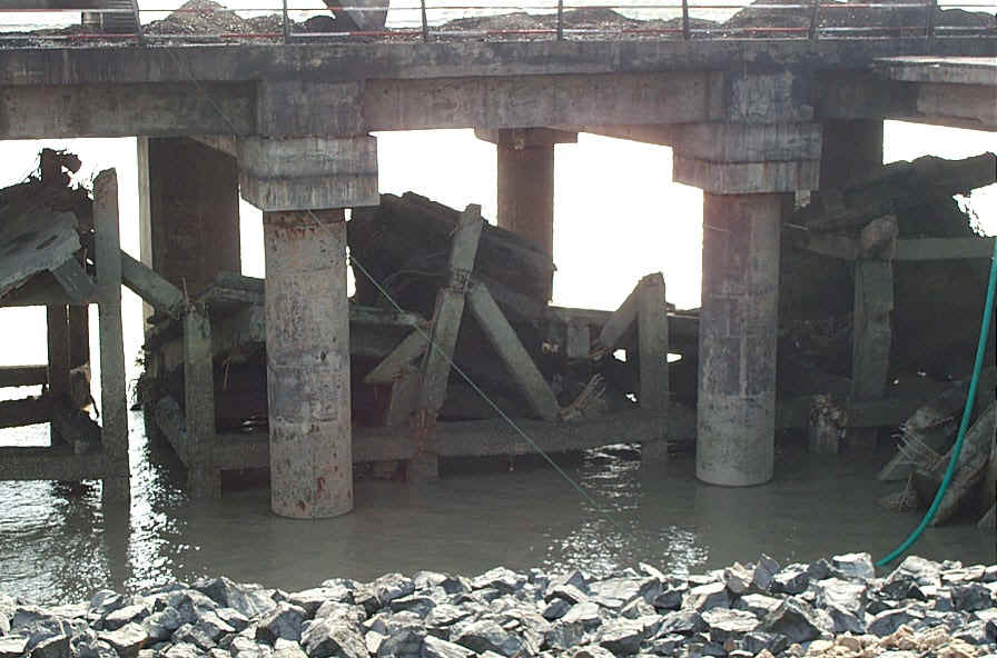
Pile-supported wharf constructed over previous wharf (dcp_0024.jpg, 2/14/01, 2:57 pm, N22.95765, E70.44906).

Ten inches of lateral movement around piles of wharf (dcp_0027.jpg, 2/14/01, 3:29 pm, N22.95765, E70.44906).

Ground cracks behind wharf indicating lateral and vertical movement. Total separation across cracks was 18 in. (dcp_0025.jpg, 2/14/01, 3:25 pm, N22.95765, E70.44906).
Slide directly west of main wharf with approximately 6 m of lateral displacement, extending 100 m along shore. Head scarp coincides with stone wall (dcp_0089.jpg, 2/16/01, 1:55 pm, N22.95822, E70.44769).
Tilting failure of gravity bollard wharf. Wharf is underlain by silty clay and backfill is poorly compacted sand(dcp_0020.jpg, 2/14/01, 3:11 pm, N22.95857, E70.44672).
Movement of gravity bollard wharf. 2 m of extension measured directly behind wharf. Cracking extends 30 m behind wharf. (dcp_0019.jpg, 2/14/01, 3:10 pm, N22.95857, E70.44672).
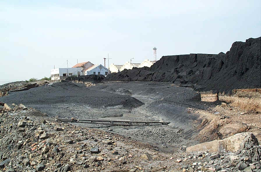
Slope failure along shore where 5 m of coal was piled. Failure extends 100 m along shore (dcp_0090.jpg, 2/16/01, 2:29 pm, N22.95959, E70.44574).
Ground movement extending west of coal pile slope failure (dcp_0018.jpg, 2/14/01, 3:01 pm, N22.95959, E70.44574).
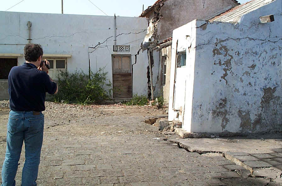
Ground cracking and extension damaging building adjacent to coal pile slide (dcp_0017.jpg, 2/14/01, 3:00 pm, N22.95959, E70.44574).
Nose of port immediately after the earthquake (dsc00003.jpg, photo by Captain Agarwal, 1/26/01).
Nose of port at high tide after the earthquake (dsc00002.jpg, photo by Captain Agarwal, 1/26/01).
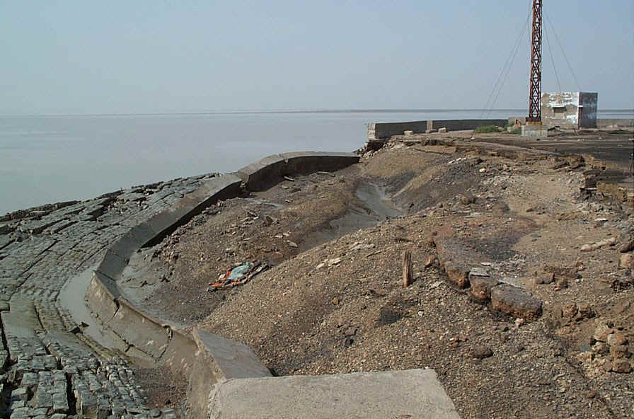
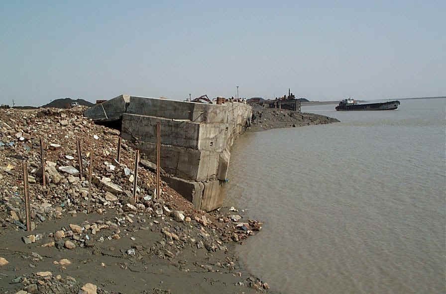
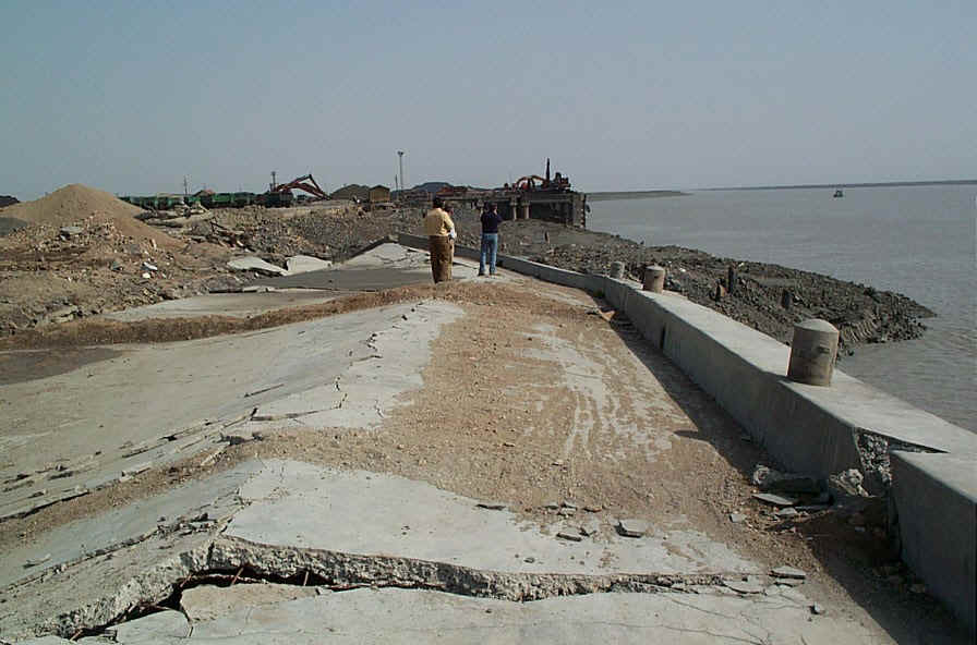
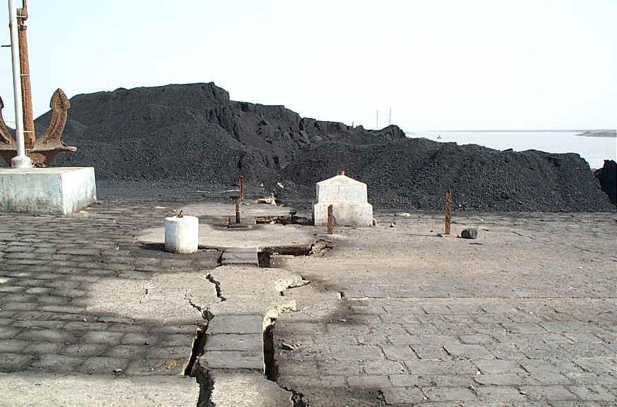
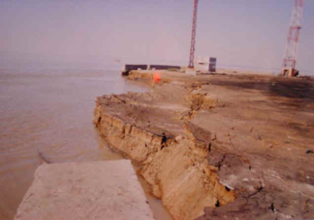
Final configuration of nose of port after earthquake. Approximately 2.5 m of vertical deformation and 2.5 m of horizontal deformation (dcp_0091.jpg, 2/16/01, 2:46 pm, N22.95765, E70.44906).
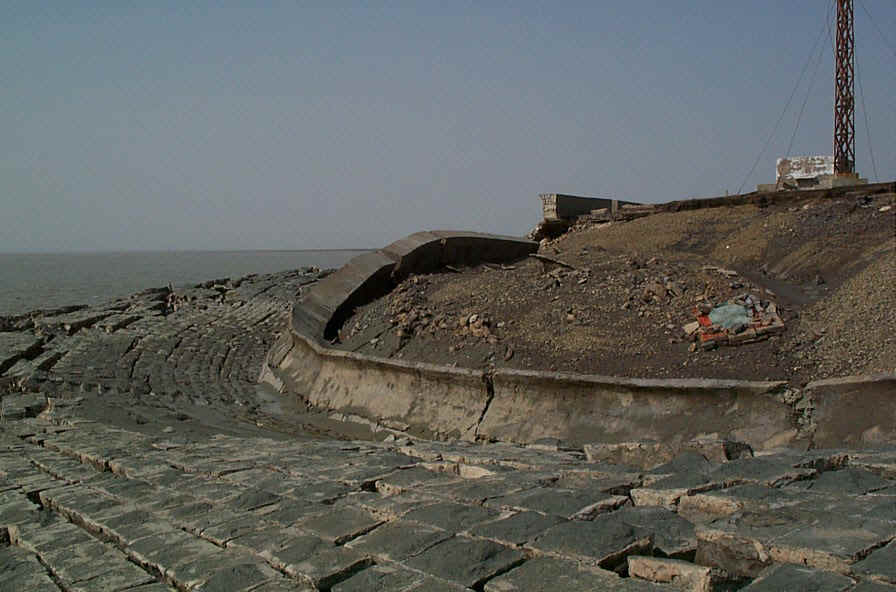
Final configuration of nose of port after earthquake (dcp_0013.jpg, 2/14/01, 2:53 pm, N 22.95765, E 70.44906).
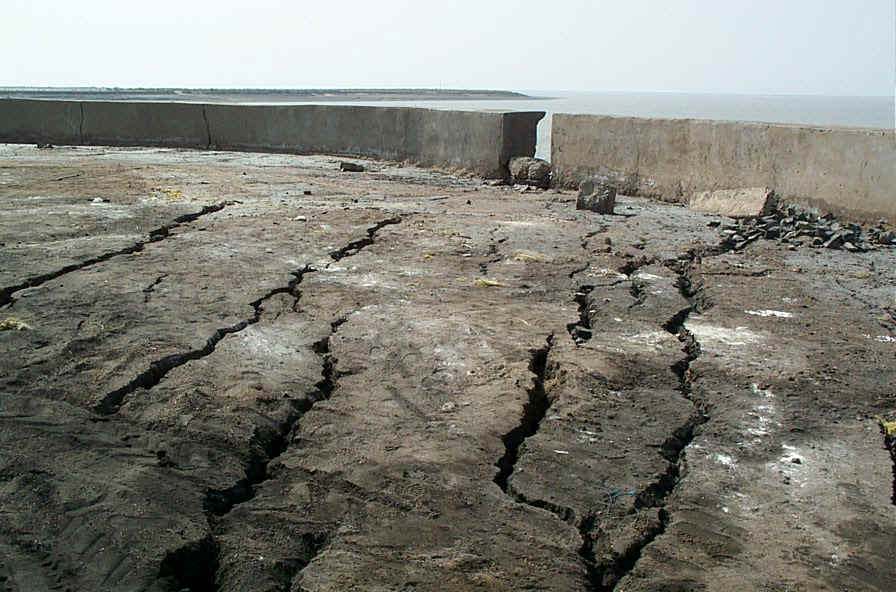
Ground cracking along northern edge of nose of port (dcp_0015.jpg, 2/14/01, 2:57 pm, N22.95765, E70.44906).
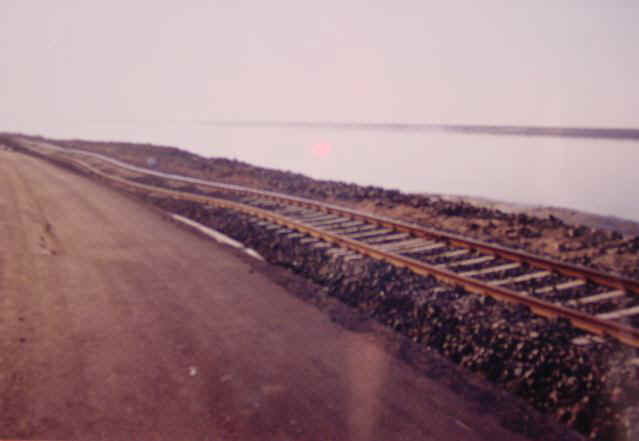
Movement of Navlakhi Port access road and railroad immediately after earthquake (dsc00005.jpg, photo by Captain Agarwal, 1/26/01).
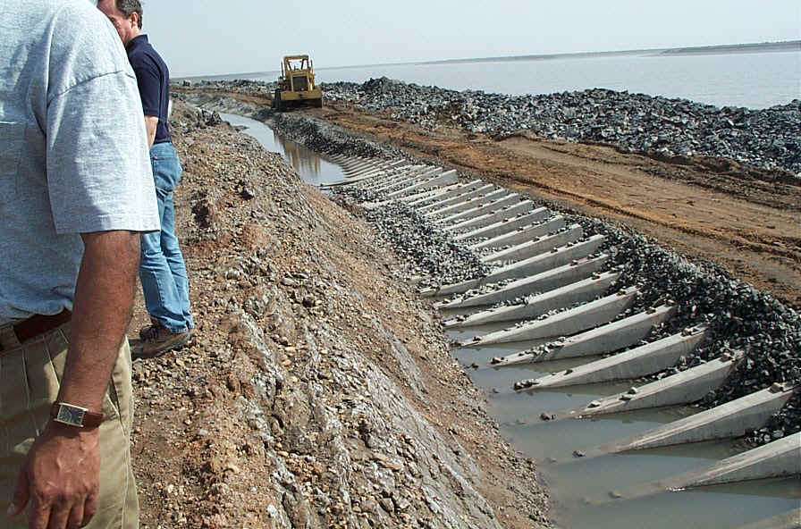
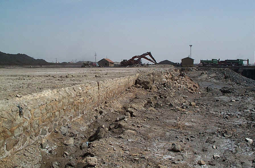
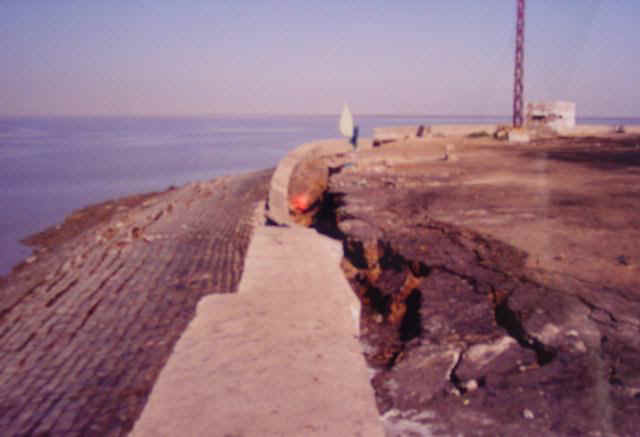
Slope failure along Navlakhi Port access road and railroad (dcp_0009.jpg, 2/14/01, 2:35pm).