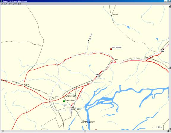
Figure 1. General location of ground cracking observations made 12 km to the Northwest of the epicenter on February 16, 2001.
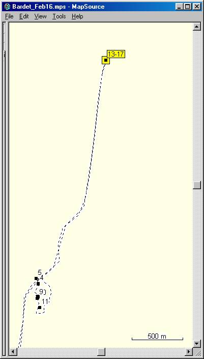
Figure 2. Closeup view of Figure 1 showing the location of pictures.
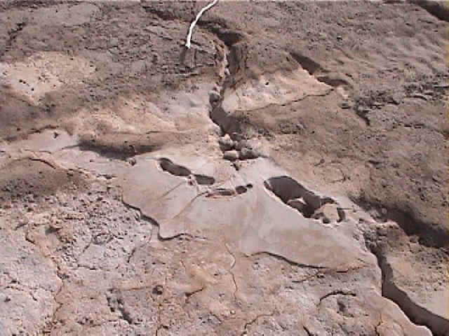
Figure 3. Liquefaction sand ejecta littering the ground surface through ground cracks (2/16/01 4:14:45 PM, N23.40012 E70.22790).
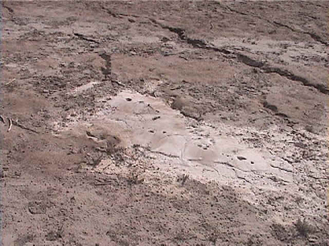
Figure 4. A series of parallel ground cracks with small vertical offset and sand ejecta (2/16/01 4:14:32 PM, N23.40018 E70.22788).
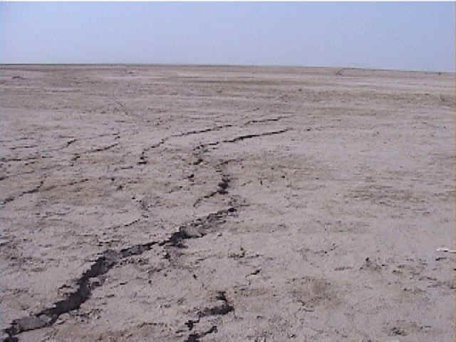
Figure 5. Parallel ground cracks extended over long distance in the Rann of Kachchh (2/16/01 4:12:45 PM, N23.40062 E70.22770).
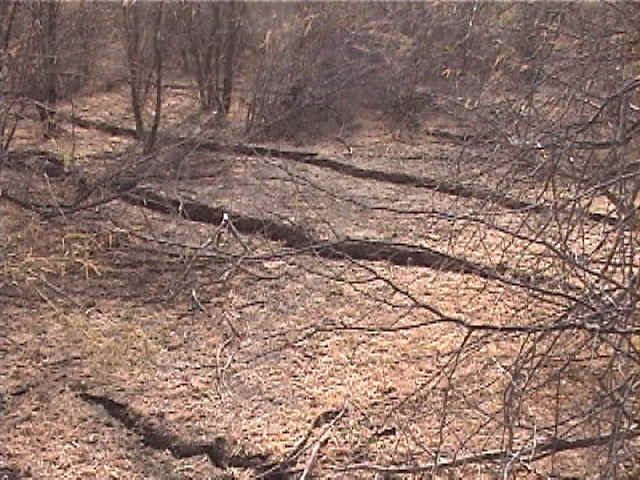
Figure 6. Series of parallel ground cracks with vertical offset hidden by thorny bushes (2/16/01 4:22:09 PM, N23.39905 E70.22785).
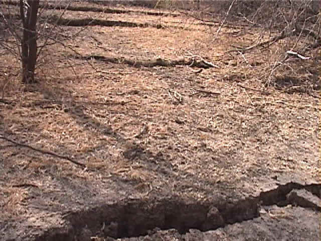
Figure 7. Another series of ground cracks with vertical offset (2/16/01 4:23:19 PM, N23.39901 E70.22792).
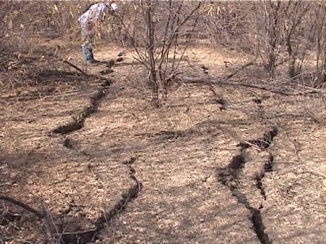
Figure 8. The ground cracks ran over hundred of meters among thorny bushes (2/16/01 4:30:08 PM, N23.39896 E70.22784).
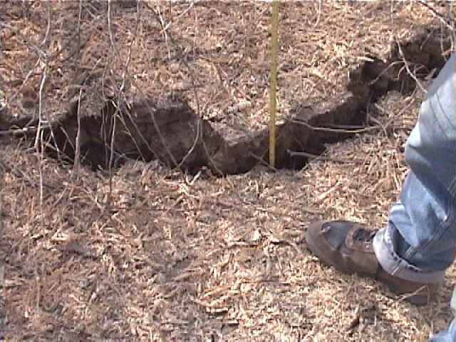
Figure 9. Vertical offset 10 cm high (2/16/01 4:31:40 PM, N23.39893 E70.22784).
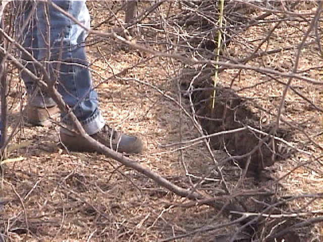
Figure 10. Vertical offset varied from cracks to cracks (2/16/01 4:34:00 PM, N23.39888 E70.22782).
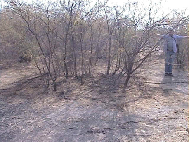
Figure 11. The direction of ground cracking changed abruptly at 90 degrees at this location (2/16/01 4:38:21 PM, N23.39809 E70.22803).
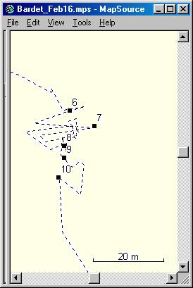
Figure 12. Location of pictures 6 to 11 indicate that the cracks ran along the North-South direction, and followed the contour of the Rann of Kachchh.
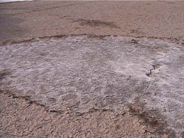
Figure 13. Through a small ground crack, salt water was ejected and left out a salt deposit after evaporating (2/16/01 5:04:39 PM, N23.41984 E70.23441).
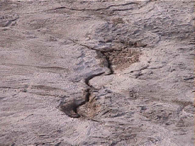
Figure 14. Close view of a ground crack with salt deposit (2/16/01 5:04:48 PM, N23.41985 E70.23440).
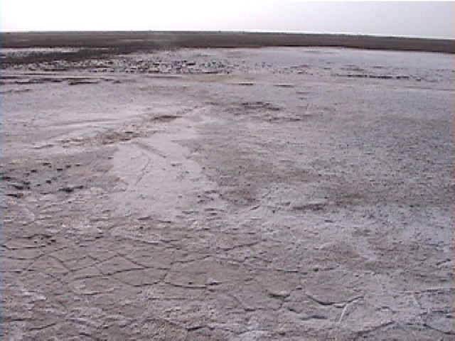
Figure 15. Some salt deposits covered large areas in the Rann of Kachchh (2/16/01 5:06:42 PM, N23.41984 E70.23441).
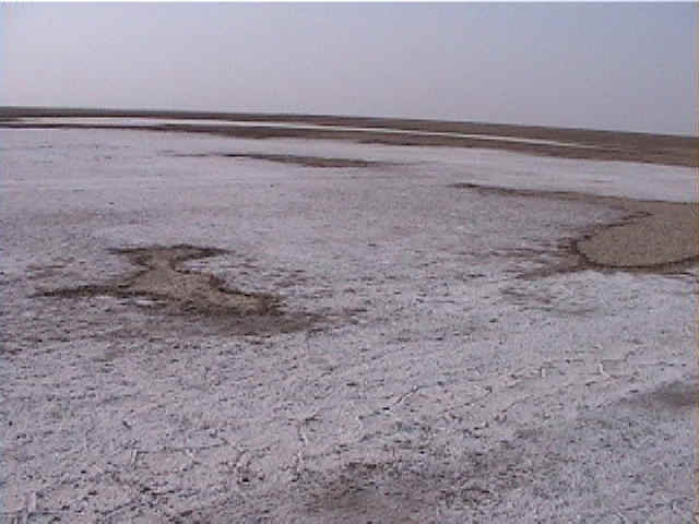
Figure 16. Another large deposits of salt centered about a small ground crack (2/16/01 5:06:47 PM, N23.41984 E70.23441).
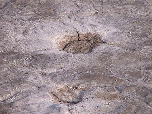
Figure 17. Close view of a small ground crack with salt deposit (2/16/01 5:08:42 PM, N23.41985 E70.23442).