Flight over earthquake damaged areas
The reconnaissance flight took place on February 12, 2001. The flight crew was made of J. P. Bardet, J. P. Singh, Colonel H. Singh, and Capt. Rajiv Nanavaty, a pilot from Ahmedabad Aviation & Aeronautics Limited. The flight was rendered more complicated than usual due to strict restrictions on flight zones close to the India-Pakistan border. At this time, no survey flights were allowed by local air traffic control, and only point-to-point direct flights were permitted. In spite of these complications, a flight path was selected carefully to go over the critical areas that had been previously identified thanks to valuable information from the EERI team lead by W. Lettis and S. Jain.
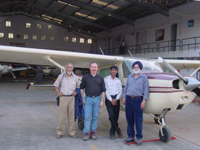
Figure 1 shows the fixed wing aircraft used in the reconnaissance, and the aerial survey reconnaissance team. Figure 2 shows the flight path. The flight initiated in the morning at 7:00 AM and ended at 7:00 PM. Two stops in Rajkot were required to fill up the airplane tanks. For refueling the aircraft, gasoline had to be carried to Rajkot by ground transportation (Figure 4). The flight altitude was set to a minimum of 3000 feet by air traffic control. In some instances however, the pilot was able to go lower to allow closer photographs. Figure 3 shows the portable GPS unit used to track the aircraft position, and to determine automatically the position of digital pictures. The GPS unit gave the location of the photographs after setting a common time for the DVD camera, still digital camera, and the GPS unit.
Figure 1. In Ahmedabad, the aircraft used for flight over, and the aerial survey reconnaissance team. From left to right, Colonel H. Singh, J. P. Bardet, Capt. Rajiv Nanavaty, and J. P. Singh (2/12/01 6:18:56 PM, N23.06806 E72.61980).
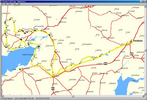
Figure 2. Flight path of February 12, 2001: Ahmedabad, Rajkot, Bhuj (Southern route), Rajkot (Northern Route), and back to Ahmedabad (straight route).
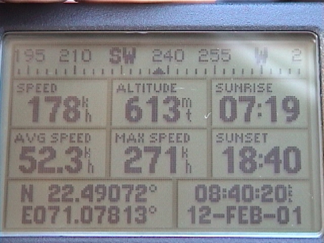
Figure 3. View of the handheld GPS unit used to set a common time between video equipments and GPS unit, and to obtain the locations of pictures from the GPS tracklog (2/12/01 8:40:19 AM, N22.49413 E71.08381).
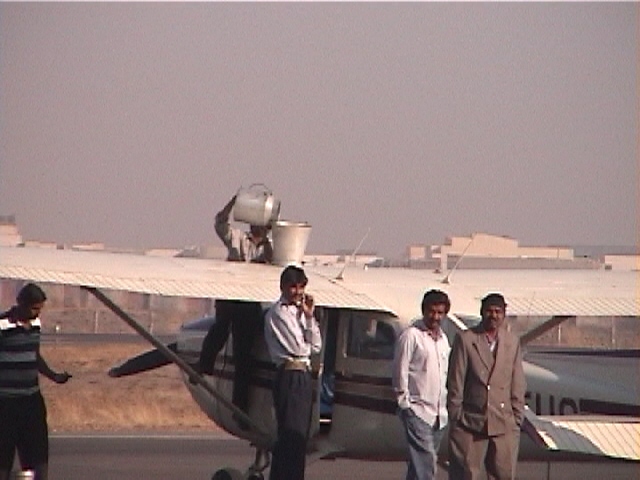
Figure 4. The reconnaissance aircraft was refueled in Rajkot using a non traditional method. Fuel had to be transported by truck from Ahmedabad to Rajkot (2/12/01 9:07:40 AM, N22.30923 E70.78162).
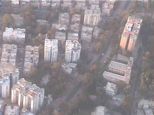
Figure 5. View of Ahmedabad 2 km to the Southwest of the airport. From the aircraft there was no apparent sign of damage along the flight path (2/12/01 7:38:45 AM, N23.05875 E72.60388).
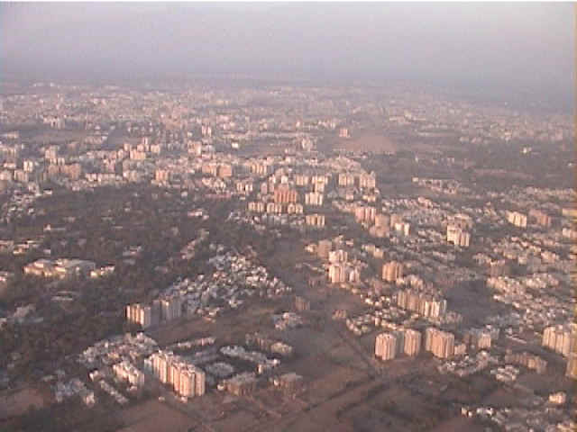
Figure 6. View of the city of Ahmedabad, 13 km to the Southwest of the Ahmedabad airport (2/12/01 6:02:04 PM, N23.01116 E72.50579).
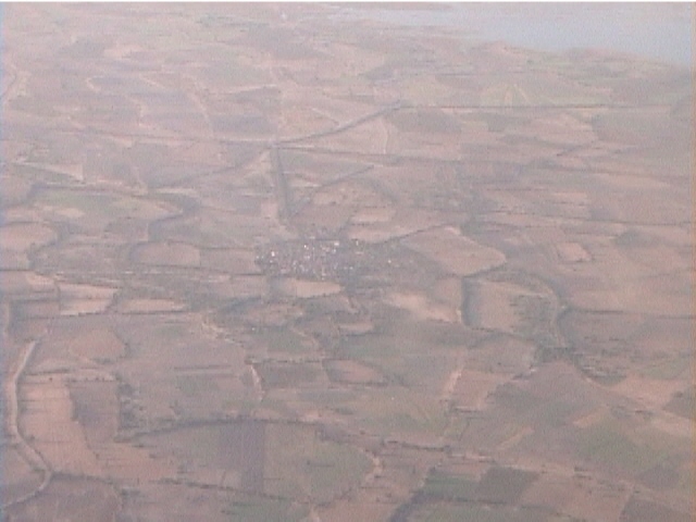
Figure 7. View of the country side about 60 km to the Southwest of Ahmedabad (2/12/01 7:59:30 AM, N22.84053 E72.10208).
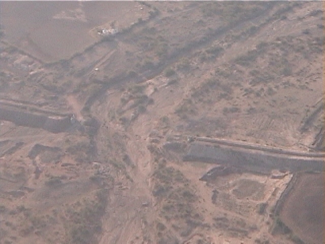
Figure 8. A flood control levee, cut by a stream, was temporarily put out of service, 70 km to the northeast of Rajkot. Flood control levees are used for controlling flood and protecting villages during the monsoon (2/12/01 8:26:58 AM, N22.60347 E71.42745).
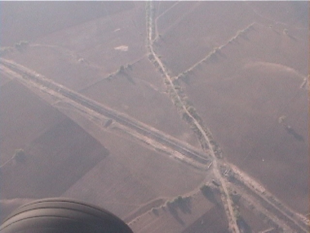
Figure 9. Another temporary flood control levee cut by a road, 70 km to the northeast of Rajkot (2/12/01 8:27:49 AM, N22.58908 E71.41025).
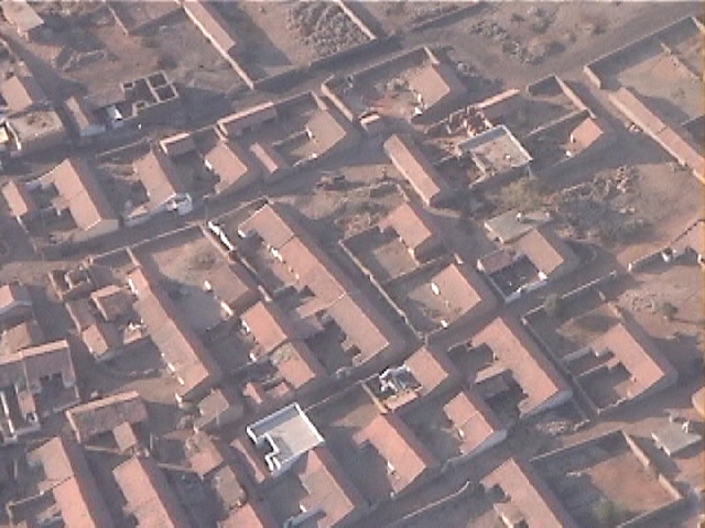
Figure 10. A typical village in Gujarat with one-story stone houses, tile roof, and enclosed yards. 2 km to the Southeast of Than and 50 km to the Northeast of Rajkot (2/12/01 8:35:02 AM, N22.55632 E71.21716).
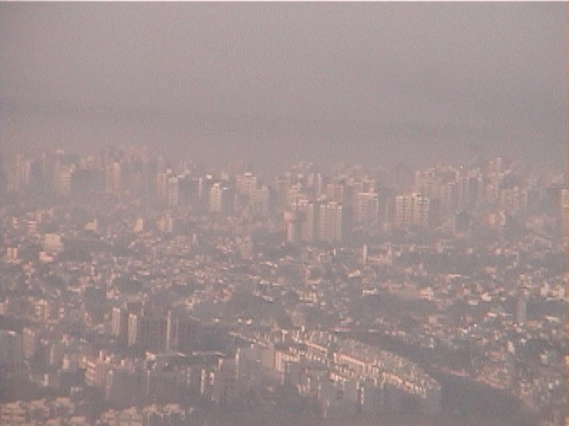
Figure 11. View of Rajkot, a large city where there were only limited earthquake damage apparent from the aircraft. There were however 385 dead and more than 10,000 injured reported in the city (2/12/01 8:52:27 AM, N22.33289 E70.80712).
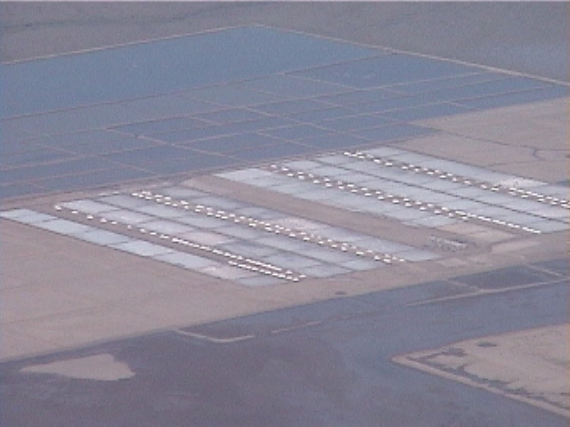
Figure 12. Along the shores of the Gulf of Kachchh, 30 km to the Northeast of Jamnagar, there are many large evaporation ponds and salt farms (2/12/01 10:34:14 AM, N22.64855 E70.28654).
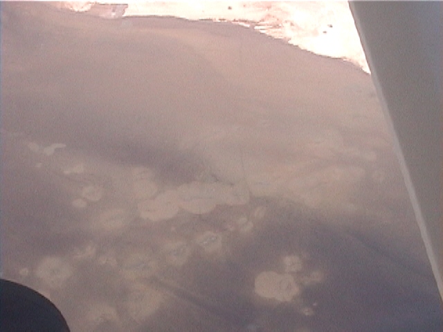
Figure 13. Large spots of lighter coloration were observed from the aircraft beneath the water surface on the oceanfloor in the Gulf of Kachchh, 22 km to the South of Navlakhi port. These spots looked like those observed on the dry marsh land of the Rann of Kachchh (2/12/01 10:39:20 AM, N22.74962 E70.34456).
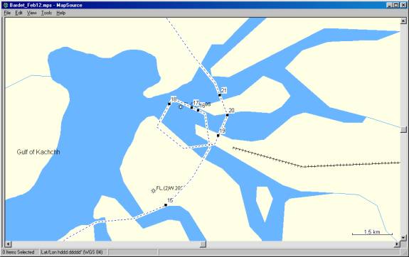
Figure 14. Closeup of tracklog and location of figures in the vicinity of Navalkhi port.
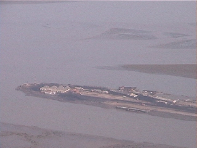
Figure 15. General view of Navalkhi port located in the Gulf of Kachchh, 25 km to the Southeast of Ghandidham (2/12/01 10:48:25 AM, N22.92851 E70.43793).
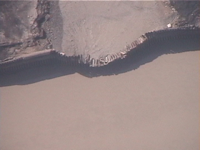
Figure 16. Damage to sheet pile wall retaining structure in Navlakhi port. A subsequent ground survey revealed that the damage was caused by a storm, and not by the earthquake (2/12/01 10:50:04 AM, N22.96045 E70.44979).

Figure 17. Earthquake-related failure of the breakwater in the Navlakhi port (2/12/01 10:50:10 AM, N22.96145 E70.44743).
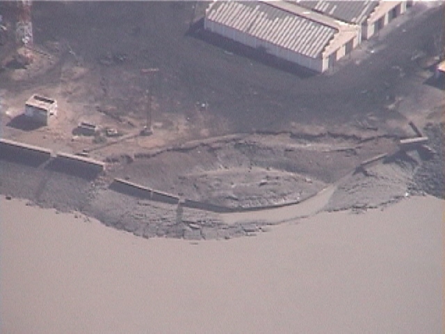
Figure 18. Another view of the earthquake-related failure of the breakwater at the tip of Navlakhi port (2/12/01 10:50:34 AM, N22.96262 E70.43922).
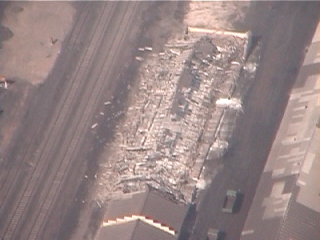
Figure 19. Collapse of a warehouse along railway tracks in Navlakhi port (2/12/01 10:52:09 AM, N22.95199 E70.45710).
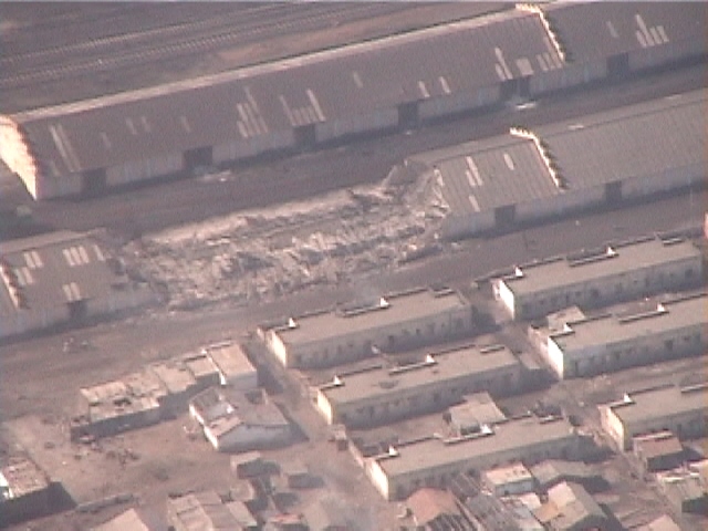
Figure 20. Collapse of a second warehouse in Navlakhi port (2/12/01 10:52:31 AM, N22.95889 E70.46045).
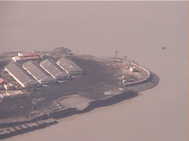
Figure 21. View of the tip of Navlakhi port with apparent distress of sheetpile wall retaining structure (2/12/01 10:52:50 AM, N22.96556 E70.45763).
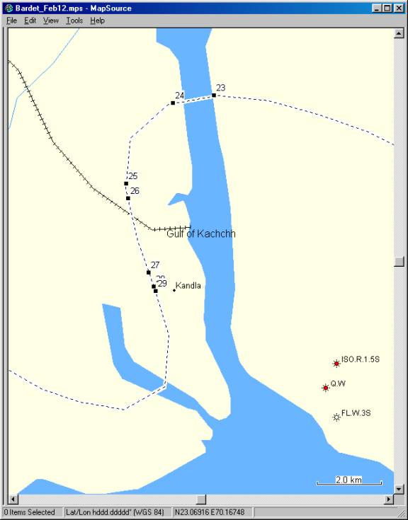
Figure 22. Closeup of tracklog and location of figures in the vicinity of Kandla port.
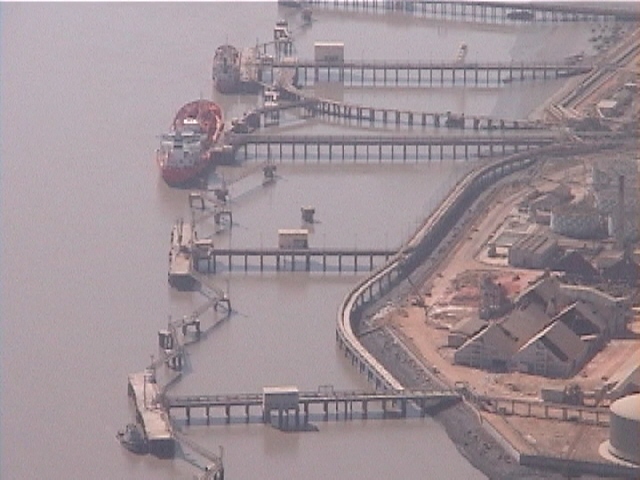
Figure 23. No apparent damage to industrial jetties, 5 km North of the Kandla port (2/12/01 11:02:12 AM, N23.05399 E70.22788).
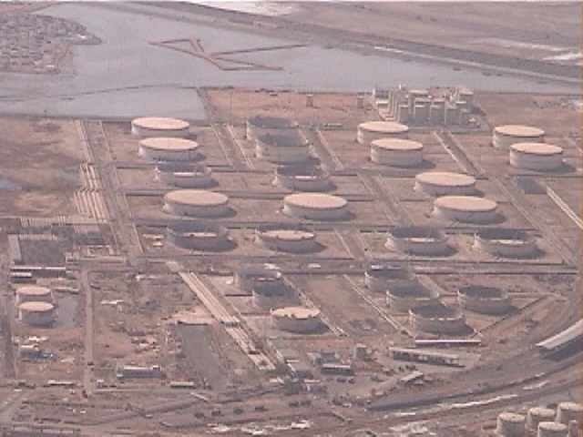
Figure 24. No apparent damage to large tank farms, 5 km North of the Kandla port (2/12/01 11:02:37 AM, N23.05188 E70.21532).
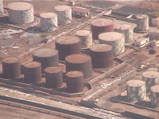
Figure 25. No apparent damage to tank farms, 2 km North of the Kandla port (2/12/01 11:03:38 AM, N23.02931 E70.20108).
Figure 26. No apparent damage to an elevated water tank, 2 km North in Kandla port (2/12/01 11:03:47 AM, N23.02516 E70.20162).
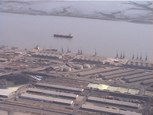
Figure 27. General view of Kandla port, a modern port which handled 45 millions tons in the year 2000. (2/12/01 11:04:33 AM, N23.00439 E70.20798).
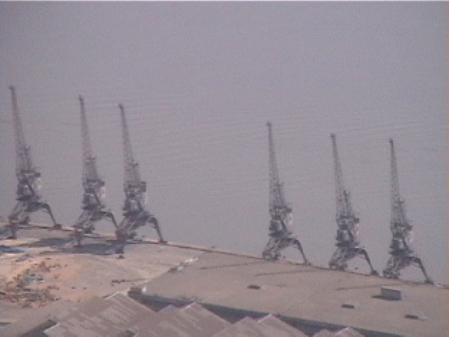
Figure 28. Kandla Port: no apparent evidence of damage to cranes although there was no visible operation on some berths (2/12/01 11:04:42 AM, N23.00039 E70.20951).
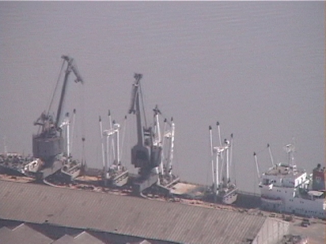
Figure 29. On some berths at Kandla port, there were usual signs of cargo activity (2/12/01 11:04:45 AM, N22.99903 E70.20994).
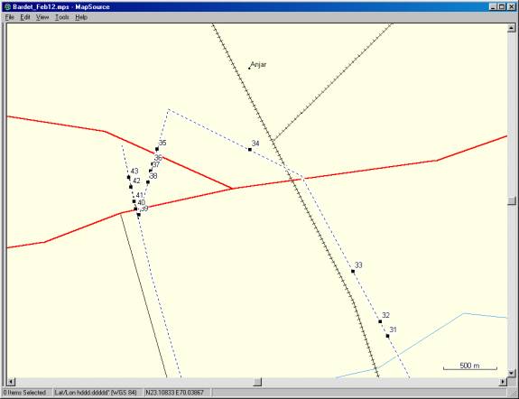
Figure 30. Closeup of tracklog and location of figures in the vicinity of Anjar.
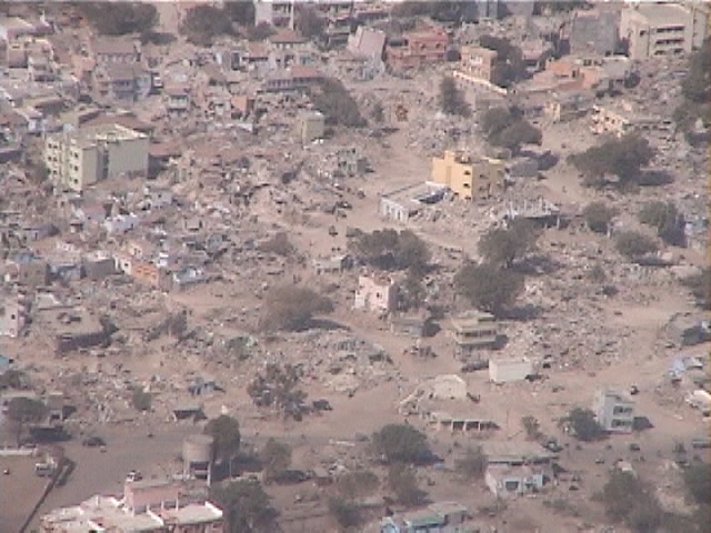
Figure 31. Very few masonry buildings were left standing 2 km to the Southeast of the Anjar (2/12/01 11:14:50 AM, N23.10079 E70.05062).
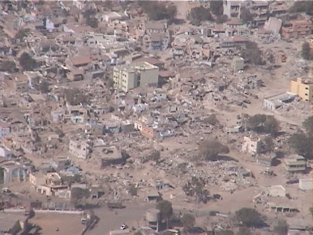
Figure 32. Damage in Anjar was so extensive that it looked like Anjar had been bombed (2/12/01 11:14:53 AM, N23.10198 E70.04995).
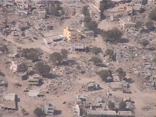
Figure 33. Closer view of a damaged section of Anjar (2/12/01 11:15:04 AM, N23.10621 E70.04747).
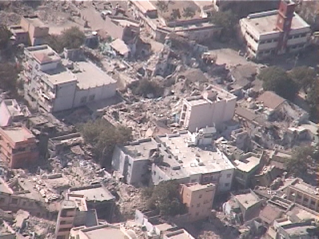
Figure 34. Closer view of damage to Anjar (2/12/01 11:15:37 AM, N23.11644 E70.03802).
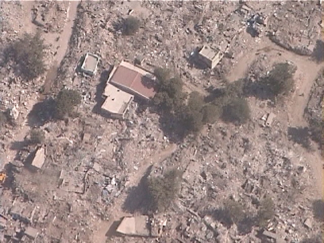
Figure 35. A 200 m by 700 m area of Anjar, located to the Northwest of Downtown Anjar, was totally devastated by the earthquake (2/12/01 11:16:07 AM, N23.11649 E70.02953).
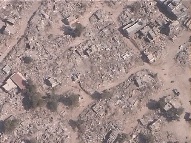
Figure 36. View of the damaged section of Anjar totally flattened by the earthquake (2/12/01 11:16:11 AM, N23.11526 E70.02916).
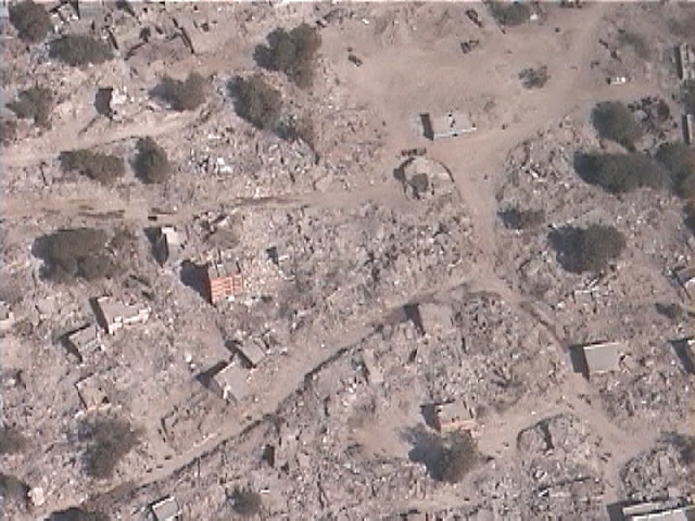
Figure 37. Another view of the section of Anjar totally devastated by the earthquake (2/12/01 11:16:13 AM, N23.11465 E70.02897).
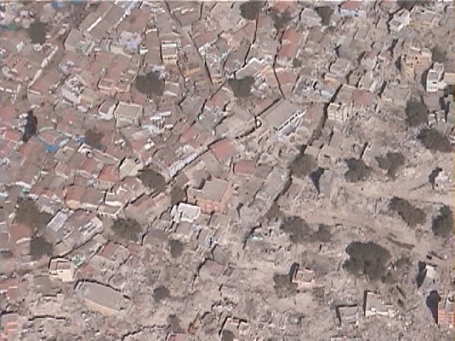
Figure 38. To the eastern edge of the damaged section of Anjar, there was contrast in damage intensity (2/12/01 11:16:16 AM, N23.11373 E70.02870).
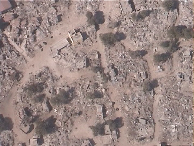
Figure 39. Pervasive devastation to masonry buildings in the damaged areas of Anjar (2/12/01 11:16:25 AM, N23.11097 E70.02786).
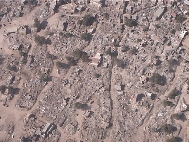
Figure 40. A completely destroyed section of Anjar located along the main highway (2/12/01 11:16:30 AM, N23.11148 E70.02758).
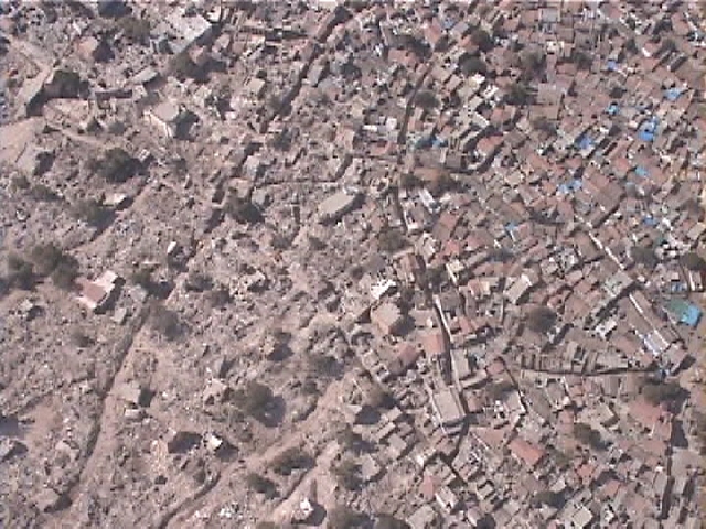
Figure 41. Damage contrast between two different sections of Anjar (2/12/01 11:16:33 AM, N23.11209 E70.02744).
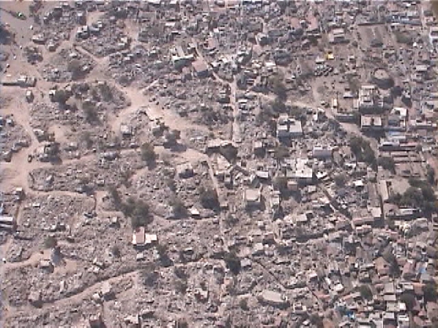
Figure 42. A second example of damage contrast between different sections of Anjar (2/12/01 11:16:39 AM, N23.11332 E70.02715).
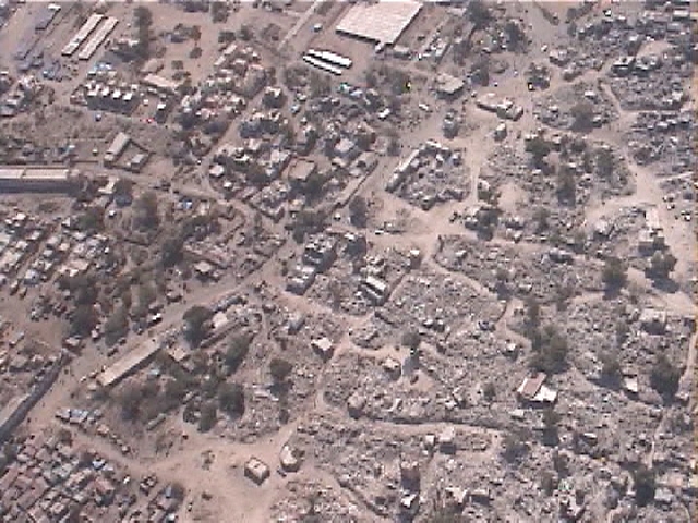
Figure 43. A third example of damage contrast between different sections of Anjar (2/12/01 11:16:43 AM, N23.11414 E70.02696).
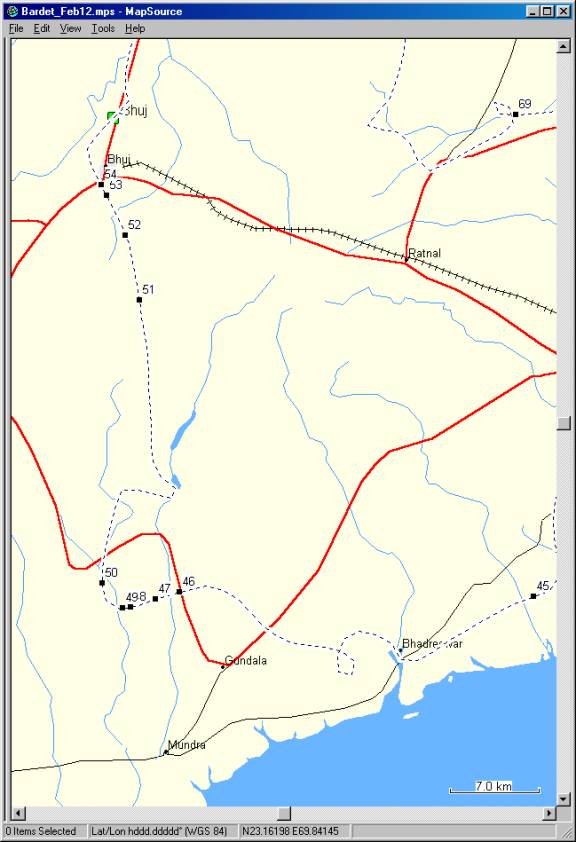
Figure 44. Closeup of tracklog and location of figures between Mundra and Bhuj.
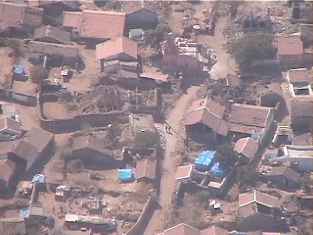
Figure 45. Village with partial damage, 20 km to the Southwest of Ghandidham (2/12/01 11:24:29 AM, N22.94869 E69.99381).
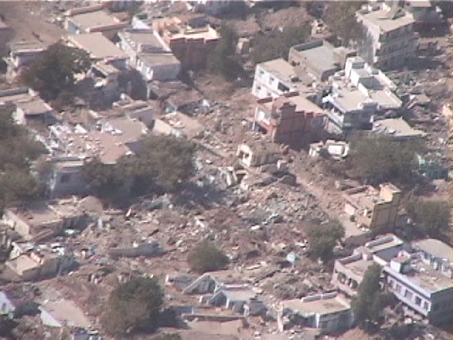
Figure 46. View of a small town devastated by the earthquake, 12 km to the North of Mundra (2/12/01 11:38:30 AM, N22.95186 E69.72143).
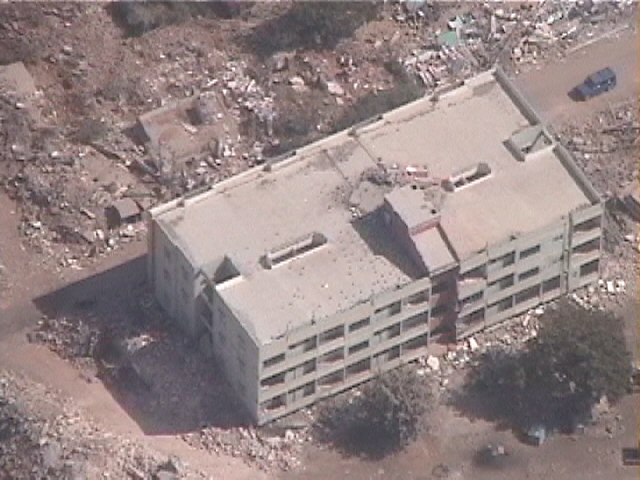
Figure 47. A four-story RC building with damage to roof and first floor in a small town 12 km to the North of Mundra (2/12/01 11:39:12 AM, N22.94675 E69.70269).
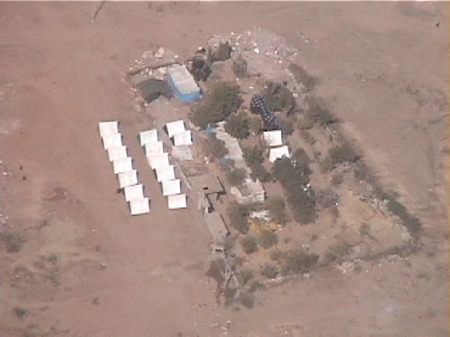
Figure 48. A small refugee camp erected in an open space far from other buildings, 12 km to the North of Mundra (2/12/01 11:39:57 AM, N22.94146 E69.68347).
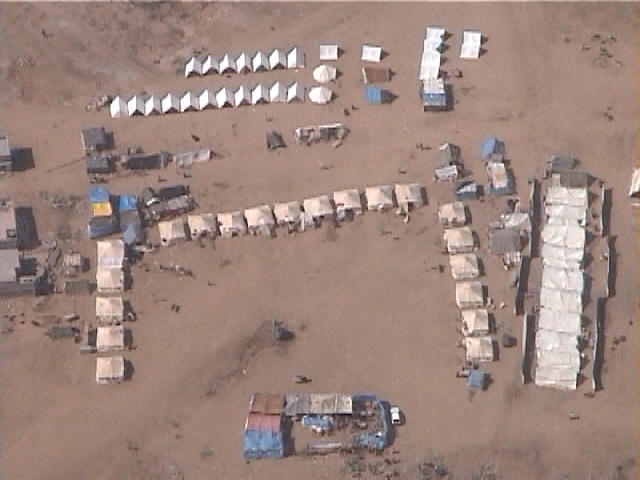
Figure 49. Another small refugee camp erected in an open space, 12 km to the North of Mundra (2/12/01 11:40:11 AM, N22.94056 E69.67751).
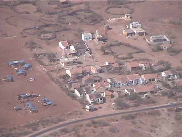
Figure 50. The inhabitants of this small village erected tents close to their dwellings, 14 km to the North of Mundra (2/12/01 11:41:22 AM, N22.95841 E69.66147).
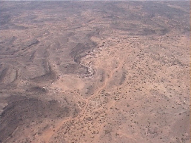
Figure 51. 10 km to the South to Bhuj, the landscape becomes more montaineous (2/12/01 11:51:57 AM, N23.15900 E69.69015).
Figure 52. Damage to the central parts of a two-story building in Bhuj (2/12/01 11:53:42 AM, N23.20458 E69.67958).
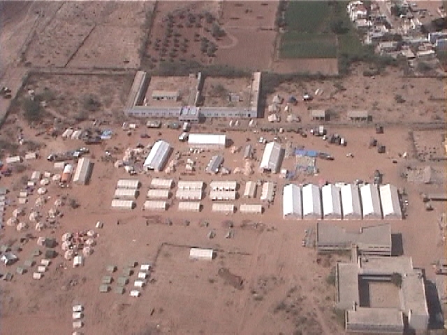
Figure 53. Temporary hospital in Bhuj. Hospital buildings were reported damaged in Bhuj (2/12/01 11:54:56 AM, N23.23289 E69.66506).
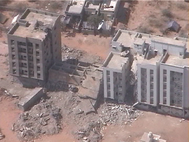
Figure 54. In Bhuj, the six-story building at the center completely collapsed, and its neighbor lost its first floor (2/12/01 11:55:17 AM, N23.24032 E69.66071).
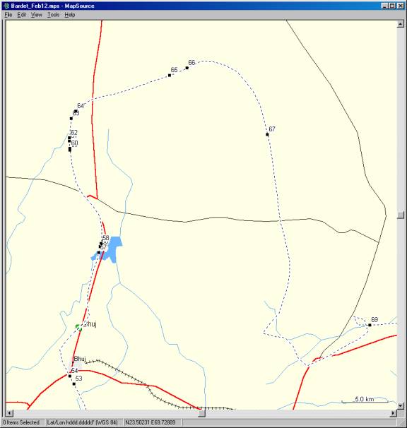
Figure 55. Closeup of tracklog and location of figures to the North of Bhuj (12:00:00 AM, N E).
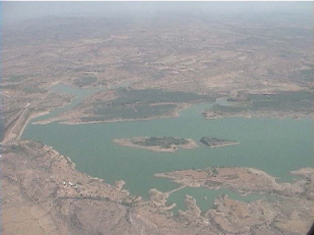
Figure 56. View of the Rudramatra reservoir and its retaining dam, 12 km to the North of Bhuj (2/12/01 1:47:32 PM, N23.36725 E69.69315).
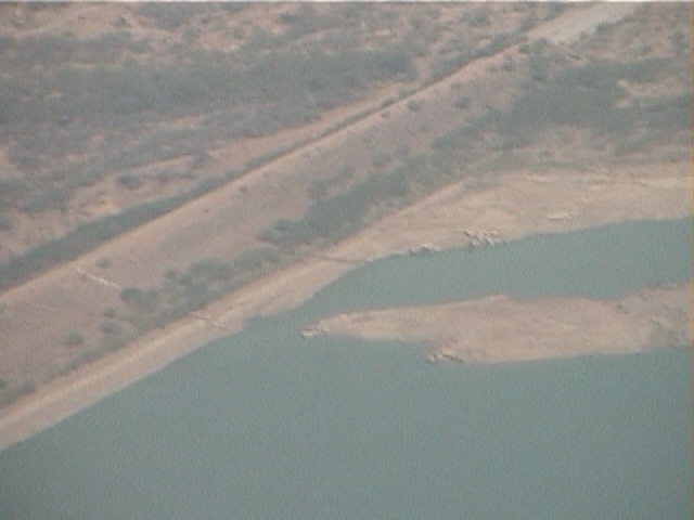
Figure 57. There were some signs of longitudinal cracks at the upstream toe of the Rudramatra dam, 12 km to the North of Bhuj (2/12/01 1:47:15 PM, N23.36143 E69.69169).
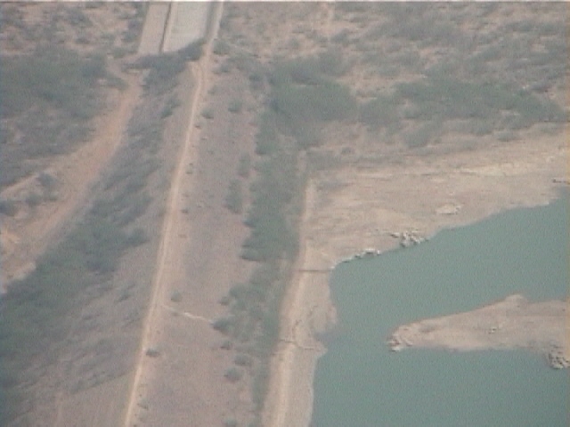
Figure 58. Close view of the cracks at the upstream toe of the Rudramatra dam, 12 km to the North of Bhuj (2/12/01 1:47:41 PM, N23.37033 E69.69391).
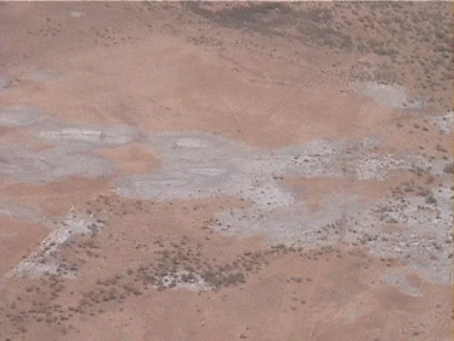
Figure 59. Large elongated spots of lighter coloration littering the ground surface of the Rann of Kachchh, 23 km to the North of Bhuj (2/12/01 1:51:39 PM, N23.46150 E69.66092).
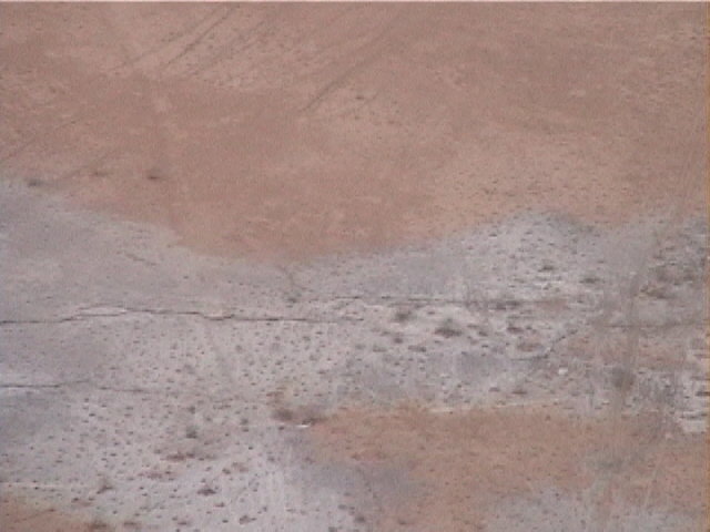
Figure 60. Ground cracks at the center of light coloration spots in the Rann of Kachchh. Brine was ejected from the ground cracks and left a thin layer of white salt deposit after evaporation (2/12/01 1:51:43 PM, N23.46321 E69.66076).
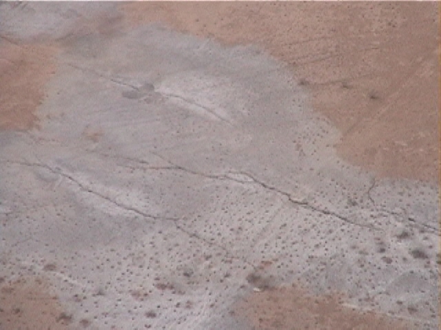
Figure 61. Some ground cracks were running parallel to one another, in the Rann of Kachchh 23 km to the North of Bhuj (2/12/01 1:52:00 PM, N23.47038 E69.66042).
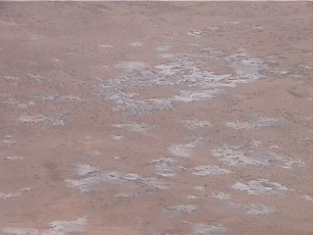
Figure 62. In some other instances, salt deposits were separated and circular, 23 km to the North of Bhuj (2/12/01 1:52:08 PM, N23.47370 E69.66051).
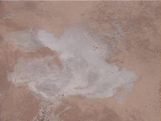
Figure 63. A close view of a salt deposit revealed a small ground crack at its lower left corner, through which brine was ejected (2/12/01 1:52:52 PM, N23.49224 E69.66240).
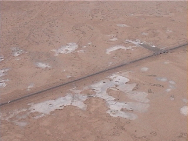
Figure 64. Isolated salt deposit on each side of a road (2/12/01 1:53:12 PM, N23.49952 E69.66710).
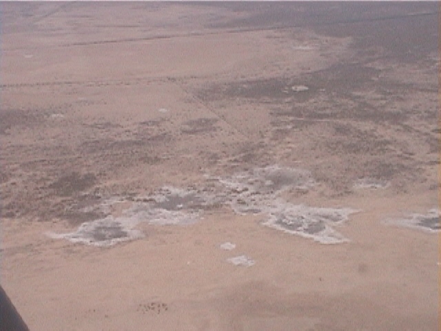
Figure 65. Salt deposit had often darker colors close to their center, possibly to soil ejection and moisture, 33 km to the North of Bhuj (2/12/01 1:57:10 PM, N23.53477 E69.76693).
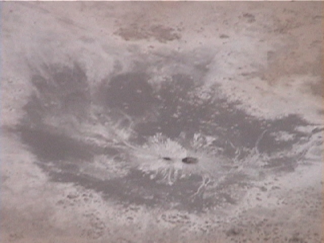
Figure 66. Brine was also ejected through circular openings, which looked like flat volcanoes from the aircraft, 33 km to the North of Bhuj (2/12/01 1:57:54 PM, N23.54184 E69.78548).
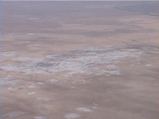
Figure 67. Concentration of salt deposit due to brine ejection, in the Rann of Kachchh 32 km to the Northeast of Bhuj (2/12/01 2:02:45 PM, N23.47657 E69.87147).
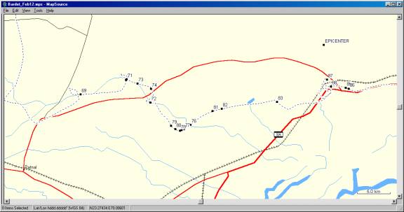
Figure 68. Closeup of tracklog and location of figures in the vicinity of Tapar dam (12:00:00 AM, N E).
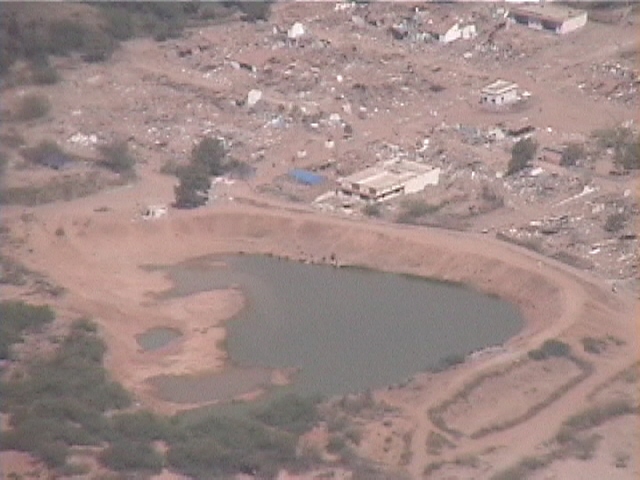
Figure 69. A small village 14 km to the Northeast of Ratnal was totally damaged by the earthquake (2/12/01 2:18:22 PM, N23.29043 E69.98047).
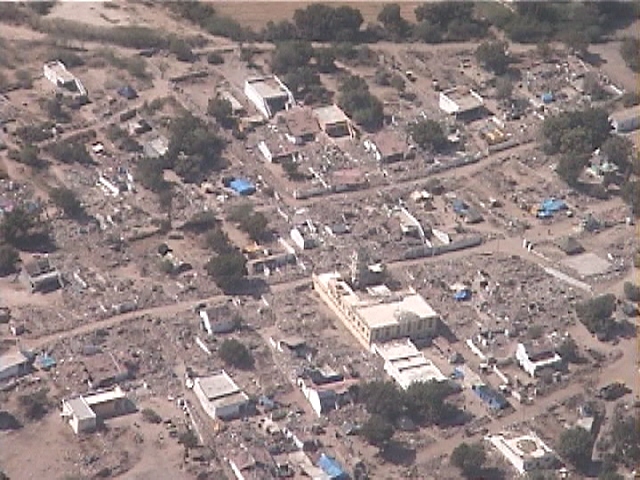
Figure 70. Very few buildings were left standing in a village, 20 km to the Northeast of Ratnal (2/12/01 2:21:39 PM, N23.31027 E70.04796).
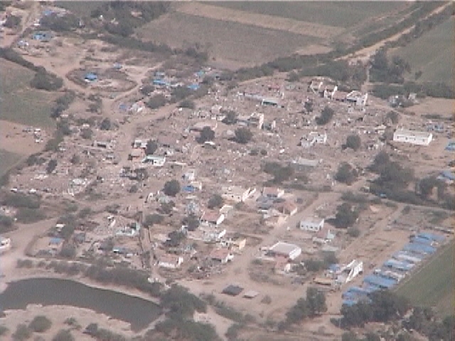
Figure 71. Another view of the village located 20 km to the Northeast of Ratnal (2/12/01 2:22:58 PM, N23.31098 E70.04885).
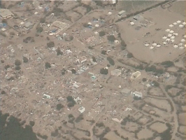
Figure 72. Total devastation of a small village, 22 km to the North of Ghandidham (2/12/01 2:25:32 PM, N23.27908 E70.08428).
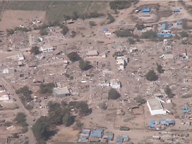
Figure 73. A small village destroyed. Blue tents were erected as temporary shelters, 27 km to the North of Ghandidham (2/12/01 2:23:40 PM, N23.30526 E70.06514).
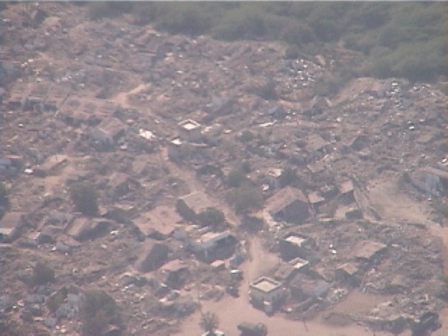
Figure 74. A village destroyed, 25 km to the North of Ghandidham (2/12/01 2:24:36 PM, N23.29831 E70.08506).
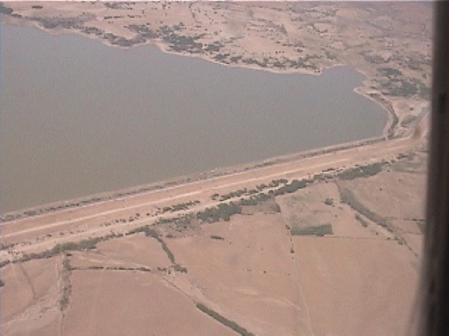
Figure 75. View of the Tapar reservoir, 18 km to the North of Ghandidham (2/12/01 2:29:13 PM, N23.24134 E70.13065).
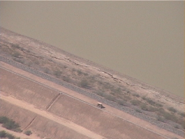
Figure 76. Tapar dam displayed longitudinal cracks at its upstream toe, 18 km to the North of Ghandidham (2/12/01 2:29:51 PM, N23.24884 E70.14398).
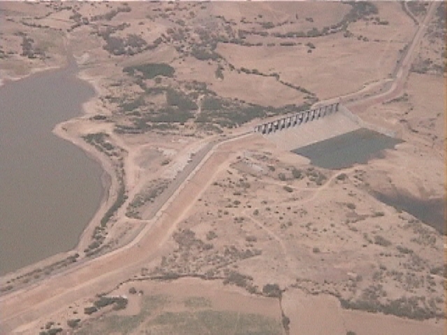
Figure 77. Tapar reservoir had a very large spillway to accommodate the enormous floods during the monsoon, 18 km to the North of Ghandidham (2/12/01 2:29:24 PM, N23.24291 E70.13483).
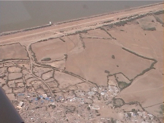
Figure 78. The village, downstream of the Tapar reservoir, was destroyed by the earthquake (2/12/01 2:29:07 PM, N23.24049 E70.12837).
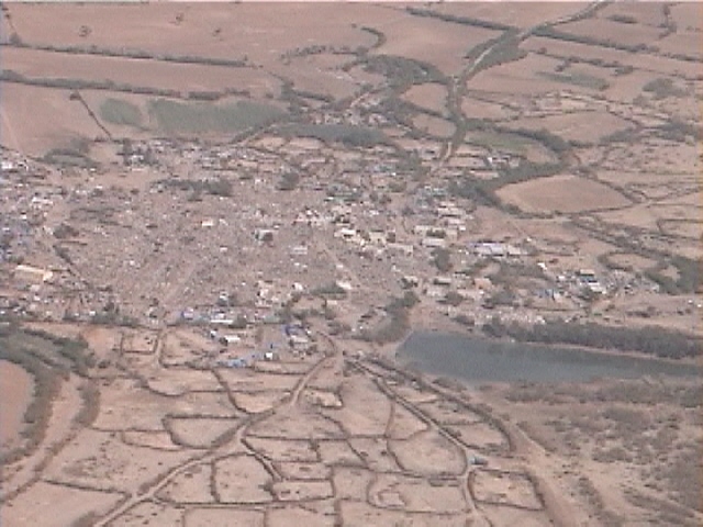
Figure 79. Another view of the destroyed village close to Tapar dam, 18 km to the North of Ghandidham (2/12/01 2:28:27 PM, N23.24746 E70.11525).
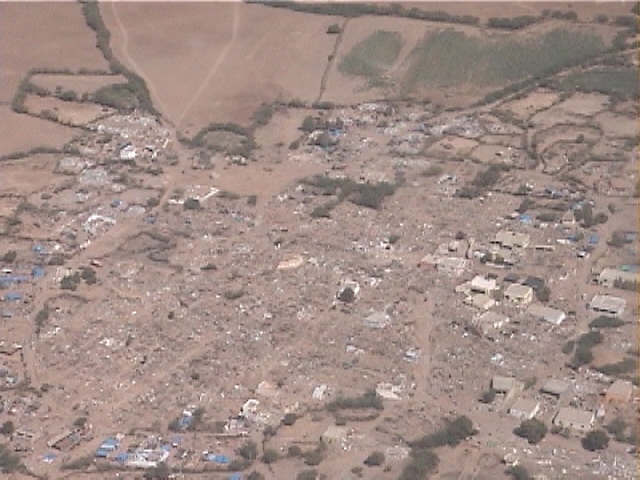
Figure 80. A close view of the destroyed village close to Tapar dam, 18 km to the North of Ghandidham (2/12/01 2:28:47 PM, N23.24293 E70.12142).
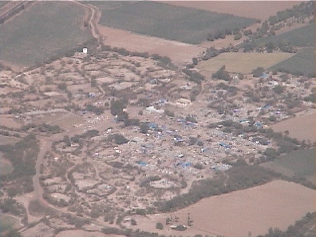
Figure 81. A village with substantial damage, 22 km to the North of Ghandidham (2/12/01 2:31:25 PM, N23.26738 E70.17646).
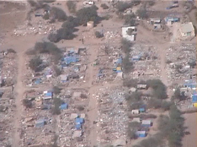
Figure 82. Close view of village with substantial damage, 22 km to the North of Ghandidham (2/12/01 2:32:00 PM, N23.27073 E70.19054).
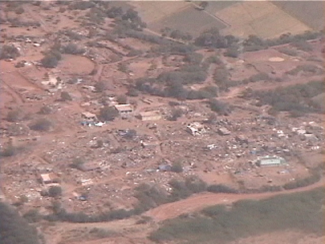
Figure 83. A damaged village, 26 km to the Northeast of Ghandidham (2/12/01 2:35:18 PM, N23.28015 E70.27236).
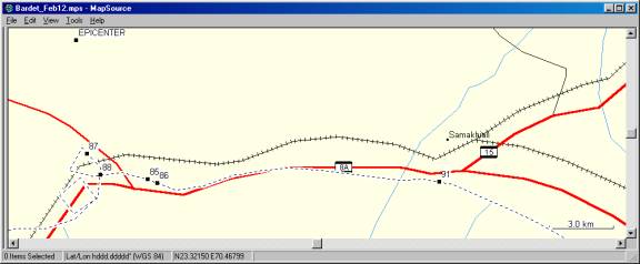
Figure 84. Closeup of tracklog and location of figures in the vicinity of Bhachau (12:00:00 AM, N E).
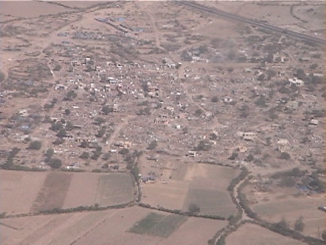
Figure 85. The eastern section of Bhachau underwent severe damage (2/12/01 2:43:45 PM, N23.29956 E70.37472).
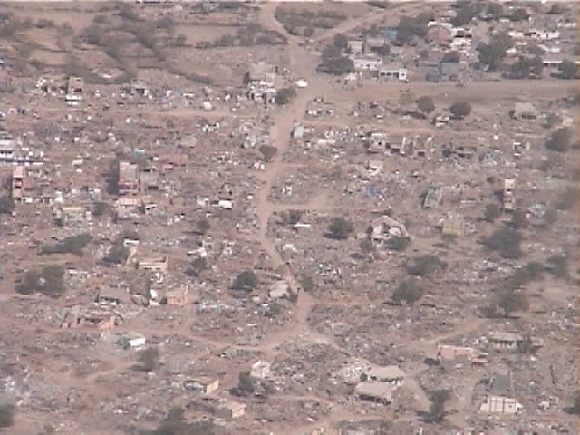
Figure 86. Close view of the eastern part of Bhachau that underwent severe damage (2/12/01 2:43:56 PM, N23.29804 E70.37912).
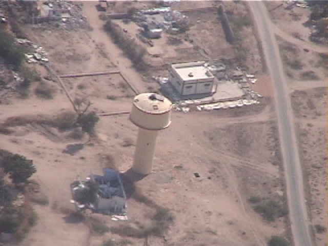
Figure 87. An elevated water tank in the western part of Bhachau apparently undamaged next to a damaged house (2/12/01 2:41:35 PM, N23.31056 E70.34683).
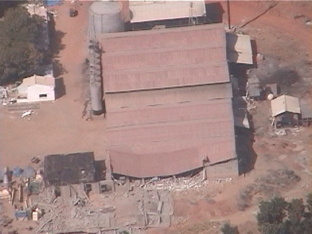
Figure 88. In the western part of Bhachau, the sidewall of this factory fell down, and its roof caved in (2/12/01 2:42:53 PM, N23.30149 E70.35283).
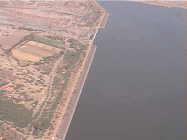
Figure 89. A large reservoir, 28 km to the North of Rajkot, retained much more water than most other reservoirs. There was no sign of damage visible from the aircraft (2/12/01 3:28:59 PM, N22.55363 E70.73946).
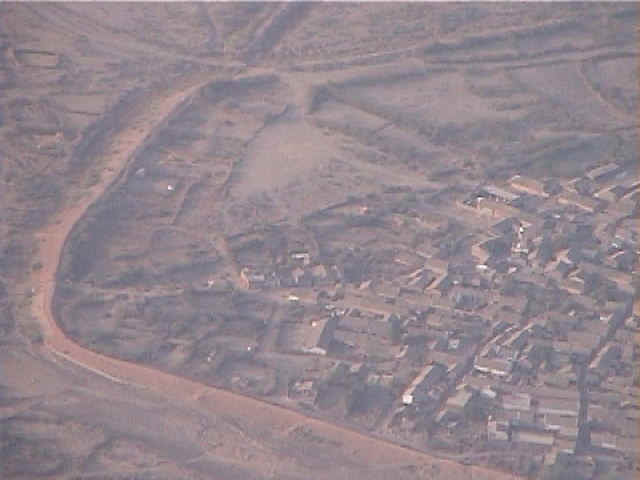
Figure 90. A village surrounded by a levee, 84 km to the Southwest of Ahmedabad (2/12/01 5:35:55 PM, N22.76142 E71.90364).
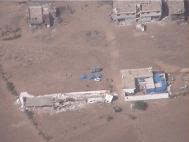
Figure 91. Collapse of an elongated structure in Samakhiali (2/12/01 2:49:08 PM, N23.29856 E70.50844).
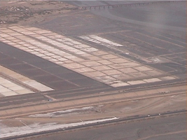
Figure 92. Evaporation pond 1 km to the North of Surajbari bridges (2/12/01 2:57:26 PM, N23.21764 E70.69727).
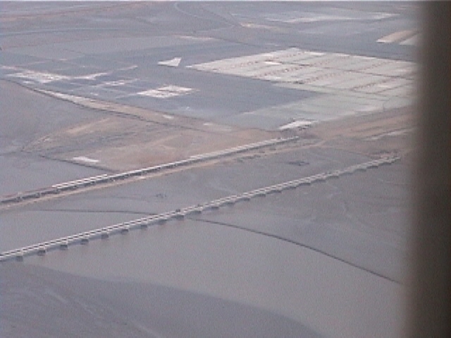
Figure 93. The new and existing Surajbari bridges (2/12/01 2:57:41 PM, N23.21291 E70.70032).
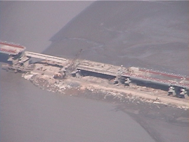
Figure 94. One section of the new Surajbari bridge was still under construction at the time of the earthquake (2/12/01 2:58:29 PM, N23.19540 E70.70735).
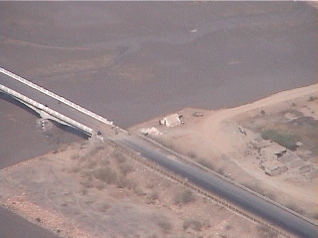
Figure 95. One of the approach ramp of the old Surajbari bridge was guarded by military personnel (2/12/01 2:58:49 PM, N23.18841 E70.71080).
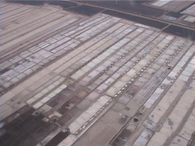
Figure 96. In this area of the Gulf of Kachchh, 6 km North of Maliya, there are many evaporation ponds for producing salt (2/12/01 3:00:50 PM, N23.14772 E70.73186).
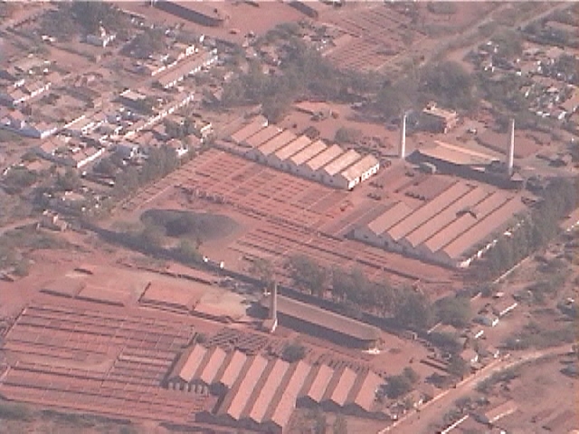
Figure 97. No apparent damage to this factory and its tall chimneys, 1 km North of Morvi (2/12/01 3:14:15 PM, N22.84639 E70.82383).
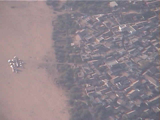
Figure 98. The inhabitants of this small village, 15 km North of Limbdi, moved in into tents erected in open spaces at a safe distance from their dwellings (2/12/01 5:28:56 PM, N22.68352 E71.74086).
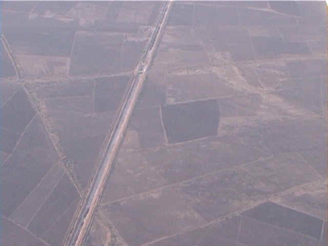
Figure 99. Drainage channels are also a way to move water from reservoirs to agricultural fields, 15 km to the North of Limbdi (2/12/01 5:34:52 PM, N22.74962 E71.87899).