Observations on ground deformation and cracking of
February 17, 2001
This document reports the ground cracking and deformation which was observed to the
South of Chang Dam and to the North of the epicenter. The investigation was carried out
during the afternoon of February 17, 2001. Figure 1 shows the reconnaissance path which
initiated at Gandhidam. Figure 2 shows the location of photographs on ground cracking and
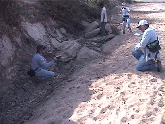
deformation to the South of Chang reservoir. The investigation was prompted by a farmer
who reported large ground cracks in the vicinity of Chang Dam. Four members of the
reconnaissance team (i.e., J. P. Bardet, Robb Moss, E. Rathje, and Bob Wright)
investigated those ground cracking as possible evidences of surface faulting.
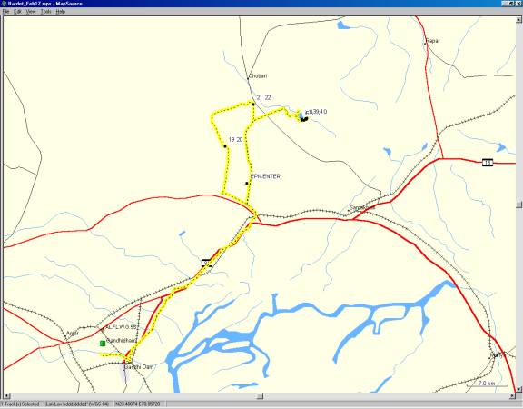
- GPS tracklogs of reconnaissance team and location of Figures 19-22.
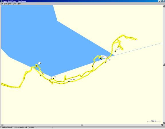
- Tracklog and location of Figures 3 - 18 to the South of Chang Dam.
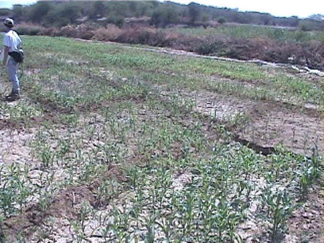
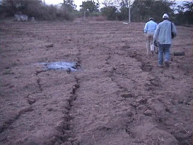
- Series of parallel ground cracks in a agricultural field along the northern bank of a
dry river bed. During the rainy season, the river feeds the Chang reservoir (2/17/01
1:53:05 PM, N23.45700 E70.43411).
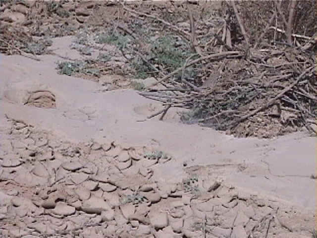
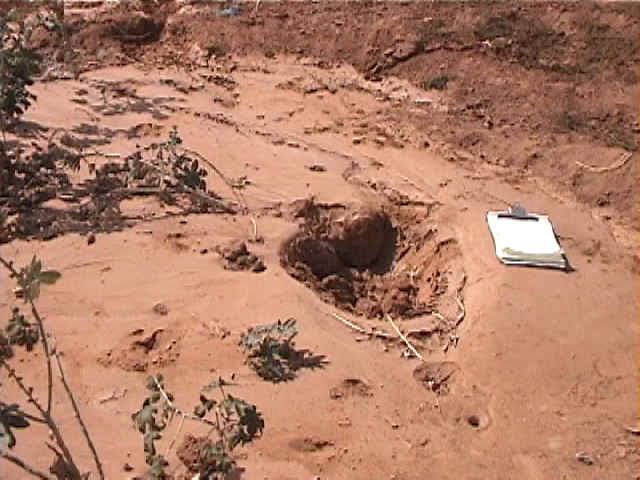
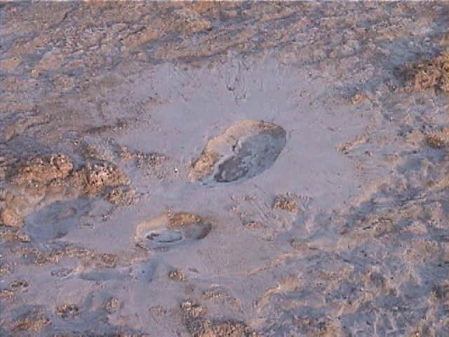
- A sand boil close to the ground cracks of Fig. 3 implied that soil liquefaction had
taken place close to the river bed, and may have contributed to ground cracking. The
reconnaissance team experienced a small aftershock at this location, but no water was
ejected at this time (2/17/01 1:53:35 PM, N23.45700 E70.43411).
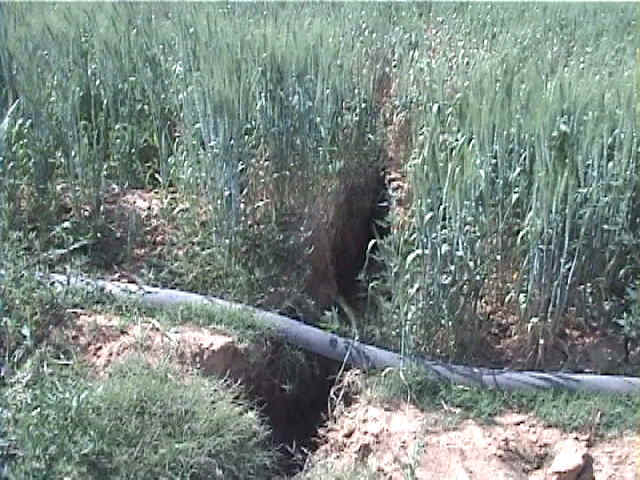
- Ground crack along the south side of the stream channel with about one foot of vertical
displacement (2/17/01 2:10:52 PM, N23.45597 E70.43457).
- Another ground cracking in the agricultural field of Fig. 3 (2/17/01 2:27:44 PM,
N23.45561 E70.43600).
- Sand littering the ground surface of the northern bank (2/17/01 2:48:07 PM, N23.45690
E70.44042).
- Along the northern bank of the dry river bed, there was series of parallel cracks
similar to those usually observed for liquefaction-induced lateral spreads (2/17/01
2:58:19 PM, N23.45772 E70.44140).
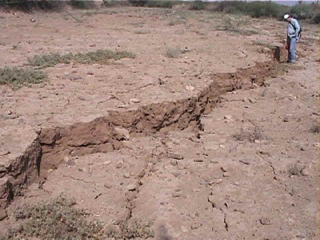
- Along the northern bank of the dry river bed, the cracks had vertical offset as high as
60 cm (2/17/01 2:57:38 PM, N23.45773 E70.44134).
- Another view of the ground cracks of Fig. 9 (2/17/01 2:58:38 PM, N23.45765 E70.44146).
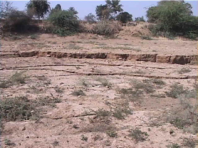
- Some sections of the dry stream channel was inclined, as if this area of the channel had
been domed or arched (2/17/01 3:01:54 PM, N23.45733 E70.44191).
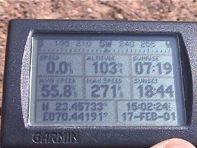
- GPS check indicating an excellent positioning of the tracking program (2/17/01 3:02:27
PM, N23.45734 E70.44191).
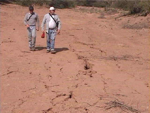
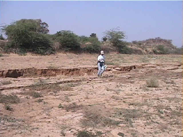
- Robb Moss and Bob Wright walking along ground cracks (2/17/01 3:16:09 PM, N23.45844
E70.44302).
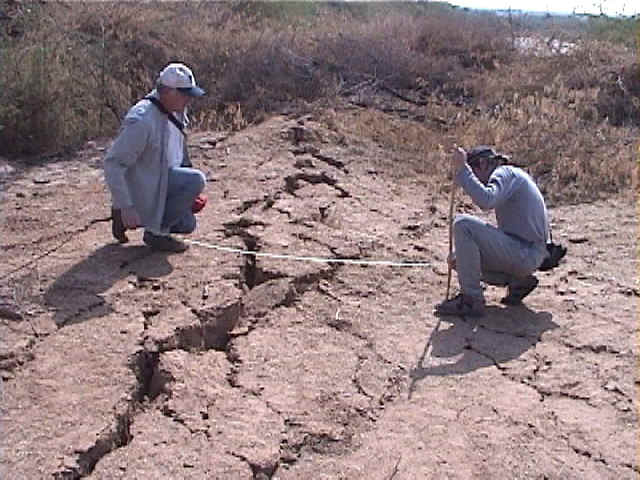
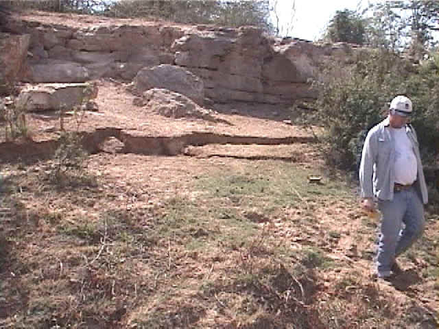
- Ground cracks with 30 cm vertical offset. This photo is looking southwest along the
ground crack along the south bank. It shows south side up displacement on the main crack
and an adjacent north tilted block, hinged on the northside, within a zone of overall
uplift. This geometry is not easily attributed to compressional deformation at the toe of
a lateral spread (2/17/01 3:18:48 PM, N23.45849 E70.44307).
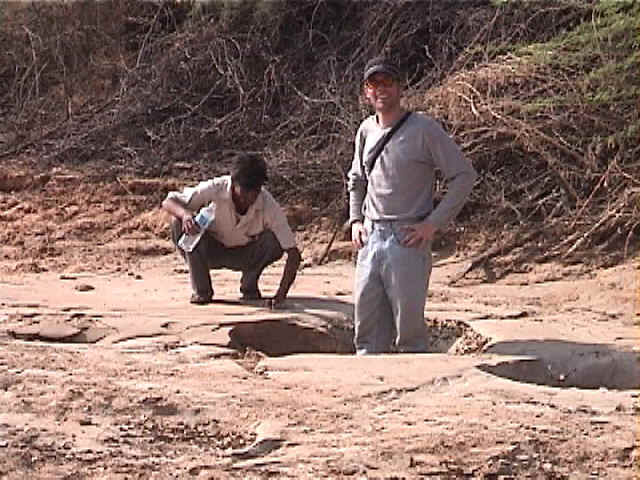
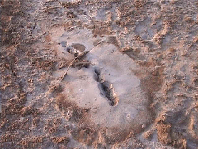
- Large sand boils in the dry river bed (2/17/01 4:02:17 PM, N23.45530 E70.43787).
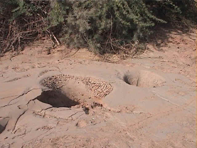
- Another view of the sand boil in the river bed. Water must have been ejected with
violence to create such orifices (2/17/01 4:02:51 PM, N23.45529 E70.43774).
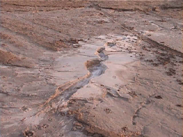
- Along the southern bank of the dry river bed, there were vertical depressions and
inclined stone slabs. One side of the river bed had been uplifted, possibly as it was
located at the bulging toe of an area spreading laterally (2/17/01 4:12:52 PM, N23.45542
E70.43551).
- Silt and salt deposit littering the ground surface (2/17/01 6:02:17 PM, N23.41509
E70.30593).
- Silt and salt deposit littering the ground surface (2/17/01 6:02:52 PM, N23.41511
E70.30587).
- Sand ejecta littering the ground surface along ground cracks (2/17/01 6:04:18 PM,
N23.41512 E70.30589).
- Series of parallel ground cracks in a gently sloping ground. A possible explanation for
these ground cracks is liquefaction-induced ground deformation (2/17/01 6:52:50 PM,
N23.48008 E70.35272).
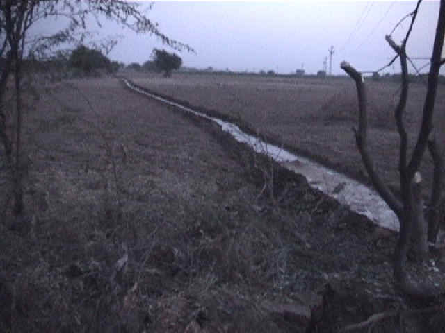
- The water flowing in an irrigation ditch close to the ground cracks of Fig. 21 indicated
that the ground surface had a gentle inclination at this location (2/17/01 6:59:04 PM,
N23.48008 E70.35273).