SURAJBARI BRIDGES
As shown in Fig. 1, the two Surajbari bridges are
located 43 km to the southeast of the epicenter, across the little rann of Kachchh, on the
Kandla road on NH8A between Km 280/0 to 282/0 across a tidal creek called "Hadakiya
Creek." These bridges provide a vital link between the entire Kachchh District which
and the Western part of India.
- The old bridge
The need for constructing the first bridge was felt during the 1965 war with Pakistan. The
construction of the bridge was undertaken about this period, and was completed in June
1968. The bridge deck rests on alternate series pins and rollers. Since its construction,
the bridge has been exposed to aggressive saline environment and corrosion processes. In
1994, distress in the top slab of the superstructure was observed as the result of massive
deterioration due to saline atmosphere.
- The new bridge
A new bridge was needed in view of strategic and economic considerations. The new two-lane
bridge, which is located only 150 m upstream of the existing bridge, was still under
construction during the earthquake, with only one span remaining to be completed on
February 14, 2001. The new bridge has 39 spans, and a total length of 1255 m. Each span is
approximately 32.2 m in length, and is made of prestressed concrete. The foundation is a
circular well foundation, 24 feet in diameter and 50 feet in height. The bridge deck is
supported by elastomeric bearing pads.
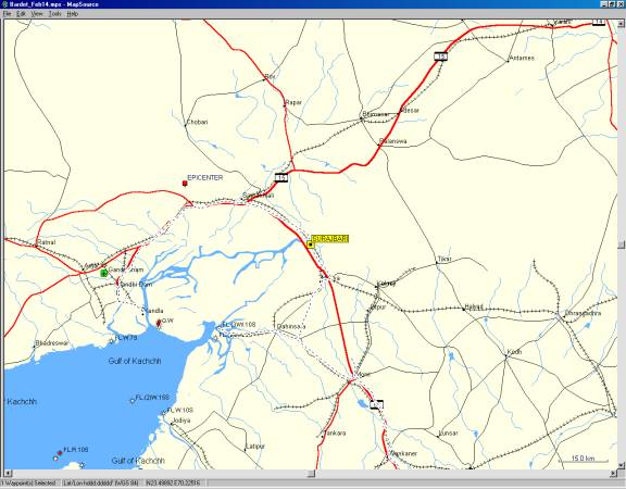
- General location of Surajbari bridges with respect to earthquake epicenter.
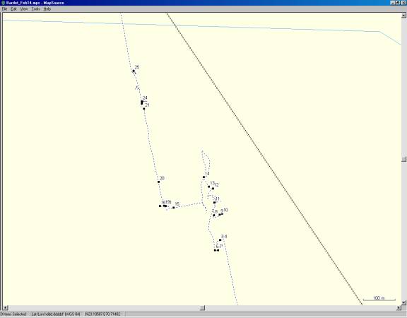
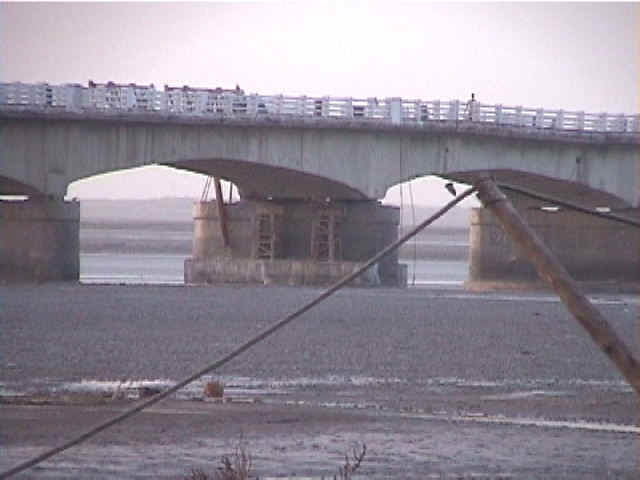
- Location of photographs.Both bridges are practically aligned in the North-South
direction. The new bridge is to the East of the old bridge.
New Bridge
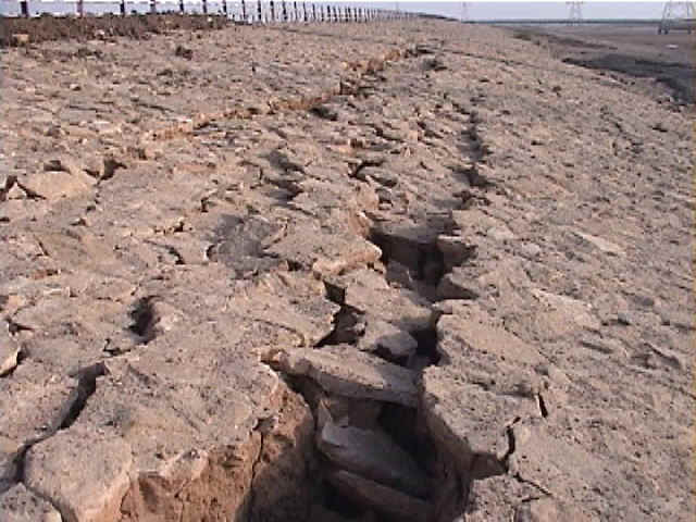
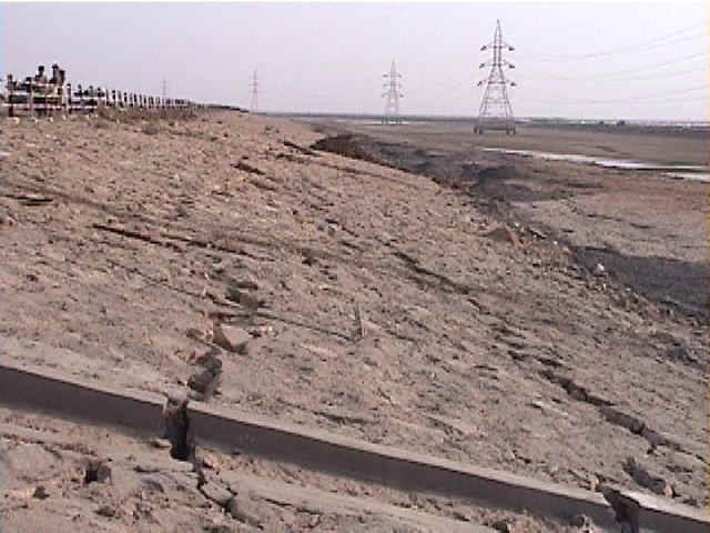
- There were signs of lateral and vertical deformations in the embankment of the access
road of the new bridge on the Maliya side. The bridge approach consists of a 3.7 m high
embankment with 3H:1V side slopes, underlain by a 4.3 m high loading berm with 2H:1V side
slopes. Engineers at the bridge indicated that the foundation soils consist of 10 to 15 m
of soft clay (the same soil as Navlakhi and Kandla Ports) underlain by sand and then stiff
clay (2/14/01 5:21:29 PM, N23.19071 E70.71942).
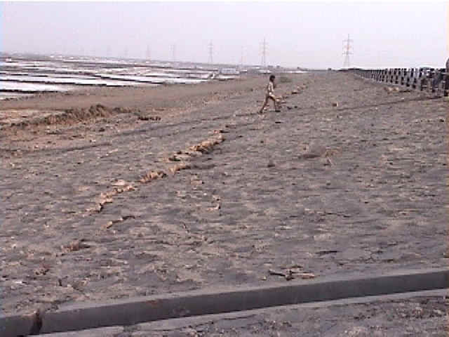
- Some longitudinal cracks were as wide as 1 m along the embankment slope of the access
road. Smaller cracks and soil ejecta were observed along the berm at the base of the
approach embankment (2/14/01 5:21:54 PM, N23.19071 E70.71941).
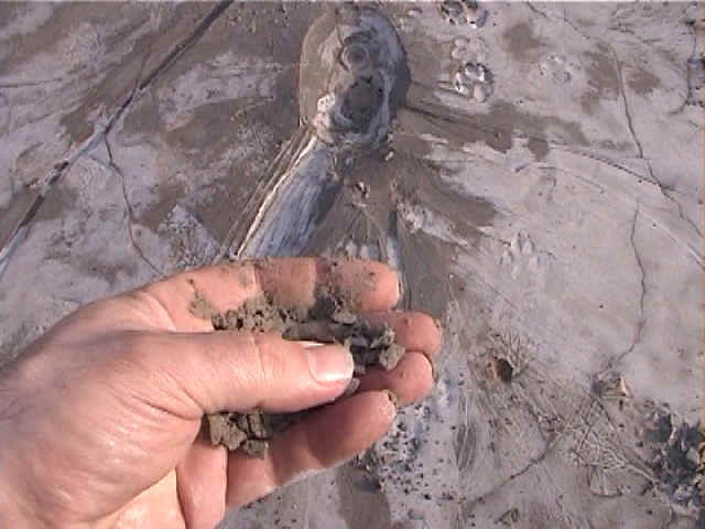
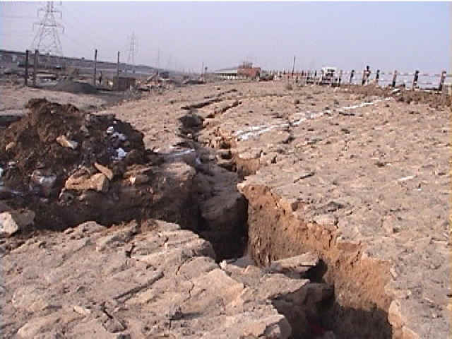
- There were ejecta of fine sand on the surface of the embankment. The settlement and
lateral spread of the embankment certainly resulted from the liquefaction of the saturated
soils under the embankment (2/14/01 5:23:50 PM, N23.19042 E70.71935).
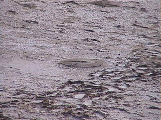
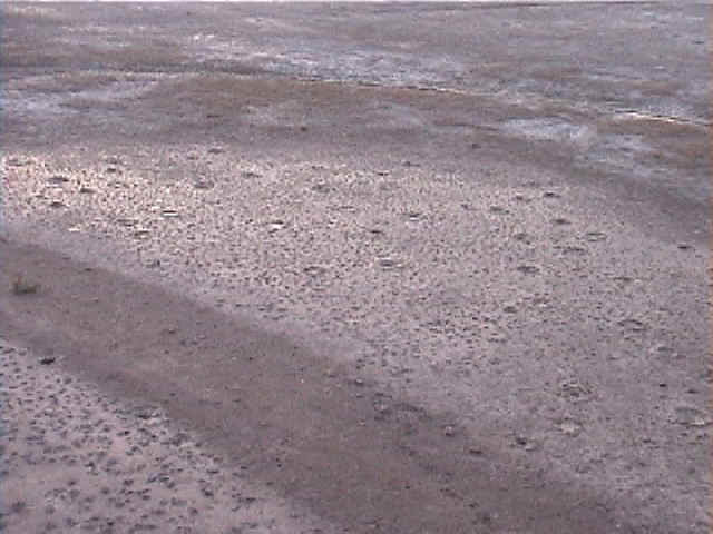
- Many sand boils were observed on the native ground surface in the vicinity of the bridge
access road (2/14/01 5:24:37 PM, N23.19042 E70.71925).
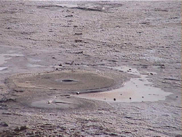
- Another view of sand boils on the native ground surface in the vicinity of the bridge
access road (2/14/01 5:24:43 PM, N23.19042 E70.71925).
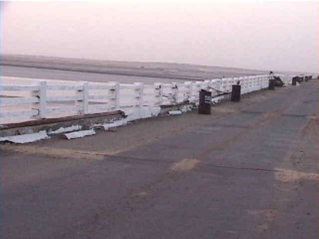
- The Eastern side of the embankment of the access road displayed also ground cracks
(2/14/01 5:29:19 PM, N23.19141 E70.71922).
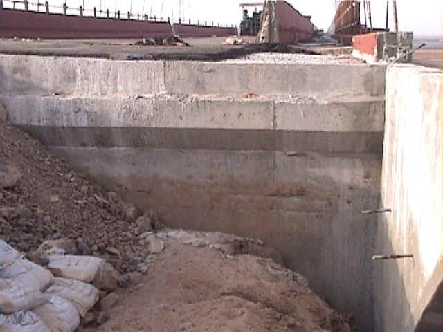
- As indicated by the dirt marks on the abutment, the fill directly adjacent to the bridge
abutment settled approximately 70 cm (2/14/01 5:31:19 PM, N23.19143 E70.71940).
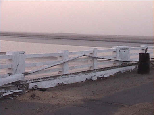
- Another view of the eastern cover of the access road embankment (2/14/01 5:32:01 PM,
N23.19145 E70.71948).
- The bridge deck moved laterally dynamically on its elastomeric pads and sheared the
restraining keys (2/14/01 5:37:32 PM, N23.19177 E70.71923).
The bridge deck was reported to have moved back practically to its original position,
without only a few centimeters of permanent deformation after the earthquake.
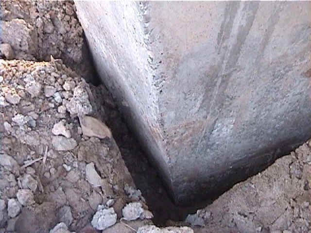
- There were signs of relative displacement between the uncompacted soil and the bridge
piers as shown by 5-cm wide gaps between soil and pier (2/14/01 5:54:16 PM, N23.19216
E70.71919).
- Evidence of dynamic impact between two deck sections and relative permanent lateral
displacement (2/14/01 5:55:39 PM, N23.19222 E70.71907).
Old bridge
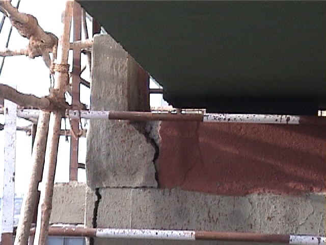
- Pier 12 of the old bridge tilted toward Samakhiyali side creating cracks at the junction
between well cap and pier bottom (2/14/01 6:04:59 PM, N23.19249 E70.71891).
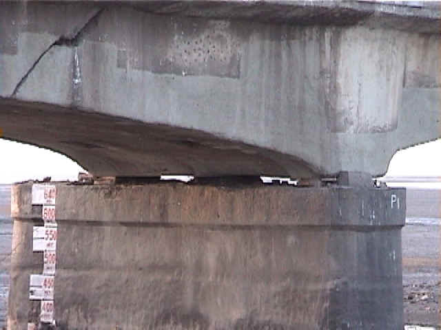
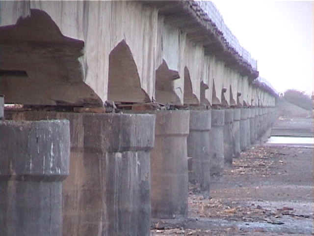
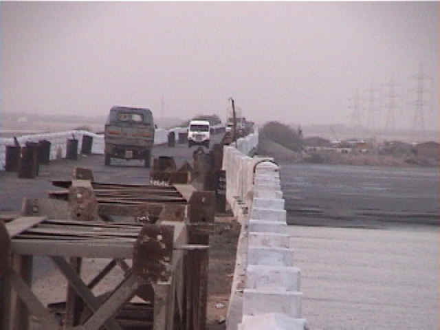
- All the supports of the bridge deck were practically destroyed during the earthquake;
they were replaced by temporary wooden supports (2/14/01 6:11:36 PM, N23.19162 E70.71798).
- Another view of the destroyed supports of the bridge deck (2/14/01 6:14:58 PM, N23.19167
E70.71757).
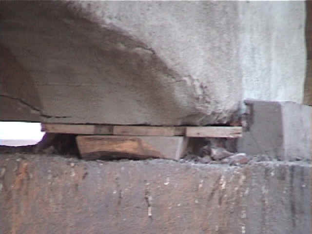
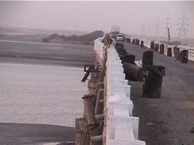
- A close view of the temporary wooden supports for the bridge deck (2/14/01 6:15:44 PM,
N23.19168 E70.71769).
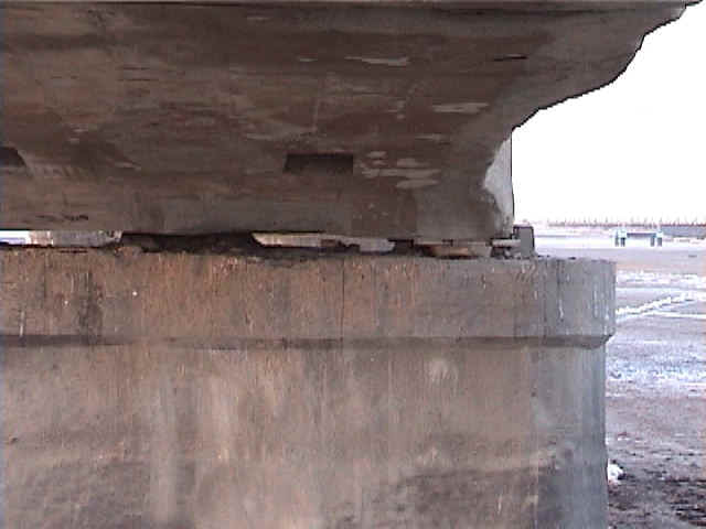
- From below the bridge deck, some sections of the bridge deck had moved to the East about
one meter (2/14/01 6:15:51 PM, N23.19167 E70.71774).
- Numerous water ejecta were observed on the natural ground surface on each side of the
old bridge (2/14/01 6:20:21 PM, N23.19168 E70.71769).
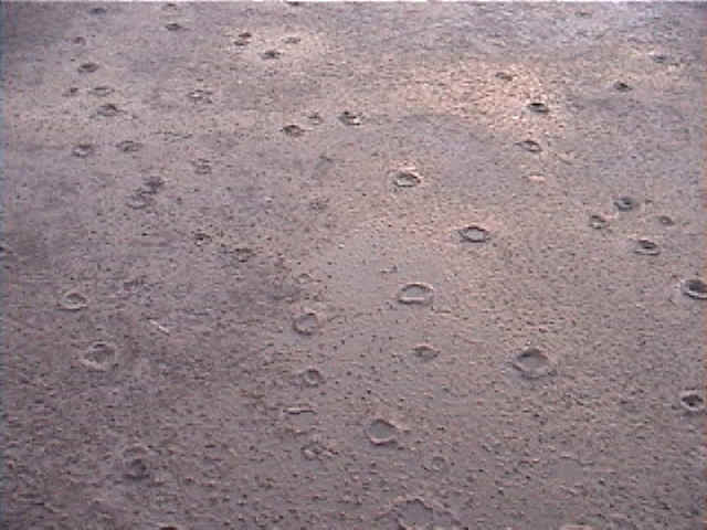
- Closer view of the water ejecta on the natural ground surface on each side of the
old bridge (2/14/01 6:22:04 PM, N23.19235 E70.71752).
- The bridge deck settled as Pier 12 tilted sideways (2/14/01 6:26:42 PM, N23.19442
E70.71707).
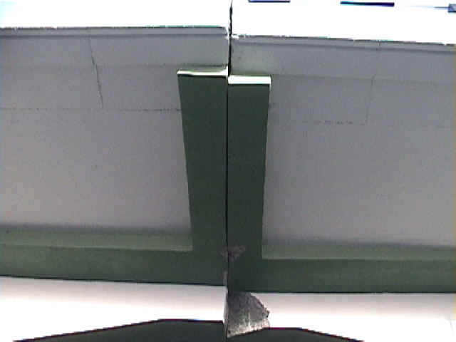
- Evidence of compression in the bridge deck; the lifeline conduit buckled (2/14/01
6:28:02 PM, N23.19456 E70.71701).
- Lateral offset in the railguard of the bridge deck indicated that the bridge deck had
moved permanently one meter after the earthquake (2/14/01 6:28:36 PM, N23.19461
E70.71702).
- Another view of the railguard of the bridge deck showing lateral movement (2/14/01
6:29:13 PM, N23.19462 E70.71701).
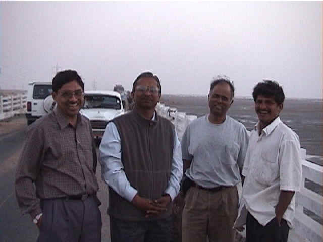
- Members of the reconnaisance team for the Surajabri bridges. From left to right: K. D.
Talsmania, J. R. Thakey, U. Patel, and a local engineer (2/14/01 6:44:28 PM, N23.19549
E70.71675).