Adani Port
Adani Port is privately owned and operated, and is located due south of Mundra along the northern margin of the Gulf of Kachchh. Three portions of the facility were inspected, a spit/wharf structure, an earth fill under construction for a rail facility, and the approach road fill. All have been constructed recently, as described in the captions below.
Spit/Wharf Facility
This facility consists of a spit constructed from rockfill that connects to a pile-supported wharf structure. The rockfill is 7 m in height with foundation soils consisting of 2 m clay over 23 m sand over rock (according to Port personnel). The construction of the fill was reportedly completed in 1998.
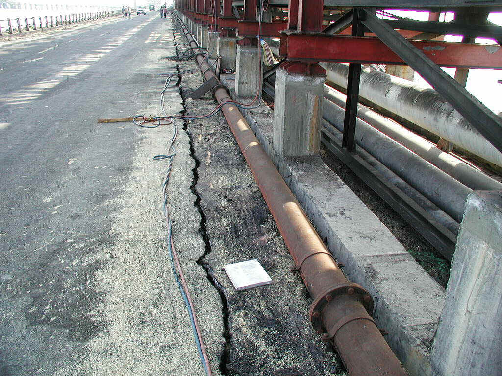
Figure 1. View of crack in earthfill spit at Adani Port.
Crack width is 5-8 cm. This crack was the only evidence of lateral deformations on the
spit. The steel frame for the pipeline structure to the right of the photograph has spread
footing foundations that did not appear to be damaged. No settlement monitoring program
was in place prior to the earthquake. Settlement of the earthfill spit relative to a
pile-supported wharf is about 20 cm. (2/17/01 4:24:16 PM, N22.7623 E69.7031).
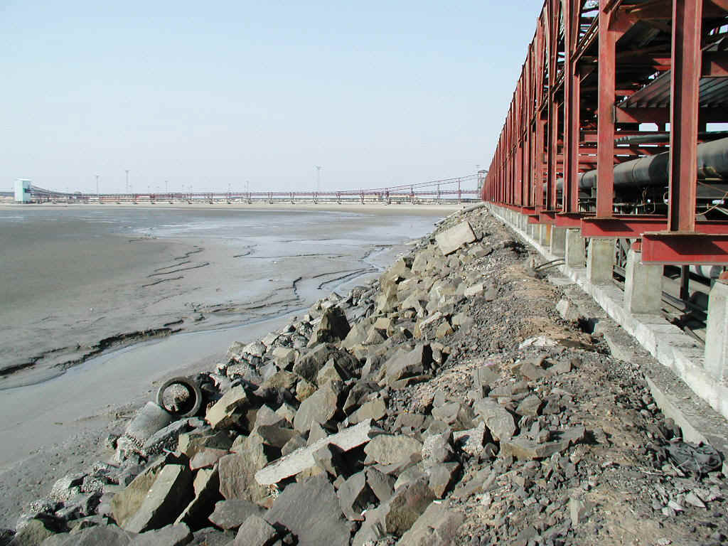
Figure 2. Face of rockfill spit slope. Slope angle is
1.5H:1.0V. Note soft marine foundation soils. (2/17/01 4:25:35 PM, N22.7636 E69.7033).
Earthfill for Rail Yard
The earthfill for the railyard is 3 m in thickness, and has foundation soil conditions similar to those reported above for the spit. Construction of the fill took about 5 months and was completed only weeks before the earthquake. The fill is quite large, having a long direction of about 1.3 km and a width of about 100-200 m. The fill is gravelly sand.
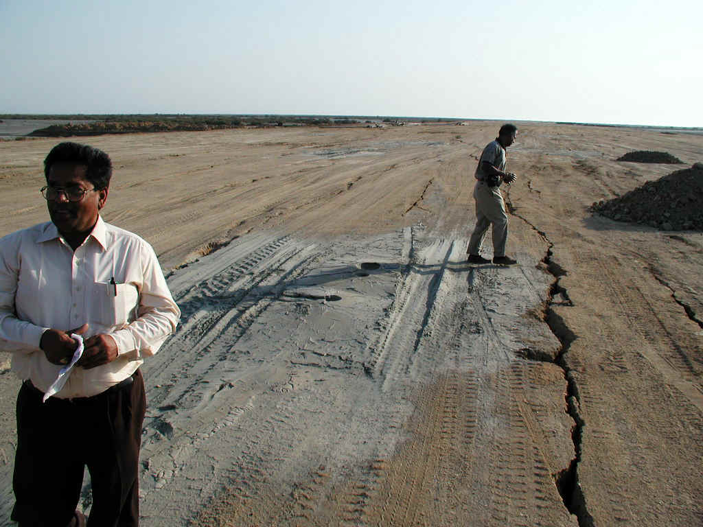
Figure 3. Cracks in surface of fill, with sand boils
emerging from some cracks. The sand boil material was field-identified as very fine silty
sand. The boils were first observed by Port personnel 15 minutes after the earthquake, and
were spraying 1.3 m into the air at that time. (2/17/01 5:18:12 PM, N22.8150 E69.7095).
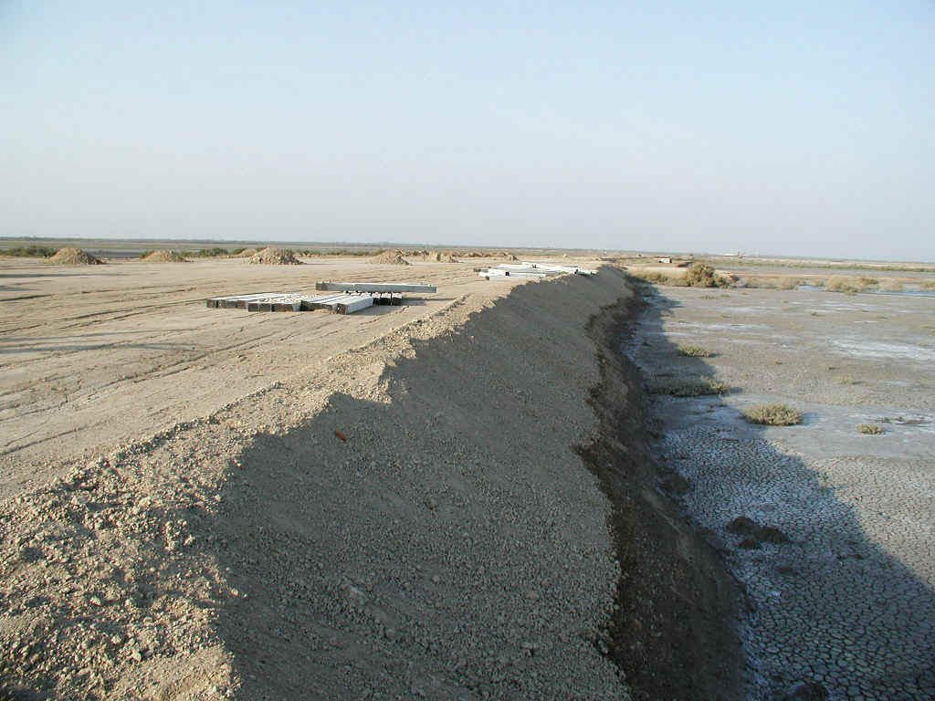
Figure 4. View of fill edge slope showing soft foundation soil. Light spots on
foundation soil are sand boils. (2/17/01 5:30:42 PM, N22.8272 E69.7110).
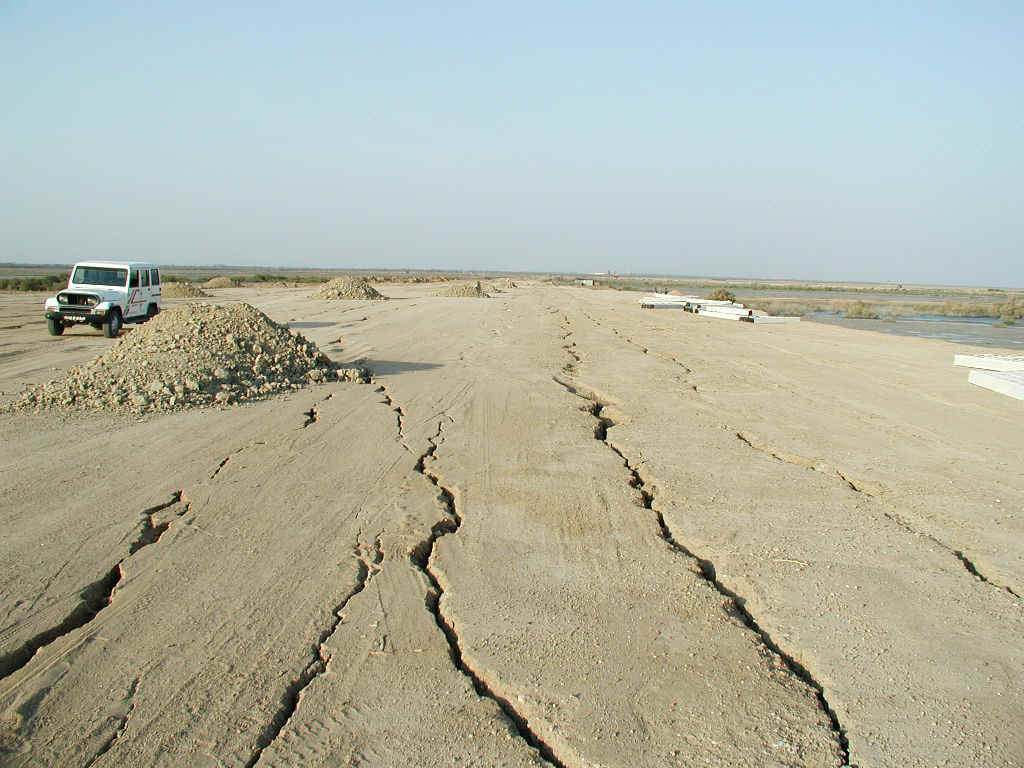
Figure 5. View of cracks across surface of fill. Cracks ran in the longitudinal
direction of the fill and were primarily extensional (i.e., little vertical offset).
Horizontal displacements across cracks from the midpoint of fill to edge were 30-45 cm.
(2/17/01 5:28:29 PM, N22.8250 E69.7107).
Approach Road Fill
The approach road to the site passes over foundation soils visually similar to those at the railroad yard, but no damage was observed in this fill. The fill thickness is approximately 1.5 m (as compared to 3.0 for the rail yard fill), and the fill was completed 6 years ago.
Figure 6. View of approach road fill showing lack of cracking in asphalt pavement.
(2/17/01 6:16:58 PM, N22.8724 E69.7164).
Figure 7. Sand boils on foundation soils for road fill. These soil conditions are
visually similar to those at the railroad fill (2/17/01 6:18:27 PM, N22.8738 E69.7166).