The January 26, 2001, Gujarat, India, earthquake
This page was last updated on June 07, 2005
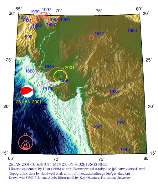
A severe earthquake occurred in Gujarat, India about 160 miles (250 km) west of Ahmadabad, India or about 180 miles (290 km) southeast of Hyderabad, Pakistan on January 26 at 8:46 AM local time. As of February 1, at least 14,239 people reported killed(AP), 15,000-20,000 unconfirmed dead, and 61,632 injured.
Data from USGS
01/01/26 03:16:41 UTC
LAT: 23.40N
LON: 70.32E
Depth: 23.6 km
7.5Mw
INDIA
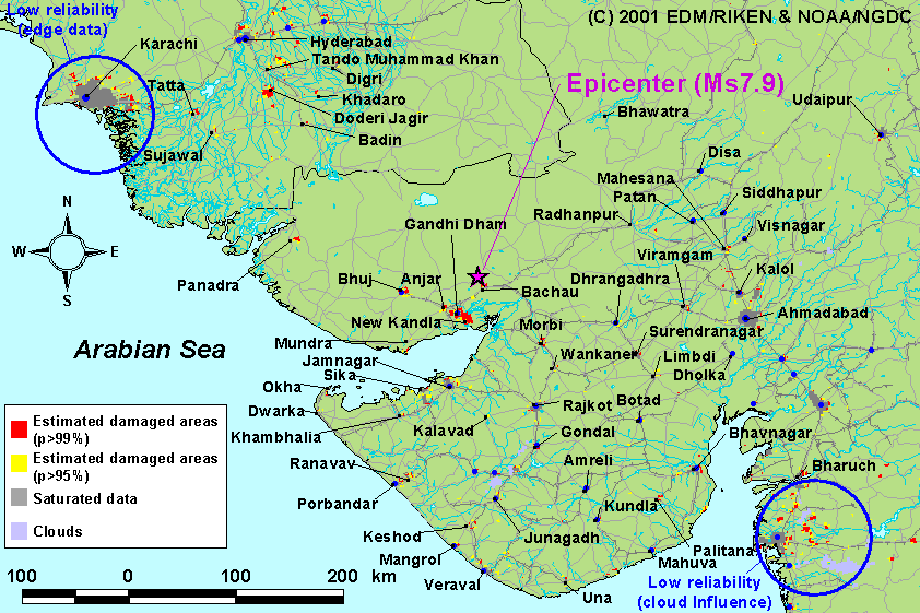
Estimated Damage Areas due to the earthquake in
Gujarat, India on January 26, 2001
Based on the Nighttime Satellite Images
by Earthquake
Disaster Mitigation Research Center (EDM), The Institute of Physical and
Chemical Research (RIKEN)
(http://www.miki.riken.go.jp/India2001/dmsp.html)
As per available information from State Government of Gujarat, the extent of damage is as under: -
As on 26 February 2001 (Local time):
S.No. |
Districts |
Human Death |
1 |
Ahmedabad |
751 |
2 |
Amreli |
00 |
3 |
Anand |
01 |
4 |
Banaskantha |
32 |
5 |
Bharuch |
09 |
6 |
Bhavnagar |
04 |
7 |
Gandhinagar |
08 |
8 |
Jamnagar |
119 |
9 |
Junagadh |
08 |
10 |
Kachchh (Bhuj) |
18414 |
11 |
Kheda |
00 |
12 |
Mehsana |
00 |
13 |
Navsari |
17 |
14 |
Patan |
38 |
15 |
Porbandar |
09 |
16 |
Rajkot |
433 |
17 |
Surat |
46 |
18 |
Surendranagar |
113 |
19 |
Vadodara |
01 |
20 |
Sabarkantha |
00 |
21 |
Valsad |
00 |
Total: |
20003 |