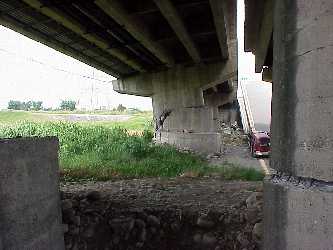
Bridges
across Tachia River and to the South along Highway 3
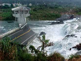
Waterfall created by reverse fault movement just north of the south
abutment of heavily damaged multi-span bridge north of City of Fengyuan
and to the west of the Shihkang Dam (N 24.2786 E 120.7592; 9/30/99)
View to south showing right lateral offset of about 3 to 4 m and uplift
or about 4 to 5 m in this bridge (N 24.28 E 120.76; 9/30/99)
View to south showing felled spans and rupture (N 24.28 E 120.76; 9/30/99)
View to southwest along fault that cuts through bridge west of Shihkang
Dam (N 24.2805 E 120.7602; 9/30/99)
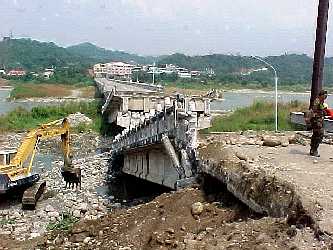
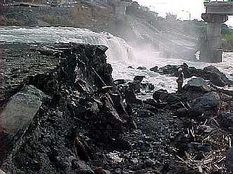
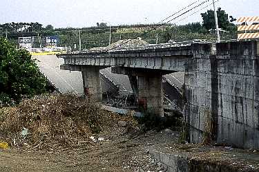
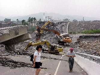
Collapse of 2 spans of 11 span bridge that is located just east of Shihkang
Dam (N 24.2817 E 120.7792; 9/30/99)
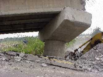
View to southwest at the bridge collapse shown in previous photograph;
piers at this bridge had a tilt away from the south abutment of about 1
degree (N 24.2817 E 120.7792; 9/30/99)
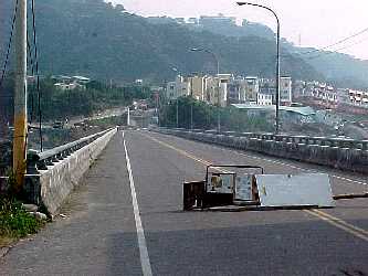
View to south showing compression at bridge joints and felled spans
(N 24.2854 E 120.7801; 9/30/99)
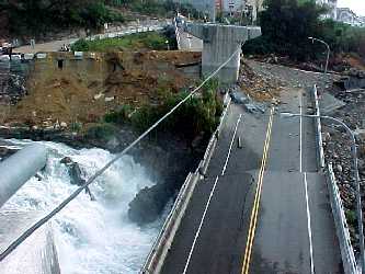
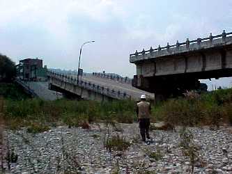
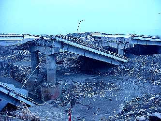
View to south along bridge east of Shihkang Dam showing downward and
downstream relative movement of central section with respect to both abutments
(N 24.2854 E 120.7801; 9/30/99)
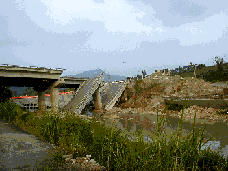
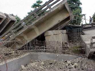
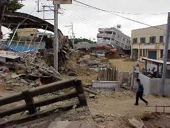
Collapsed bridge on Highway 3 between Fengyuan and Dunshr (N24.2854 E120.7969).
Longitudinal direction of bridge is roughly NS. View is to the east, showing
area near the north abutment pushed toward creek by the toe of a landslide.
View of bridge with headscarp of landslide visible in background (N24.2854
E120.7969), looking south.
Close-up view of headscarp above collapsed bridge (N24.2854 E120.7969).
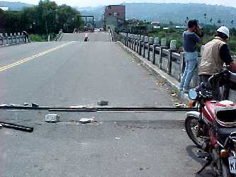
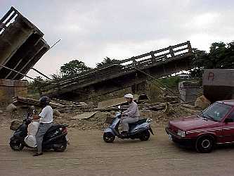
Collapsed bridge spans near Highway 129/136 intersection near Taiping
(N 24.1335 E120.7352). The longitudinal direction for the bridge has an
azimuth of approximately 300 degrees. The fault is known to pass beneath
the bridge based on exposures west and east of the spans, but its precise
location is unknown due to grading near the bridge. View in photo is to
the NE. Note the spans have been pushed to the SE (to the right in the
photograph) off their supports, possibly from compression associated with
the faulting.
Close up of failed span (N 24.1335 E120.7352). Several of the bridge supports,
such as this one, were tilted. No evidence of liquefaction was found at
the site, but boils and/or spread features would have been concealed by
post-earthquake grading in the area.
Fault exposed west of bridge (N 24.1335 E120.7352). View is from the
NW abutment of bridge, looking west.
Bridge on Highway 3 near Wufeng (N 24.0118 E 120.6948). Bridge is oriented
in the NS direction. View is nearly along strike of fault expression to
the west. Small ridge in foreground is a surface expression of the fault,
which passes very near one of the bridge piers.
Fault passing adjacent to bridge pier (N 24.0118 E 120.6948). Note
tilting of pier, which is located on the hanging wall, immediately adjacent
to the surface expression of the fault.
View from the tilted pier to the north (N 24.0118 E 120.6948). Deck movement
imposed by the tilted pier (behind photographer) appears to have failed
this adjacent pier in shear.
Mingju bridge on Highway 3 between Mingjian and Jushan (N 23.8146 E
120.7080). Bridge is oriented in the NS direction. Eight spans failed near
the south abutment. View in photograph is to the south. It was reported
by NCREE that the fault was located very near this bridge. No fault trace
was observed at the bridge during our site visit, possibly due to grading
in the area.
Tilted bridge column on Mingju bridge (N 23.8146 E 120.7080). Note the
collapsed deck to the right has been pushed off support, and deck to left
has been pushed to the right, indicating possible compression of the spans.
The cause of the tilt in this bridge pier is unknown.
Collapsed decks on Mingju bridge near south abutment (N 23.8146 E 120.7080),
looking west. Note each deck has been pushed off its support to the south.