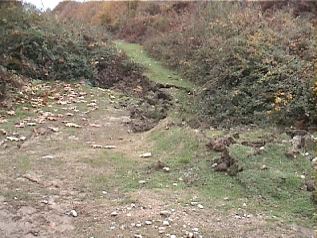
Between Duzce and Bolu
Figure 1. Fault surface rupture in unpopulated area to the south of Highway 100 between Duzce and Bolu (November 17, 1999, 11:50:16, N 40.7747, E 31.2373).
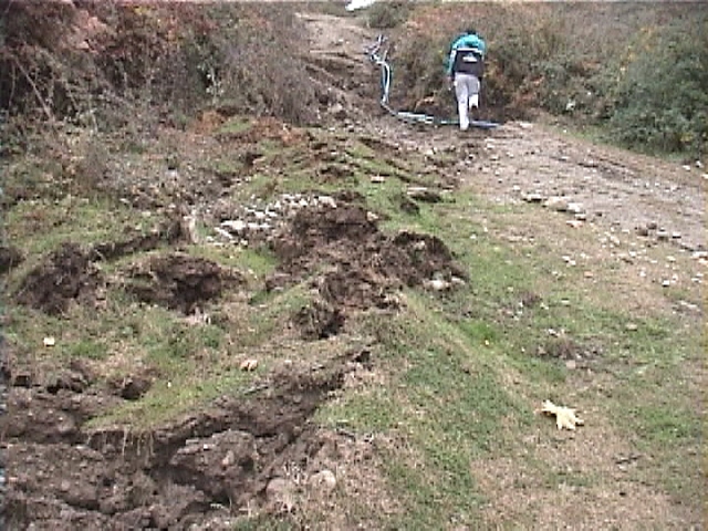
Figure 2. The fault surface rupture cut through a dirt road in the country side and broke utility lines (November 17, 1999, 11:52:36, N 40.7748, E 31.2374).
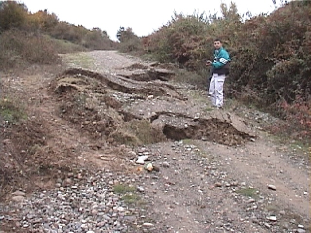
Figure 3. Another view of the fault surface rupture cutting the unpaved road (November 17, 1999, 11:56:06, N 40.7748, E 31.2375)
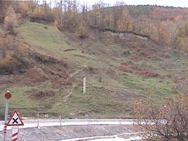
Figure 4. The November 12, 1999 earthquake reactivated an existing landslide along Highway 100 (November 17, 1999, 14:57:34, N 40.7543, E 31.3648).
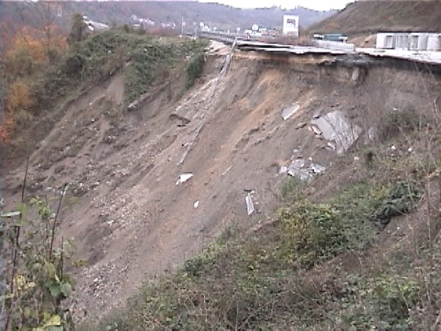
Figure 5. A reinforced earth wall collapsed and took with it part of the asphalt pavement of Highway 100 between Bolu and Duzce (November 17, 1999, 15:10:45, N 40.7555, E 31.3709).
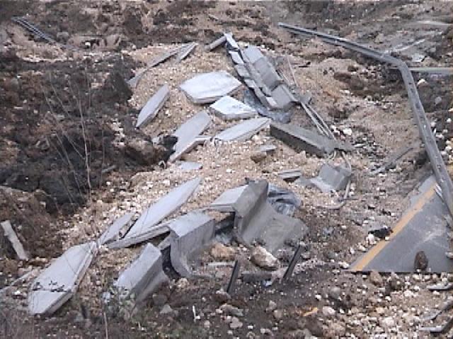
Figure 6. View of the face plates of the collapsed reinforced earth wall at the bottom of the slope in Fig. 5 (November 17, 1999, 15:10:46, N 40.7555, E 31.3709).