The City of Duzce
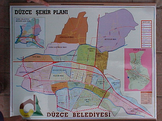
Figure 1. Master plan of Duzce showing general layout of city (north is up). Duzce has a population of about 77,000.
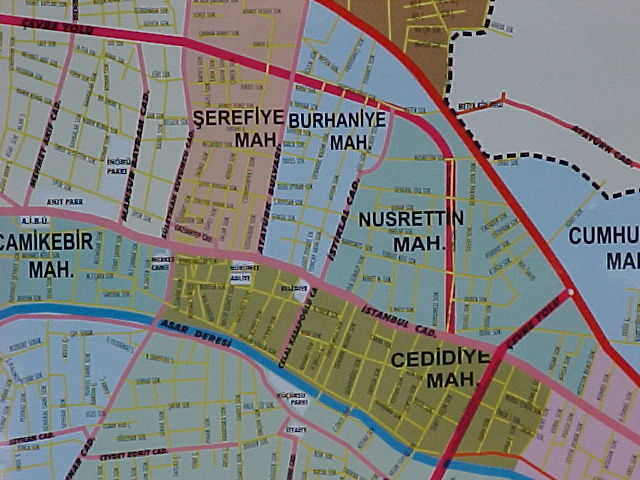
Figure 2. Close-up of map showing central part of city which was populated during the 1967 Mudurnu Valley Earthquake (M 7.1). The central bridge is shown in the middle of the lower left quadrant of the photograph.
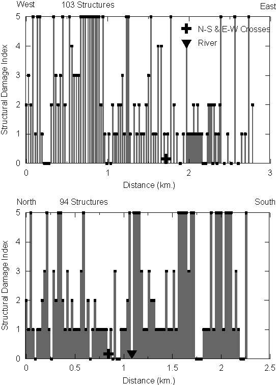
Structural Damage Index [No evidence of ground failure, i.e. settlement or tilt, was observed along the lines surveyed]
|
Index |
Description |
Interpretation |
|
D0 |
No Observable Damage |
No cracking, broken glass, etc. |
|
D1 |
Light Damage |
Cosmetic cracking, no observable distress to load bearing structural elements |
|
D2 |
Moderate Damage |
Cracking in load bearing elements, but no significant displacements across these cracks |
|
D3 |
Heavy Damage |
Cracking in load bearing elements with significant deformations across the cracks |
|
D4 |
Partial Collapse |
Collapse of a portion of the building in plan view (i.e. a corner, or a wing of building) |
|
D5 |
Collapse |
Collapse of the complete structure or loss of a floor of the structure. |
Figure 3. Damage survey along West (N40.50445 31.08381) - East (N40.50148 E31.10310) line and North (N40.84542 E31.16030) - South (N40.82761 E31.15263) line through Duzce (Crossing Point at N40.50352 E31.09582 and River Crossing at N40.83704 E31.15880).
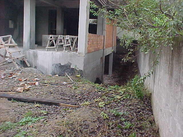
Figure 4. Most buildings in Duzce have basements similar to this one (N40.837 E31.158; 11/18/99). The groundwater level is reported to be at a depth of at least 3 to 5 meters.
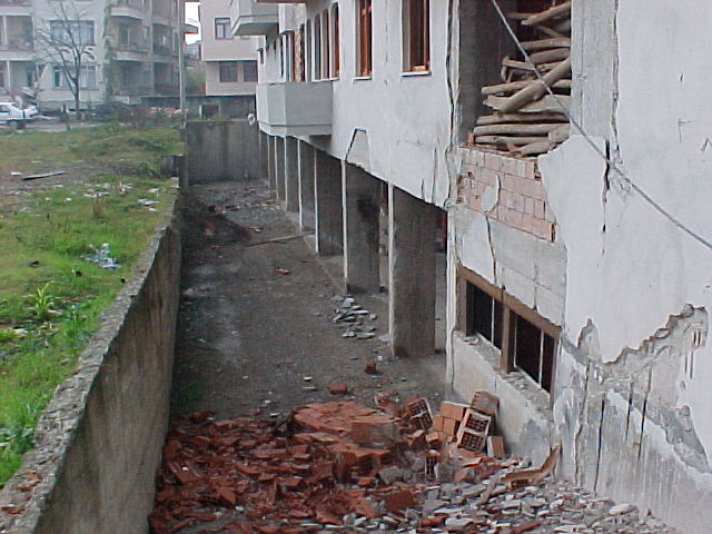
Figure 5. Another basement and retaining wall in Duzce (N40.83434 E31.16186; 11/18/99).
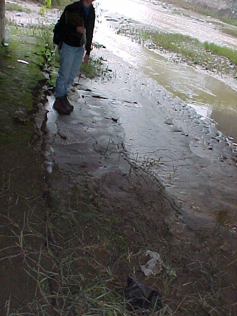
Figure 6. Possible liquefaction in river channel through center of city (N40.83578 E31.16339; 11/18/99)
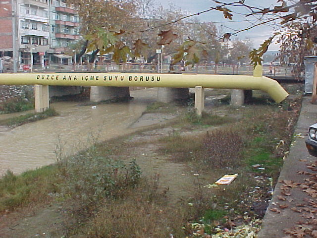
Figure 7. There was no observable distress to bridges and pipelines crossing the river due to ground failure associated with liquefaction (N40.83709 E31.14553; 11/18/99).
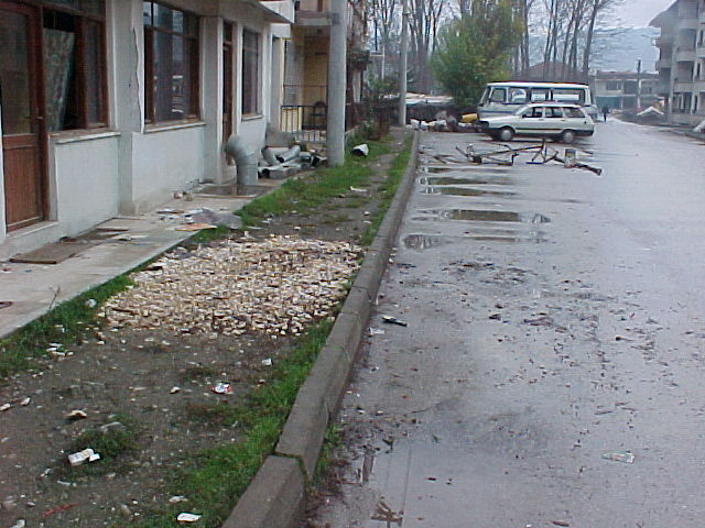
Figure 8. There was no observable ground failure due to liquefaction or ground softening within Duzce, as evidenced by the undeformed curb.
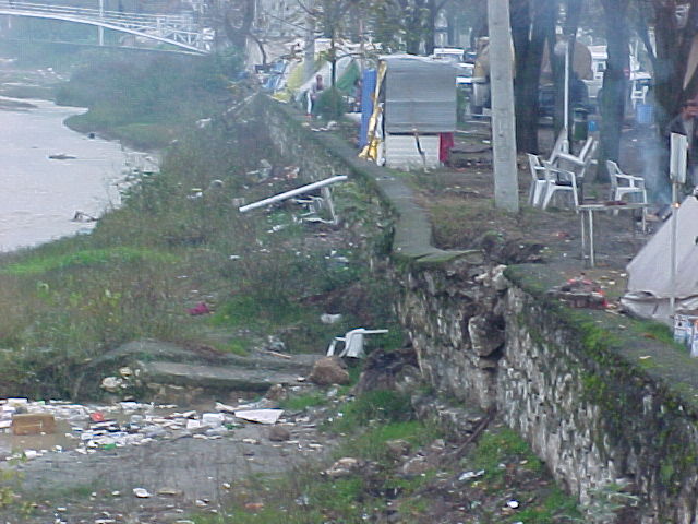
Figure 9. Small, isolated river channel wall failure in Duzce (N40.83549 E31.16376; 11/18/99).
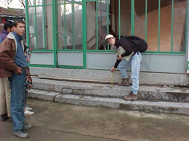
Figure 10. Fairly isolated ground settlement of 1 cm adjacent to building in southern area of city (N40.83889 E31.15480; 11/18/99)
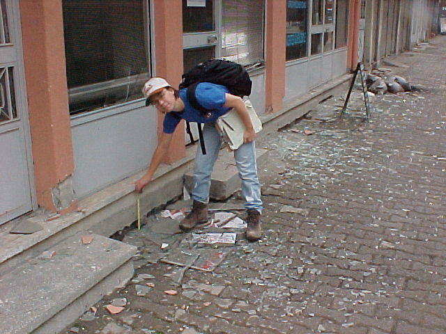
Figure 11. Fairly localized ground settlement of 1.5 cm adjacent to a building with basement in northern section of town (N40.83876 E31.16484; 11/18/99)
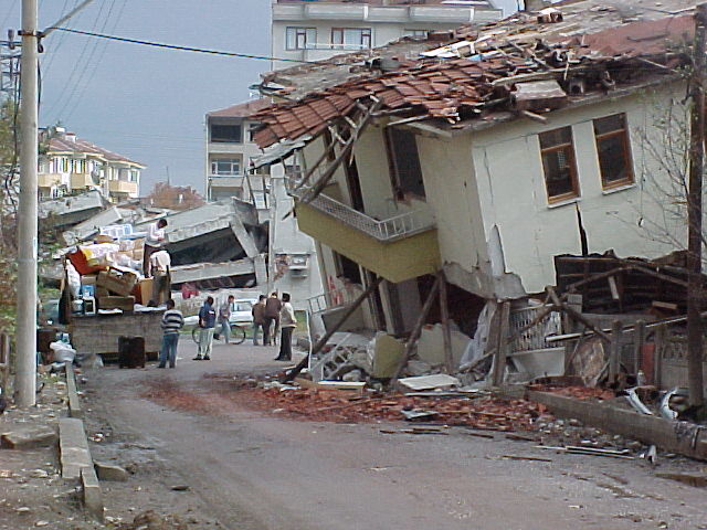
Figure 12. Heavily damaged area north of older section of Duzce (N40.84362 E31.16180; 11/18/99)
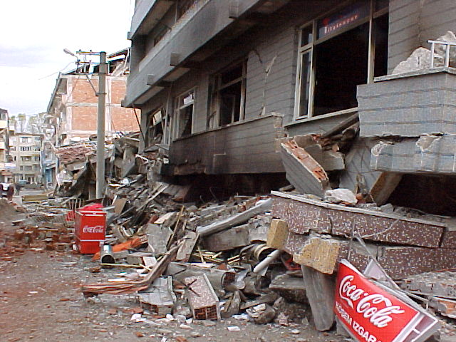
Figure 13. Collapsed building and fire in heavily damaged area of Duzce. The evidence of several fires was observed (N40.83886 E31.16012; 11/18/99)
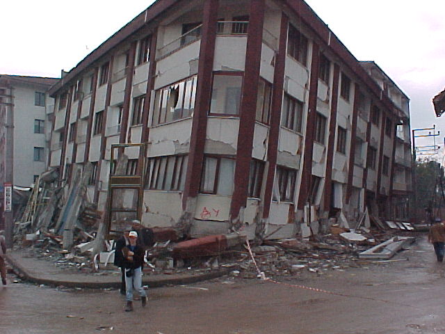
Figure 14. There was extensive damage in the area south of the central bridge in the City of Duzce. This area was reported as only lightly damaged due to the 8/17/99 Kocaeli Earthquake (N40.83668 E31.15824; 11/18/99)
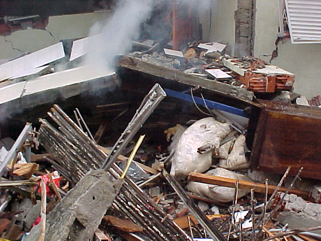
Figure 15. Parts of this building were still burning several days after the earthquake (N40.83668 E 31.15824; 11/18/99).
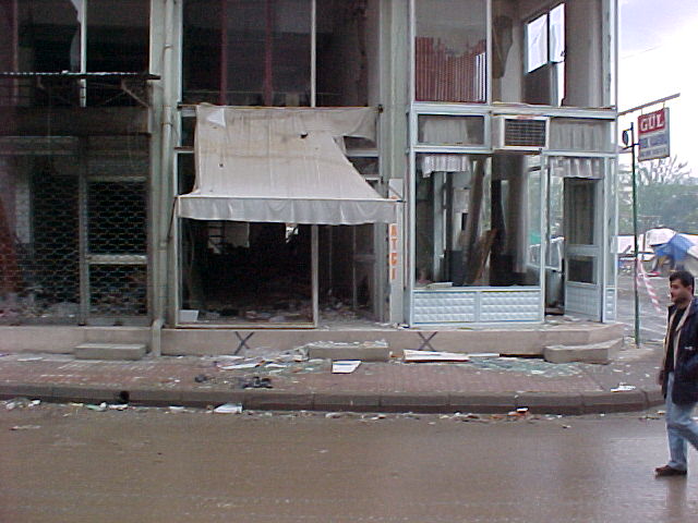
Figure 16. The blue "X" indicates that this building was inspected and judged to be safe following the 8/17/99 Kocaeli Earthquake. However, many of the buildings marked with a blue "X" were damaged by the 11/12/99 Duzce Earthquake (N40.8367 E31.1582; 11/18/99).
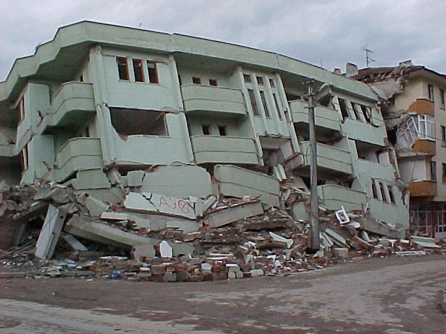
Figure 17. This building was also marked with a blue "X" (see column at lower left hand side of photo), but collapsed during the 11/12/99 Duzce Earthquake (N40.83663 E31.17010; 11/18/99)
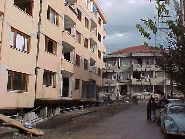
Figure 18. Partially collapsed soft first story of this apartment building constructed in 1998 (N40.84288 E31.15844; 11/18/99).
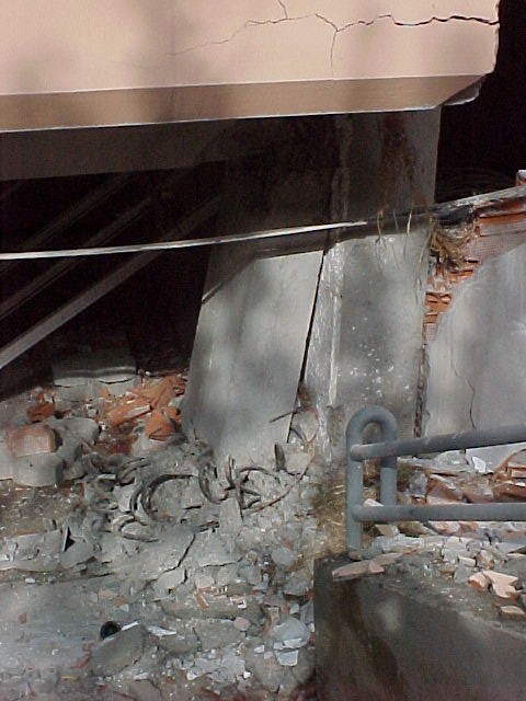
Figure 19. Close-up of column in building shown in previous photograph (N40.84288 E31.15844; 11/18/99).
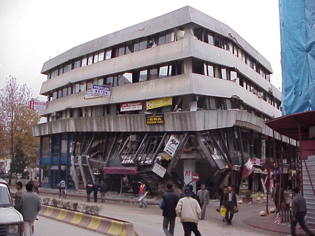
Figure 20. A retrofitted bank building contained retrofitted (jacketed) columns that performed significantly better than columns in the structure that were not retrofitted which often failed in shear (N40.50343 E31.09518; 11/18/99).
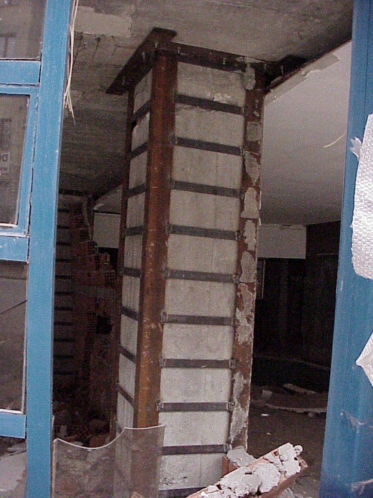
Figure 21. View of jacketed column on north side of building shown in previous photograph (N40.50343 E31.09518; 11/18/99).
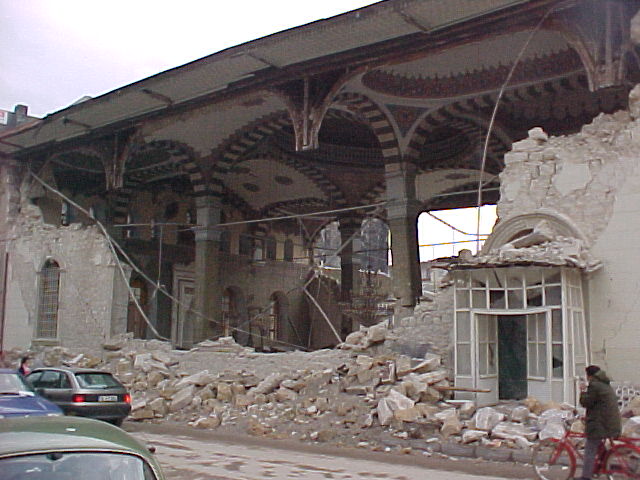
Figure 22. Collapse of exterior wall of mosque in Duzce (11/18/99)
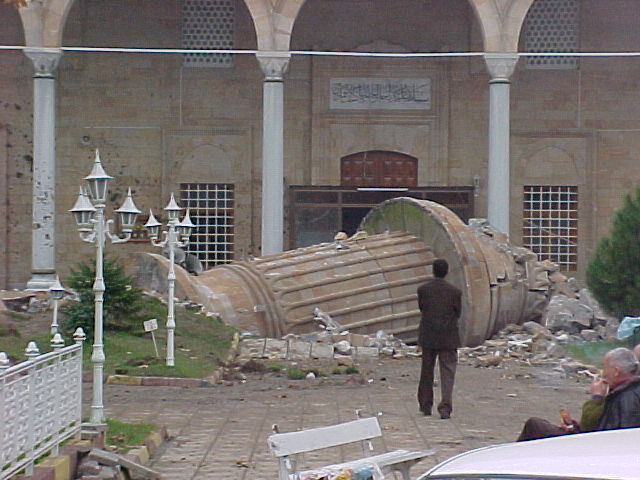
Figure 23. Minaret plows into ground after falling (N40.83883 E31.15928; 11/18/99).
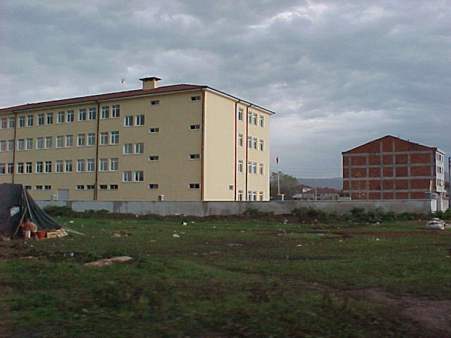
Figure 24. There was lighter damage in the Northwest part of Duzce (N40.85374 E31.15892; 11/18/99)
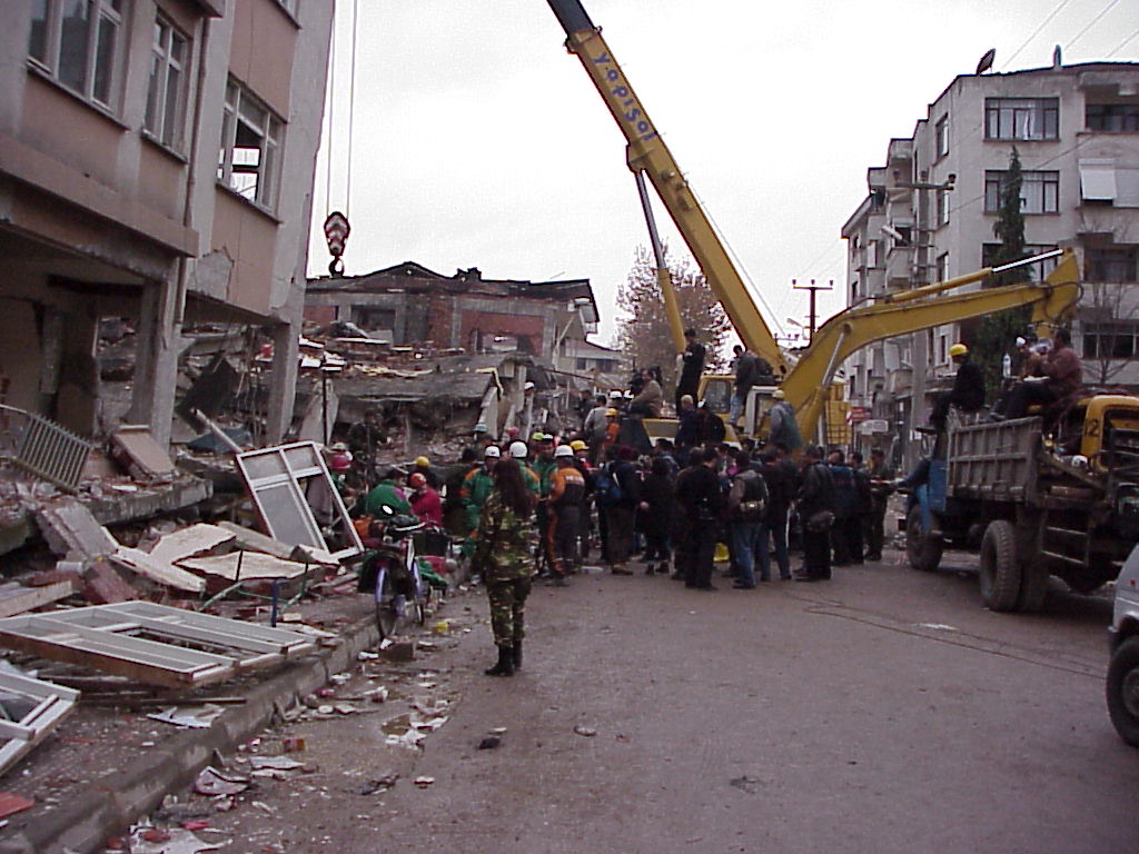
Figure 25. Rescue operation under progress several days after the earthquake in the City of Duzce (N40.50422 E31.08993; 11/18/99)