Flight over the fault surface rupture areas, Kaynasli and Duzce
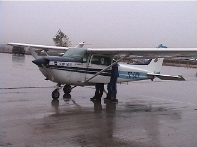
The reconnaissance flight took place on November 20, 1999. The flight crew was made of J. P. Bardet, J. Bray, A. Kaya, and a pilot from Top Air, Istanbul. The flight could not be scheduled at an earlier phase of the reconnaissance due to adverse weather conditions and restrictions on flights imposed by the Turkish government. Figure 1 shows the fixed wing aircraft used in the reconnaissance. Figure 2 shows the portable GPS unit used to track the aircraft position. The GPS unit gave the location of the still photographs after synchronizing the times of the DVD camera and still digital camera to the exact time given by the GPS unit. Figure 3 shows the flight path. The four-hour and 540 km long flight initiated from and ended at the Istanbul Airport. It went over the Golcuk and Izmit areas, the fault surface rupture in the epicenter area, Kaynasli and Duzce.
Figure 1. Fixed wing aircraft used in the aerial earthquake reconnaissance (November 20, 1999, 15:23:31, N 40.9845, E 28.8045).
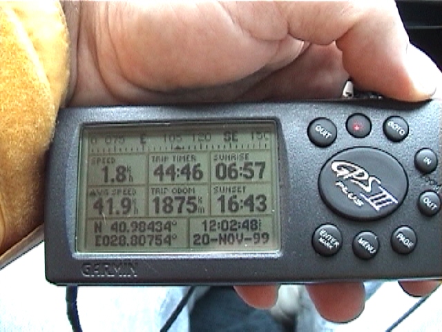
Figure 2. GPS unit used in the earthquake reconnaissance. The location of photographs are given by setting a common time between GPS and cameras (November 20, 1999, 12:02:50, N 40.9843, E 28.8075).
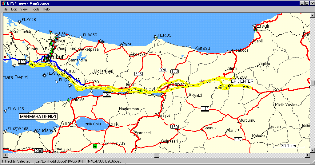
Figure 3. Flight path of the aerial earthquake reconnaissance of November 20, 1999.
Fault surface rupture
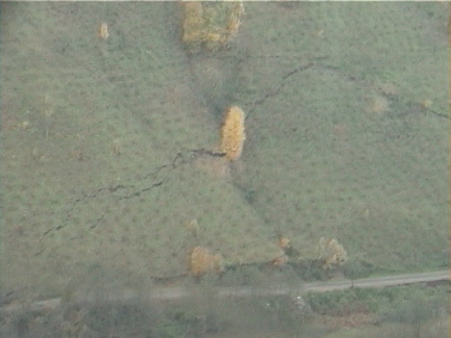
Figure 4. In the epicenter region, the fault surface rupture ran parallel to the road and went up the hill (November 20, 1999, 13:25:02, N 40.7612, E 31.0370).
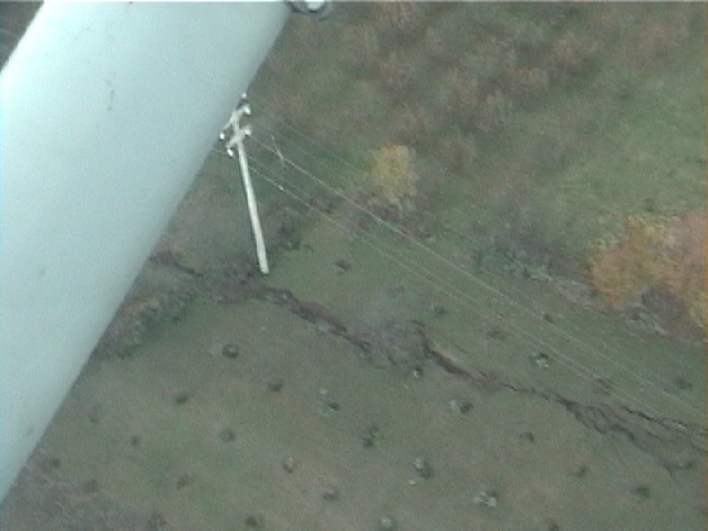
Figure 5. The fault surface rupture was clearly visible from the reconnaissance aircraft (November 20, 1999, 13:35:59, N 40.7762, E 31.3314).
Kaynasli
Kaynasli is a small town 10 km to the east of Duzce. Kaynalsi was severely damaged by the November 12, 1999, event, This small town was located on the fault surface rupture. The sources of damage were both strong ground acceleration and fault surface rupture.
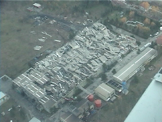
Figure 6. The roof and prefabricated structure of the warehouse completely collapsed (November 20, 1999, 13:33:43, N 40.7832, E 31.2765).
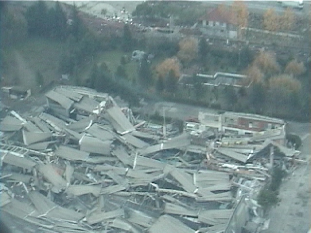
Figure 7.Closer view of the collapsed warehouse (November 20, 1999, 13:37:26, N 40.7859, E 31.2833).
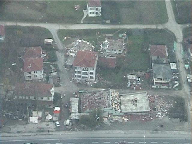
Figure 8. Collapsed and damaged apartment buildings along Highway 100 (November 20, 1999, 13:34:01, N 40.7823, E 31.2860).
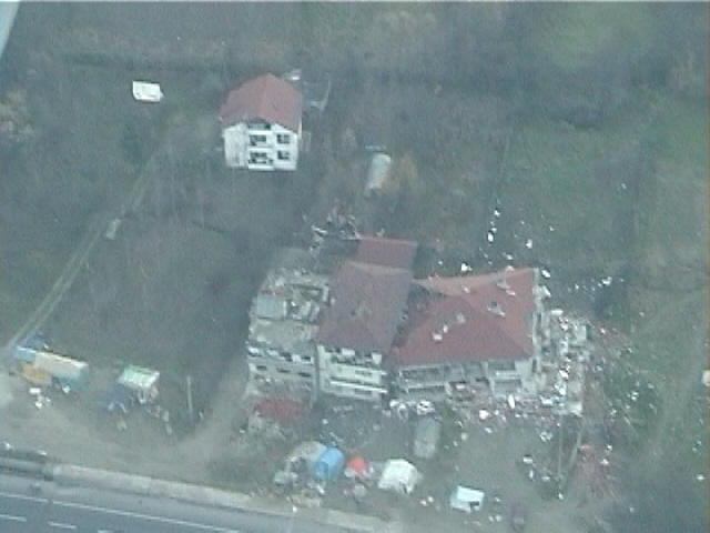
Figure 9. The first floor of the building collapsed, and the building leaned against its neighbor (November 20, 1999, 13:34:07, N 40.7813, E 31.2888).
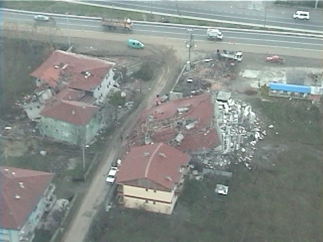
Figure 10. The apartment building to the right completely collapsed and the one to the left failed laterally (November 20, 1999, 13:38:10, N 40.7780, E 31.2981).
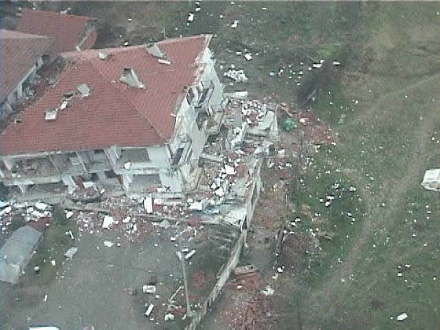
Figure 11. The four-story apartment building leaned sideways as two of its lower floors collapsed (November 20, 1999, 13:37:47, N 40.7800, E 31.2878).
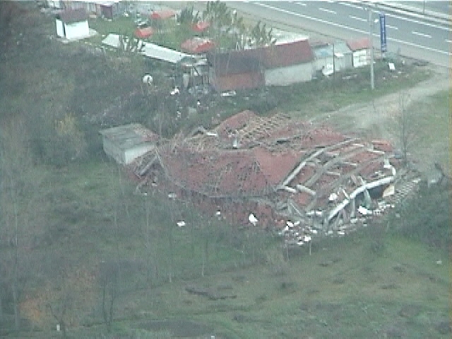
Figure 12. The apartment building collapsed as pancakes (November 20, 1999, 13:38:19, N 40.7777, E 31.3020).
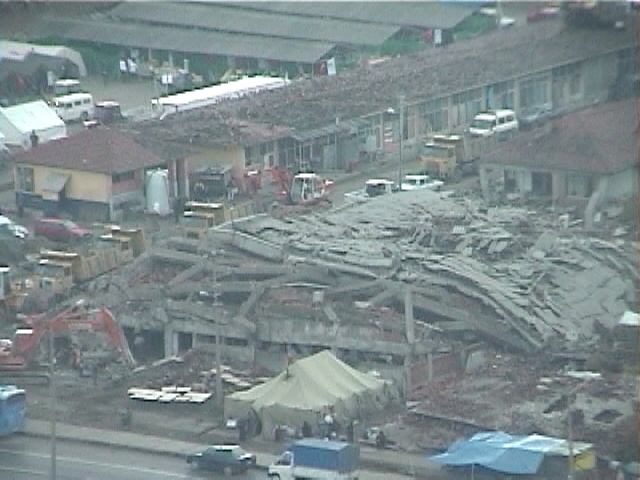
Figure 13. Complete collapse of a reinforced concrete building in Kaynasli (November 20, 1999, 13:38:38, N 40.7773, E 31.3090)
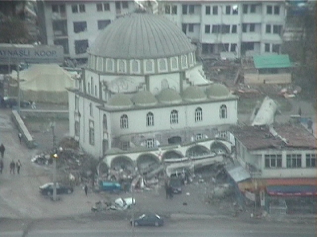
Figure 14. Collapse of the lower part of a mosque in Kaynasli (November 20, 1999, 13:38:54, N 40.7768, E 31.3147).
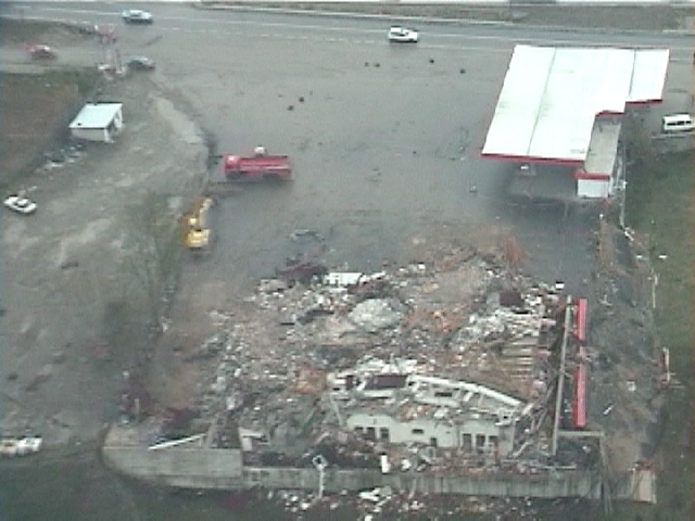
Figure 15. The building adjacent to the gas station collapsed (November 20, 1999, 13:43:00, N 40.7762, E 31.3153).
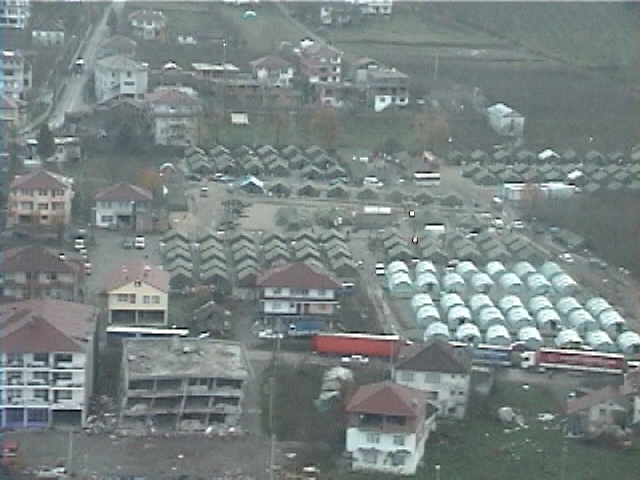
Figure 16. A tent city in Kaynasli hosted those who has lost their home during the quake (November 20, 1999,13:38:24, N 40.7776, E 31.3041).
Duzce
Duzce is about 40 km to the east of Adapazari, and has a population of 77,000. It was located within 6 km of the fault surface rupture and of the earthquake epicenter. There was severe damage in Duzce.
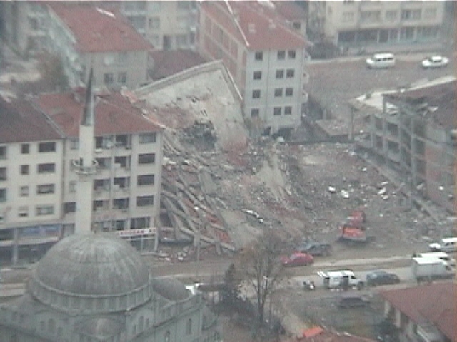
Figure 17. Collapse of an apartment building in Duzce (November 20, 1999, 13:52:44, N 40.8427, E 31.1673).
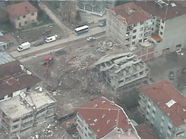
Figure 18. The collapsed building of Fig. 17 viewed from a different direction (November 20, 1999, 13:54:28, N 40.8385, E 31.1569).
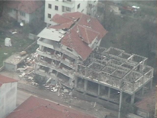
Figure 19. The lowest floors of the apartment building collapsed, and the building leaned against a building under construction (November 20, 1999, 13:53:08, N 40.8356, E 31.1642).
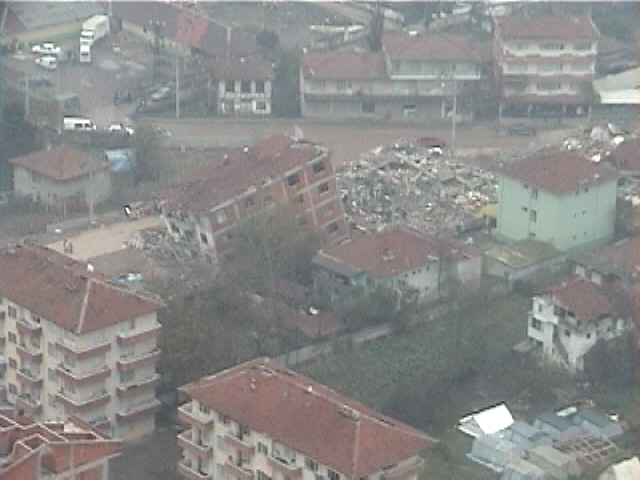
Figure 20. A leaning building adjacent to a completely collapsed building (November 20, 1999, 13:53:59, N 40.8299, E 31.1512).
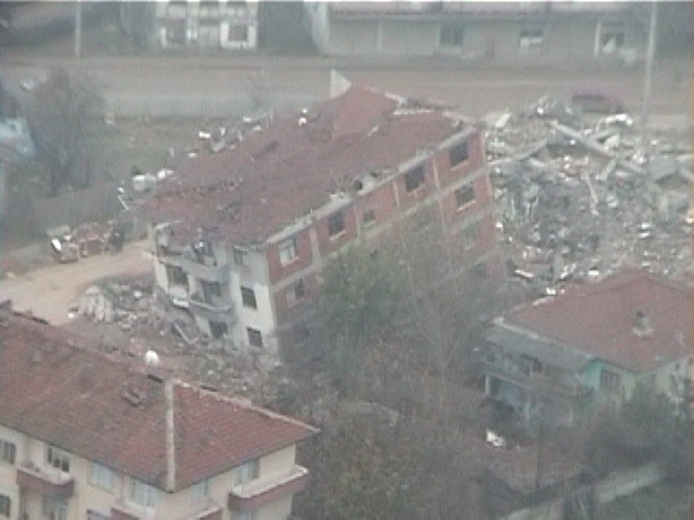
Figure 21. Closer view of Fig. 20 (November 20, 1999, 13:54:01, N 40.8305, E 31.1512).
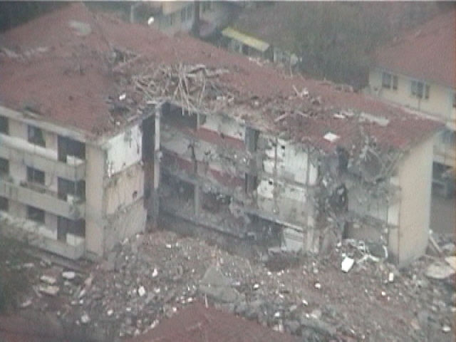
Figure 22. A quarter of the apartment building completely collapsed (November 20, 1999, 13:54:04, N 40.8314, E 31.1511).
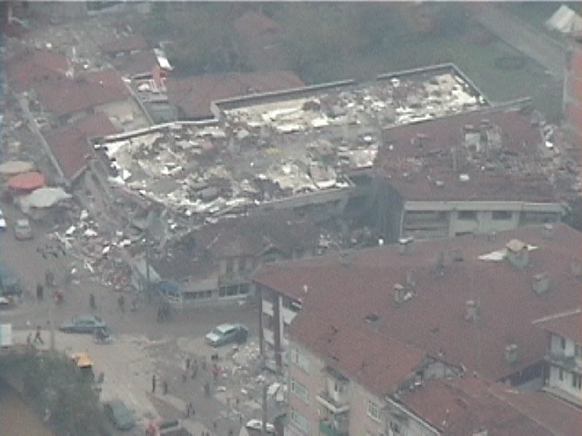
Figure 23. The building at the street corner collapsed (November 20, 1999, 13:54:14, N 40.8344, E 31.1521).
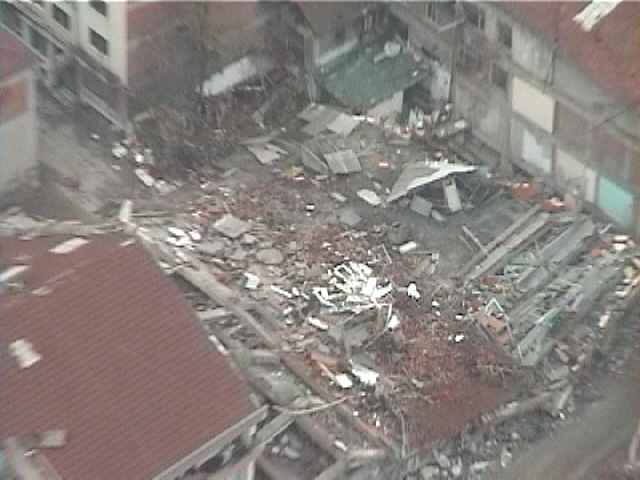
Figure 24, An apartment building completely destroyed (November 20, 1999, 13:54:24, N 40.8374, E 31.1555).
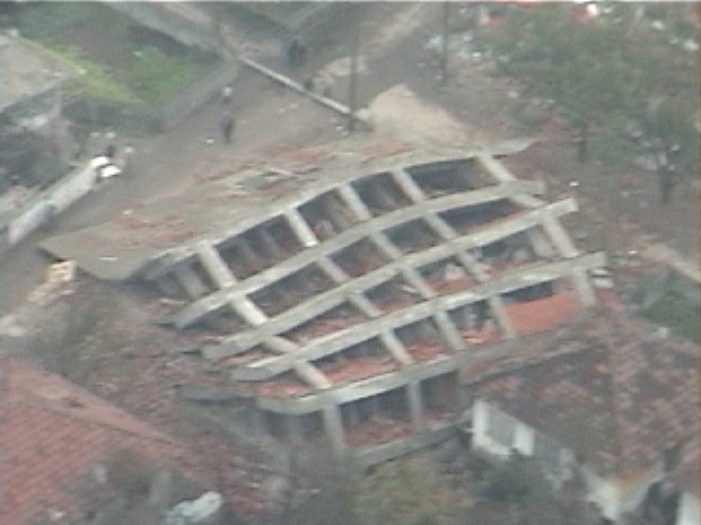
Figure 25. The building under construction collapsed and leaned toward the street (November 20, 1999, 13:54:47, N 40.8435, E 31.1637).
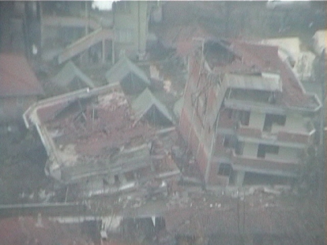
Figure 26, These similar apartment buildings failed in different ways and leaned in opposite direction (November 20, 1999, 13:55:25, N 40.8500, E 31.1663).
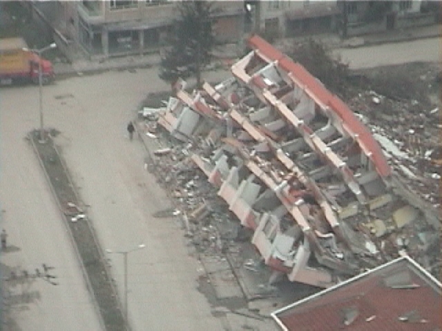
Figure 27. The 5-story buildings collapsed and leaned away from the street (November 20, 1999, 13:55:32, N 40.8494, E 31.1644).
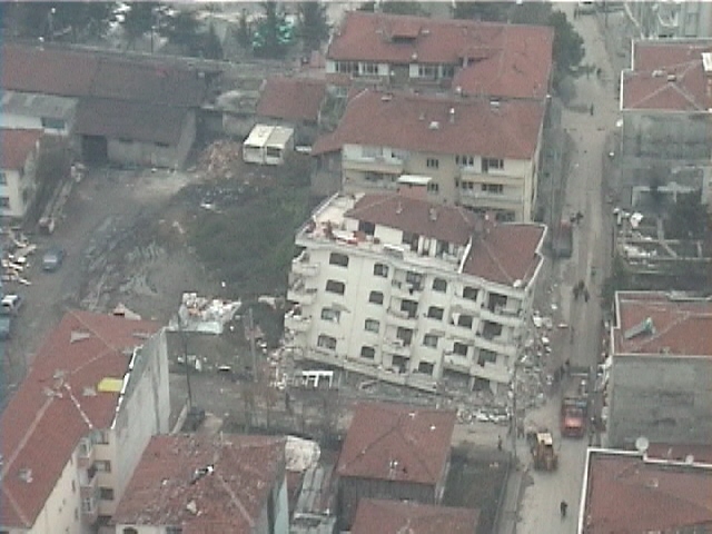
Figure 28. The first floor of the five-story building collapsed and the building leaned toward the street corner (November 20, 1999, 13:55:38, N 40.8474, E 31.1640).
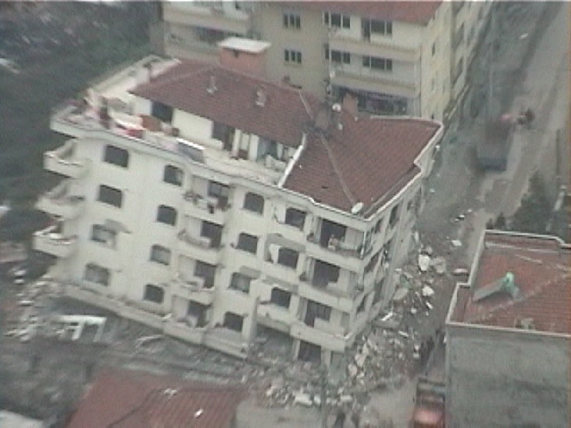
Figure 29. Closer view of the building in Fig, 28 (November 20, 1999, 13:55:39, N 40.8470, E 31.1639).
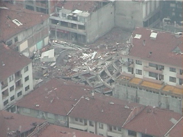
Figure 30. Collapse of a building under construction (November 20, 1999, 13:55:42, N 40.8458, E 31.1638).
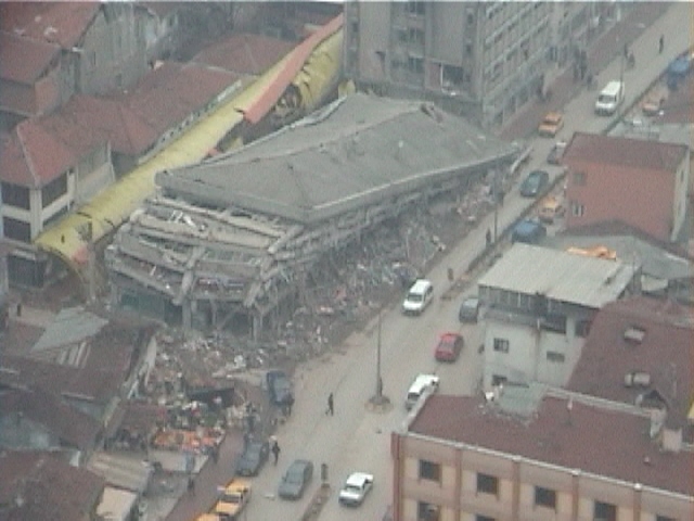
Figure 31. The floors of the buildings completely collapsed (November 20, 1999, 13:55:44, N 40.8451, E 31.1638).
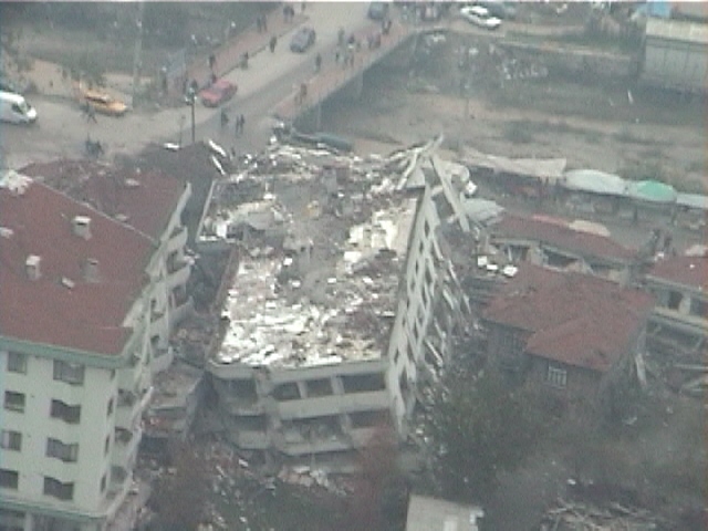
Figure 32. The lower floors of the building collapsed and the building leaned sideways (November 20, 1999, 13:56:04, N 40.8381, E 31.1617).
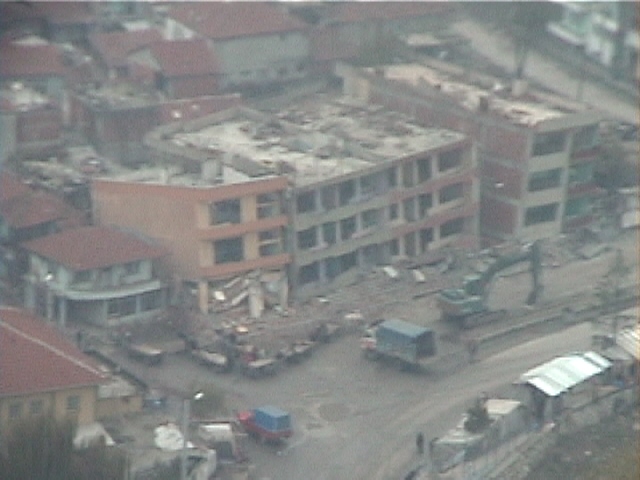
Figure 33. Collapse of the lower floors of three adjacent buildings under construction (November 20, 1999, 13:56:18, N 40.8353, E 31.1580).
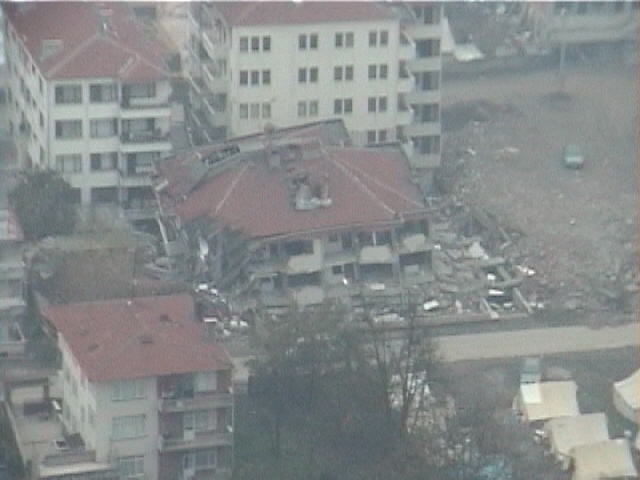
Figure 34. Collapse of the lower floors of an apartment building in Duzce (November 20, 1999, 13:56:26, N 40.8359, E 31.1538).
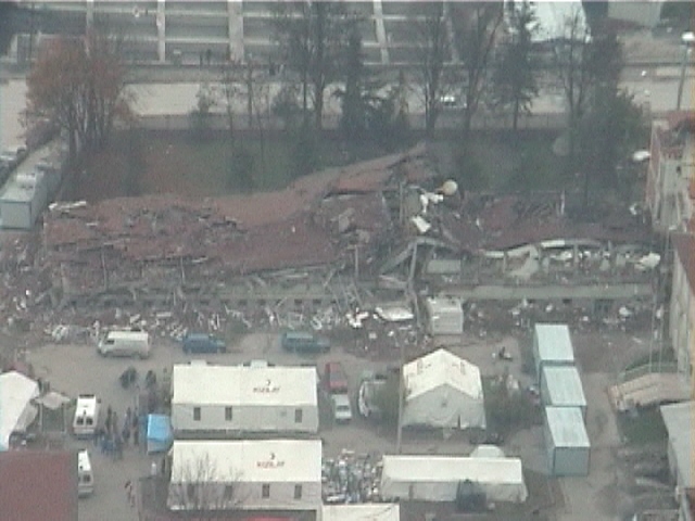
Figure 35. The elongated building collapsed and could not be identified from the air (November 20, 1999, 13:56:38, N 40.8367, E 31.1476),
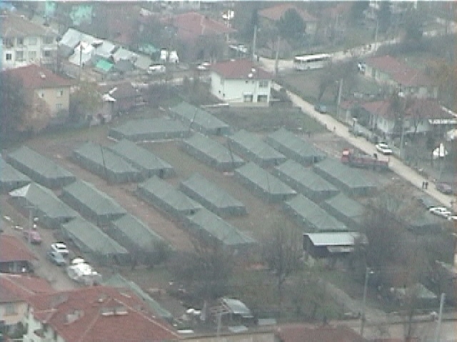
Figure 36. Large tents in Duzce erected for providing shelter to earthquake victims (November 20, 1999, 13:55:20, N 40.8503, E 31.1677).
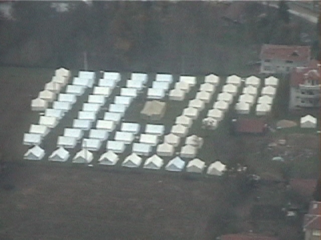
Figure 37. A large group of tent for sheltering refugees (November 20, 1999, 13:56:49, N 40.8375, E 31.1419).
Golcuk and Izmit areas
The November 12, 1999 earthquake damaged the Golcuk and Izmit areas much less than the August 17, 1999 event. However, as shown in Figs. 38 to 42, the extensive temporary housing in the Izmit area were an overwhelming reminder of the extensive damage inflicted by the August 17, 1999 event.
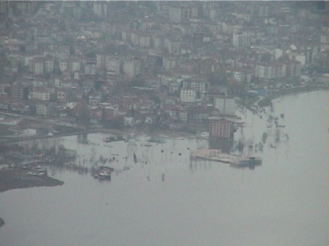
Figure 38. The land along the coastline in Golcuk was still underwater as a result of the coastal subsidence induced by the fault surface rupture during the previous Kocaeli earthquake of August 17, 1999 (November 20, 1999, 12:39:01, N 40.7448, E 29.86236).
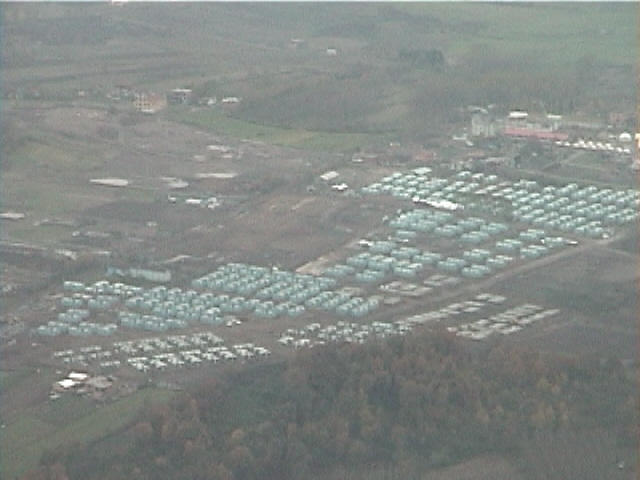
Figure 39. Temporary housing has been constructed in Izmit to host those who had lost their homes during the August 17, 1999 earthquake (November 20, 1999, 12:42:43, N 40.7334, E 29.98643).
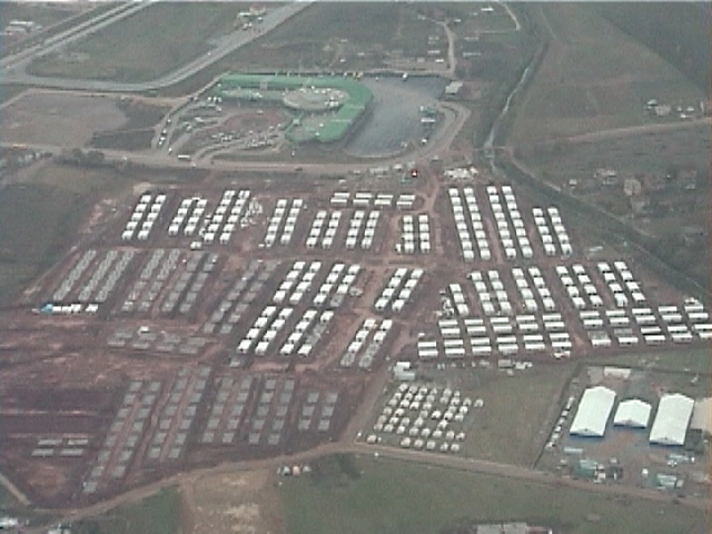
Figure 40. Another temporary housing partially completed in Izmit (November 20, 1999, 14:35:09, N 40.7626, E 29.9824).
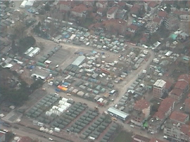
Figure 41. Tent city and temporary housing in Izmit (November 20, 1999, 14:35:49, N 40.7598, E 29.9619).
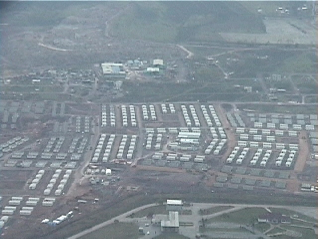
Figure 42. Large temporary housing complex built in Izmit after the August 17, 1999 earthquake (November 20, 1999, 14:41:27, N 40.7600, E 29.8008).