Field Reconnaissance:
18 November 2004
LIDAR System
of Debris Flow
Robert Pack, Randy Jibson, and
GEER Beyond Reconnaissance Team
A LIDAR survey of a debris slide / debris flow complex was completed
on November 18, 2004. The slide is located near Nagaoka in a canyon to the
north of the
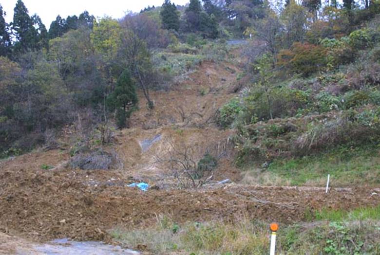
Fig. 1. Overview of
debris slide that initiated at a road fill, mobilized into a debris flow, then
deposited on a road in the foreground.
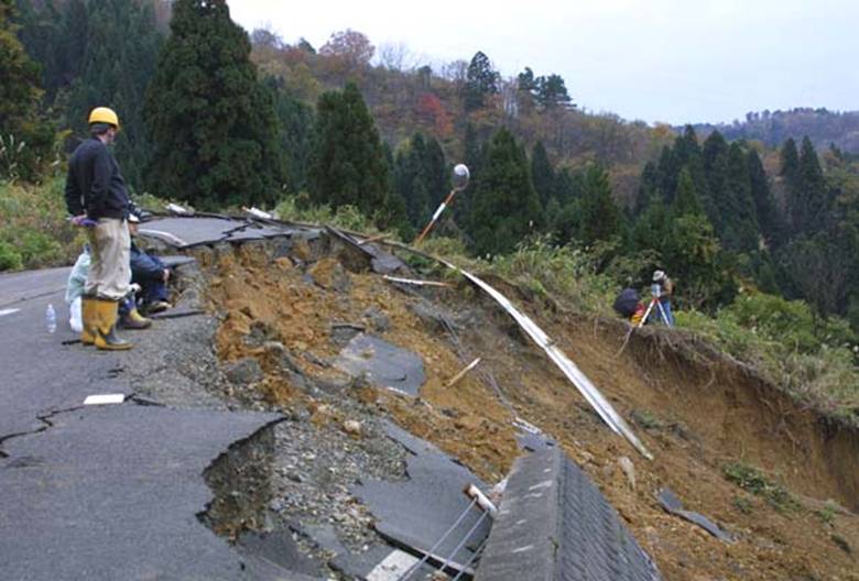
Fig. 2. Location where debris slide initiated (note LIDAR
instrument setup on side scarp).
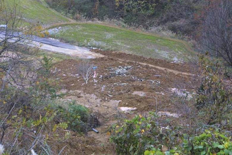
Fig. 3. View of debris flow deposit from above.
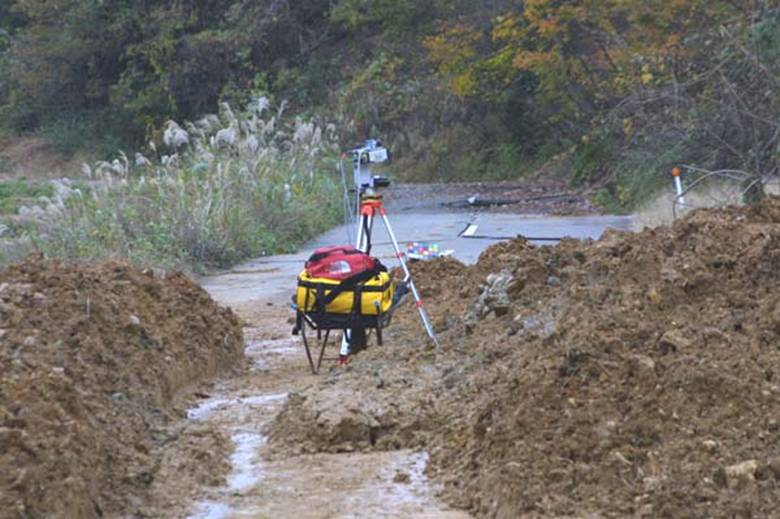
Fig. 4. LIDAR
instrument setup location used to determine debris flow profile.
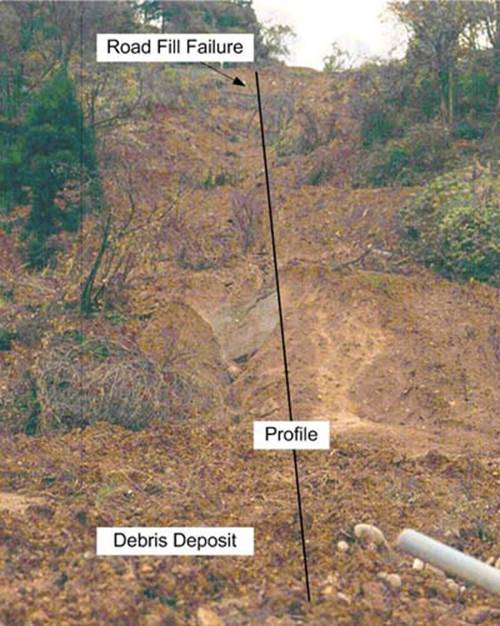
Fig. 5. Image
acquired by camera on the LIDAR system. Note the location of the profile
extracted and shown below.
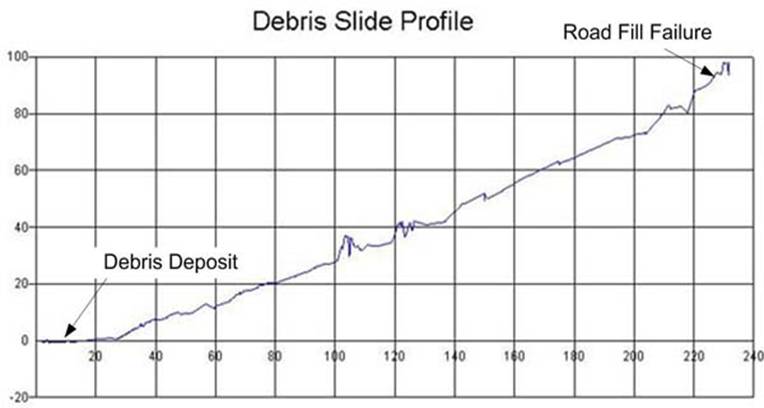
Fig. 6. LIDAR-derived
profile of debris slide. It indicates that the total relief is just under 100 m
with an average transport angle of 26°.