Preliminary Observations of the Niigata-ken Chuetsu, Japan, Earthquake of October 23, 2004
A preliminary report for the EERI-GEER earthquake engineering reconnaissance team
Prepared by J. P. Bardet
November 4, 2004
Outline
On October 23, 2004 at 08:56:00 (UTC, Coordinated Universal Time) and 5:56:00 PM (local time in Japan), a magnitude Mw 6.6 earthquake struck 80 km to the South of Niigata, on the West coast of Honshu, Japan. The earthquake epicenter is 195 km (120 miles) North-Northwest of Tokyo, Japan. The quake was the deadliest to rock Japan in nearly a decade. On November 5, 2004, 40 people were reported to be killed and 2,900 injured. There were 395 buildings destroyed and 3,473 damaged in Niigata Prefecture. The high-speed train Shinkansen, which was bound to Niigata City, derailed at it came out of a tunnel at a speed of 200 km/h. Fortunately, no passenger was killed by the derailment. This is however the first time that a high speed train derails during an earthquake. Several roads, bridges and rail lines were damaged; at least 151 landslides and 11 fires occurred; several gas, water and power lines were damaged in Niigata Prefecture. About 100,000 people had to live in emergency shelters. The main event was followed by strong series of aftershocks.
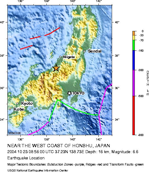
As shown in Figure 1, the epicenter is located at 37.231°N, 138.753°E at a depth of 16 km (US Geological Survey). As shown in the JAM intensity map of Figure 2, the earthquake damage were concentrated in a 40 km radius of the epicenter, and did cause any damage to Niigata city, 80 km to the North. Figures 3 and 4 show the source mechanism of the earthquake. On November 8, no traces of surface faulting had been reported.
Figure 1. Location of epicenter of the Niigata-ken Chuetsu earthquake of October 23, 2004.
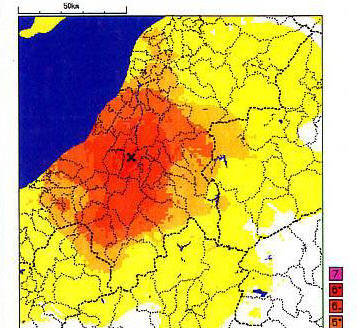
Figure 2. Map of JMA intensity for the Niigata-ken Chuetsu earthquake of October 23, 2004
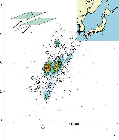
Figure 3. Source mechanism of the Niigata-ken Chuetsu earthquake of October 23, 2004 (Courtesy of Yagi@IISEE).
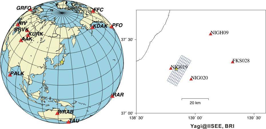
Figure 4. Fault plane, epicenter and recordings station for determination of source mechanism (Courtesy of Yagi@IISEE).
Initial reconnaissance of the earthquake
This preliminary report summarizes the observations of the reconnaissance team of the Earthquake Engineering Research Institute (EERI) and the Geotechnical Earthquake Engineering Research (GEER) organizations. This preliminary report covers only four days of reconnaissance efforts from October 30 till November 2, 2004. Figure 5 shows the area covered by the earthquake reconnaissance, which extends from Niigata to the North to Kawaguchi to the South . As shown in Figure 5, the yellow dash lines represent the electronic bread crumbs (i.e., GPS track logs) of one of the investigators. A more comprehensive reconnaissance report will be issued by the EERI as a special volume of Earthquake Spectra.
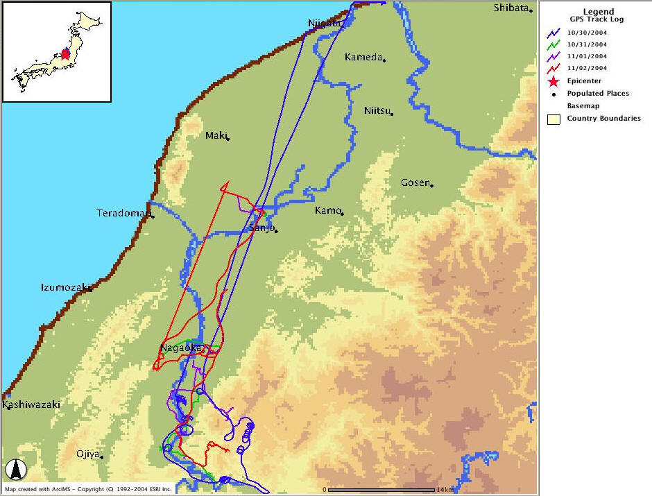
Figure 5. GPS track logs of J. P. Bardet (blue, green, purple and read lines) showing area covered by earthquake reconnaissance.
The members of the preliminary EERI-GEER reconnaissance team were:
We would like to express all our thanks to our Japanese colleagues who helped us in our reconnaissance effort, including Prof. Iemura, Kyoto University; Prof. Susumu Iai, Kyoto University, Prof. Tetsuo Tobita, Kyoto University, Hajime Tanaka, University of Tokyo; Jorgen Johansson, University of Tokyo; Yoshikazu Takahashi, Kyoto University; Fumio Yamazaki, Chiba University; Masa Hamada, Waseda University; and Iwao Yasuda, Hasshu Co, Ldt. The financial support of the EERI and the National Science Foundation through research grants to EERI and U.C. Berkeley are acknowledged.