NOVEMBER 1, 2004 FIELD RECONNAISSANCE OF THE 2004
NIIGATA-KEN CHUETSU EARTHQUAKE
Prepared by J. P. Bardet, S. Iai and T. Tobita
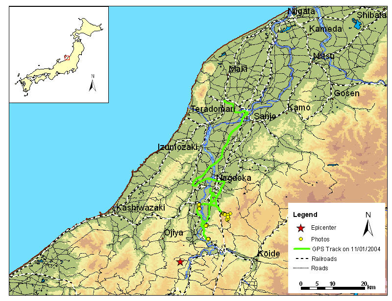
A three-member group of the EERI-GEER reconnaissance team carried out on November 1, 2004 a field reconnaissance of the October 23, 20004 Niigata-ken Chuetsu earthquake. The group was composed of J. P. Bardet, University of Southern California, and Susumu Iai and Tetsuo Tobita, Kyoto University, Kyoto, Japan. Figure 1 shows the complete GPS track log of the reconnaissance on November 1, 2004. It starts at Sanjo to the North and extends 4 km to the South of Ojiya. Figure 2 shows a detail map of the track between Nagaoka and Ojiya. The main areas investigated were landslides to the North, damage to railway tracks and tunnels along the Shinano River, and damage to Ojiya. The access roads to the landslide areas were sealed off by police barrages, as local residents had been evacuated and were not yet allowed to return to their homes. A permit had to be obtained from the Mayor's office in the Nagaoka City Hall. We thank Susumu Iai for requesting and obtaining that permit.
Figure 1. Complete GPS track log of the reconnaissance team on November 1, 2004.
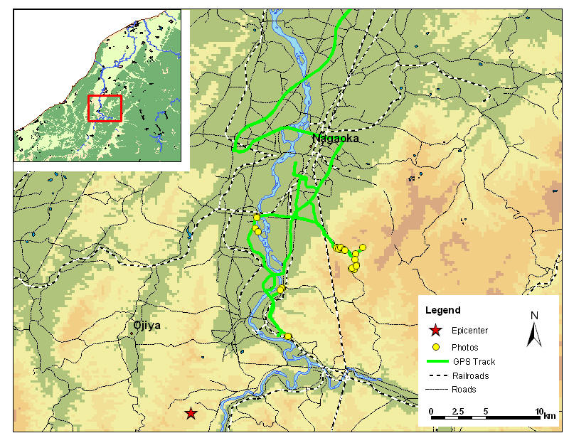
Figure 2. Detailed GPS track log of the reconnaissance team on November 1, 2004.
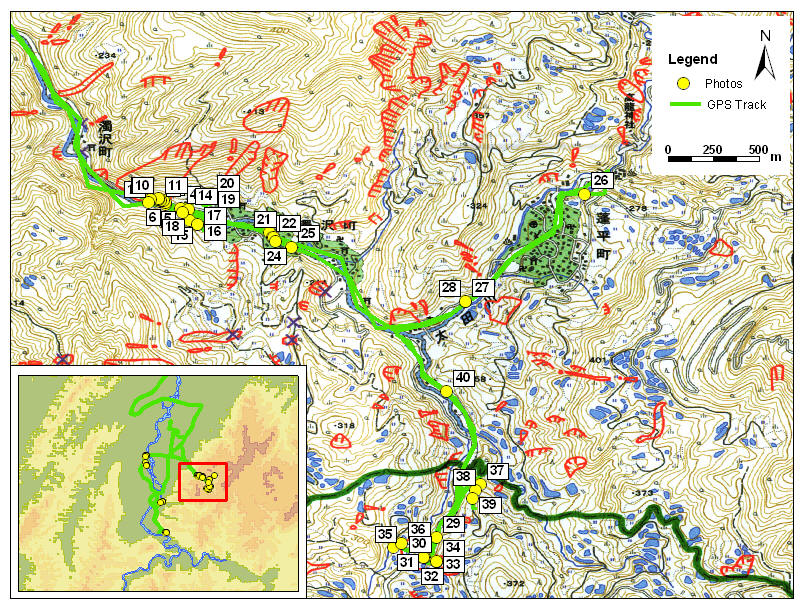
Figure 3. Location of Figures 4 to 40 (landslide area to the North of the earthquake area) (11/7/2004 10:02:11 PM).
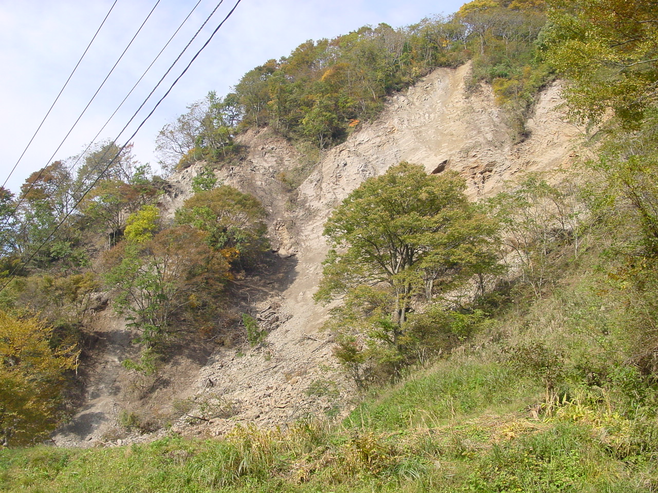
Figure 4. Landslide in steep terrain (11/1/2004 11:44:00 AM, N37.36615 E138.87383).
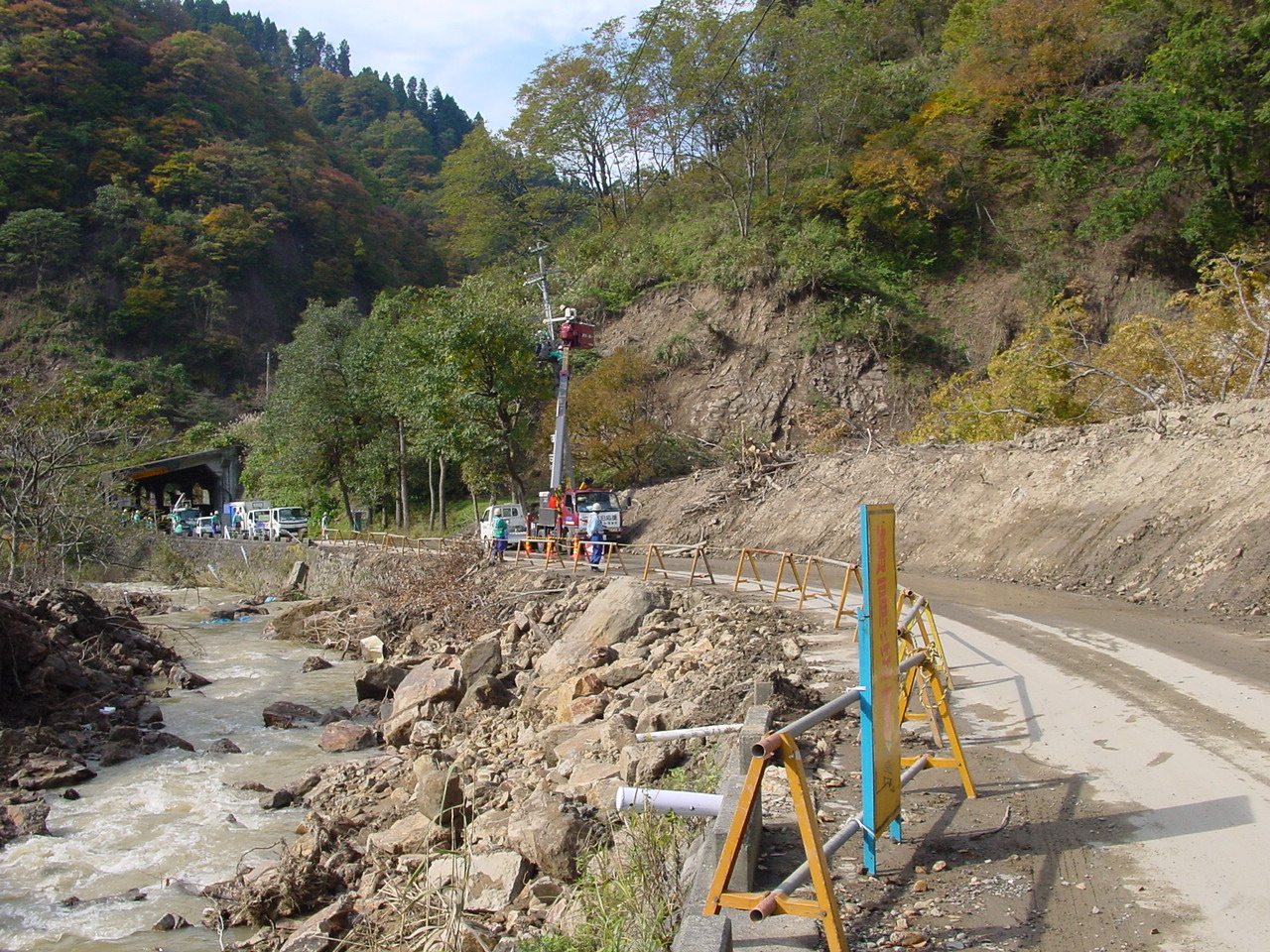
Figure 5. The landslide, which covered the road after the earthquake, was cleaned up. It had taken the electrical wires, which were repaired at the time of the investigation. (11/1/2004 11:45:50 AM, N37.36635 E138.87312).
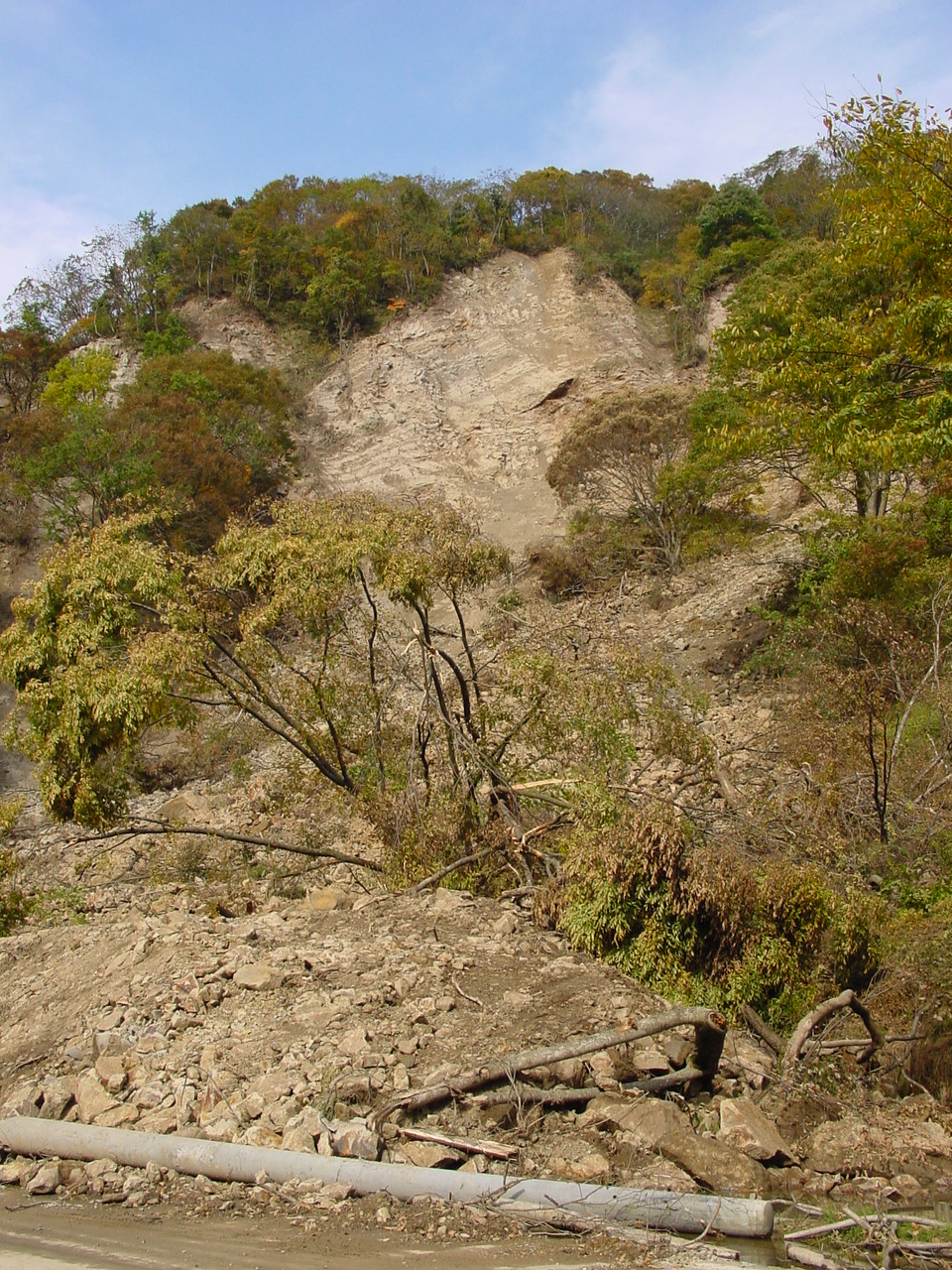
Figure 6. Another view of the landslide in Figure 4 (11/1/2004 11:46:03 AM, N37.36642 E138.87309).
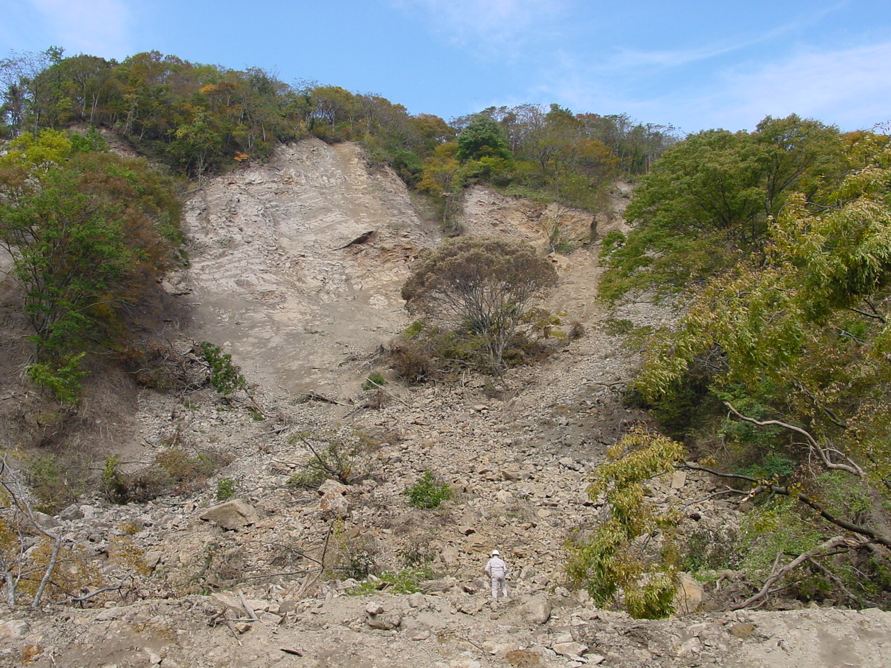
Figure 7. Another view of the landslide in Figure 4 (11/1/2004 11:48:52 AM, N37.36647 E138.87283).
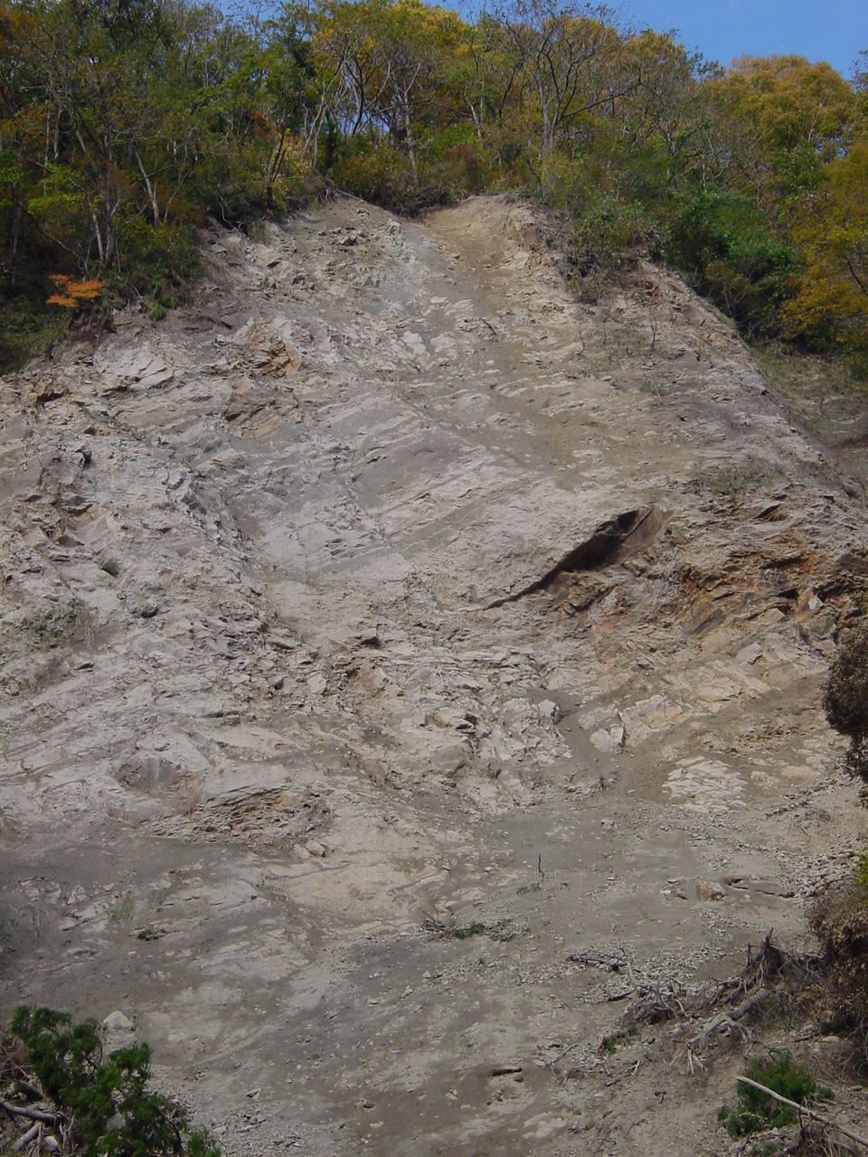
Figure 8. The bedding was exposed at the headscarp of the landslide. It was inclined but not parallel to the slope. The material was a poorly cemented mudstone (11/1/2004 11:55:05 AM, N37.36652 E138.87300).
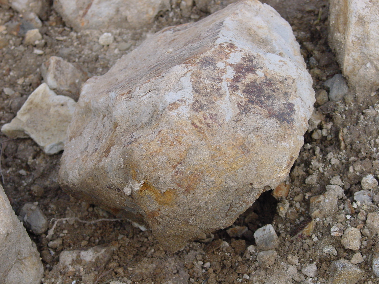
Figure 9. An example of soft rock (i.e., poorly cemented mudstone) at the toe of landslide (11/1/2004 11:55:44 AM, N37.36655 E138.87285).
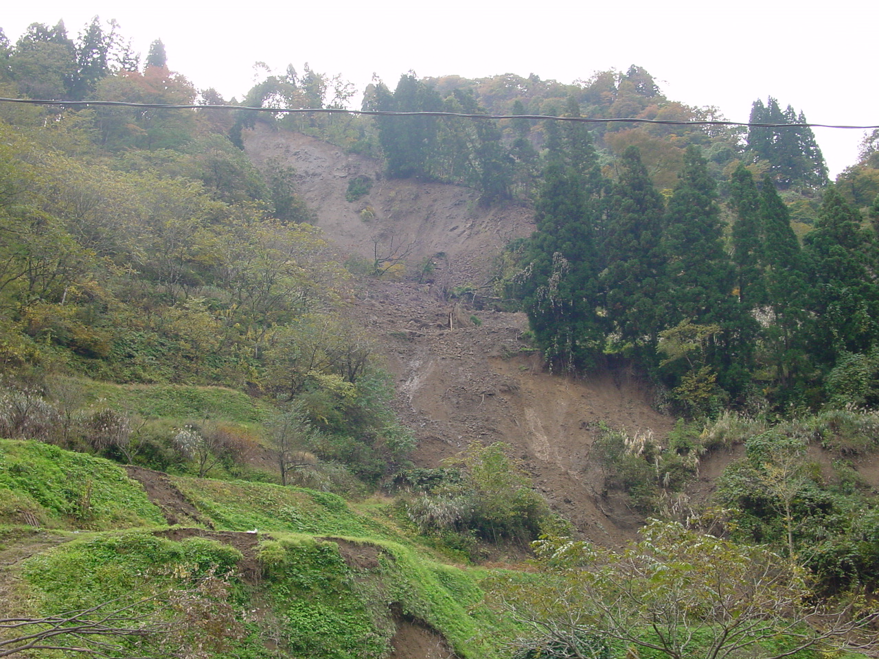
Figure 10. Another landslide on the hill across the road (11/1/2004 12:02:02 PM, N37.36660 E138.87276).
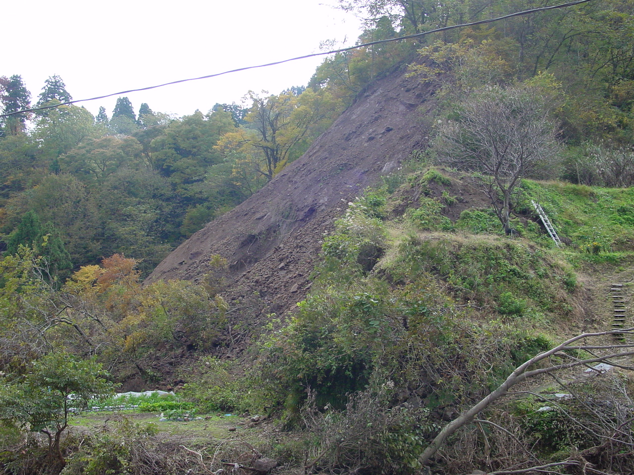
Figure 11. A small landslide in a steep slope (11/1/2004 12:03:24 PM, N37.36662 E138.87277).
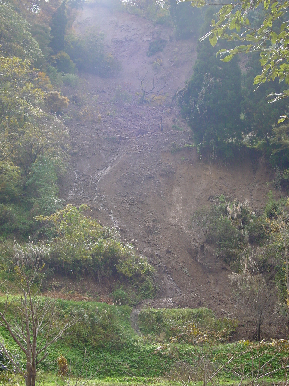
Figure 12. Another view of the landslide in Figure 10. Water was flowing down the slope. The area had undergone a lot of rain in the past weeks and the terrain was saturated. Under there circumstances, landslides could have occurred under the effect of gravity, without the need for additional accelerations from earthquakes. The earthquakes acted as a catalyst and precipitated all these incipient landslides at once. (11/1/2004 12:04:21 PM, N37.36660 E138.87239).
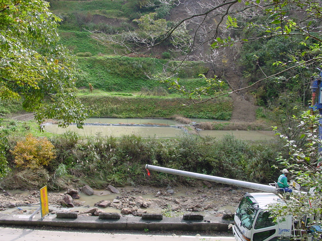
Figure 13. At the toe of the landslide there were ponds that seemed undamaged. These ponds are used to raise fish (11/1/2004 12:06:02 PM, N37.36642 E138.87225).
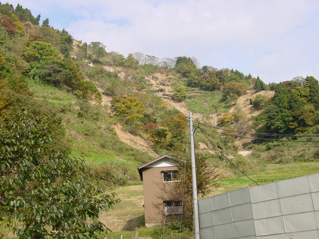
Figure 14. A few hundred meters to the Southeast of the landslide in Figure 4, there were steep slopes with signs of past debris flows. (11/1/2004 12:12:12 PM, N37.36610 E138.87425).
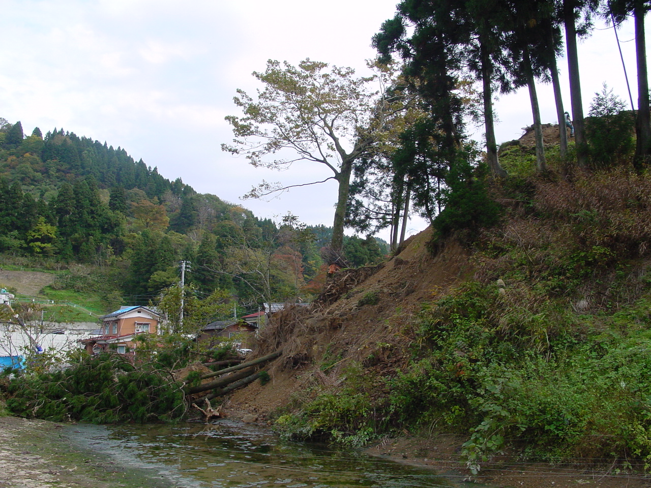
Figure 15. A small slope failure that took down a few trees (11/1/2004 12:15:54 PM, N37.36553 E138.87427).
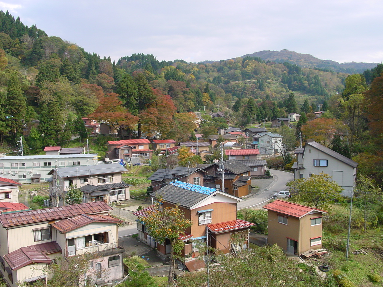
Figure 16. The village had been evacuated by the civilian authority. Damage could be seen only in the far distance (11/1/2004 12:21:50 PM, N37.36537 E138.87469).
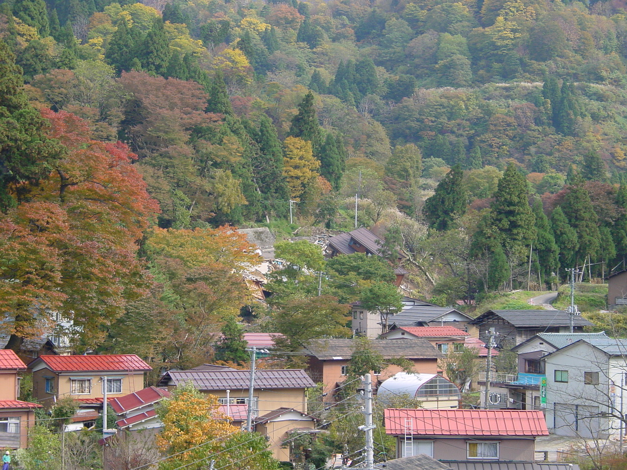
Figure 17. In the far distance in the village of Figure 16, a house and a tree indicated serious damage (11/1/2004 12:22:02 PM, N37.36535 E138.87469).
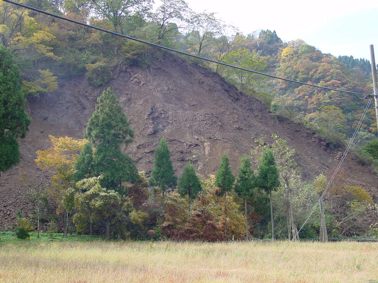
Figure 18. Shallow slope failure in a steep slope (11/1/2004 12:27:58 PM, N37.36594 E138.87396).
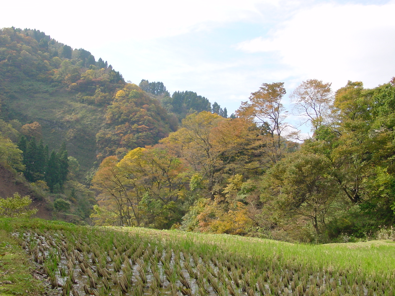
Figure 19. When facing in some directions, one could only see the beauty of the site colored by fall, left untouched by the earthquake (11/1/2004 12:45:50 PM, N37.36666 E138.87535).
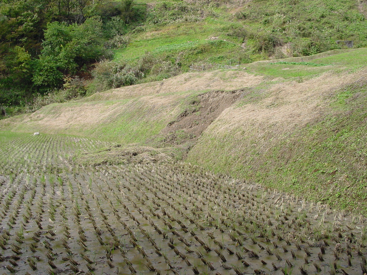
Figure 20. A local slope failure in a small embankment in a rice field (11/1/2004 12:52:22 PM, N37.36670 E138.87532).
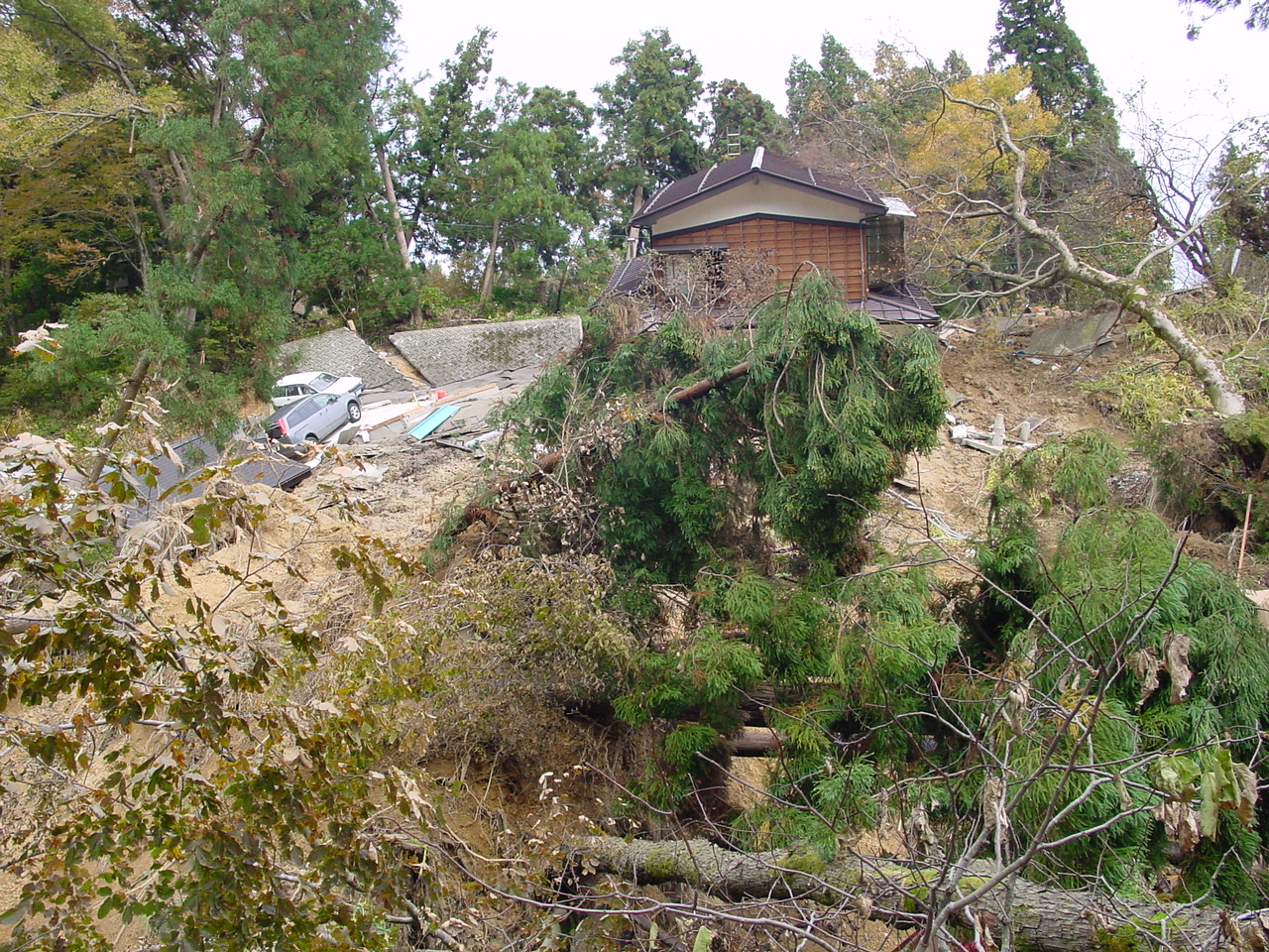
Figure 21. In the upper part of the village (11/1/2004 1:04:08 PM, N37.36495 E138.87820).
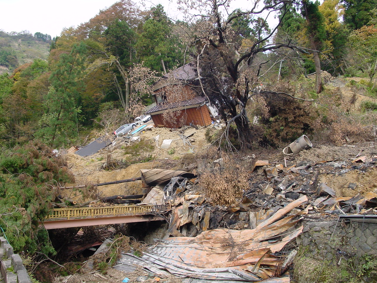
Figure 22. The landslide debris had filled up the stream bed below, and started a fire which consumed neighboring buildings (11/1/2004 1:06:44 PM, N37.36474 E138.87834).
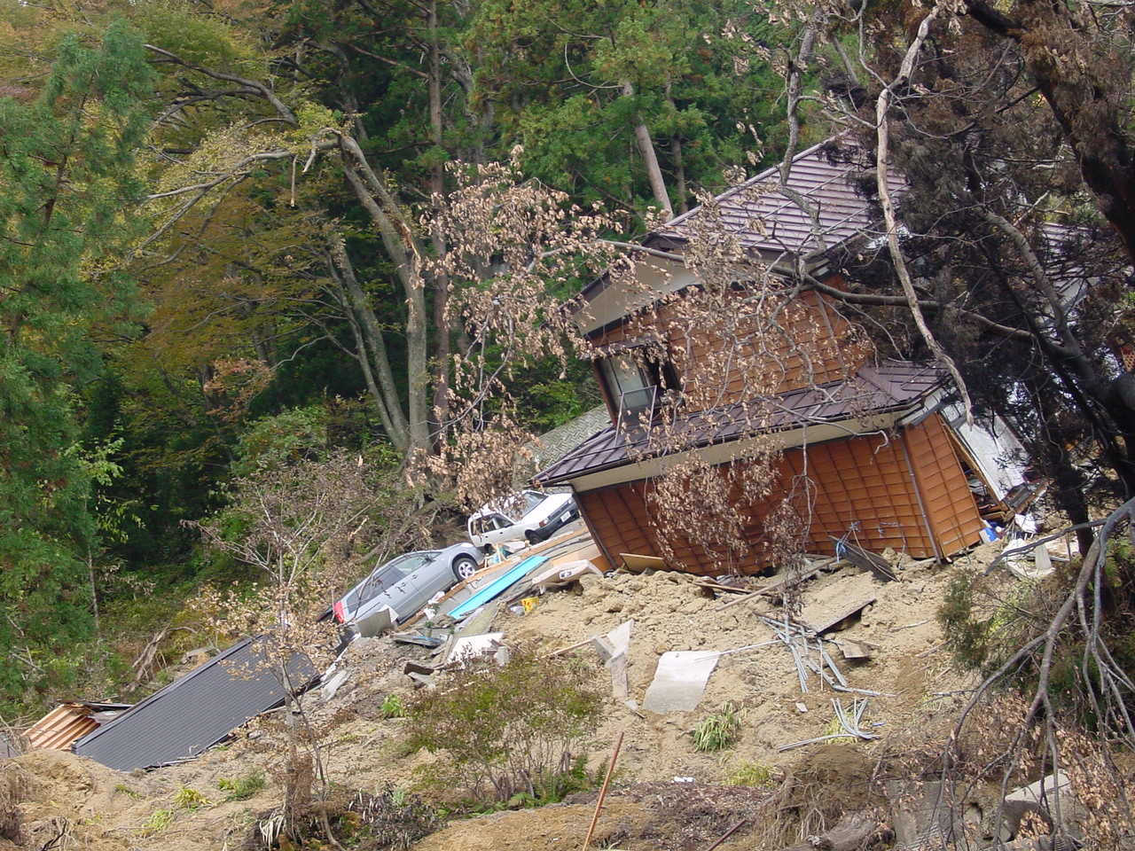
Figure 23. Closeup view of the house on the landslide (11/1/2004 1:07:02 PM, N37.36474 E138.87840).
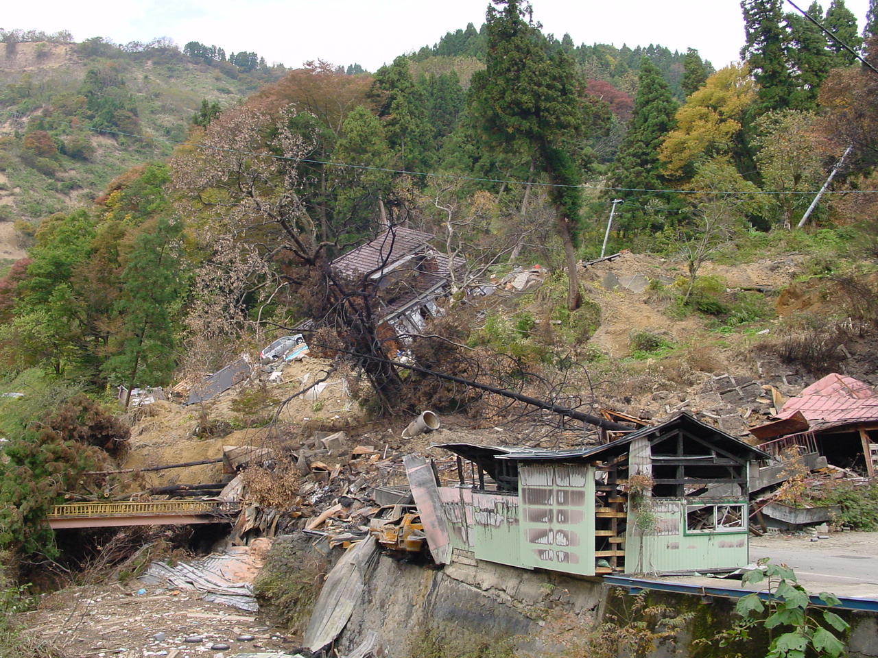
Figure 24. The landslide started fires that burnt down a few houses and trees (11/1/2004 1:08:14 PM, N37.36451 E138.87849).
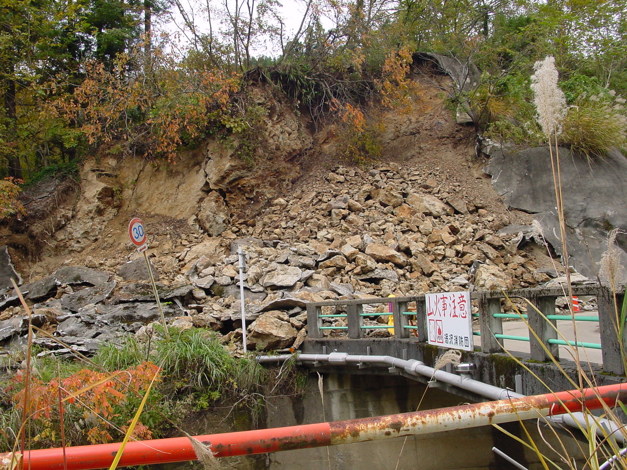
Figure 25. The steep slope, the face of which was covered with shotcrete (11/1/2004 1:13:36 PM, N37.36424 E138.87927).
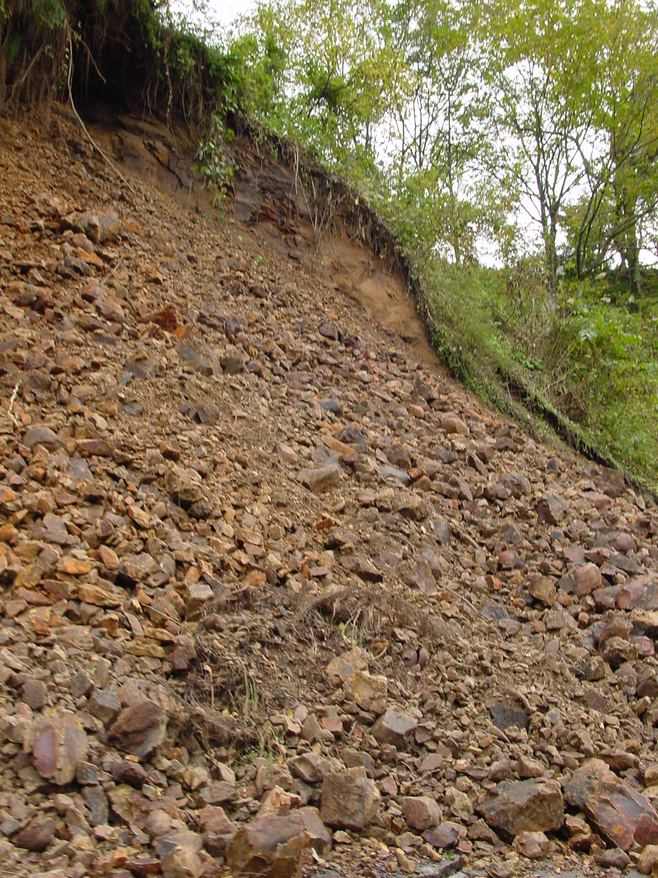
Figure 26. Close view of the debris of the steep slope, which is made of poorly cemented mudstone (11/1/2004 1:21:35 PM, N37.36686 E138.89368).
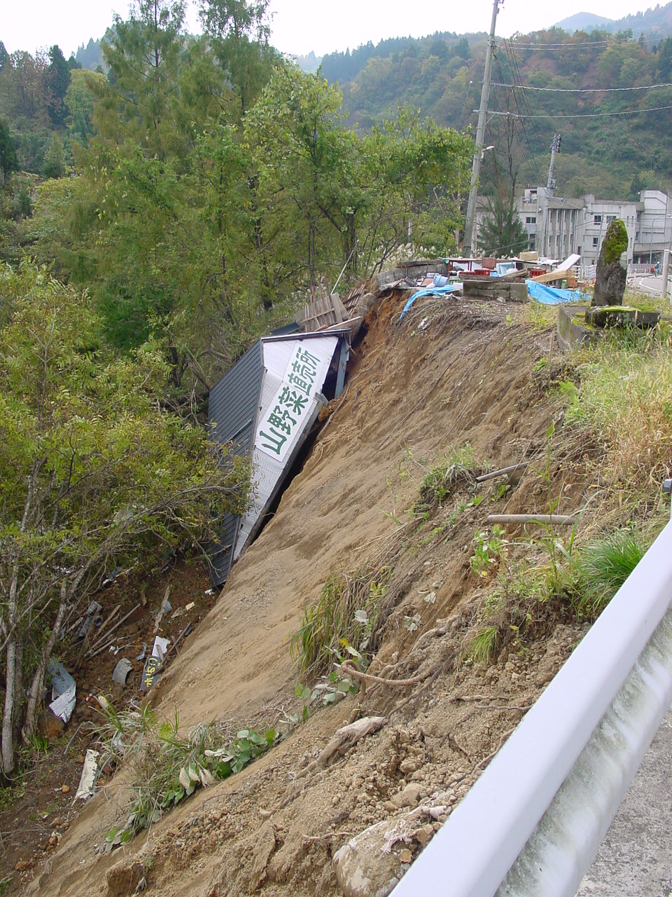
Figure 27. A house fell down on a very steep slope close to a stream (11/1/2004 1:30:07 PM, N37.36159 E138.88785).
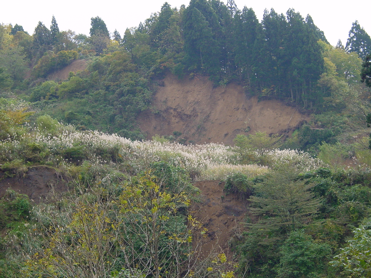
Figure 28. Clean surface of the headscarp of a landslide on a steep slope (11/1/2004 1:30:20 PM, N37.36157 E138.88782).
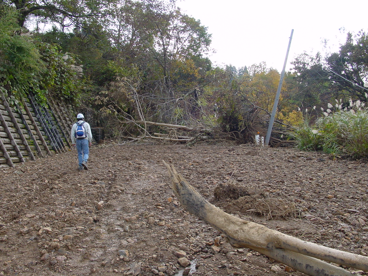
Figure 29. The road was littered by debris brought by water and cut by a landslide (11/1/2004 1:49:26 PM, N37.34998 E138.88640).
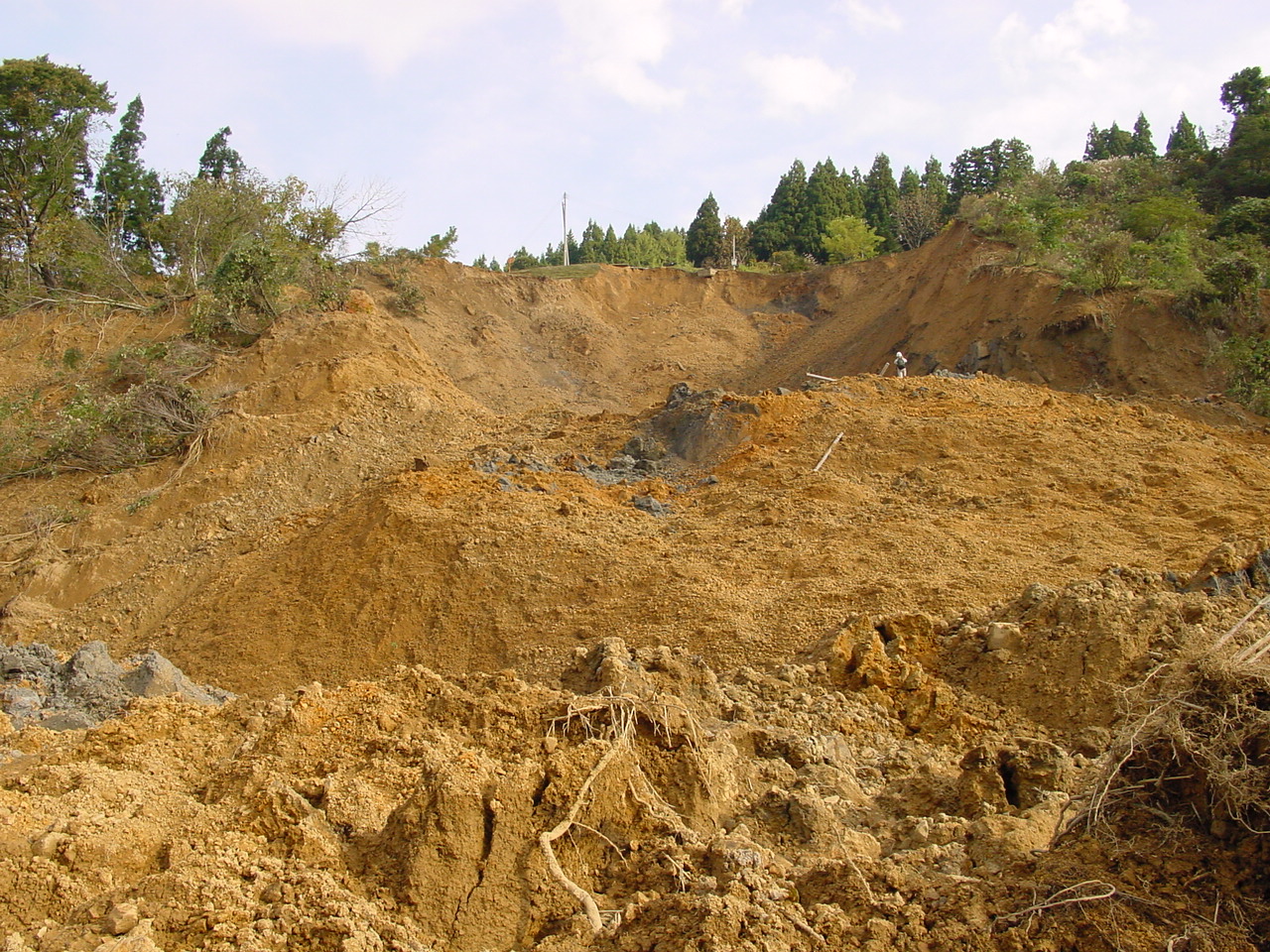
Figure 30. The landslide had the classical bowl shape in geotechnical engineering. The material was identified as soil, and highly weathered soft rock (11/1/2004 1:56:14 PM, N37.34901 E138.88580).

Figure 31. View from the mid part of the landslide toe which blocked the road (11/1/2004 1:56:24 PM, N37.34899 E138.88579).
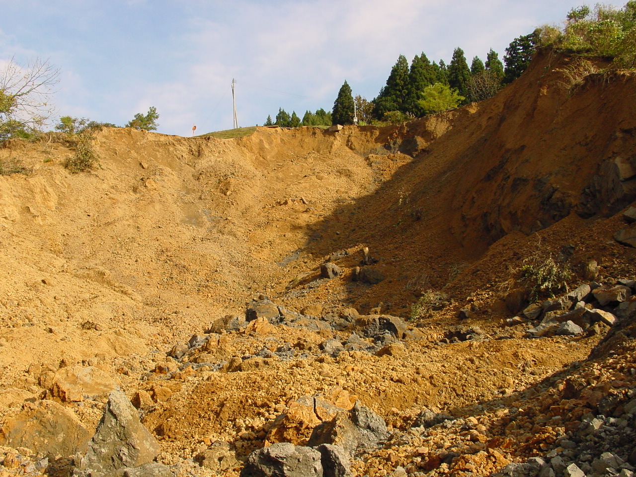
Figure 32. View of the headscarp of the landslide. Among the yellow-orange soil, there were layers of gray mudstone, poorly cemented rock which could be crushed between fingers. (11/1/2004 2:02:54 PM, N37.34880 E138.88640).
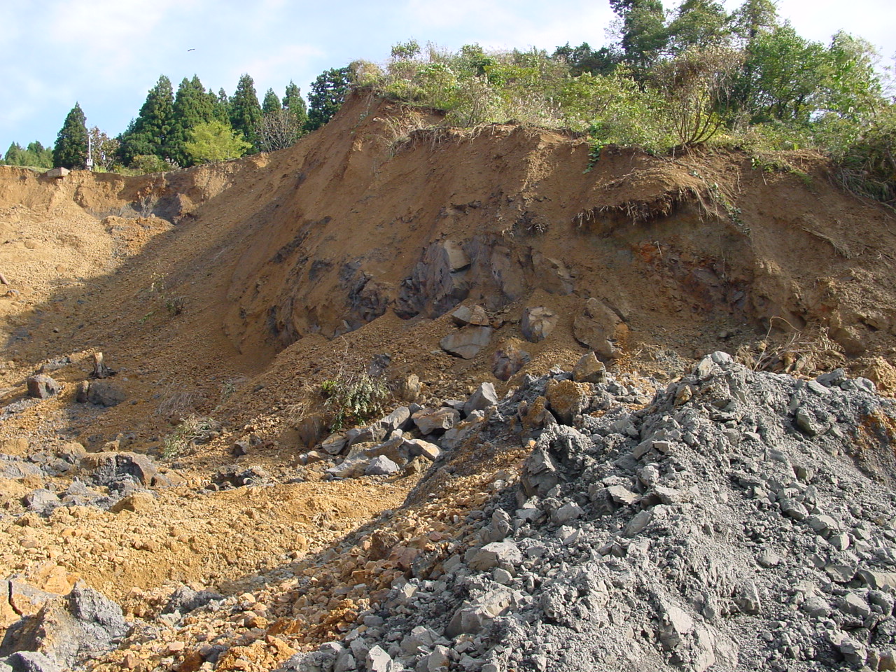
Figure 33. Close view of the grey mudstone layers. (11/1/2004 2:03:12 PM, N37.34880 E138.88640).
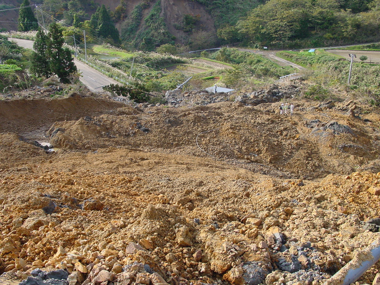
Figure 34. The toe of the landslide viewed from its mid part (11/1/2004 2:03:24 PM, N37.34881 E138.88640).
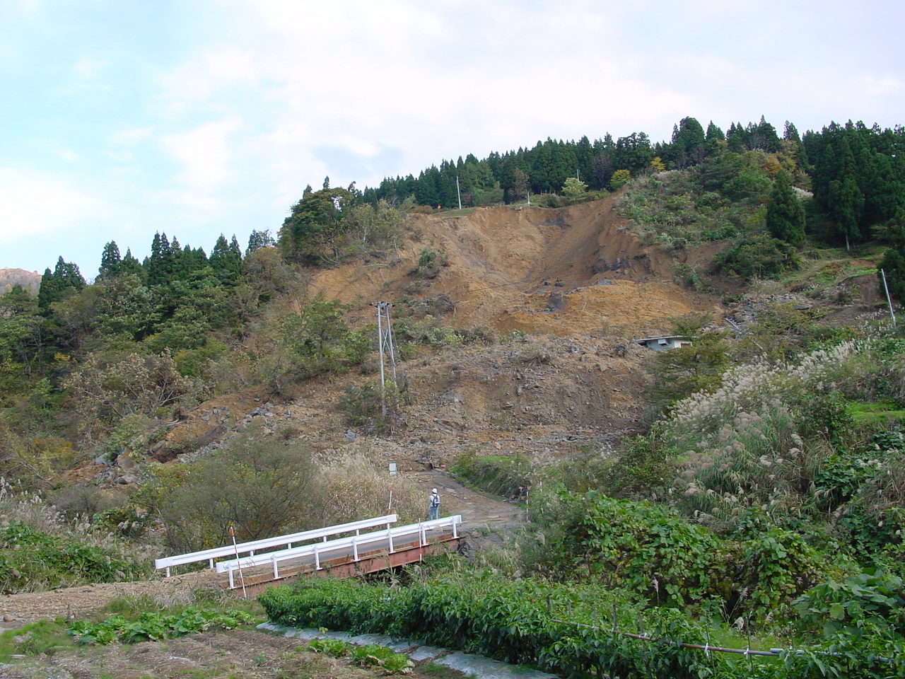
Figure 35. A view of the landslide from across the stream below the blocked road (11/1/2004 2:13:40 PM, N37.34948 E138.88429).
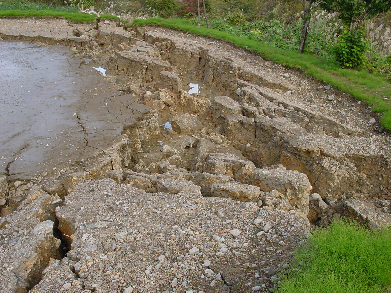
Figure 36. On the hill across the landslide, a pond embankment cracked and discharged its content into the stream below (11/1/2004 2:16:08 PM, N37.34970 E138.88470).
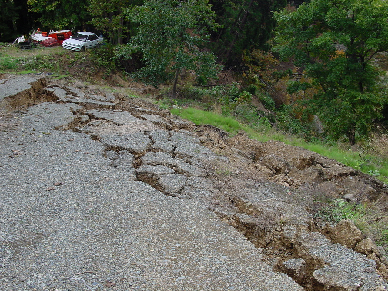
Figure 37. Superficial slope instability in loosely compacted material along the edge of a local road (11/1/2004 2:38:12 PM, N37.35260 E138.88857).
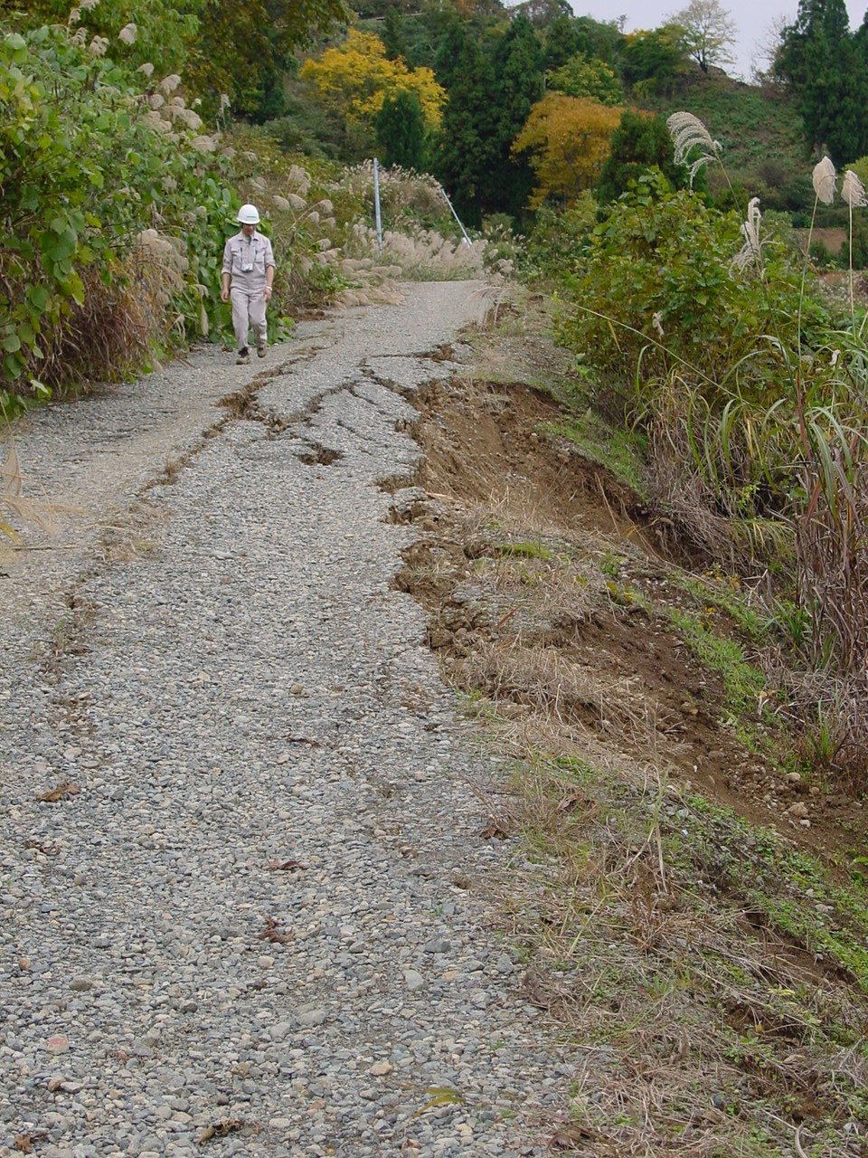
Figure 38. The local dirt road had suffered damage (11/1/2004 2:39:30 PM, N37.35230 E138.88831).
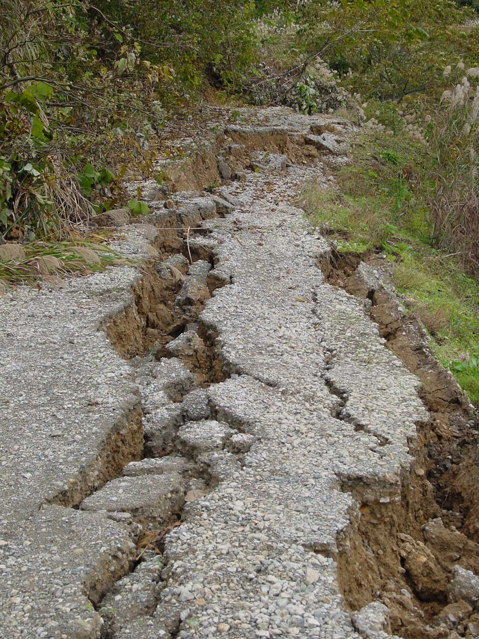
Figure 39. At some locations, the dirt roads were severely damaged and blocked by landslides (11/1/2004 2:40:19 PM, N37.35190 E138.88820).
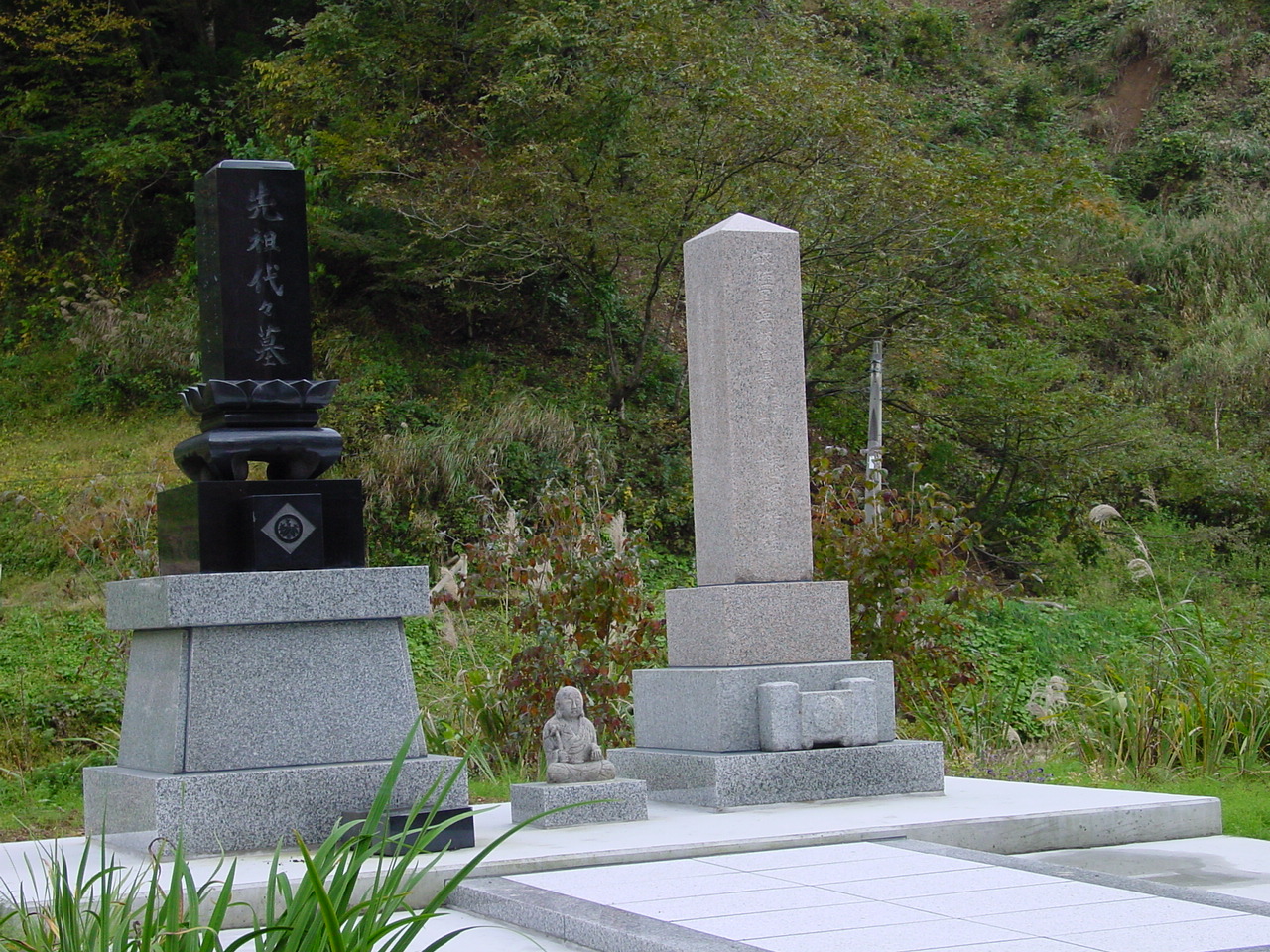
Figure 40. In the vicinity of the landslide these monument tombs remained standing intact; they were not toppled by the earthquake (11/1/2004 2:52:40 PM, N37.35715 E138.88689).
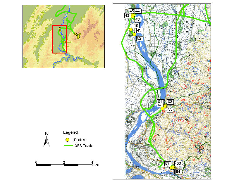
Figure 41. Location of Figures 42 to 67 (11/7/2004 10:04:05 PM).
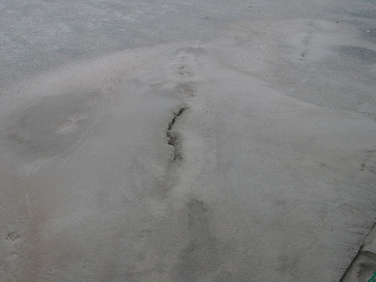
Figure 42. A sand boil in an open field behind a levee along the Shinano River (11/1/2004 3:16:32 PM, N37.39180 E138.80634).
Figure 43. The sand boil surfaced in an athletic/recreational field, which had been recently leveled and seeded. The color of the sand ejecta was similar to the ground color (11/1/2004 3:17:14 PM, N37.39178 E138.80650).
Figure 44. The leveled ground indicated clearly ground cracks and was littered with sand ejecta (11/1/2004 3:19:00 PM, N37.39227 E138.80658).
Figure 45. The sand boil emerged along long cracks in the ground. In the background, the levee along the Shinano River implied that the water table was close to the ground surface (11/1/2004 3:19:14 PM, N37.39228 E138.80653).
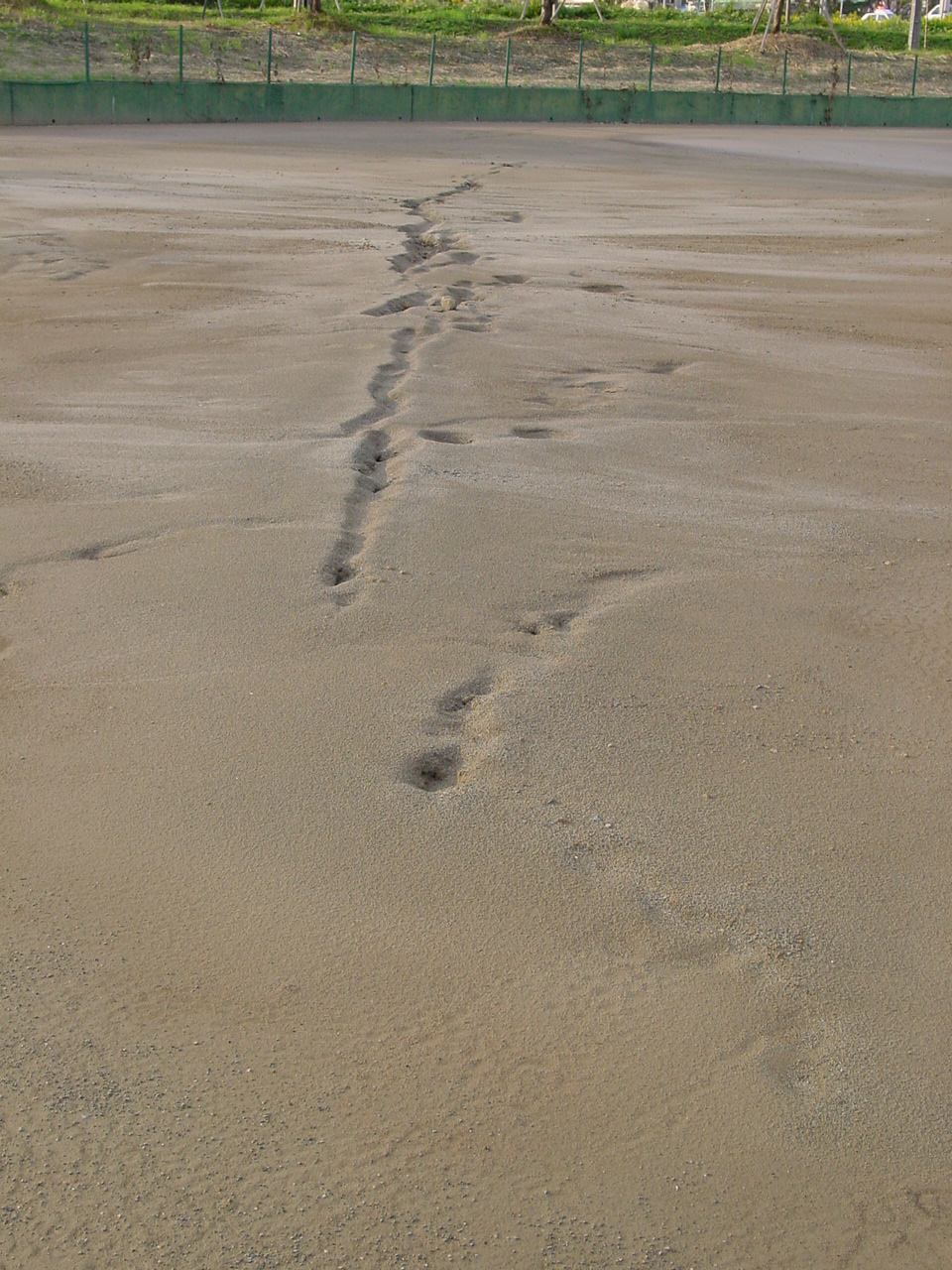
Figure 46. Close view of the sand boils which had been washed out by rain after the earthquake (11/1/2004 3:22:09 PM, N37.39208 E138.80684).
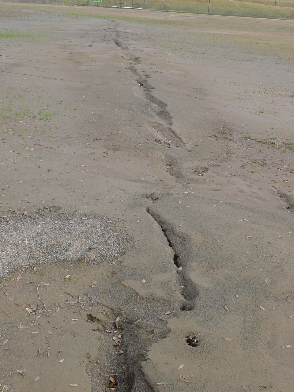
Figure 47. Close view of the sand boils which had been washed out by rain after the earthquake (11/1/2004 3:24:27 PM, N37.39125 E138.80643).
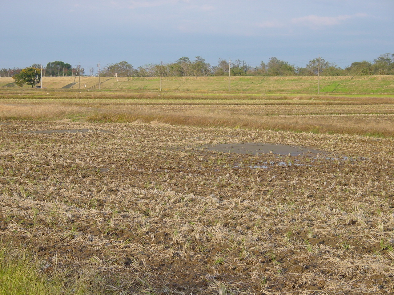
Figure 48. Sand littering the agricultural field, an evidence for liquefaction (11/1/2004 3:37:46 PM, N37.38281 E138.80540).
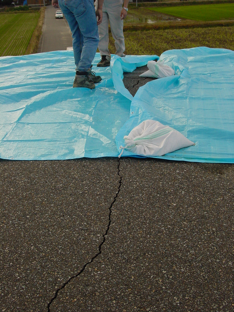
Figure 49. The levees along the Shinano River displayed various degrees of longitudinal and transverse cracking. The top of the levees were covered by blue tarps anchored with sand bags, which had to be lifted to reveal cracks (11/1/2004 3:44:01 PM, N37.37975 E138.80769).
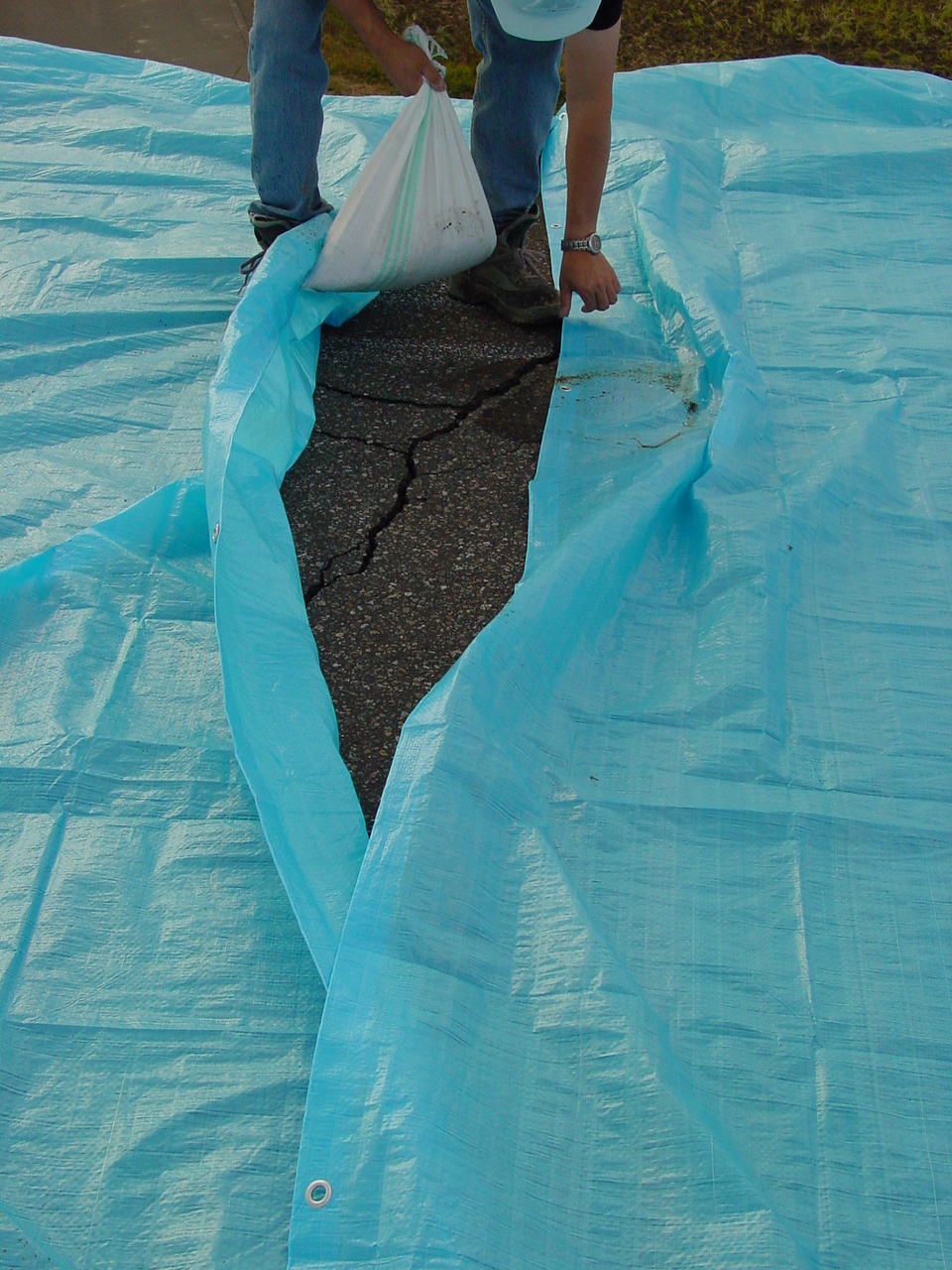
Figure 50. Another view of the levees along the Shinano River, the cracks of which had been covered with blue tarps (11/1/2004 3:44:12 PM, N37.37974 E138.80769).
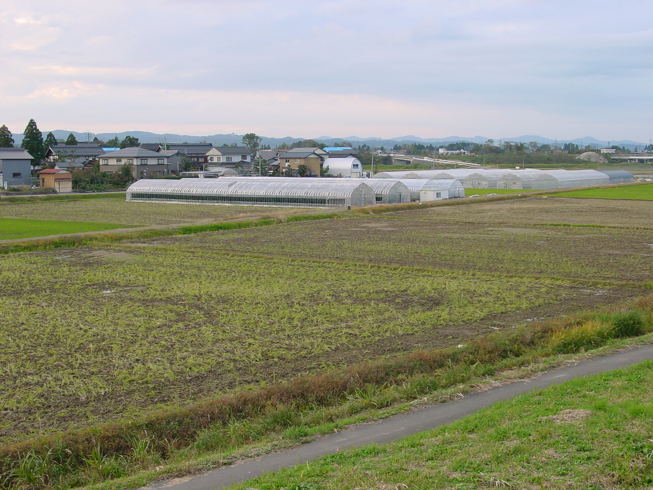
Figure 51. View from the top of the levees of the agricultural fields behind the levees along the Shinano River. Some sand ejecta were visible on the ground surface (11/1/2004 3:45:38 PM, N37.37975 E138.80769).
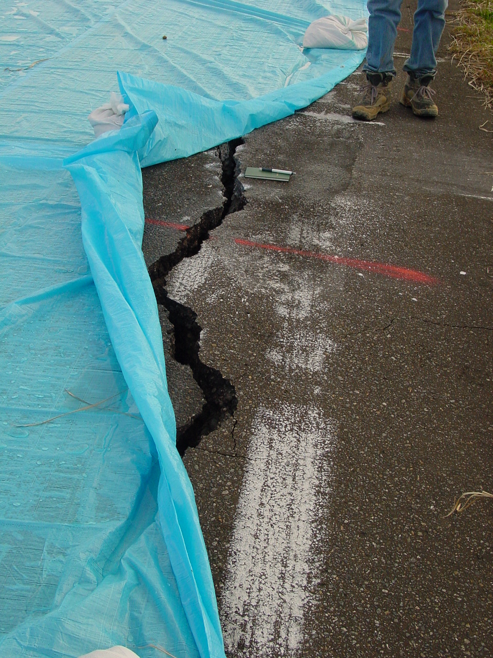
Figure 52. A large longitudinal crack in the asphalt pavement at the top on a levee along the Shinano River (11/1/2004 3:46:31 PM, N37.37971 E138.80768).
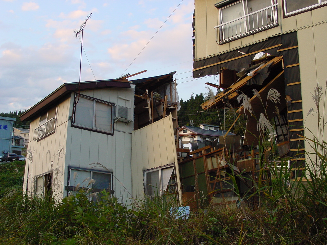
Figure 53. The house was cut in two by a landslide close to the railway track (11/1/2004 4:17:08 PM, N37.29399 E138.83301).
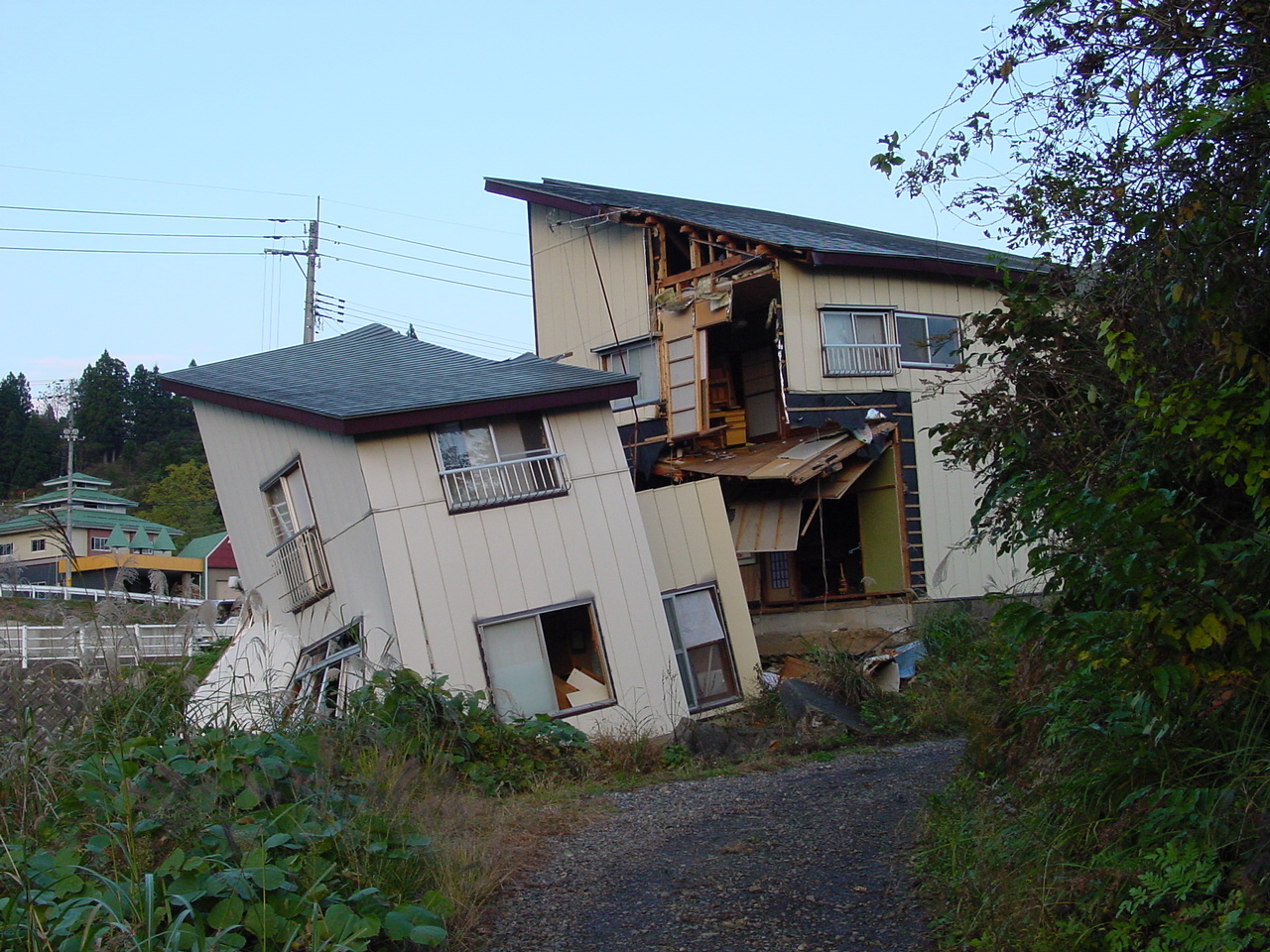
Figure 54. Another view of Figure 53. The house was supported by two separate slabs (11/1/2004 4:17:40 PM, N37.29394 E138.83267).
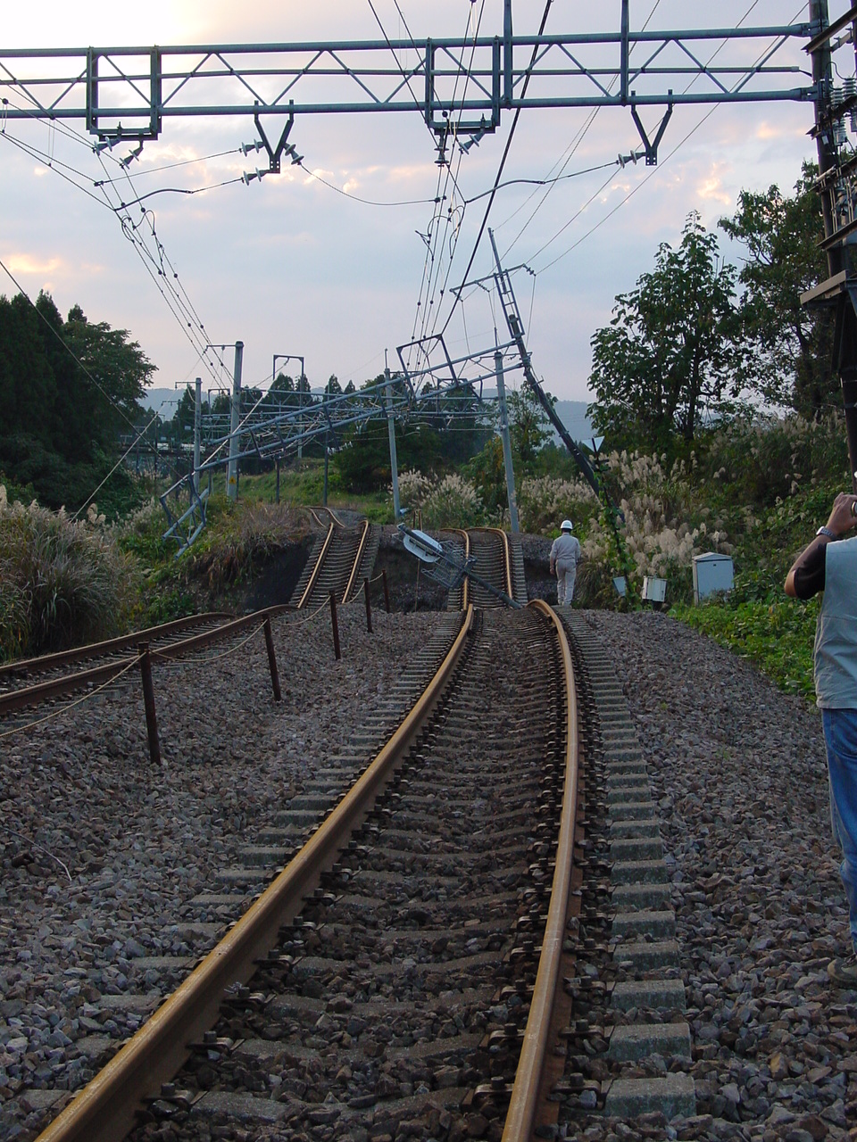
Figure 55. Damage to a local train track along the Shinano River (11/1/2004 4:18:25 PM, N37.29403 E138.83205).
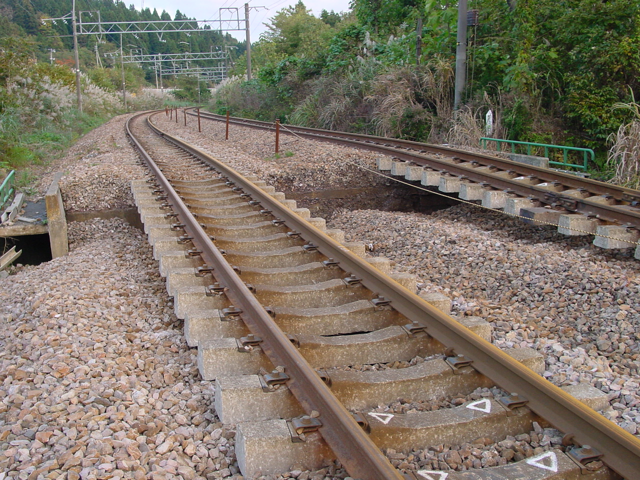
Figure 56. Settlement of the ballast material and fill close to a small pedestrian passage (11/1/2004 4:18:42 PM, N37.29390 E138.83209).
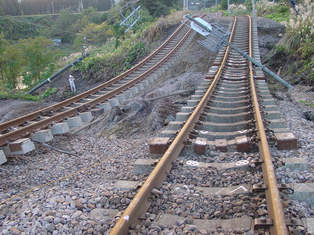
Figure 57. The ground and ballast material slid toward the Shinano River under the railway track (11/1/2004 4:19:36 PM, N37.29396 E138.83183).
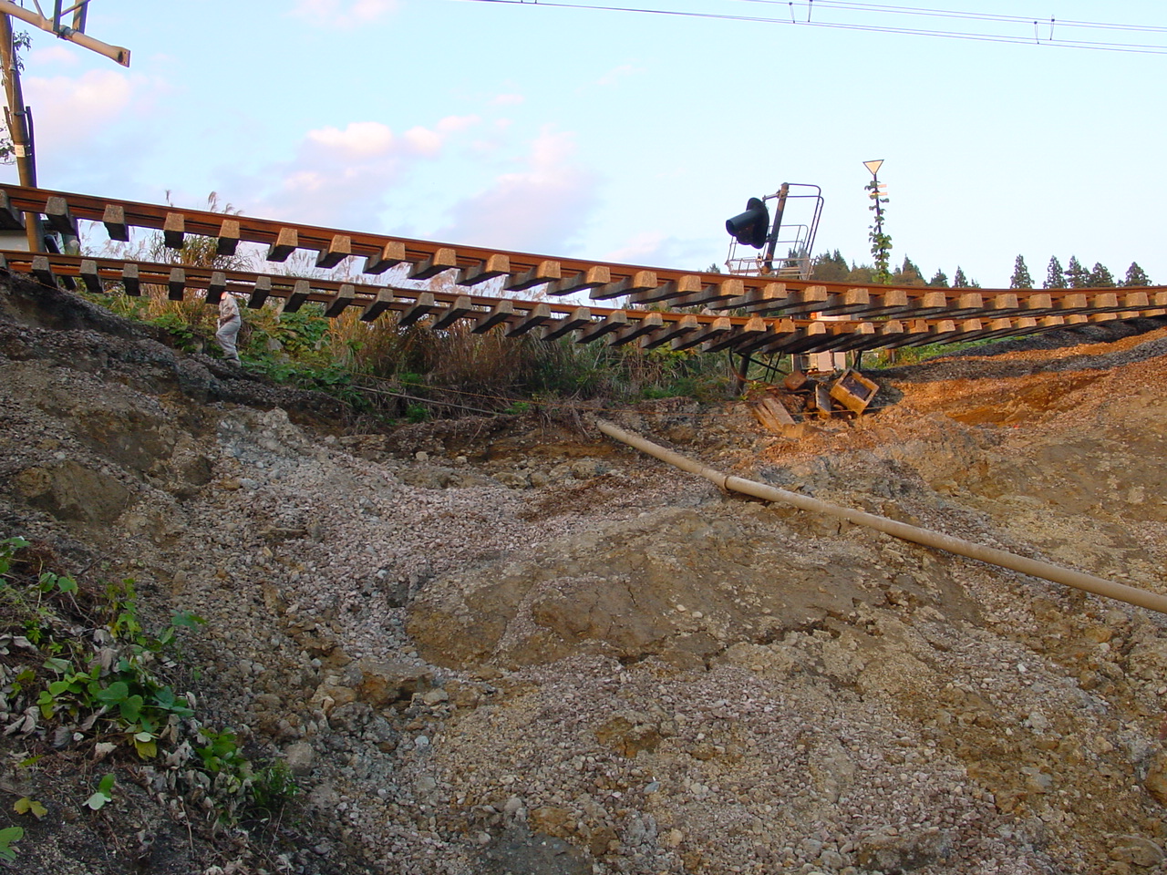
Figure 58. The railway track was left hanging in the air as the ground slid beneath it (11/1/2004 4:23:34 PM, N37.29381 E138.83144).
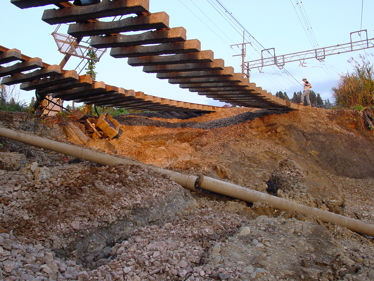
Figure 59. Close view of Figure 58 (11/1/2004 4:24:02 PM, N37.29390 E138.83145).
Figure 60. Another view of the settlement of the abutment in Figure 56 (11/1/2004 4:26:22 PM, N37.29395 E138.83234).
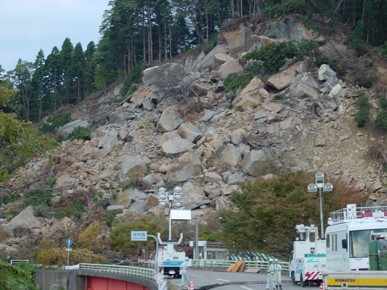
Figure 61. The White Rock slide viewed from the South (11/1/2004 4:44:10 PM, N37.33369 E138.82730).
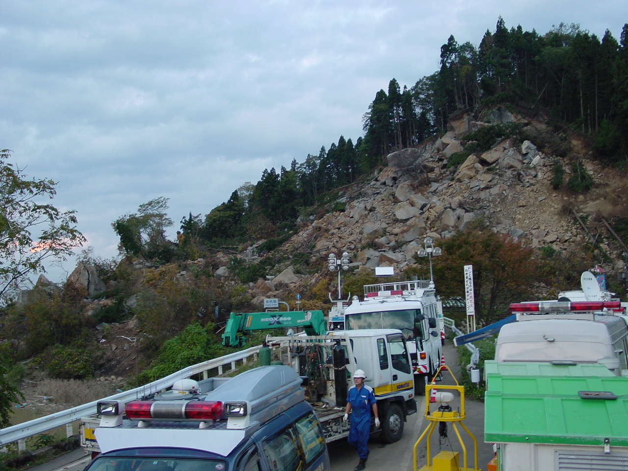
Figure 62. Repair and clean-up operations were ongoing at the White Rock slide to extract a person trapped under the debris (11/1/2004 4:44:44 PM, N37.33375 E138.82739).
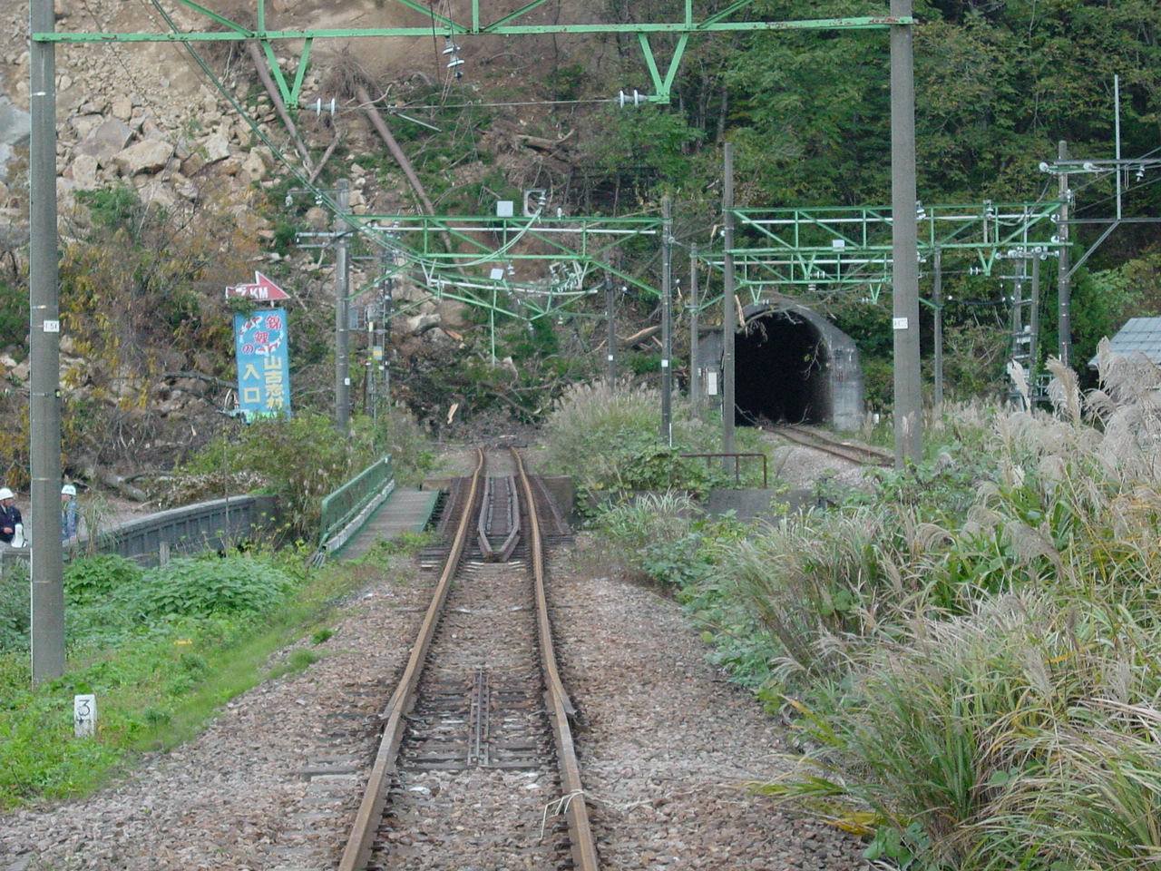
Figure 63. One of the portal of the train tunnel was covered by the White Rock slide (11/1/2004 4:46:26 PM, N37.33366 E138.82761).
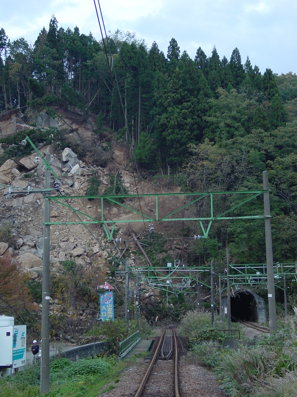
Figure 64. Another view of Figure 63 (11/1/2004 4:46:50 PM, N37.33369 E138.82756).
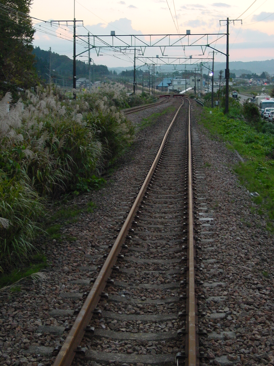
Figure 65. The railway track exiting the tunnel underwent some small settlement and lateral deformation in the distance (11/1/2004 4:46:58 PM, N37.33368 E138.82750).
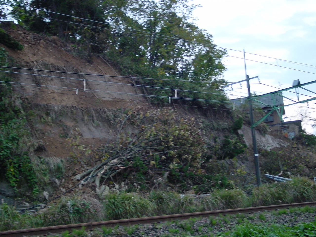
Figure 66. A small slope instability close to the railway track passed close to a house (11/1/2004 4:47:48 PM, N37.33341 E138.82718).
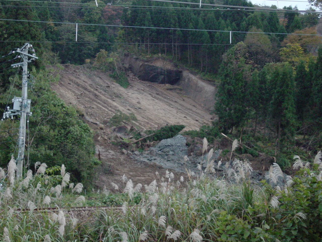
Figure 67. The landslide moved along a clear failure surface parallel to the ground (11/1/2004 4:50:26 PM, N37.33191 E138.82564).