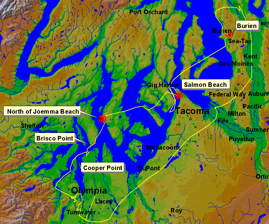
The coastline to the south of Cooper Point on both sides of the Eld Inlet is an area identified as having high landslide susceptibility. However, the aerial survey did not identify any earthquake induced deep-seated, or surficial landslide movements.
N47 08 31.5 W122 55 38.2, (3/3/01)
Brisco Point represents a typical steep coastal bluff site in the South Puget Sound that would be expected to experience some form of failure from large ground motions, either as surficial sloughing, or as a deeper cliff retreat failure. No traces of ground failure were observed at this location however.
N47 09 56.3 W122 52 25.8, (3/3/01)
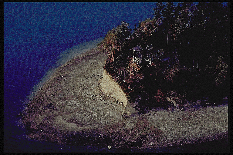
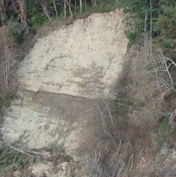
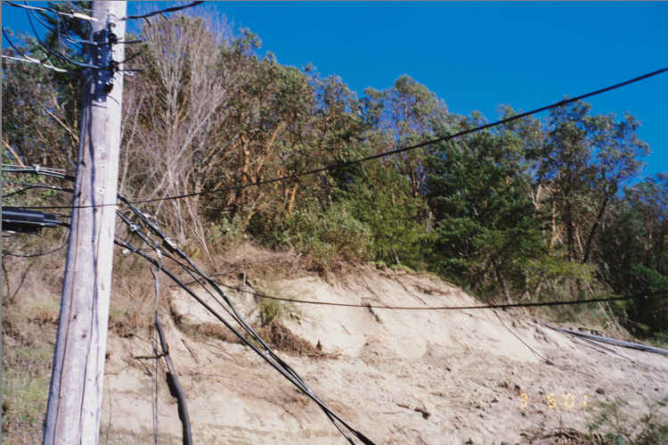
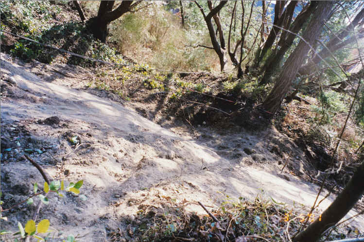
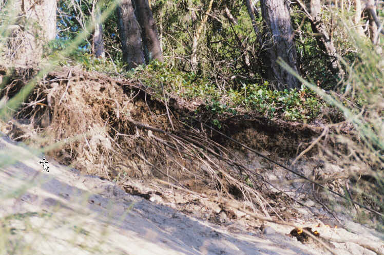
A small surficial slide was observed on the western coast of the Key Peninsula to the north of Joemma Beach. The slide scar is shallow and planar and is likely related to both earthquake induced ground motions as well as adverse groundwater conditions caused by the presence of a thin clay bed underlieing a thick sandy deposit. This stratigraphy is common in the Puget Sound coastal bluffs. The photo below shows the slide debris deposited on the beach at the base of the bluff.
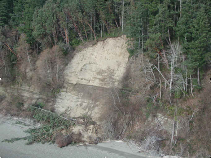
The area in the vicinity of the clay bed was observed to be saturated and seeping water to the failure plane during the aerial survey.
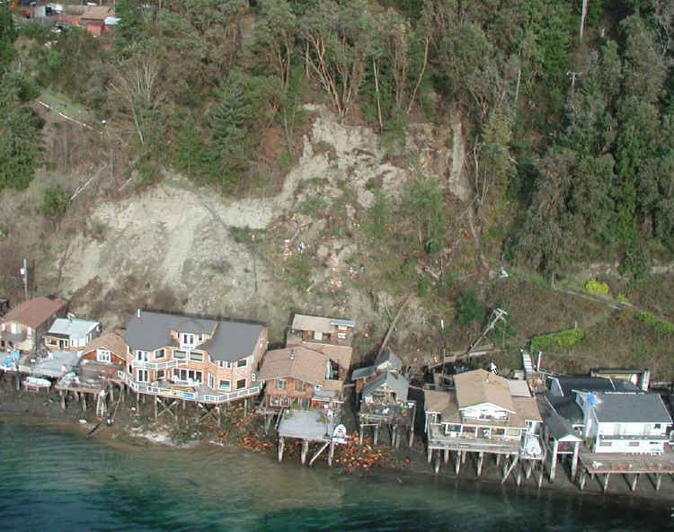
Salmon Beach is a site that has experienced previous landslide movements. During the December, 1996 storm events, landslides at Salmon Beach cut off telephone service to the area. During this storm event, several shallow slides on nearby bluffs overlooking the Tacoma Narrows straight also occured (Baum et al, 1998). Recently, a slide was initiated at Salmon Beach due to the excavation of an approximately 5-foot trail at the upper 1/3 of the slope. The trail was cut for a sewer line connecting the houses at toe of the slope (next to the beach) to the city sewer system (Bastani).The slide was reactivated due to the Nisquallyearthquake, destroying two houses at its toe and putting in danger one or two more.
The photo below shows a previous slide scar located to the left with the scar caused by the Nisqually Earthquake located to the right. The slide occured on a fairly steep section of the coastal bluff and caused damage to residences located at the foot of the bluff including knocking down power poles.
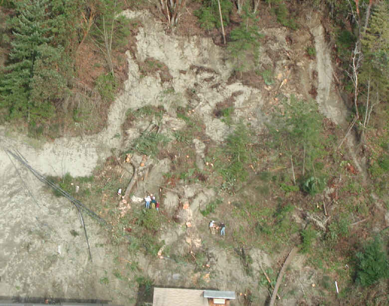
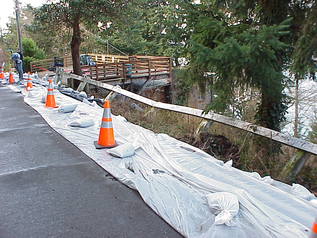
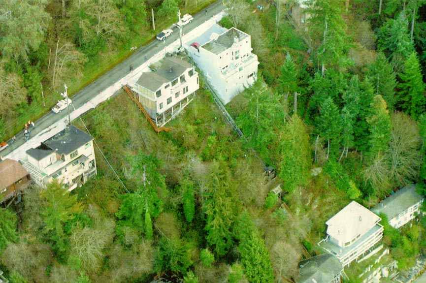
About a 180 m long section on the Puget Sound side of Maple Wild South roadway in the city of Burien has moved horizontally by about 5 inches and settled vertically by as much as 12 inches after the earthquake. Many of the houses have been red tagged. The utility personnel at the site mentioned about increased number of sewer lines joint replacement over the past few years. There have also been some cracks observed at the edge of the slopes below the houses. These observations point that earth movement has been taking place over a period of time and the earthquake further extenuated the slide resulting in a slump at the surface. Inclinometers have been placed to monitor the progress of the slump.
Displacements in the crest of a slide along Maple Wild Road in Burien. The picture shows a fenced displaced by the downard slope movement.