Photographs

Photographs taken by members
of the geotechnical reconnaissance team
|
Soil Liquefaction
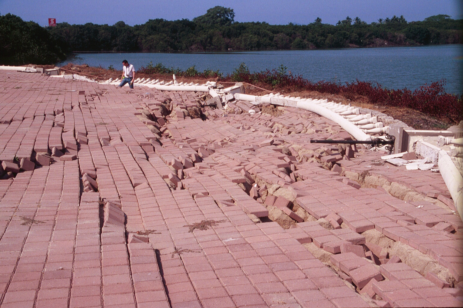
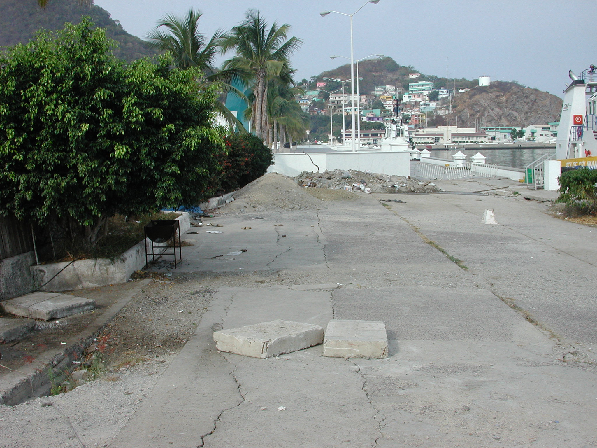
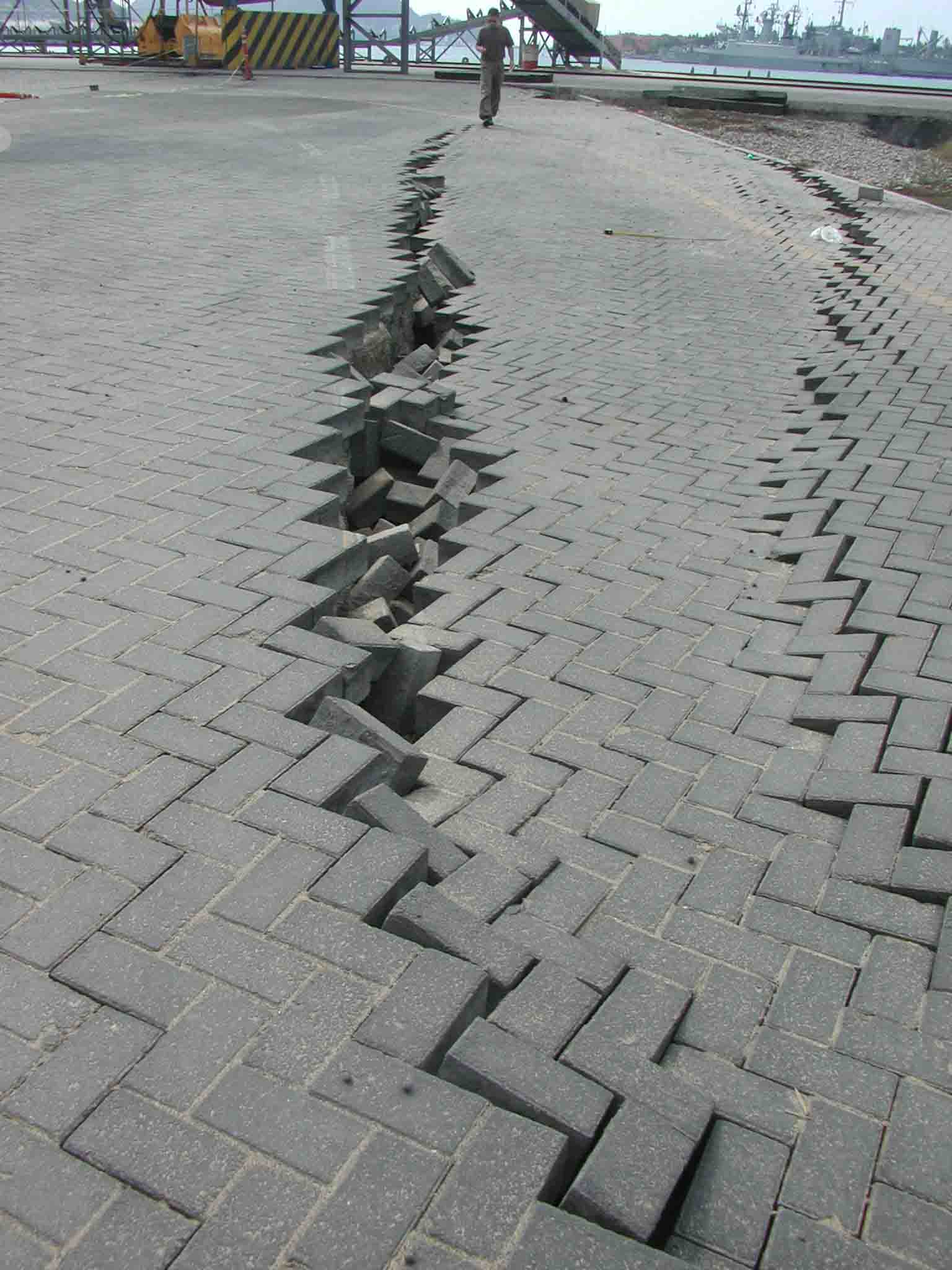
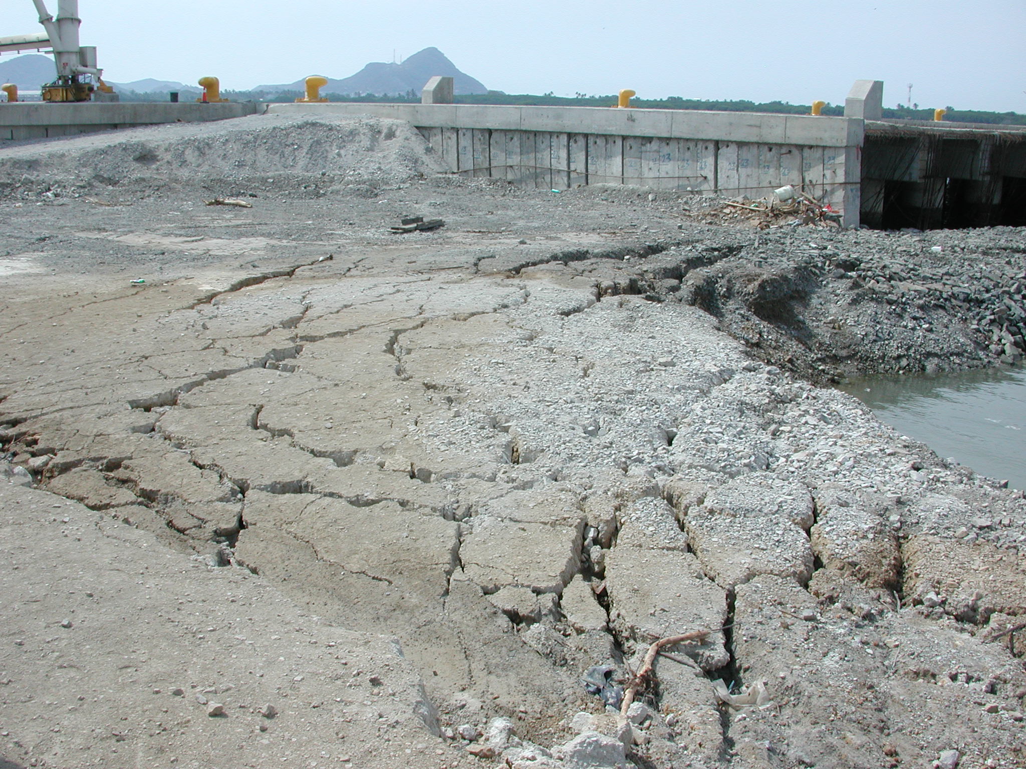
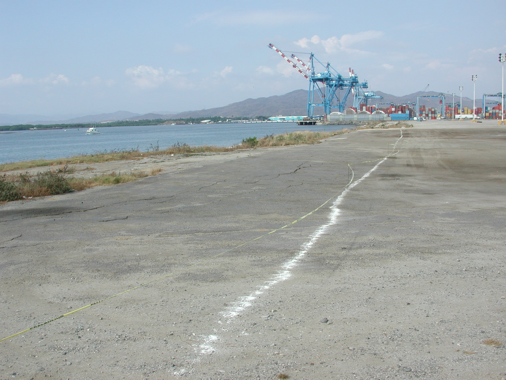
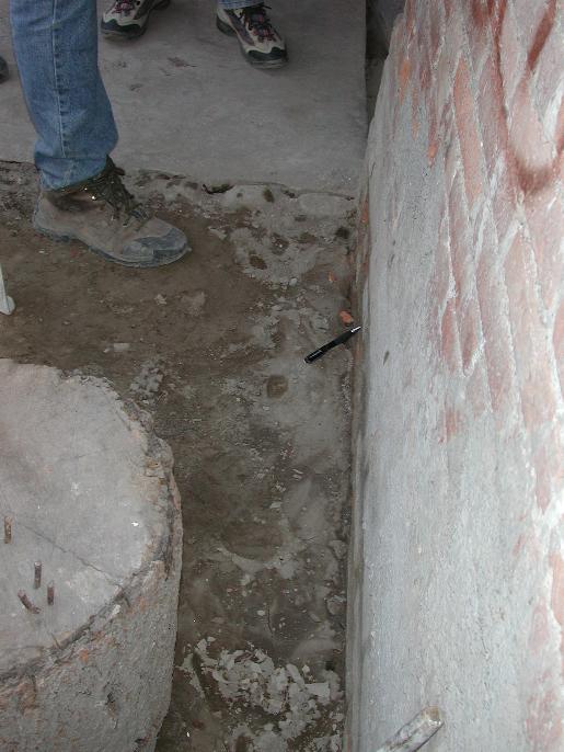
Soil liquefaction caused damage in the coastal city of Manzanillo and in the cities of neighboring Villa de Álvarez and Colima, located approximately 80 km inland. Liquefaction was also observed along a river valley south of Tecomán. Liquefaction may have also occurred at some additional locations in the sparsely habited regions of the state of Colima, though this was not confirmed during the reconnaissance. In Manzanillo, home to one of the largest ports in Mexico, liquefaction was largely confined to waterfront sites including multiple locations at the commercial shipping port, a public walk near the center of town, and a promenade located off a major boulevard (see photographs below). Liquefaction-related damage at the port occurred principally at undeveloped or non-critical areas and port operations were not significantly affected by liquefaction. During the 1995 earthquake, the Port of Manzanillo suffered considerable damage due to liquefaction. Since then, various ground-improvement techniques (for example, stone columns, vibro-compaction) have reportedly been used during repairs or new construction at the port to increase liquefaction resistance of the ground at locations essential for daily operations. These ground improvement efforts were undertaken in response to the significant liquefaction that occurred at the port in the 1995 Manzanillo earthquake. It appeared that these improved sites generally performed well, with no obvious liquefaction-related ground deformation features. Quantitative assessment of the performance of these improved areas would provide valuable information about performance of the ground improvement techniques used at the port. Other areas of the port where ground improvement had not been performed apparently suffered seismic compaction and lateral spreading. A detailed review of the performance of port facilities was not performed, because the team could not get authorization to enter some portions of the facilities. Observed ground distortions (ground cracking with possible lateral spreading) in a residential district located about 3 km northeast of Manzanillo's city center suggest that liquefaction may have also occurred in this neighborhood, though this was not confirmed. This portion of town was reportedly underlain by miscellaneous fill. A majority of the waterfront liquefaction sites in Manzanillo were marked by lateral spreading of the ground toward the free face. The horizontal displacements varied between sites, but were often in the range of 1-3 m. Figure 1 shows lateral spread of a pedestrian promenade located off a major boulevard, which was not damaged. The promenade surface consisted of paving blocks, whose positions after the earthquake clearly preserve the deformations caused by lateral spreading. Apparently, a 0.2-0.5 m thick crust of silty sand moved over an unknown thickness of liquefied ground. An overturned concrete railing is visible near the right portion of the photograph. The ground slope was about 3% and maximum lateral spread displacements at the site were on the order of 2 m. In the city of Villa de Álvarez, just northwest of Colima, liquefaction and consequent lateral spread and shallow foundation failures damaged a number of residences in a neighborhood located about 3 km northwest of the town center. Portions of this neighborhood were reportedly built on reclaimed land adjacent to the Arroyo de Pereira, a small creek. Shallow subsurface materials at the site consisted of uncompacted, miscellaneous fill. Local residents reported that immediately after the earthquake, muddy water was ejected from cracks in pavement surfaces and damaged concrete floor slabs. Figure 8 shows a concrete column supporting a modern three-story residential structure located in the Colima neighborhood damaged by liquefaction. It is typical construction practice in Colima to support columns and load bearing walls on shallow foundations consisting of spread and wall footings. During the earthquake, the column experienced a loss of bearing capacity and dropped about 30 cm, causing significant structural damage to the building. Liquefaction and consequent loss of strength, ground settlement, and lateral spreading, alone or in combination, are suspected causes of other damage to the neighborhood, including uplifted, sunken, or cracked concrete floor slabs; cracked and distorted pavements and sidewalks; and laterally displaced residential structures. |
|
Photographs
|
|
|
|
Figure 1.
Liquefaction-induced lateral spread toward a coastal lagoon in
Manzanillo (for scale, each paving block is 20 cm square). |
|
|
|
|
|
Figure 2. Lateral
spread and ground settlement related to liquefaction of a pedestrian walkway
near the town center of Manzanillo. The concave shape of the pavement
near the right of the photograph suggests settlement of ground surface. |
|
|
Figure 3. Liquefaction and consequent later spread at the Port of Manzanillo. This portion of the port was temporarily closed to traffic during the reconnaissance visit. |
|
|
|
|
|
Figure 4. Lateral
spread at the Port of Manzanillo. This portion of the port is was
under construction at the time of the earthquake.. |
|
|
Figure 5. Lateral
spread toward the waterfront face at the Port of Manzanillo. |
|
|
Figure 6. Aerial
view of a container terminal at the Port of Manzanillo. The while lines
on the ground in the front of the photograph denote areas of liquefaction. |
|
|
Figure 7. Medium
to fine grained sand ejecta from a pavement crack adjacent to a residence
in the city of Colima. |
|
|
Figure 8. The
shallow founded column in the center of the photograph dropped 30 cm from
liquefaction-induced strength loss in the foundation soils. |
|
Photographs taken by members
of the geotechnical reconnaissance team
|
|