|
Seismicity and Ground Motions
SEISMICITY
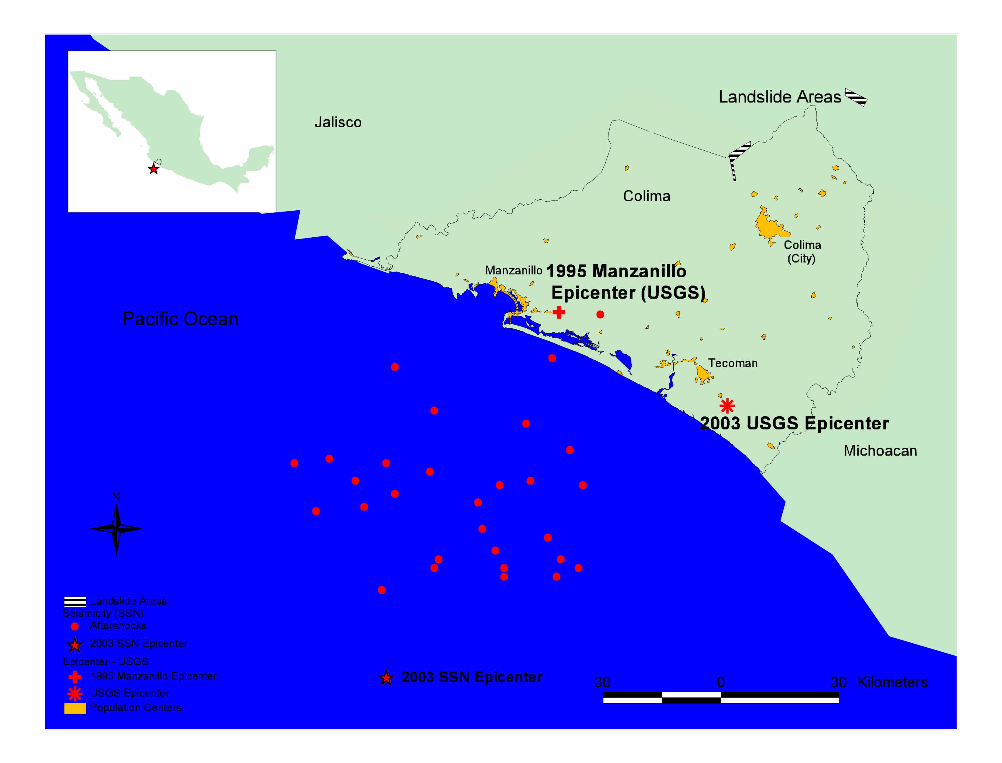
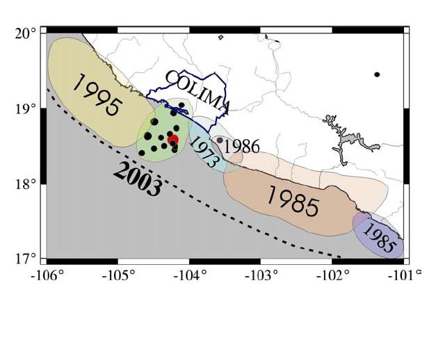
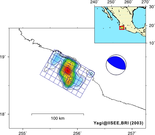
The initial reports on the magnitude of the 2003 Colima earthquake vary from Mw 7.4 (Harvard CMT) to Mw 7.6 (USGS). The reported location of the hypocenter also varies depending on the reporting agency. Table 1 lists the source parameters of the event as reported by various agencies. Figure 1 is a plot of the location of the epicenters as reported by various agencies, along with the locations of aftershock epicenters reported by the Servicio Sismológico Nacional de México (SSN). The significant discrepancies in moment magnitude and epicenter location obscure any preliminary conclusions on the unusual damage distribution (fore example, much larger damage inland in the city of Colima than in the coastal city of Manzanillo, which is closer to the rupture zone as defined by aftershock hypocenters). The damage distribution contrasts with that of the 1995 Mw 8.0 Manzanillo earthquake, where damage was largely focused near the epicentral region. The 2003 Colima earthquake occurred near the juncture of three tectonic plates: the North American Plate to the northeast, the Rivera Plate to the northwest, and the Cocos Plate to the south. Both the Rivera Plate and the Cocos Plate are being subducted beneath the North American Plate. The slower subducting Rivera Plate is moving northwest at about 20 mm per year relative to the North American Plate, and the faster Cocos plate is moving in a similar direction at a rate of about 45 mm per year ( see USGS ). The 2003 earthquake is an interplate subduction event that occurred at the contact between the North American plate with either the subducting Cocos or Rivera plates. The event filled a seismic gap located in between the rupture zones of the Mw 8.01995 Manzanillo earthquake and a Mw 7.6 earthquake in 1973 (Figure 2). A fault plane solution by Dr. Y. Yagi from the International Institute of Seismology and Earthquake Engineering (IISEE), Tokyo, is shown in Figure 3. The rupture plane has approximate dimensions of 80 km x 50 km. GROUND MOTIONS The Manzanillo Power plant record is the only strong motion record of the earthquake that was obtained within 100 km from the rupture plane. In addition, various records at distances greater than 120 km were obtained from strong motion arrays in Guadalajara and Mexico City. The Manzanillo Power Plant record registered maximum accelerations of 0.263g in the EW direction, 0.329g in the NS direction, and 0.191g in the vertical direction. Strong shaking lasted approximately 30 s. It was reported that earthquake-induced submarine movement ruptured the power plant’s main 2.4 m diameter cooling water intake pipe, which required the plant to operate at a reduced capacity in the days after the main event. Based on the data presented in Table 1, it is estimated that the Manzanillo power plant is between 10 km and 40 km from the epicenter. |
|
|
Figure
1. Epicenter location of main shock and aftershocks as reported
by the USGS and SSN. Included also is the epicenter location of the
Mw 8.0 1995 Manzanillo earthquake . |
|
|
|
|
|
Figure 2.
Approximate location of rupture planes of subduction zone events since
1973 (From
the SSN web site. Click here for more information
)
.
|
|
|
Figure 3. Fault plane solution by Dr. Y. Yagi . The contours correspond to rupture plane displacement. |
|
|