Photographs taken by members
of the geotechnical reconnaissance team
|
Apparent Site Effects
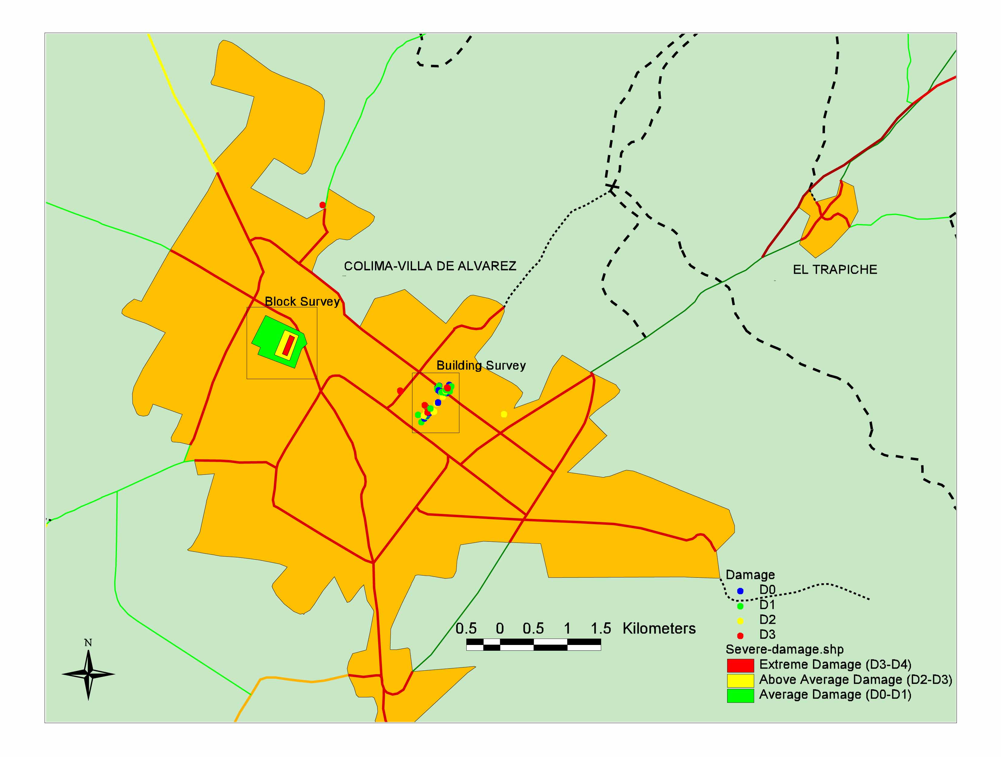
Damage surveys in the conjoined cities of Colima and Villa de Álvarez clearly indicated locations of damage concentration. Damage surveys were carried out using PQuake software (Georgia Institute of Technology) to document damage to manmade structures. PQuake directly integrates digital photography and handheld GPS technology to facilitate documenting, mapping, analyzing and visualizing damage data. The use of PQuake permitted a digital data set of the earthquake effects to be created in a timely manner. Damage surveys were performed either by assigning an average damage index (D0 = no damage, D5 = collapse) to a whole block (Block Survey) or by assigning damage indices to individual buildings. Figure 1 shows the results of the damage surveys, clearly indicating locations of damage concentration around the neighborhoods of San Isidro (Villa de Álvarez) and Lomas de Circunvalación (Colima)[Figure 2 to 4]. In addition, damage in downtown Colima to adobe housing was extensive [Figure 5]. The San Isidro neighborhood is located near the Arroyo de Pereira, a small creek flowing to the south across Colima/Villa de Álvarez. Most of the damaged area overlies highly heterogeneous fill. Evidences of liquefaction were found in areas of high damage concentration. Significant ground settlement was observed at some locations, possibly due to collapse of poorly compacted fills. There were numerous reports of open-pit sand mining earlier in the 1900s at this location. Poor filling of these pits could explain localized zones of large surface settlement. Although construction quality in the San Isidro neighborhood is poor, other neighborhoods with similar construction did not suffer as much damage. The Lomas de Circunvalación neighborhood is underlain by volcanic debris avalanche deposits that also underlie most of the north-central section of Colima. While this unit is highly heterogeneous, it is reportedly stiff and performs well as a foundation material. Intense damage in the Lomas de Circunvalación neighborhood is limited to a few city blocks. Construction patterns do not vary in this neighborhood, suggesting that localized damage is due to localized ground motion amplification, suspected to be associated with fills. |
|
|
Figure
1. Damage surveys in the city of Colima indicating areas of high
damage concentration |
|
|
|
|
|
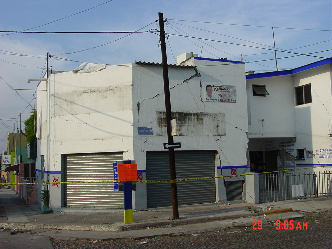
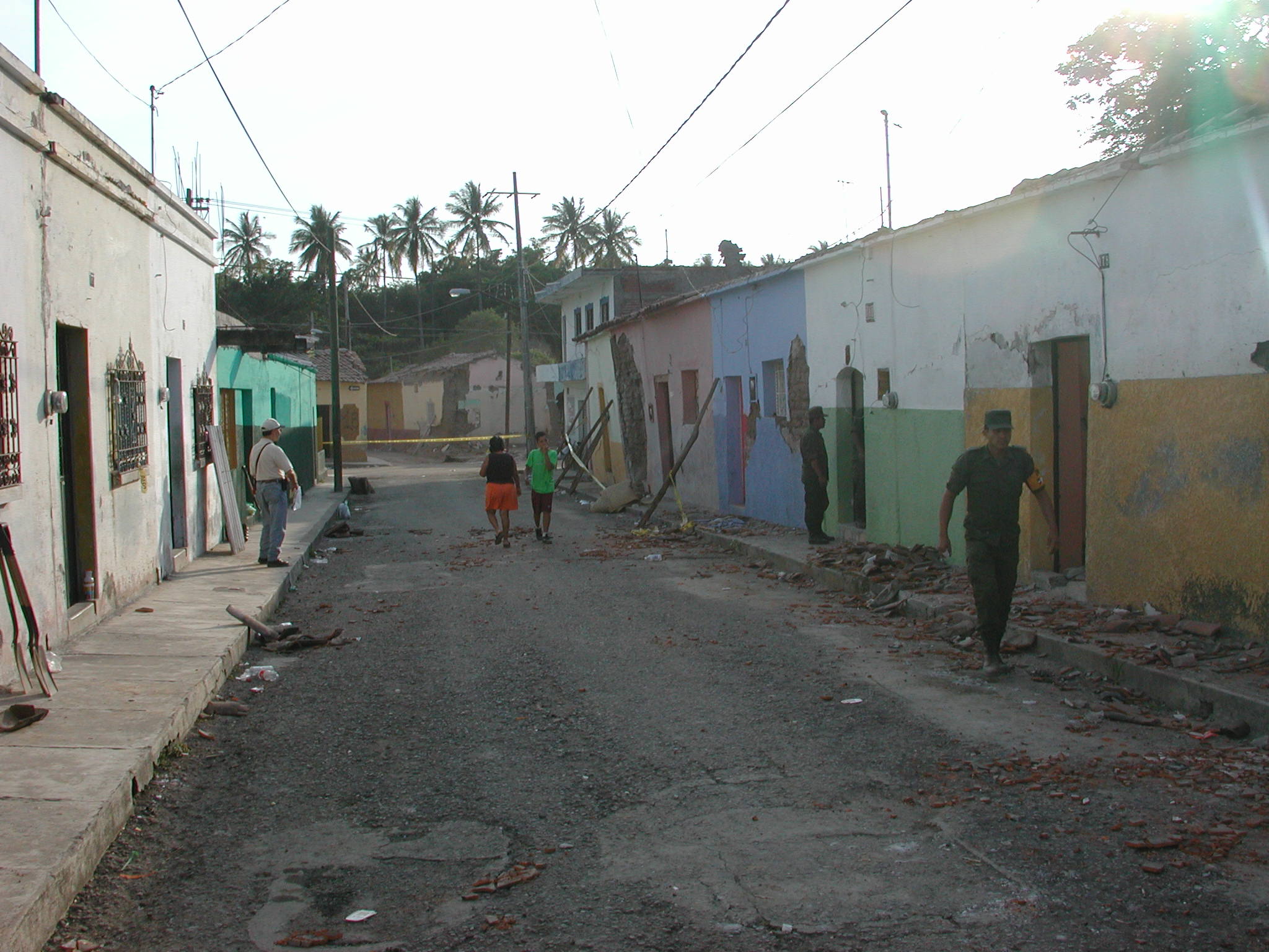
Figure 2. Typical
damage to structures in the neighborhoods
of San Isidro (Villa de Álvarez) and Lomas de Circunvalación
(Colima). |
|
|
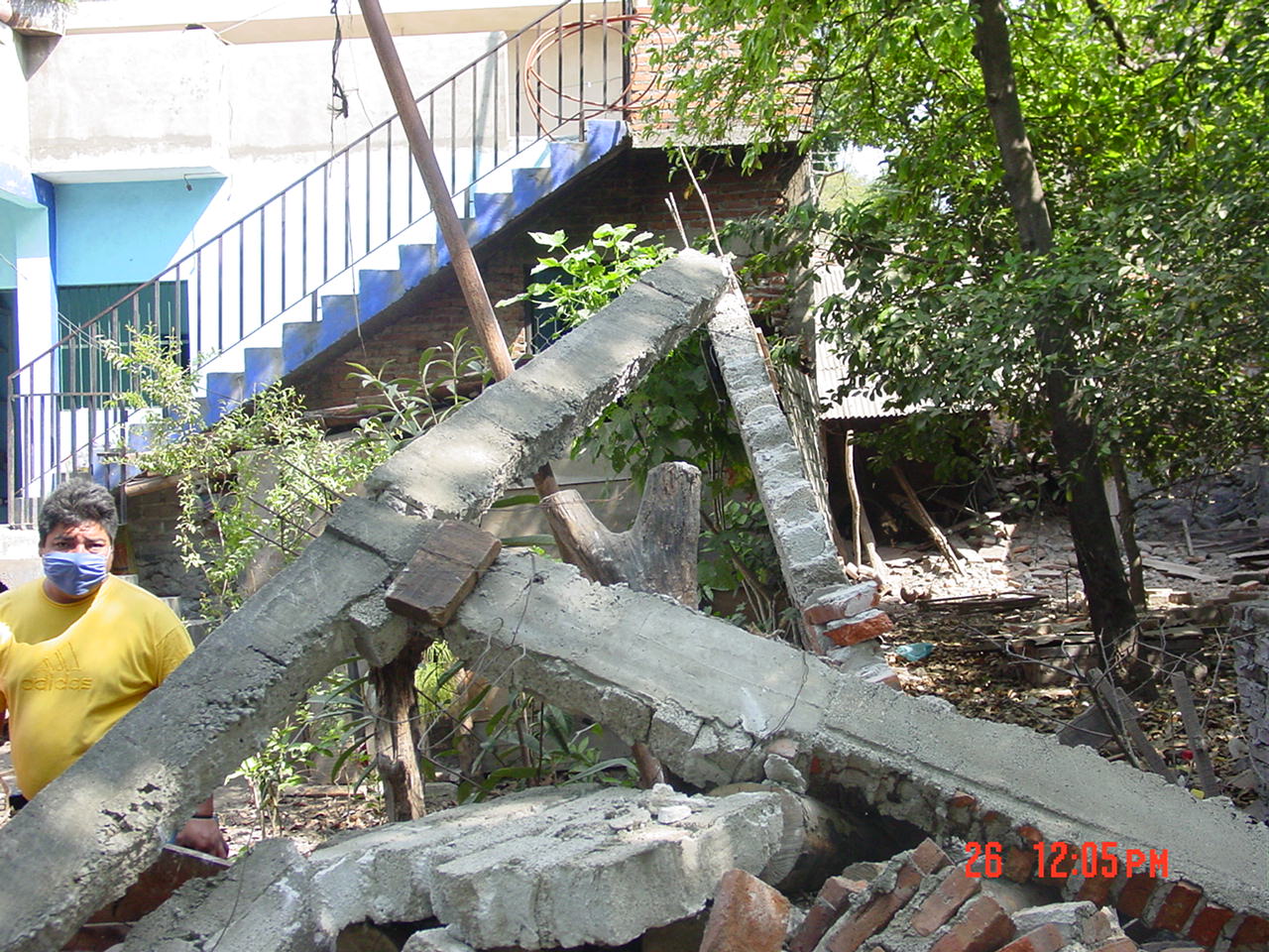
Figure 3. Typical damage to structures in the neighborhoods of San Isidro (Villa de Álvarez) and Lomas de Circunvalación (Colima). |
|
|
|
|
|
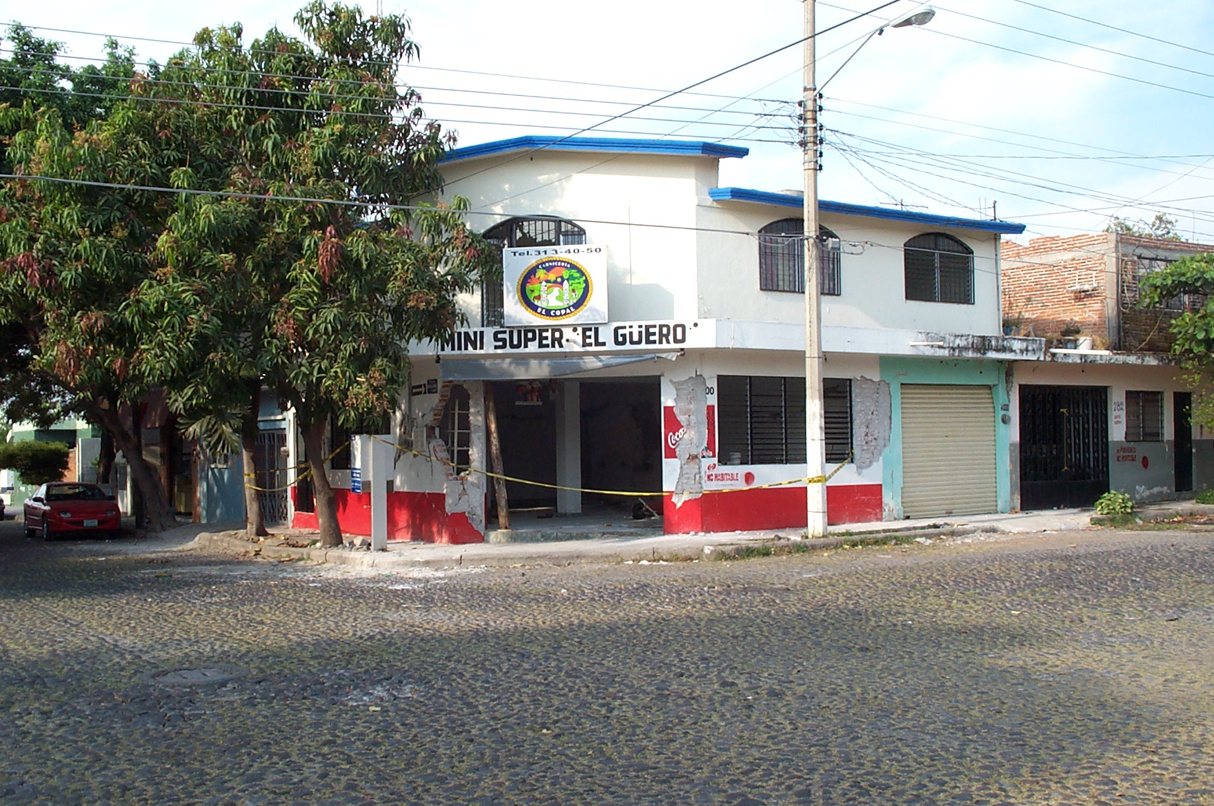
Figure 4. Typical
damage to structures in the neighborhoods
of San Isidro (Villa de Álvarez) and Lomas de Circunvalación
(Colima). |
|
|
Figure 5. Typical
damage to adobe housing in downtown Colima. |
|
Photographs taken by members
of the geotechnical reconnaissance team
|
|