Initial Geotechnical Observations of the Bhuj, India, Earthquake of January 26, 2001
A report of the NSF geotechnical earthquake engineering reconnaissance team
J. P. Bardet, S. Deaton, D. Frost, P. Goel, W. Lettis, R. Moss, U. Patel, E. Rathje, R. Seed, J. P. Singh, J. Stewart, S. V. Vandhana, and R. H. Wright
February 26, 2001
Outline
On January 26, 2001 at 8:46 AM (local time), a magnitude Mw 7.7 earthquake struck the Kachchh area in Gujarat, India. This is the most damaging earthquake in India in the last 50 years. The earthquake epicenter is located to the north of Bacchau about 160 miles (250 km) west of Ahmadabad, India or about 180 miles (290 km) southeast of Hyderabad, Pakistan. The epicenter was at N23.399 E70.316 and a depth of 23.6 km according to USGS. The earthquake damaged dams, ports and bridges, obliterated small villages in Gujarat, and caused damage to Ahmedabad, a large city 250 km away from the epicenter.
As of 20 February 2001, the Department of Agriculture and Cooperation of the Indian Government reported 19,403 dead and 68, 478 injured as the result of the earthquake. The distributionof dead and injured is given in Table 1. 228,906 houses were reported completely damaged, and 397,615 houses partially damaged. The estimated total loss of property is 135 billions rupee (3 billion $), including 60 billions rupee (1.3 billion $) of damage to private property, 10 billions rupee (220M$) of damage to public property and 10 billions rupee (220M$) of damage to utilities (power, water and industry). The impact loss on trade and industry has been estimated to 20 billions rupee (440M$).
Table 1. Losses due to the Bhuj, India, Earthquake of January 26, 2001(as of February 26, 1999)
Location |
Number of dead persons |
Number of injured persons |
| Ahmedabad | 731 |
4030 |
| Anand | 01 |
20 |
| Banaskantha | 36 |
2770 |
| Bharuch | 09 |
44 |
| Bhavanagar | 03 |
44 |
| Gandhinagar | 07 |
240 |
| Jamnagar | 117 |
4592 |
| Junagadh | 08 |
87 |
| Kachchh-Bhuj | 14896 |
39765 |
| Kheda | 00 |
28 |
| Mehsana | 0 |
1139 |
| Navsari | 17 |
51 |
| Patan | 33 |
1686 |
| Porbandar | 09 |
90 |
| Rajkot | 385 |
10567 |
| Surat | 46 |
157 |
| Surendranagar | 104 |
2851 |
| Vadodara | 01 |
256 |
| Sabarkantha | 00 |
56 |
| Amreli | 00 |
05 |
| Valsad | 00 |
00 |
Total |
16403 |
68478 |
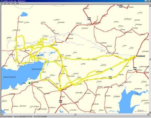
This preliminary report summarizes the observations of the geotechnical earthquake engineering reconnaissance team sponsored by the US National Science Foundation assisted of the Earthquake Enginering Research Institute (EERI) and various organizations from India. This preliminary report covers only the reconnaissance efforts carried out from Feburary 12 to February 18, 2001. Figure 1 shows the area covered by the earthquake reconnaissance, which encompasses from Ahmedabad to the East and Bhuj to the West. As shown in Fig. 1, the dash lines represent the electronic bread crumbs (i.e., GPS tracklogs) of only two investigators. A more comprehensive report will be issued in the future.
Figure 1. GPS tracklogs of J. P. Bardet (yellow dash line) and W. Lettis (black dash line) showing area covered by earthquake reconnaissance.
The members of the reconnaissance team are:
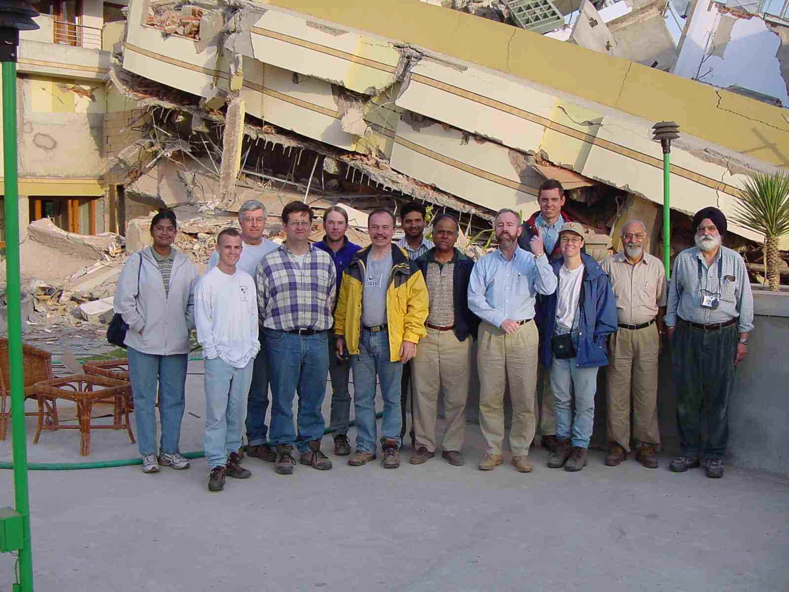
Figure 2. Members of the earthquake reconnaissance team. From left to right, Sendhil Velan Vandhana, Scott Deaton, Robert H. Wright, David Frost, Robb Moss, J. P. Bardet, Prateek Goel, Uday Patel, Raymond Seed, Jonathan Stewart, Ellen Rathje, Colonel Herbaz Singh, and J.P. Singh.
We would like to express all our thanks to our Indian and American colleagues who helped us in our reconnaissance effort, including Capt. Argawal, D. Ballantyne, S. Barot, V. D. Bhimani, K. P. Bulchandani, U. Dayal, R. Goel, A. Goyal, R. A. Gupta, S. Jain, A. K. Joti, Prof. R. K. Katti. B. K. Makwana, C. V. R. Murty, D. R. Patel, K. A. Raisinghani, B. M. Rao, C. S. Shah, Colonel H. Singh, K. D. Talsania, J. R. Thakey, N. P. Thakker, K. J. Todarmal, J. N. Vyas, and V. M. Yagnik. We express our sympathy to those who have suffered from this natural disaster. The financial support of the Earthquake Hazard Mitigation Program of the National Science Foundation is acknowledged.