Chapter Two: Geoscience and Strong Motions
2.1 Introduction
The January 17, 1995, Hyogoken-Nanbu (Kobe) Earthquake was assigned a JMA magnitude of 7.2 by the Japan Meteorological Agency (JMA). Seismological analyses indicate a seismic moment of 2.5x1026 dyne-cm, corresponding to a moment magnitude of 6.9, with a source duration of 6 to 10 seconds (Kikuchi, 1995). The hypocenter of the earthquake (34.60° N and 135.00° E, focal depth of 14 km, origin time 05:46:53.9, 1/17/1995 JST; JMA) was located about 20 km southwest of downtown Kobe between the northeast tip of Awaji Island and the mainland (Figure 2.1). The rupture length of this shallow, primarily strike-slip earthquake is inferred from the aftershock distribution and the waveform modeling of teleseismic and strong motion seismograms to have been about 30 km to 50 km long and 15 km wide, produced by bilateral rupture from the hypocenter (Pitarka et al., 1995; Kikuchi, 1995). The rupture of this earthquake directly into downtown Kobe appears to have contributed to the high level of destruction that occurred.
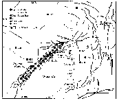 Figure 2.1: Mainshock epicenter (JMA), aftershock zone, and peak ground motions of the 1995 Kobe earthquake, superimposed on a map of active faults. The aftershock zone is based on locations by the Disaster Prevention Research Institute, Kyoto University, using data from the micro-earthquake networks of Kyoto, Tokyo, and Nagoya Universities. The strong motion data are from the Committee of Earthquake Observation and Research in the Kansai Area, JR, Osaka Gas, and JMA, and represent different measures of ground motion. The active faults are from Research Group for Active Faults (1980). Modified from K. Kohketsu, Earthquake Research Institute, University of Tokyo.
Next Page
Table of Contents
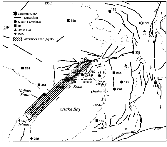 Figure 2.1: Mainshock epicenter (JMA), aftershock zone, and peak ground motions of the 1995 Kobe earthquake, superimposed on a map of active faults. The aftershock zone is based on locations by the Disaster Prevention Research Institute, Kyoto University, using data from the micro-earthquake networks of Kyoto, Tokyo, and Nagoya Universities. The strong motion data are from the Committee of Earthquake Observation and Research in the Kansai Area, JR, Osaka Gas, and JMA, and represent different measures of ground motion. The active faults are from Research Group for Active Faults (1980). Modified from K. Kohketsu, Earthquake Research Institute, University of Tokyo.