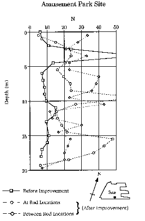
 Figure 4.1: Pre- and post-treatment standard penetration resistance values at the Portopialand Amusement Park site on Port Island (after Fudo Construction Co., Ltd., 1995).
Figure 4.1: Pre- and post-treatment standard penetration resistance values at the Portopialand Amusement Park site on Port Island (after Fudo Construction Co., Ltd., 1995).
 Figure 4.2: Parking lot between the Phase I seawall on the south and the Portopialand Amusement Park on the north.
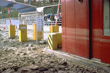 Figure 4.3: Parking lot kiosk showing high water level caused by sand liquefaction.
The east side of the park is separated from the adjacent road by a strip of unpaved, fenced-off ground. At the southern edge of the east side there is a small water supply building that is fenced on all sides. Liquefaction ejecta covered much of the enclosed area around this building, and differential settlements and ground cracking occurred around the building. At the northern end of the east side there was a large sand boil within the fenced off area. No other evidence of liquefaction was observed in the fenced-off area along the east side. The adjacent street surface had a hummocky appearance, and on the other side of the street differential settlements of 10 to 50 cm were observed between a building and its adjacent sidewalk and fence.
The north side of the park is next to a road and elevated railway. Differential settlements of 20 to 50 cm occurred between the supporting piers for the railway and the adjacent ground surface. Sand boils were also observed in this area.
The west side of the park is next to the grassy area of a public park. Large sand boils and many ground cracks were seen in the grassy area near the amusement park (Figure 4.4). A differential settlement of roughly 30 cm was observed between a ramp to the elevated railway and the surrounding ground near the northwest corner of the amusement park (Figure 4.5).
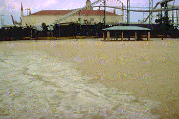 Figure 4.4: Sand boils and ground cracks in the grassy area near the amusement park.
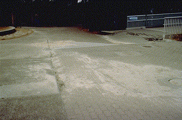 Figure 4.5: Differential settlement and sand boils outside the northwest corner of the amusement park.
Clear evidence of liquefaction inside the amusement park was limited to a small area near the southwest corner, where ground cracking and sand boils were observed as shown in Figure 4.6. Additional cracking and ejecta were observed along most of the southern boundary of the park (Figure 4.7), although some of this may have been the result of a broken water line. Over the remainder of the park the only apparent damage consisted of occasional cracks and separations in pavement materials that were generally less than 5 mm wide, but up to 25 mm wide in some spots, with Figure 4.8 being an example. Cracks and separations generally were smallest near the northern boundary and became progressively larger toward the south. Many large areas in the park had no visible cracks, separations, or differential settlements, as illustrated in Figure 4.9.
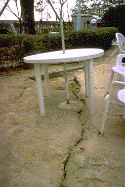 Figure 4.6: Sand boil at the southwest corner of the amusement park.
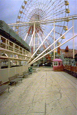 Figure 4.7: Cracks and ejecta along the southern boundary of the amusement park.
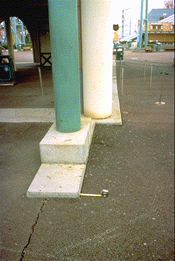 Figure 4.8: Small separation between pavement and concrete in the amusement park.
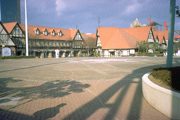 Figure 4.9: Undamaged area in the central portion of the Portopialand amusement park.
No differential settlements were observed at any of the large footings for the Ferris wheel or roller coaster. The roller coaster was operated during the field reconnaissance and appeared to function satisfactorily. No signs of structural distress were seen in any of the park facilities, and all gas lines were reported to be intact.
The significance of the observed liquefaction inside the park along its southern boundary depends on the southern limit of the ground improvement. Liquefaction evidence was mostly within a distance of 10 to 20 m from the southern fence line, which is roughly one half to one times the thickness of the liquefiable fill. Given the extensive liquefaction observed in the parking lot on the south side of the park, ground cracks and soil ejecta could be expected to extend some distance into the treated area. Correlation of the ground performance with level of improvement, together with accurate settlement and lateral displacement data both within the park and in the surrounding areas should provide valuable insights for design of ground improvement projects in the future.