2019 Ridgecrest Earthquake Sequence
Event Date :
07-04-2019
Location :
Ridgecrest, CA
Report Date :
07-19-2019
Event Category:
Earthquake
Sequence of Events:
Yes
EQ Magnitude :
M 6.4, 7.1
Report Number:
GEER-064
DOI:
doi:10.18118/G6H66K
Event Latitude:
35.769500
Event Longitude:
-117.599330
Collaborators:
Scott J. Brandenberg, Pengfei Wang, Chukwuebuka C. Nweke, Kenneth Hudson, Silvia Mazzoni, Yousef Bozorgnia, Christine A. Goulet, Kenneth W. Hudnut, Craig A. Davis, Sean K. Ahdi, Farzin Zareian, Jawad Fayaz, Richard D. Koehler, Colin Chupik, Ian Pierce, Alana Williams, Sinan Akciz, Martin B. Hudson, and Tadahiro Kishida
Contributors:
Ben Brooks, Ryan Gold, Dan Ponti, Katherine Scharer, Devin McPhillips, Chris DuRoss, Todd Ericksen, Janis Hernandez, Jay Patton, Brian Olson, Tim Dawson, Jerome Treiman, Kelly Blake, Jeffrey Buchhuber, Chris Madugo, and Joseph Sun, Andrea Donnellan, Greg Lyzenga, and Erik Conway
Summary:
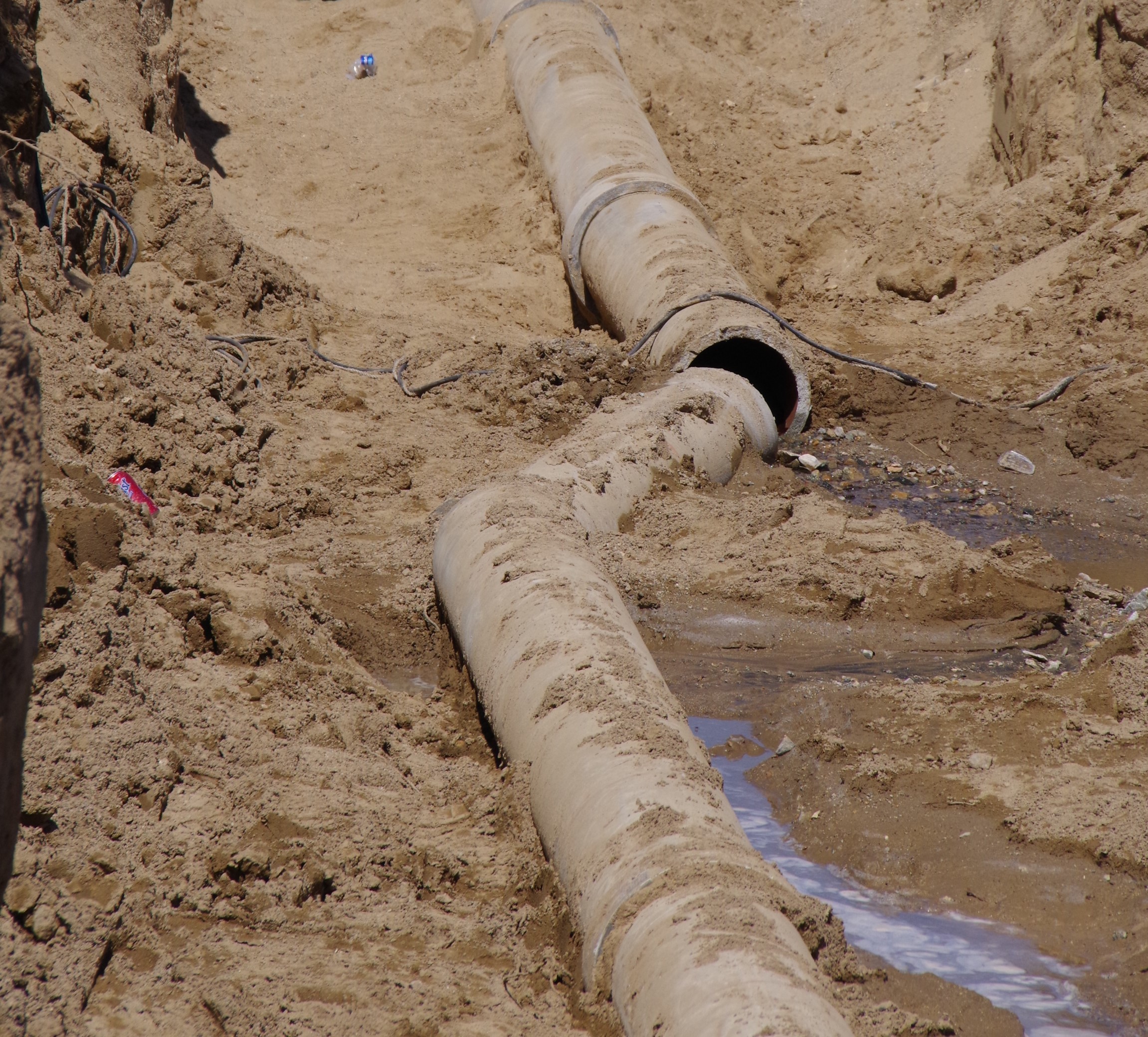
The Ridgecrest Earthquake sequence included a foreshock event on July 4 2019 (M6.4) and a M7.1 mainshock event on July 5 2019. These events occurred in the Eastern California Shear Zone, near Indian Wells Valley, south of China Lake and west of Searles Valley. GEER has partnered with several organizations to collect perishable data and document the important impacts of these events, including the US Geological Survey, the California Geological Survey, the US Navy, the Southern California Earthquake Center, and local utilities. Critical geotechnical features of this event are extensive left-lateral (M6.4 event) and right-lateral (M7.1 event) surface ruptures over fault segments of variable complexity and width as well as across extensional and compressive step-over zones. We also document lifeline performance at fault crossings (gas, water, electrical), mainshock slip and afterslip, liquefaction and lateral spreading features, and liquefaction effects on structures. These effects are documented using field (ground) mapping and aerial imagery that will support subsequent development of high-resolution digital elevation models. Over 1200 ground motions were recorded from the foreshock and mainshock alone, with many additional aftershock records. The data demonstrate significant impacts of site response and rupture directivity on ground motion attributes.
File Upload :
| File Title | File Version | File Date | File Type |
|---|---|---|---|
| Full Report | Version 1 | 07-19-2019 |
PDF
|
| Full Report | Version 2 | 03-26-2018 |
PDF & GIF (clicking on paper clip symbol)
|
The work of the GEER Association, in general, is based upon work supported in part by the National Science Foundation through the Geotechnical Engineering Program under Grant No. CMMI-1266418. Any opinions, findings, and conclusions or recommendations expressed in this material are those of the authors and do not necessarily reflect the views of the NSF. The GEER Association is made possible by the vision and support of the NSF Geotechnical Engineering Program Directors: Dr. Richard Fragaszy and the late Dr. Cliff Astill. GEER members also donate their time, talent, and resources to collect time-sensitive field observations of the effects of extreme events.